List of cultural property of national significance in Switzerland: Uri
This list contains all cultural property of national significance (class A) in the canton of Uri from the 2009 Swiss Inventory of Cultural Property of National and Regional Significance. It is sorted by municipality and contains 41 individual buildings, 3 collections and 2 archaeological finds.
The geographic coordinates provided are in the Swiss coordinate system as given in the Inventory.
Altdorf
| KGS No.? |
Picture | Name | Street Address | CH1903 X coordinate | CH1903 Y coordinate | Location |
|---|---|---|---|---|---|---|
| 5772 | 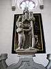 |
Ossuary Chapel of St. Anna | Kirchplatz 2 | 691.734 | 193.139 | 46°52′59″N 8°38′32″E / 46.883038°N 8.642185°E |
| 8582 |  |
Dätwyler-Stiftung | Gotthardstrasse 31 | 692.097 | 192.566 | 46°52′40″N 8°38′49″E / 46.877834°N 8.646831°E |
| 5786 |  |
Federal Grain Silo | Eyschachen | 691.037 | 191.692 | 46°52′12″N 8°37′58″E / 46.870119°N 8.632753°E |
| 9057 |  |
Federal Magazine | Eyschachen | 691.010 | 191.775 | 46°52′15″N 8°37′57″E / 46.870869°N 8.632415°E |
| 5775 |  |
Fremdenspital with Chapel | Gemeindehausplatz 2 | 691.677 | 193.134 | 46°52′59″N 8°38′29″E / 46.883001°N 8.641436°E |
| 5789 |  |
House im Eselmätteli | Herrengasse 1 | 691.576 | 193.094 | 46°52′58″N 8°38′24″E / 46.882655°N 8.640103°E |
| 5776 |  |
Jauch House or Suworow House | Hellgasse 9 | 692.062 | 192.877 | 46°52′50″N 8°38′47″E / 46.880636°N 8.646435°E |
| 8579 |  |
Historical Museum of Uri | Gotthardstrasse 18 | 691.955 | 192.564 | 46°52′40″N 8°38′42″E / 46.877835°N 8.644968°E |
| 5778 |  |
Catholic Parish Church of St. Martin | Kirchplatz | 691.730 | 193.168 | 46°53′00″N 8°38′32″E / 46.883299°N 8.642138°E |
| 8791 |  |
State Archives of Uri | Bahnhofstrasse 13 | 691.671 | 192.895 | 46°52′51″N 8°38′29″E / 46.880852°N 8.641309°E |
| 5783 |  |
Tell Monument and Türmli (Tower) | Rathausplatz | 691.872 | 192.999 | 46°52′54″N 8°38′38″E / 46.881759°N 8.643967°E |
| Unknown | ISOS Stadt: Altdorf |
Andermatt
| KGS No.? |
Picture | Name | Street Address | CH1903 X coordinate | CH1903 Y coordinate | Location |
|---|---|---|---|---|---|---|
| 5804 |  |
Old and New Teufelsbrücke | Schöllenen | 688.165 | 166.885 | 46°38′51″N 8°35′25″E / 46.64738°N 8.590311°E |
| 5807 |  |
General-Suworow Monument | Schöllenen | 688.301 | 166.874 | 46°38′50″N 8°35′32″E / 46.647263°N 8.592085°E |
| 9748 | House (Talmuseum) | Gotthardstrasse 113 | 688.564 | 165.263 | 46°37′58″N 8°35′43″E / 46.632738°N 8.59521°E | |
| Unknown | ISOS Dorf: Andermatt |
Attinghausen
| KGS No.? |
Picture | Name | Street Address | CH1903 X coordinate | CH1903 Y coordinate | Location |
|---|---|---|---|---|---|---|
| 5813 |  |
Ruins of Attinghausen Castle | Schulhausweg | 690.824 | 190.806 | 46°51′44″N 8°37′47″E / 46.862179°N 8.629783°E |
| 5814 |  |
Schweinsberg House | Schweinsberggasse 6 | 690.551 | 191.025 | 46°51′51″N 8°37′34″E / 46.864186°N 8.626247°E |
Bauen
| KGS No.? |
Picture | Name | Street Address | CH1903 X coordinate | CH1903 Y coordinate | Location |
|---|---|---|---|---|---|---|
| Unknown | ISOS Dorf: Bauen |
Bürglen
| KGS No.? |
Picture | Name | Street Address | CH1903 X coordinate | CH1903 Y coordinate | Location |
|---|---|---|---|---|---|---|
| 5821 |  |
In Der Spielmatt «Planzerhaus» House | Klausenstrasse 144 | 693.397 | 192.319 | 46°52′32″N 8°39′50″E / 46.875431°N 8.663832°E |
| 5822 |  |
Catholic Parish Church of St. Peter and Paul with Ossuary and Ölberg Chapel |
Kirchplatz | 693.293 | 192.283 | 46°52′30″N 8°39′45″E / 46.875122°N 8.662461°E |
| Unknown | ISOS Dorf: Bürglen (UR) |
Erstfeld
| KGS No.? |
Picture | Name | Street Address | CH1903 X coordinate | CH1903 Y coordinate | Location |
|---|---|---|---|---|---|---|
| 10309 | Stallscheune | Hinterwiler, Wilerstrasse | 693.213 | 184.020 | 46°48′03″N 8°39′35″E / 46.800813°N 8.659725°E | |
| 5830 | Pilgrimage Chapel of Jagdmatt | Kapellweg | 692.267 | 185.869 | 46°49′03″N 8°38′52″E / 46.817576°N 8.647707°E | |
| 10310 | House | Talweg 14 | 691.929 | 186.110 | 46°49′11″N 8°38′36″E / 46.81979°N 8.643327°E | |
| Unknown | ISOS Verstädtertes Dorf: Erstfeld |
Flüelen
| KGS No.? |
Picture | Name | Street Address | CH1903 X coordinate | CH1903 Y coordinate | Location |
|---|---|---|---|---|---|---|
| 9063 |  |
Flüelen railway station (SBB) | Bahnhofstrasse 1 | 690.335 | 195.187 | 46°54′06″N 8°37′27″E / 46.901649°N 8.624239°E |
| 5834 |  |
Ziegelhütte | Seemattstrasse 4 | 690.221 | 195.149 | 46°54′05″N 8°37′22″E / 46.901323°N 8.622735°E |
| Unknown | ISOS Verstädtertes Dorf: Flüelen |
Göschenen
| KGS No.? |
Picture | Name | Street Address | CH1903 X coordinate | CH1903 Y coordinate | Location |
|---|---|---|---|---|---|---|
| Unknown | ISOS Verstädtertes Dorf: Göschenen |
Gurtnellen
| KGS No.? |
Picture | Name | Street Address | CH1903 X coordinate | CH1903 Y coordinate | Location |
|---|---|---|---|---|---|---|
| Unknown | ISOS Spezialfall: Gurtnellen-Wiler |
Hospental
| KGS No.? |
Picture | Name | Street Address | CH1903 X coordinate | CH1903 Y coordinate | Location |
|---|---|---|---|---|---|---|
| 10245 |  |
Galgen | 687.120 | 164.165 | 46°37′23″N 8°34′34″E / 46.623052°N 8.576148°E | |
| 5844 |  |
Langobarden Tower | Turmmatte | 686.410 | 163.670 | 46°37′07″N 8°34′00″E / 46.618691°N 8.566786°E |
| 10246 | Ökonomiegebäude / Stallscheune | Steg | 687.185 | 164.360 | 46°37′29″N 8°34′37″E / 46.624797°N 8.577033°E | |
| Unknown | ISOS Dorf: Hospental |
Isenthal
| KGS No.? |
Picture | Name | Street Address | CH1903 X coordinate | CH1903 Y coordinate | Location |
|---|---|---|---|---|---|---|
| 10247 |  |
House | Ringli | 686.160 | 196.159 | 46°54′39″N 8°34′11″E / 46.910946°N 8.569636°E |
Schattdorf
| KGS No.? |
Picture | Name | Street Address | CH1903 X coordinate | CH1903 Y coordinate | Location |
|---|---|---|---|---|---|---|
| 10248 | Dance Hall | Kirchgasse | 692.790 | 191.075 | 46°51′52″N 8°39′20″E / 46.864327°N 8.655618°E |
Seedorf
| KGS No.? |
Picture | Name | Street Address | CH1903 X coordinate | CH1903 Y coordinate | Location |
|---|---|---|---|---|---|---|
| 5856 | Benedictine Nuns Convent of St. Lazarus | Klosterweg 4 | 689.533 | 193.030 | 46°52′56″N 8°36′48″E / 46.882357°N 8.613291°E | |
| 5858 |  |
Schlösschen A Pro | A Pro-Strasse | 688.998 | 193.490 | 46°53′12″N 8°36′23″E / 46.886566°N 8.606363°E |
Seelisberg
| KGS No.? |
Picture | Name | Street Address | CH1903 X coordinate | CH1903 Y coordinate | Location |
|---|---|---|---|---|---|---|
| 5860 |  |
Rütlihaus Auf Der Rütliwiese | Rütli | 687.801 | 202.576 | 46°58′06″N 8°35′33″E / 46.968448°N 8.592412°E |
| 9746 |  |
Schillerstein | 688.106 | 204.190 | 46°58′59″N 8°35′48″E / 46.982924°N 8.596732°E | |
| 5859 |  |
Wirtshaus zur Treib | Treib | 687.291 | 204.653 | 46°59′14″N 8°35′10″E / 46.987196°N 8.58611°E |
| 10249 | House | Buchholz | 686.361 | 203.888 | 46°58′50″N 8°34′25″E / 46.980437°N 8.573741°E |
Silenen
| KGS No.? |
Picture | Name | Street Address | CH1903 X coordinate | CH1903 Y coordinate | Location |
|---|---|---|---|---|---|---|
| 10250 |  |
Farm House | Kirchstrasse 49 | 694.235 | 183.088 | 46°47′32″N 8°40′23″E / 46.792287°N 8.672919°E |
| 10312 |  |
Former Sust with Hotel | Dörfli 15 | 694.231 | 181.582 | 46°46′43″N 8°40′21″E / 46.778742°N 8.672556°E |
| 5869 |  |
Eisenschmelzofen | 697.352 | 180.287 | 46°46′00″N 8°42′47″E / 46.766646°N 8.713142°E | |
| 5868 |  |
SBB Powerplant | Gotthardstrasse 115 | 694.123 | 180.345 | 46°46′03″N 8°40′15″E / 46.767631°N 8.670888°E |
| 10449 |  |
Meier Tower | Sustenweg | 694.206 | 181.629 | 46°46′45″N 8°40′20″E / 46.779168°N 8.672238°E |
| 10313 |  |
House | Burghofstatt, Dörfli 1 | 694.183 | 181.670 | 46°46′46″N 8°40′19″E / 46.77954°N 8.671946°E |
| 5867 | |
Zwing Uri Castle Prehistoric and Medieval settlement / Castle |
694.080 | 181.088 | 46°46′28″N 8°40′14″E / 46.77432°N 8.670477°E | |
| Unknown | ISOS Weiler: Dörfli | |||||
| Unknown | ISOS Spezialfall: Amsteg | |||||
| Unknown | ISOS Spezialfall: Berghotel Maderanertal |
Sisikon
| KGS No.? |
Picture | Name | Street Address | CH1903 X coordinate | CH1903 Y coordinate | Location |
|---|---|---|---|---|---|---|
| 5873 |  |
Tell Chapel Bei Der Tellsplatte | 689.340 | 198.617 | 46°55′57″N 8°36′43″E / 46.932634°N 8.611855°E |
Spiringen
| KGS No.? |
Picture | Name | Street Address | CH1903 X coordinate | CH1903 Y coordinate | Location |
|---|---|---|---|---|---|---|
| 10314 | House | Oberdorf | 699.014 | 192.006 | 46°52′18″N 8°44′15″E / 46.871803°N 8.737436°E |
Unterschächen
| KGS No.? |
Picture | Name | Street Address | CH1903 X coordinate | CH1903 Y coordinate | Location |
|---|---|---|---|---|---|---|
| 5878 | Sawmill | Bielen | 701.609 | 190.562 | 46°51′30″N 8°46′16″E / 46.858425°N 8.771147°E |
Wassen
| KGS No.? |
Picture | Name | Street Address | CH1903 X coordinate | CH1903 Y coordinate | Location |
|---|---|---|---|---|---|---|
| 5883 |  |
Catholic Parish Church of St. Gallus | Kirchgasse | 688.890 | 173.530 | 46°42′25″N 8°36′04″E / 46.707052°N 8.601066°E |
References
- All entries, addresses and coordinates are from: "Kantonsliste A-Objekte". KGS Inventar (in German). Federal Office of Civil Protection. 2009. Retrieved 25 April 2011.
External links
- Swiss Inventory of Cultural Property of National and Regional Significance, 2009 edition:
- "Revision of the PCP Inventory (Revision des KGS-Inventars)". KGS Forum. Federal Office of Civil Protection (13/2008). 2008.
This article is issued from Wikipedia - version of the 8/12/2016. The text is available under the Creative Commons Attribution/Share Alike but additional terms may apply for the media files.