List of Scheduled Roman to modern Monuments in Pembrokeshire

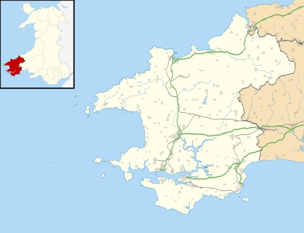
Pembrokeshire is the fifth-largest county in Wales, but has more Ancient Monuments (526) than any except Powys. This gives it an extremely high density of monuments, with 33.4 per 100km2. (Only the tiny County Boroughs of Newport and Merthyr Tydfil have a higher density). With three-quarters of its boundary being coastline, Pembrokeshire occupies the western end of the West Wales peninsular, terminating with the tiny cathedral city of St David's. It was a historic county in its own right but between 1975 and 1996 it joined Carmarthen and Ceredigion in the much larger county of Dyfed.

Over two thirds of Pembrokeshire's Ancient Monuments (346) date to pre-historic times. Even this is too many entries to conveniently show in one list, so the list is subdivided into three, with all the Roman to modern entries on this list, and subdividing the prehistoric sites along the lines of the former local districts of Preseli Pembrokeshire, (the northern half) and South Pembrokeshire. The two lists of prehistoric sites include hill forts, promontory forts on both coastal headlands and inland locations. They also include a variety of enclosures, hut sites and Raths, a wide range of burial sites and other ritual and religious sites listed as barrows and chambered tombs, stone circles and standing stones.

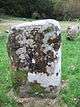
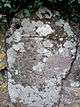
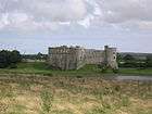
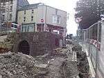
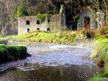
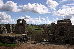
The county's 182 Roman, medieval and post-medieval sites include only 3 sites from Roman times, but from the Early Medieval period there are many inscribed stones, stone crosses, and holy wells. Also scheduled are many Medieval castles, mottes and baileys, priories, chapels and churches, houses, town walls and a Bishop's palace, along with a wide variety of post-medieval sites from coalmines, kilns and dovecotes through to 19th and 20th century coastal defenses.

Scheduled Ancient Monuments (SAMs) have statutory protection. The compilation of the list is undertaken by Cadw Welsh Historic Monuments, which is an executive agency of the National Assembly of Wales.[1] The list of scheduled monuments below is supplied by Cadw[2] with additional material from RCAHMW and Dyfed Archaeological Trust.

Scheduled Roman to modern Monuments in Pembrokeshire

The list is sorted by period, and then by Community so that sites of similar age and locality are placed near each other. Clicking on one of the heading arrows will sort the list by that information.

Image Name Site type Community Location Details Period SAM No
& Refs
Castle Flemish Enclosure Ambleston 51°54′14″N 4°53′53″W / 51.904°N 4.8981°W / 51.904; -4.8981 (Castle Flemish),
SN007267
Roman
PE058
[3]
Roman Road 300m East of Bryn Farm Roman Road Llanddewi Velfrey 51°49′57″N 4°40′43″W / 51.8326°N 4.6786°W / 51.8326; -4.6786 (Roman Road 300m East of Bryn Farm),
SN155182
Roman
PE472
[4]
Hut Groups on Gateholm Island Hut circle settlement Marloes and St Brides 51°43′09″N 5°13′48″W / 51.7192°N 5.23°W / 51.7192; -5.23 (Hut Groups on Gateholm Island),
SM769072
Roman
PE180
[5]
West Angle Bay Early Medieval Settlement Cemetery Angle 51°41′05″N 5°06′32″W / 51.6848°N 5.109°W / 51.6848; -5.109 (West Angle Bay Early Medieval Settlement),
SM851030
St Anthony's Chapel churchyard Early Medieval
PE554
[6]
Maen Colman Cross-marked stone Boncath 52°00′50″N 4°36′02″W / 52.0138°N 4.6006°W / 52.0138; -4.6006 (Maen Colman),
SN216382
Early Medieval
PE203
[7]
Carew Cross - geograph.org.uk - 13993.jpg
Carew Cross Cross Carew 51°41′53″N 4°49′40″W / 51.698°N 4.8278°W / 51.698; -4.8278 (Carew Cross),
SN047037
4 metres (13 ft) high, spectacular cross commemorating Maredudd ab Edwin, 11th century King of Deheubarth Early Medieval
PE009
[8]
Bridell Parish Church - geograph.org.uk - 650500.jpg
Inscribed Pillar Stone in Bridell Churchyard Inscribed stone Cilgerran 52°02′49″N 4°39′37″W / 52.0469°N 4.6604°W / 52.0469; -4.6604 (Inscribed Pillar Stone in Churchyard),
SN176420
Early Medieval
PE143
[9]
Inscribed Stone in Cilgerran hurchyard Inscribed stone Cilgerran 52°03′23″N 4°38′25″W / 52.0563°N 4.6404°W / 52.0563; -4.6404 (Inscribed Stone in Churchyard),
SN190430
Early Medieval
PE144
[10]
Inscribed Stone near Glan-Dwr Independent Chapel Inscribed stone Crymych 51°55′35″N 4°37′57″W / 51.9263°N 4.6324°W / 51.9263; -4.6324 (Inscribed Stone near Glan-Dwr Independent Chapel),
SN190285
Early Medieval
PE147
[11]
Rhyd-y-Gath Pillar Cross Cross-marked stone Crymych 51°57′04″N 4°35′56″W / 51.951°N 4.5988°W / 51.951; -4.5988 (Rhyd-y-Gath Pillar Cross),
SN215312
Early Medieval
PE233
[12]
Five Pillar-Crosses in Llanychllwydog Churchyard Cross-marked stone Cwm Gwaun 51°58′20″N 4°53′44″W / 51.9723°N 4.8955°W / 51.9723; -4.8955 (Five Pillar-Crosses in Churchyard),
SN012343
Early Medieval
PE227
[13]
Llanllawer Holy Well Holy Well Cwm Gwaun 51°59′10″N 4°55′57″W / 51.986°N 4.9326°W / 51.986; -4.9326 (Holy Well),
SM987360
Early Medieval
PE229
[14]
Pillar Cross in Llanychaer Churchyard Cross Cwm Gwaun 51°58′23″N 4°55′32″W / 51.9731°N 4.9255°W / 51.9731; -4.9255 (Pillar Cross in Churchyard),
SM991345
Early Medieval
PE230
[15]
Two Pillar-Crosses in Llanllawer Churchyard Cross-marked stone Cwm Gwaun 51°59′08″N 4°55′59″W / 51.9855°N 4.9331°W / 51.9855; -4.9331 (Two Pillar-Crosses in Churchyard, Llanllawer),
SM986359
Early Medieval
PE228
[16]
Two Pillar-Crosses in Pontfaen Churchyard Cross Cwm Gwaun 51°58′11″N 4°52′52″W / 51.9698°N 4.8812°W / 51.9698; -4.8812 (Two Pillar-Crosses in Churchyard),
SN021340
Early Medieval
PE226
[17]
Inscribed Stone 130m E of Penwaun Cross Dinas Cross 51°59′53″N 4°56′18″W / 51.9981°N 4.9382°W / 51.9981; -4.9382 (Inscribed Stone 130m E of Penwaun),
SM983373
Early Medieval
PE485
[18]
Pillar Stone in Penparke Cross Eglwyswrw 51°59′02″N 4°46′44″W / 51.9839°N 4.7788°W / 51.9839; -4.7788 (Pillar Stone in Penparke),
SN093354
Early Medieval
PE448
[19]
Tre-Bwlch Pillar Crosses Cross-marked stone Eglwyswrw 51°58′55″N 4°47′18″W / 51.9819°N 4.7882°W / 51.9819; -4.7882 (Tre-Bwlch Pillar Crosses),
SN086351
Early Medieval
PE234
[20]
Inscribed Stone in outer face of wall of St Michael's Church (now in Llandissilio Church) Cross-marked stone Llandissilio West 51°51′46″N 4°43′58″W / 51.8628°N 4.7329°W / 51.8628; -4.7329 (Inscribed Stone in outer face of wall of St Michael's Church (now in Llandissilio Church)),
SN119218
Early Medieval
CM068
[21]
Mesur-y-Dorth Cross-Incised Stone Cross-marked stone Llanrhian 51°55′56″N 5°08′44″W / 51.9323°N 5.1456°W / 51.9323; -5.1456 (Mesur-y-Dorth Cross-Incised Stone),
SM839307
Early Medieval
PE047
[22]
Drim Camp Ringwork Llawhaden 51°50′29″N 4°48′41″W / 51.8415°N 4.8114°W / 51.8415; -4.8114 (Drim Camp),
SN064196
Early Medieval
PE107
[23]
Inscribed Stones outside Ruined Church of St Teilo (now in Maenclochog Church). Cross-marked stone Maenclochog 51°54′43″N 4°47′18″W / 51.9119°N 4.7883°W / 51.9119; -4.7883 (Inscribed Stones outside Ruined Church of St Teilo (now in Maenclochog Church).),
SN083273
Early Medieval
PE146
[24]
Martin`s Haven Early Christian Inscribed Cross Cross-marked stone Marloes and St Brides 51°44′06″N 5°14′42″W / 51.7351°N 5.2449°W / 51.7351; -5.2449 (Martin`s Haven Early Christian Inscribed Cross),
SM760090
Early Medieval
PE431
[25]
2nd Wheel Cross, Mathry Church - geograph.org.uk - 947069.jpg
Two Pre-Norman Gravestones in Mathry Churchyard Cross-marked stone Mathry 51°56′45″N 5°05′15″W / 51.9459°N 5.0875°W / 51.9459; -5.0875 (Two Pre-Norman Gravestones in Churchyard),
SM879319
Early Medieval
PE150
[26]
Castell Pen-Gawsai Earthwork (unclassified) Mynachlog-Ddu 51°55′08″N 4°44′57″W / 51.9188°N 4.7493°W / 51.9188; -4.7493 (Castell Pen-Gawsai),
SN110280
Early Medieval
PE289
[27]
Cilgwyn, Cross Inscribed Stone at Cilfair Cross-marked stone Nervern 51°59′19″N 4°48′07″W / 51.9887°N 4.8019°W / 51.9887; -4.8019 (Cilgwyn, Cross Inscribed Stone at Cilfair),
SN077359
Early Medieval
PE560
[28]
NevernCross.jpg
High Cross in Nevern Churchyard Cross Nevern 52°01′31″N 4°47′42″W / 52.0254°N 4.7951°W / 52.0254; -4.7951 (High Cross in Churchyard),
SN083400
Early Medieval
PE164
[29]
Inscribed Stone in Nevern Churchyard Inscribed stone Nevern 52°01′31″N 4°47′43″W / 52.0254°N 4.7952°W / 52.0254; -4.7952 (Inscribed Stone in Churchyard),
SN083400
Early Medieval
PE151
[30]
Velindre Pillar-Cross Cross-marked stone New Moat 51°53′48″N 4°50′37″W / 51.8967°N 4.8437°W / 51.8967; -4.8437 (Velindre Pillar-Cross),
SN044258
Early Medieval
PE236
[31]
Pillar Cross 140m SE of Newport Church Cross-marked stone Newport, Pembrokeshire 52°00′50″N 4°49′49″W / 52.014°N 4.8302°W / 52.014; -4.8302 (Pillar Cross 140m SE of Newport Church),
SN059388
Early Medieval
PE305
[32]
Pillar Cross in Newport Churchyard Cross-marked stone Newport, Pembrokeshire 52°00′54″N 4°49′54″W / 52.0151°N 4.8318°W / 52.0151; -4.8318 (Pillar Cross in Newport Churchyard),
SN058389
Early Medieval
PE304
[33]
Incised Cross at Cemetery Cross Roads Cross-marked stone Pencaer 52°00′46″N 5°00′28″W / 52.0127°N 5.0078°W / 52.0127; -5.0078 (Incised Cross at Cemetery Cross Roads),
SM937392
Early Medieval
PE258
[34]
Llanwnwr Cross-Slab Cross-marked stone Pencaer 52°01′22″N 5°04′09″W / 52.0228°N 5.0692°W / 52.0228; -5.0692 (Llanwnwr Cross-Slab),
SM895405
Early Medieval
PE072
[35]
Tal-y-Gaer Corbelled Hut Corbelled hut Pencaer 52°00′28″N 5°04′15″W / 52.0079°N 5.0709°W / 52.0079; -5.0709 (Tal-y-Gaer Corbelled Hut),
SM893388
Early Medieval
PE210
[36]
Two Early Christian Crosses in Morvil Churchyard Cross Puncheston 51°56′25″N 4°51′27″W / 51.9402°N 4.8574°W / 51.9402; -4.8574 (Two Early Christian Crosses in Morvil Churchyard),
SN036307
Early Medieval
PE235
[37]
Inscribed Stone at Llangwarran Farm Inscribed stone Scleddau 51°56′34″N 5°00′49″W / 51.9428°N 5.0135°W / 51.9428; -5.0135 (Inscribed Stone at Llangwarran Farm),
SM929314
Early Medieval
PE145
[38]
St Justinian's Chapel Chapel St Davids and the Cathedral Close 51°52′45″N 5°18′31″W / 51.8793°N 5.3087°W / 51.8793; -5.3087 (St Justinian's Chapel),
SM723252
Early Medieval
PE014
[39]
St Non's Chapel Chapel St Davids and the Cathedral Close 51°52′20″N 5°16′08″W / 51.8722°N 5.2689°W / 51.8722; -5.2689 (St Non's Chapel),
SM750243
Early Medieval
PE013
[40]
St Patrick's Chapel Chapel St Davids and the Cathedral Close 51°53′51″N 5°17′44″W / 51.8974°N 5.2955°W / 51.8974; -5.2955 (St Patrick's Chapel),
SM734272
Early Medieval
PE012
[41]
St Govan's Chapel and Well Chapel Stackpole and Castlemartin 51°35′55″N 4°56′12″W / 51.5986°N 4.9367°W / 51.5986; -4.9367 (St Govan's Chapel and Well),
SR967929
Early Medieval
PE321
[42]
Hang Stone Davey Near Lamber Smithy Cross-marked stone The Havens 51°47′27″N 5°03′09″W / 51.7909°N 5.0524°W / 51.7909; -5.0524 (Hang Stone Davey Near Lamber Smithy),
SM895146
Early Medieval
PE078
[43]
Inscribed Stone in Churchyard Inscribed stone Wolfscastle 51°54′48″N 4°57′17″W / 51.9133°N 4.9548°W / 51.9133; -4.9548 (Inscribed Stone in Churchyard),
SM968279
Early Medieval
PE152
[44]
Angle Castle (or Hall) Building (Unclassified) Angle 51°41′02″N 5°05′21″W / 51.6838°N 5.0891°W / 51.6838; -5.0891 (Angle Castle),
SM865028
Variously assigned as Almshouse, Nunnery and castle remains, it is a late medieval hall, now in ruins, south of Angle village street. Medieval
PE069
[45]
Angle Dovecot Dovecote Angle 51°41′09″N 5°05′19″W / 51.6858°N 5.0885°W / 51.6858; -5.0885 (Angle Dovecot),
SM866031
Medieval
PE067
[46]
East Blockhouse and lower "Pillbox" - geograph.org.uk - 427497.jpg
Remains of East Blockhouse N of Rat Island Blockhouse Angle 51°40′56″N 5°07′27″W / 51.6821°N 5.1242°W / 51.6821; -5.1242 (Remains of East Blockhouse N of Rat Island),
SM841027
Medieval
PE398
[47]
Pele Tower, Angle Tower Angle 51°41′06″N 5°05′18″W / 51.6851°N 5.0884°W / 51.6851; -5.0884 (The Tower),
SM866030
Part of a medieval moated mansion, which was later used as a Rectory, alongside Castle Farm. Medieval
PE068
[48]
Pointz Castle, Brawdy - geograph.org.uk - 519044.jpg
Pointz Castle Mound Motte Brawdy 51°52′12″N 5°09′11″W / 51.8699°N 5.1531°W / 51.8699; -5.1531 (Pointz Castle Mound),
SM830237
Medieval
PE272
[49]
Camrose Mound & Bailey Castle Motte & Bailey Camrose 51°50′22″N 5°00′39″W / 51.8394°N 5.0109°W / 51.8394; -5.0109 (Camrose Mound & Bailey Castle),
SM926199
Medieval
PE217
[50]
Carew Bridge (geograph 3208931).jpg
Carew Bridge Bridge Carew 51°41′57″N 4°49′36″W / 51.6991°N 4.8267°W / 51.6991; -4.8267 (Carew Bridge),
SN047038
Medieval
PE083
[51]
View of Carew Castle - geograph.org.uk - 67100.jpg
Carew Castle Motte & Bailey Carew 51°41′55″N 4°49′48″W / 51.6985°N 4.83°W / 51.6985; -4.83 (Carew Castle),
SN046037
Medieval
PE001
[52]
Castell Pen-yr-Allt Castle Cilgerran 52°02′46″N 4°41′16″W / 52.0461°N 4.6877°W / 52.0461; -4.6877 (Castell Pen-yr-Allt),
SN157420
Medieval
PE169
[53]
Cilgerran Castle Castle Cilgerran 52°03′25″N 4°38′03″W / 52.0569°N 4.6342°W / 52.0569; -4.6342 (Cilgerran Castle),
SN194431
Medieval
PE002
[54]
Cilgerran Castle Additional Area Castle Cilgerran 52°03′24″N 4°38′05″W / 52.0566°N 4.6346°W / 52.0566; -4.6346 (Cilgerran Castle Additional Area),
SN195430
Medieval
PE384
[55]
Castell Crychydd Motte & Bailey Clydey 51°59′03″N 4°32′00″W / 51.9841°N 4.5332°W / 51.9841; -4.5332 (Castell Crychydd),
SN261347
Medieval
PE205
[56]
Castell Dyffrynmawr Motte Crymych 51°59′06″N 4°39′33″W / 51.985°N 4.6593°W / 51.985; -4.6593 (Castell Dyffrynmawr),
SN175352
Medieval
PE208
[57]
Castle Mound, Llanfyrnach Motte Crymych 51°57′04″N 4°35′32″W / 51.951°N 4.5921°W / 51.951; -4.5921 (Castle Mound, Llanfyrnach),
SN219312
Medieval
PE097
[58]
Chapel and Burial Ground near Tre-Henry Chapel Crymych 51°56′34″N 4°36′02″W / 51.9429°N 4.6006°W / 51.9429; -4.6006 (Chapel and Burial Ground near Tre-Henry),
SN213303
Medieval
PE098
[59]
Castell Eglwyswrw Motte & Bailey Eglwyswrw 52°00′46″N 4°42′48″W / 52.0127°N 4.7132°W / 52.0127; -4.7132 (Castell Eglwyswrw),
SN139383
Medieval
PE171
[60]
Castell Llain-Fawr Motte Eglwyswrw 52°00′14″N 4°41′43″W / 52.0039°N 4.6954°W / 52.0039; -4.6954 (Castell Llain-Fawr),
SN150373
Medieval
PE209
[61]
Court Moated Site Moated Site Eglwyswrw 52°01′18″N 4°43′08″W / 52.0218°N 4.7189°W / 52.0218; -4.7189 (Court Moated Site),
SN135394
Medieval
PE303
[62]
Haverfordwest Castle Castle Haverfordwest 51°48′10″N 4°58′11″W / 51.8028°N 4.9698°W / 51.8028; -4.9698 (Haverfordwest Castle),
SM953157
Medieval
PE366
[63]
Haverfordwest Priory Priory Haverfordwest 51°47′51″N 4°57′51″W / 51.7976°N 4.9643°W / 51.7976; -4.9643 (Haverfordwest Priory),
SM956151
Medieval
PE017
[64]
Medieval Crypt, Haverfordwest House (domestic) Haverfordwest 51°48′04″N 4°58′17″W / 51.8011°N 4.9713°W / 51.8011; -4.9713 (Medieval Crypt at Corner of Market Street and High Street),
SM952155
Medieval Crypt at the corner of Market Street and High Street Medieval
PE079
[65]
Hayscastle Motte Motte Hayscastle 51°53′24″N 5°03′36″W / 51.8899°N 5.0599°W / 51.8899; -5.0599 (Castle Mound),
SM895257
Medieval
PE221
[66]
Eastington Manor farmhouse - geograph.org.uk - 1337353.jpg
Eastington Manor House Manor Hundleton 51°40′56″N 5°02′17″W / 51.6822°N 5.038°W / 51.6822; -5.038 (Eastington Manor House),
SM901025
Medieval
PE263
[67]
Castell Ringwork Lampeter Velfrey 51°47′59″N 4°40′38″W / 51.7996°N 4.6772°W / 51.7996; -4.6772 (Castell),
SN154146
Medieval
PE177
[68]
Llangwathan Castle Mound Motte Lampeter Velfrey 51°48′18″N 4°42′28″W / 51.8051°N 4.7078°W / 51.8051; -4.7078 (Llangwathan Castle Mound),
SN134153
Medieval
PE434
[69]
Hodgeston Moated Site Moated Site Lamphey 51°39′33″N 4°51′03″W / 51.6592°N 4.8509°W / 51.6592; -4.8509 (Hodgeston Moated Site),
SS029995
Medieval
PE246
[70]
Lamphey Bishop's Palace Palace Lamphey 51°40′19″N 4°52′00″W / 51.672°N 4.8668°W / 51.672; -4.8668 (Lamphey Palace),
SN018009
Medieval
PE003
[71]
Pengawse Medieval House Site Manor Llanddewi Velfrey 51°49′15″N 4°38′50″W / 51.8207°N 4.6471°W / 51.8207; -4.6471 (Pengawse Medieval House Site),
SN176168
Medieval
PE389
[72]
Dingstopple Castle Mound Motte Llawhaden 51°49′56″N 4°48′56″W / 51.8321°N 4.8156°W / 51.8321; -4.8156 (Dingstopple Castle Mound),
SN060185
Medieval
PE183
[73]
Llawhaden Bridge Bridge Llawhaden 51°49′15″N 4°47′42″W / 51.8207°N 4.7951°W / 51.8207; -4.7951 (Llawhaden Bridge),
SN074173
Medieval
PE023
[74]
Llawhaden Castle Castle Llawhaden 51°49′20″N 4°47′51″W / 51.8223°N 4.7976°W / 51.8223; -4.7976 (Llawhaden Castle),
SN073175
Medieval
PE024
[75]
Llawhaden Hospital Hospital Llawhaden 51°49′15″N 4°48′23″W / 51.8207°N 4.8063°W / 51.8207; -4.8063 (Llawhaden Hospital),
SN067173
Medieval
PE162
[76]
St Teilo's Church & Churchyard Church Maenclochog 51°54′30″N 4°45′52″W / 51.9083°N 4.7644°W / 51.9083; -4.7644 (St Teilo's Church & Churchyard),
SN099269
Medieval
PE165
[77]
Manorbier Castle Castle Manorbier 51°38′45″N 4°47′57″W / 51.6457°N 4.7993°W / 51.6457; -4.7993 (Manorbier Castle),
SS064978
Medieval
PE004
[78]
Manorbier Dovecot Dovecote Manorbier 51°38′46″N 4°48′06″W / 51.646°N 4.8016°W / 51.646; -4.8016 (Manorbier Dovecot),
SS062978
Medieval
PE459
[79]
The Lydstep Tavern and Bishop's Palace. - geograph.org.uk - 218140.jpg
The Old Palace, Lydstep Palace Manorbier 51°39′05″N 4°46′04″W / 51.6515°N 4.7677°W / 51.6515; -4.7677 (The Old Palace, Lydstep),
SS086983
Medieval
PE403
[80]
Castell Coch House (domestic) Martletwy 51°47′18″N 4°47′52″W / 51.7884°N 4.7979°W / 51.7884; -4.7979 (Castell Coch),
SN072136
Medieval
PE053
[81]
Cresswell Castle House (domestic) Martletwy 51°43′41″N 4°49′34″W / 51.7281°N 4.826°W / 51.7281; -4.826 (Cresswell Castle 100m W of Cresswell Quay),
SN049070
Medieval
PE396
[82]
Minwear Ringwork Ringwork Martletwy 51°47′11″N 4°48′42″W / 51.7863°N 4.8116°W / 51.7863; -4.8116 (Minwear Ringwork),
SN062135
Medieval
PE433
[83]
Sister's House Building (Unclassified) Martletwy 51°47′10″N 4°51′14″W / 51.786°N 4.854°W / 51.786; -4.854 (Sister's House),
SN032135
Medieval
PE302
[84]
Pill Priory Priory Milford Haven 51°43′29″N 5°02′18″W / 51.7246°N 5.0382°W / 51.7246; -5.0382 (Pill Priory),
SM902075
Late 12th century priory of the Tironensian Order. Daughter church of St Dogmaels Abbey. Medieval
PE070
[85]
Clyn Pattel Motte & Bailey Motte Narberth, Pembrokeshire 51°47′42″N 4°42′56″W / 51.7949°N 4.7156°W / 51.7949; -4.7156 (Clyn Pattel Motte & Bailey),
SN128142
Medieval
PE412
[86]
Narberth Castle Castle Narberth, Pembrokeshire 51°47′46″N 4°44′33″W / 51.7962°N 4.7424°W / 51.7962; -4.7424 (Narberth Castle),
SN109143
Medieval
PE040
[87]
Castell Nanhyfer Motte & Bailey Nevern 52°01′36″N 4°47′49″W / 52.0267°N 4.7969°W / 52.0267; -4.7969 (Castell Nanhyfer),
SN082401
Medieval
PE160
[88]
Rock Hewn Cross 220m West of Nevern Church Cross Nevern 52°01′31″N 4°47′55″W / 52.0252°N 4.7986°W / 52.0252; -4.7986 (Rock Hewn Cross 220m West of Church),
SN081400
Medieval
PE161
[89]
Castell-y-Fran Motte New Moat 51°51′54″N 4°47′20″W / 51.8651°N 4.789°W / 51.8651; -4.789 (Castell-y-Fran),
SN088222
Medieval
PE185
[90]
New Moat Castle Mound Motte & Bailey New Moat 51°53′34″N 4°48′57″W / 51.8929°N 4.8158°W / 51.8929; -4.8158 (New Moat Castle Mound),
SN063253
Medieval
PE241
[91]
Medieval Pottery Kiln, Newport Memorial Hall Pottery kiln Newport, Pembrokeshire 52°00′57″N 4°50′16″W / 52.0158°N 4.8377°W / 52.0158; -4.8377 (Medieval Pottery Kiln, Newport Memorial Hall),
SN053390
Medieval
PE437
[92]
Newport Castle (Unoccupied parts) Castle Newport, Pembrokeshire 52°00′51″N 4°49′58″W / 52.0141°N 4.8327°W / 52.0141; -4.8327 (Newport Castle (Unoccupied parts)),
SN057388
Medieval
PE087
[93]
The Old Castle, Newport Ringwork Newport, Pembrokeshire 52°01′12″N 4°49′51″W / 52.02°N 4.8309°W / 52.02; -4.8309 (The Old Castle),
SN058395
Medieval
PE404
[94]
Paterchurch Tower, Pembroke Dock Tower Pembroke Dock 51°41′37″N 4°57′23″W / 51.6935°N 4.9565°W / 51.6935; -4.9565 (Paterchurch Tower, Pembroke Dock),
SM957035
Medieval
PE380
[95]
Medieval Building at Kingston Farm Building (Unclassified) Pembroke 51°39′30″N 4°54′03″W / 51.6582°N 4.9007°W / 51.6582; -4.9007 (Medieval Building at Kingston Farm),
SR994995
Medieval
PE401
[96]
Monkton Priory Dovecot Dovecote Pembroke 51°40′41″N 4°55′42″W / 51.678°N 4.9282°W / 51.678; -4.9282 (Monkton Priory Dovecot),
SM976017
Medieval
PE415
[97]
Pembroke Castle Castle Pembroke 51°40′37″N 4°55′14″W / 51.6769°N 4.9205°W / 51.6769; -4.9205 (Pembroke Castle),
SM981016
Medieval
PE005
[98]
Pembroke Town Walls Town Wall Pembroke 51°40′31″N 4°54′32″W / 51.6753°N 4.9088°W / 51.6753; -4.9088 (Pembroke Town Wall),
SM989014
Medieval
PE015
[99]
Carswell Medieval House House (domestic) Penally 51°40′34″N 4°45′08″W / 51.676°N 4.7523°W / 51.676; -4.7523 (Carswell Old House),
SN098010
Medieval
PE373
[100]
Celtic cross situated in the churchyard at St Nicholas and St Teilo's church, Penally.jpg
Sculptured Stone Cross in Penally Church Cross Penally 51°39′35″N 4°43′22″W / 51.6597°N 4.7228°W / 51.6597; -4.7228 (Sculptured Stone Cross in Church),
SS117992
Medieval
PE142
[101]
The Watchtower, Penally Beacon Penally 51°40′03″N 4°42′59″W / 51.6674°N 4.7163°W / 51.6674; -4.7163 (The Watchtower),
SN122000
Medieval
PE439
[102]
West Tarr Vaulted Hall House House (domestic) Penally 51°40′24″N 4°45′54″W / 51.6734°N 4.765°W / 51.6734; -4.765 (West Tarr Vaulted Hall House),
SN089008
Medieval
PE423
[103]
Whitewell Medieval house House (domestic) Penally 51°39′28″N 4°45′21″W / 51.6578°N 4.7558°W / 51.6578; -4.7558 (Whitewell),
SS096990
Medieval
PE137
[104]
Castell Hendre Motte Puncheston 51°54′44″N 4°50′40″W / 51.9122°N 4.8445°W / 51.9122; -4.8445 (Castell Hendre),
SN044275
Medieval
PE240
[105]
Castell Mael Ringwork Puncheston 51°55′50″N 4°53′47″W / 51.9306°N 4.8963°W / 51.9306; -4.8963 (Castell Mael),
SN009297
Medieval
PE232
[106]
Castell Mound, Castlebythe Motte Puncheston 51°55′27″N 4°52′44″W / 51.9242°N 4.8788°W / 51.9242; -4.8788 (Castell Mound),
SN021290
Medieval
PE238
[107]
Deserted Medieval Site at New Inn Deserted Rural Settlement Puncheston 51°56′16″N 4°49′39″W / 51.9378°N 4.8276°W / 51.9378; -4.8276 (Deserted Medieval Site at New Inn),
SN057303
Medieval
PE402
[108]
Rudbaxton Motte Motte Rudbaxton 51°50′46″N 4°57′42″W / 51.846°N 4.9618°W / 51.846; -4.9618 (Rudbaxton Motte),
SM961205
Medieval
PE432
[109]
Mounds on the Island, Slebech Mound Slebech 51°47′25″N 4°51′10″W / 51.7903°N 4.8528°W / 51.7903; -4.8528 (Mounds on the Island),
SN033140
Medieval
PE276
[110]
Picton Castle Mound Motte Slebech 51°47′06″N 4°52′39″W / 51.7851°N 4.8775°W / 51.7851; -4.8775 (Picton Castle Mound),
SN016135
Castle mound in the grounds of Picton Castle. Also known as the Belvedere or Dungledi Medieval
PE277
[111]
Slebech Old Church Church Slebech 51°47′21″N 4°51′17″W / 51.7893°N 4.8547°W / 51.7893; -4.8547 (Slebech Old Church),
SN032139
Ruined Church of St John, between Slebech Hall and the estuary shore Medieval
PE275
[112]
Remains of Medieval Farmhouse with Round Chimney at Croftufty Farmstead Solva 51°52′54″N 5°12′55″W / 51.8817°N 5.2153°W / 51.8817; -5.2153 (Remains of Medieval Farmhouse with Round Chimney at Croftufty),
SM788252
Medieval
PE395
[113]
Parc y Castell Mound and Bailey Castle Castle St Davids and the Cathedral Close 51°52′47″N 5°16′43″W / 51.8796°N 5.2785°W / 51.8796; -5.2785 (Parc y Castell Mound and Bailey Castle),
SM745252
Medieval
PE108
[114]
St Davids Bishop's Palace Palace St Davids and the Cathedral Close 51°52′56″N 5°16′15″W / 51.8821°N 5.2708°W / 51.8821; -5.2708 (St David's Cathedral Close: The Bishops Palace and Garden),
SM750254
Medieval
PE006
[115]
St Davids Cathedral Close: Archdeacon of Cardigans Ground House (domestic) St Davids and the Cathedral Close 51°52′59″N 5°16′06″W / 51.883°N 5.2684°W / 51.883; -5.2684 (St Davids Cathedral Close: Archdeacon of Cardigans Ground),
SM751255
Medieval
PE443
[116]
St Davids Cathedral Close: Chanter's Orchard House (domestic) St Davids and the Cathedral Close 51°52′53″N 5°16′12″W / 51.8814°N 5.2701°W / 51.8814; -5.2701 (St Davids Cathedral Close: Chanter's Orchard),
SM750255
Medieval
PE440
[117]
St Davids Cathedral Close: Cloister Hall (Undercroft only) Undercroft St Davids and the Cathedral Close 51°52′57″N 5°16′06″W / 51.8825°N 5.2682°W / 51.8825; -5.2682 (St Davids Cathedral Close: Cloister Hall (Undercroft only)),
SM751254
Medieval
PE445
[118]
St Davids Cathedral Close: Close Wall and Sites of Former Gateways Wall St Davids and the Cathedral Close 51°52′59″N 5°16′14″W / 51.8831°N 5.2705°W / 51.8831; -5.2705 (St Davids Cathedral Close: Close Wall and Sites of Former Gateways),
SM750255
Medieval
PE018
[119]
St Davids Cathedral Close: The Free School School St Davids and the Cathedral Close 51°52′54″N 5°16′09″W / 51.8818°N 5.2693°W / 51.8818; -5.2693 (St Davids Cathedral Close: The Free School),
SM750254
Medieval
PE442
[120]
St Davids Cathedral Close: Vicar`s College Religious house St Davids and the Cathedral Close 51°52′57″N 5°16′03″W / 51.8826°N 5.2674°W / 51.8826; -5.2674 (St Davids Cathedral Close: Vicar`s College),
SM752255
Medieval
PE441
[121]
St Davids Cathedral Mill Leat Leat St Davids and the Cathedral Close 51°52′49″N 5°16′33″W / 51.8803°N 5.2758°W / 51.8803; -5.2758 (St Davids Cathedral Mill Leat),
SM746242
Medieval
PE457
[122]
The City Cross Cross St Davids and the Cathedral Close 51°52′52″N 5°15′56″W / 51.8811°N 5.2656°W / 51.8811; -5.2656 (The City Cross),
SM753253
Medieval
PE094
[123]
Whitewell Hospital St Davids and the Cathedral Close 51°52′45″N 5°16′08″W / 51.8792°N 5.269°W / 51.8792; -5.269 (Whitewell),
SM751251
Medieval
PE482
[124]
St Dogmaels Abbey and Coach House Abbey St Dogmaels 52°04′50″N 4°40′50″W / 52.0806°N 4.6806°W / 52.0806; -4.6806 (St Dogmaels Abbey),
SN164458
Medieval
PE073
[125]
St Ishmael's Castle Mound Motte St Ishmael's 51°43′31″N 5°08′10″W / 51.7254°N 5.1361°W / 51.7254; -5.1361 (Castle Mound),
SM835076
Medieval
PE196
[126]
Scotsborough House Ruins Country House St Mary Out Liberty 51°40′37″N 4°43′28″W / 51.6769°N 4.7245°W / 51.6769; -4.7245 (Scotsborough House Ruins),
SN117010
Medieval
PE547
[127]
Flimston Farmhouse Farmstead Stackpole and Castlemartin 51°37′17″N 5°00′00″W / 51.6213°N 5°W / 51.6213; -5 (Flimston Farmhouse),
SR924956
Medieval
PE447
[128]
Linney Deserted Medieval Village Deserted Medieval Village Stackpole and Castlemartin 51°37′47″N 5°02′32″W / 51.6297°N 5.0422°W / 51.6297; -5.0422 (Linney Deserted Medieval Village),
SR895967
Medieval
PE469
[129]
Pricaston Farmhouse Farmstead Stackpole and Castlemartin 51°37′43″N 5°00′36″W / 51.6285°N 5.01°W / 51.6285; -5.01 (Pricaston Farmhouse),
SR917964
Medieval
PE451
[130]
Sentence Castle Mound Motte Templeton 51°46′17″N 4°44′23″W / 51.7715°N 4.7398°W / 51.7715; -4.7398 (Sentence Castle Mound),
SN110116
Medieval
PE110
[131]
Tenby Castle Castle Tenby 51°40′21″N 4°41′41″W / 51.6726°N 4.6947°W / 51.6726; -4.6947 (Tenby Castle),
SN137005
Medieval
PE163
[132]
Tenby Market Cross Market cross Tenby 51°40′37″N 4°42′17″W / 51.677°N 4.7046°W / 51.677; -4.7046 (Tenby Market Cross),
SN131010
Medieval
PE420
[133]
Tenby Town Wall Town Wall Tenby 51°40′16″N 4°42′02″W / 51.6711°N 4.7006°W / 51.6711; -4.7006 (Tenby Town Wall),
SN133004
Medieval
PE007
[134]
Higgons Well Holy Well Uzmaston and Boulston 51°47′49″N 4°57′27″W / 51.797°N 4.9575°W / 51.797; -4.9575 (Higgons Well),
SM961151
Medieval
PE430
[135]
House Platforms N of St. Mary's Churchyard House platform Wiston 51°49′33″N 4°52′17″W / 51.8257°N 4.8715°W / 51.8257; -4.8715 (House Platforms N of St. Mary's Churchyard),
SN022180
Medieval
PE461
[136]
Moat NW of Merryborough Farm Moated Site Wiston 51°48′59″N 4°54′35″W / 51.8165°N 4.9097°W / 51.8165; -4.9097 (Moat NW of Merryborough Farm),
SM995170
Medieval
PE465
[137]
Wiston Castle Motte & Bailey Wiston 51°49′36″N 4°52′16″W / 51.8268°N 4.8711°W / 51.8268; -4.8711 (Wiston Castle),
SN022181
Medieval
PE077
[138]
Wolfscastle Castle Mound Motte & Bailey Wolfscastle 51°53′59″N 4°58′11″W / 51.8996°N 4.9698°W / 51.8996; -4.9698 (Wolfscastle Castle Mound),
SM957265
Medieval
PE254
[139]
Corn Drying Kiln 130m E of Mirianog-Ganol Corn-drying kiln Eglwyswrw 51°58′37″N 4°42′39″W / 51.9769°N 4.7109°W / 51.9769; -4.7109 (Corn Drying Kiln 130m E of Mirianog-Ganol),
SN139344
Post-Medieval/Modern
PE466
[140]
Tafarn-y-bwlch Deserted Rural Settlement Rectangular hut Eglwyswrw 51°58′11″N 4°47′50″W / 51.9696°N 4.7972°W / 51.9696; -4.7972 (Tafarn-y-bwlch Deserted Rural Settlement),
SN079338
Post-Medieval/Modern
PE490
[141]
Underhill Wood Primitive Coal Workings Coal mine Jeffreyston 51°43′37″N 4°46′03″W / 51.7269°N 4.7674°W / 51.7269; -4.7674 (Underhill Wood Primitive Coal Workings),
SN089067
Post-Medieval/Modern
PE463
[142]
Grove Colliery Engine house Kilgetty/Begelly 51°43′55″N 4°41′46″W / 51.7319°N 4.6961°W / 51.7319; -4.6961 (Grove Colliery),
SN139071
Post-Medieval/Modern
PE489
[143]
Stepaside/Kilgetty Ironworks Limekiln Kilgetty/Begelly 51°44′04″N 4°41′38″W / 51.7345°N 4.694°W / 51.7345; -4.694 (Stepaside/Kilgetty Ironworks),
SN140074
Post-Medieval/Modern
PE418
[144]
Hook Quay Quay Llangwm 51°46′01″N 4°56′01″W / 51.767°N 4.9337°W / 51.767; -4.9337 (Hook Quay),
SM976116
Post-Medieval/Modern
PE529
[145]
Aberfelin Mill Mill Llanrhian 51°56′54″N 5°09′10″W / 51.9482°N 5.1528°W / 51.9482; -5.1528 (Aberfelin Mill),
SM834324
Post-Medieval/Modern
PE376
[146]
Moated Site 100m East of Caeforiog Bridge Moated Site Llanrhian 51°53′51″N 5°11′01″W / 51.8976°N 5.1836°W / 51.8976; -5.1836 (Moated Site 100m East of Caeforiog Bridge),
SM810269
Post-Medieval/Modern
PE449
[147]
Porthgain Quarry and Harbour Industrial building Llanrhian 51°56′54″N 5°10′59″W / 51.9483°N 5.183°W / 51.9483; -5.183 (Porthgain Quarry and Harbour),
SM813325
Post-Medieval/Modern
PE382
[148]
Castle Malgwyn Bridge Bridge Manordeifi 52°03′41″N 4°36′04″W / 52.0615°N 4.6011°W / 52.0615; -4.6011 (Castle Malgwyn Bridge),
SN217435
Post-Medieval/Modern
PE383
[149]
Llechryd Bridge Bridge Manordeifi, (also Llangoedmor), (see also Ceredigion) 52°03′44″N 4°36′04″W / 52.0623°N 4.601°W / 52.0623; -4.601 (Llechryd Bridge),
SN218436
Post-Medieval/Modern
CD002
[150]
Hut Groups, Cairns & Cliff Castle on Skomer Island Limekiln Marloes and St Brides 51°44′27″N 5°17′56″W / 51.7408°N 5.2988°W / 51.7408; -5.2988 (Hut Groups, Cairns & Cliff Castle on Skomer Island),
SM723098
Post-Medieval/Modern
PE181
[151]
Blackpool Iron Furnace Ironworks Martletwy 51°47′43″N 4°48′24″W / 51.7953°N 4.8066°W / 51.7953; -4.8066 (Blackpool Iron Furnace),
SN065144
Post-Medieval/Modern
PE484
[152]
Garden Earthworks at Coedcanlas Farm Garden Martletwy 51°44′29″N 4°53′09″W / 51.7414°N 4.8859°W / 51.7414; -4.8859 (Garden Earthworks at Coedcanlas Farm),
SN008087
Post-Medieval/Modern
PE455
[153]
Landshipping House Garden Remains Garden Martletwy 51°45′48″N 4°52′10″W / 51.7632°N 4.8695°W / 51.7632; -4.8695 (Landshipping House Garden Remains),
SN020110
Post-Medieval/Modern
PE454
[154]
Newton North Church Church Martletwy 51°47′06″N 4°48′20″W / 51.7851°N 4.8056°W / 51.7851; -4.8056 (Newton North Church),
SN065134
Post-Medieval/Modern
PE270
[155]
Haroldston House and Gardens House (domestic) Merlin's Bridge 51°47′32″N 4°57′46″W / 51.7923°N 4.9628°W / 51.7923; -4.9628 (Haroldston House and Gardens),
SM957145
Post-Medieval/Modern
PE438
[156]
Castle Point Old Fort Fort Fishguard and Goodwick 52°00′05″N 4°58′14″W / 52.0013°N 4.9705°W / 52.0013; -4.9705 (Castle Point Old Fort),
SM961378
Post-Medieval/Modern
(18th century)
PE096
[157]
American War of Independence Redan at Bath House Artillery battery Neyland 51°42′16″N 4°56′48″W / 51.7044°N 4.9467°W / 51.7044; -4.9467 (American War of Independence Redan at Bath House),
SM964047
Five-sided artillery battery dating to before 1763 Post-Medieval/Modern
(18th century)
PE452
[158]
Main gate, Defensible Barracks (geograph 3758674).jpg
Defensible Barracks, Pembroke Dock Barracks Pembroke Dock 51°41′22″N 4°57′06″W / 51.6894°N 4.9518°W / 51.6894; -4.9518 (Defensible Barracks, Pembroke Dock),
SM960030
Post-Medieval/Modern
(18th century)
PE379
[159]
Black Rock Quarry Lime Kilns Kiln Penally 51°40′06″N 4°43′09″W / 51.6684°N 4.7192°W / 51.6684; -4.7192 (Black Rock Quarry Lime Kilns),
SN121001
Post-Medieval/Modern
(18th century)
PE436
[160]
Rosemarket Dovecot Dovecote Rosemarket 51°44′07″N 4°57′53″W / 51.7354°N 4.9646°W / 51.7354; -4.9646 (Rosemarket Dovecot),
SM954083
Post-Medieval/Modern
(18th century)
PE224
[161]
Lime Kilns Kiln Solva 51°52′21″N 5°11′26″W / 51.8726°N 5.1905°W / 51.8726; -5.1905 (Lime Kilns),
SM804241
Post-Medieval/Modern
(18th century)
PE378
[162]
Cottage, Mill and Lime Kiln at Caerbwdy Mill St Davids and the Cathedral Close 51°52′28″N 5°14′43″W / 51.8745°N 5.2452°W / 51.8745; -5.2452 (Cottage, Mill and Lime Kiln at Caerbwdy),
SM767245
Post-Medieval/Modern
(18th century)
PE429
[163]
Chapel Bay Fort Fort Angle 51°41′26″N 5°05′57″W / 51.6906°N 5.0992°W / 51.6906; -5.0992 (Chapel Bay Fort),
SM858037
Post-Medieval/Modern
(19th century)
PE333
[164]
Fort Popton (Curtain Walls and Gun Emplacements only) Fort Angle 51°41′37″N 5°02′59″W / 51.6937°N 5.0496°W / 51.6937; -5.0496 (Fort Popton (Curtain Walls and Gun Emplacements only)),
SM893038
Post-Medieval/Modern
(19th century)
PE446
[165]
Dale Point Fort (Unoccupied Parts) Fort Dale 51°42′10″N 5°09′04″W / 51.7028°N 5.151°W / 51.7028; -5.151 (Dale Point Fort (Unoccupied Parts)),
SM823052
Post-Medieval/Modern
(19th century)
PE336
[166]
West Blockhouse Fort Fort Dale 51°41′18″N 5°09′28″W / 51.6883°N 5.1579°W / 51.6883; -5.1579 (West Blockhouse Fort),
SM818035
Post-Medieval/Modern
(19th century)
PE335
[167]
South Hook Fort Fort Herbrandston 51°42′27″N 5°05′02″W / 51.7075°N 5.0838°W / 51.7075; -5.0838 (South Hook Fort),
SM870054
Post-Medieval/Modern
(19th century)
PE337
[168]
Stack Rock, Milford Haven - geograph.org.uk - 532255.jpg
Stack Rock Fort Fort Herbrandston 51°42′09″N 5°05′32″W / 51.7025°N 5.0921°W / 51.7025; -5.0921 (Stack Rock Fort),
SM864049
Post-Medieval/Modern
(19th century)
PE334
[169]
Scoveston Fort Fort Llanstadwell 51°43′14″N 4°58′40″W / 51.7206°N 4.9777°W / 51.7206; -4.9777 (Fort Scoveston),
SM944066
Post-Medieval/Modern
(19th century)
PE339
[170]
Fort Hubberston Fort Milford Haven 51°42′30″N 5°03′17″W / 51.7082°N 5.0548°W / 51.7082; -5.0548 (Fort Hubberston),
SM890054
Mid-19th century fort which was in use in both world wars. Post-Medieval/Modern
(19th century)
PE338
[171]
Hakin Observatory Observatory Milford Haven 51°42′45″N 5°03′09″W / 51.7126°N 5.0525°W / 51.7126; -5.0525 (Hakin Observatory),
SM892059
Early 19th century observatory, part of an abortive attempt to set up a mathematical and technical college, now a housing estate near Milford Haven. Post-Medieval/Modern
(19th century)
PE387
[172]
South West Dockyard Tower, Pembroke Dock Tower Pembroke Dock 51°41′38″N 4°57′36″W / 51.6939°N 4.9601°W / 51.6939; -4.9601 (South West Dockyard Tower),
SM964038
Post-Medieval/Modern
(19th century)
PE332
[173]
Tramroad Incline at Saundersfoot Incline Drumhouse Saundersfoot 51°42′49″N 4°42′38″W / 51.7135°N 4.7106°W / 51.7135; -4.7106 (Tramroad Incline at Saundersfoot),
SN127052
Post-Medieval/Modern
(19th century)
PE479
[174]
Rhode Wood Shaft Mounds Shaft Mounds St Mary Out Liberty 51°42′18″N 4°41′48″W / 51.705°N 4.6967°W / 51.705; -4.6967 (Rhode Wood Shaft Mounds),
SN137043
Post-Medieval/Modern
(19th century)
PE458
[175]
Fort St Catherine Fort Tenby 51°40′15″N 4°41′31″W / 51.6707°N 4.692°W / 51.6707; -4.692 (Fort St Catherine),
SN139003
Post-Medieval/Modern
(19th century)
PE450
[176]
Gravel Bay anti-aircraft battery Artillery battery Angle 51°39′57″N 5°03′49″W / 51.6657°N 5.0635°W / 51.6657; -5.0635 (Gravel Bay anti-aircraft battery),
SM882007
Post-Medieval/Modern
(20th century)
PE494
[177]
Burton Beach Overlord Hard Hard Burton 51°42′21″N 4°55′08″W / 51.7057°N 4.9188°W / 51.7057; -4.9188 (Burton Beach Overlord Hard),
SM984048
Post-Medieval/Modern
(20th century)
PE531
[178]
Dale Airfield Airfield Dale, (also Marloes and St Brides) 51°43′00″N 5°11′39″W / 51.7166°N 5.1943°W / 51.7166; -5.1943 (Dale Airfield),
SM794068
Post-Medieval/Modern
(20th century)
PE566
[179]
Radar Station, Old Castle Head Radar station Manorbier 51°38′11″N 4°47′08″W / 51.6363°N 4.7856°W / 51.6363; -4.7856 (Radar Station, Old Castle Head),
SS073967
Post-Medieval/Modern
(20th century)
PE493
[180]
First World War Practice Trenches, Penally Range Practice trenches Penally 51°39′14″N 4°43′49″W / 51.6538°N 4.7304°W / 51.6538; -4.7304 (First World War Practice Trenches, Penally Range),
SS112985
Post-Medieval/Modern
(20th century)
PE483
[181]
Chain Home Low Radar Station, Strumble Head Radar station Pencaer 52°00′49″N 5°04′50″W / 52.0137°N 5.0806°W / 52.0137; -5.0806 (Chain Home Low Radar Station, Strumble Head),
SM886395
Post Medieval/Modern
(20th century)
PE530
[182]
Linney Tobruk Shelters Coastal battery Stackpole and Castlemartin 51°38′06″N 5°03′05″W / 51.635°N 5.0513°W / 51.635; -5.0513 (Linney Tobruk Shelters),
SR889973
Post-Medieval/Modern
(20th century)
PE534
[183]
Trevallen Downs Tank Range Firing range Stackpole and Castlemartin 51°35′59″N 4°56′03″W / 51.5998°N 4.9341°W / 51.5998; -4.9341 (Trevallen Downs Tank Range),
SR969930
Post-Medieval/Modern
(20th century)
PE533
[184]
Castle Flemish
Roman Road 300m East of Bryn Farm
Hut Groups on Gateholm Island
West Angle Bay Early Medieval Settlement
Maen Colman
Carew Cross
Inscribed Pillar Stone in Churchyard
Inscribed Stone in Churchyard
Inscribed Stone near Glan-Dwr Independent Chapel
Rhyd-y-Gath Pillar Cross
Five Pillar-Crosses in Churchyard
Holy Well
Pillar Cross in Churchyard
Two Pillar-Crosses in  Churchyard, Llanllawer
Two Pillar-Crosses in Churchyard
Inscribed Stone 130m E of Penwaun
Pillar Stone in Penparke
Tre-Bwlch Pillar Crosses
Inscribed Stone in outer face of wall of St Michael's Church (now in Llandissilio Church)
Mesur-y-Dorth Cross-Incised Stone
Drim Camp
Inscribed Stones outside Ruined Church of St Teilo (now in Maenclochog Church).
Martin`s Haven Early Christian Inscribed Cross
Two Pre-Norman Gravestones in Churchyard
Castell Pen-Gawsai
Cilgwyn, Cross Inscribed Stone at Cilfair
High Cross in Churchyard
Inscribed Stone in Churchyard
Velindre Pillar-Cross
Pillar Cross 140m SE of Newport Church
Pillar Cross in Newport Churchyard
Incised Cross at Cemetery Cross Roads
Llanwnwr Cross-Slab
Tal-y-Gaer Corbelled Hut
Two Early Christian Crosses in Morvil Churchyard
Inscribed Stone at Llangwarran Farm
St Justinian's Chapel
St Non's Chapel
St Patrick's Chapel
St Govan's Chapel and Well
Hang Stone Davey Near Lamber Smithy
Inscribed Stone in Churchyard
Angle Castle
Angle Dovecot
Remains of East Blockhouse N of Rat Island
The Tower
Pointz Castle Mound
Camrose Mound & Bailey Castle
Carew Bridge
Carew Castle
Castell Pen-yr-Allt
Cilgerran Castle
Cilgerran Castle Additional Area
Castell Crychydd
Castell Dyffrynmawr
Castle Mound, Llanfyrnach
Chapel and Burial Ground near Tre-Henry
Castell Eglwyswrw
Castell Llain-Fawr
Court Moated Site
Haverfordwest Castle
Haverfordwest Priory
Medieval Crypt at Corner of Market Street and High Street
Castle Mound
Eastington Manor House
Castell
Llangwathan Castle Mound
Hodgeston Moated Site
Lamphey Palace
Pengawse Medieval House Site
Dingstopple Castle Mound
Llawhaden Bridge
Llawhaden Castle
Llawhaden Hospital
St Teilo's Church & Churchyard
Manorbier Castle
Manorbier Dovecot
The Old Palace, Lydstep
Castell Coch
Cresswell Castle 100m W of Cresswell Quay
Minwear Ringwork
Sister's House
Pill Priory
Clyn Pattel Motte & Bailey
Narberth Castle
Castell Nanhyfer
Rock Hewn Cross 220m West of Church
Castell-y-Fran
New Moat Castle Mound
Medieval Pottery Kiln, Newport Memorial Hall
Newport Castle (Unoccupied parts)
The Old Castle
Paterchurch Tower, Pembroke Dock
Medieval Building at Kingston Farm
Monkton Priory Dovecot
Pembroke Castle
Pembroke Town Wall
Carswell Old House
Sculptured Stone Cross in Church
The Watchtower
West Tarr Vaulted Hall House
Whitewell
Castell Hendre
Castell Mael
Castell Mound
Deserted Medieval Site at New Inn
Rudbaxton Motte
Mounds on the Island
Picton Castle Mound
Slebech Old Church
Remains of Medieval Farmhouse with Round Chimney at Croftufty
Parc y Castell Mound and Bailey Castle
St David's Cathedral Close: The Bishops Palace and Garden
St Davids Cathedral Close: Archdeacon of Cardigans Ground
St Davids Cathedral Close: Chanter's Orchard
St Davids Cathedral Close: Cloister Hall (Undercroft only)
St Davids Cathedral Close: Close Wall and Sites of Former Gateways
St Davids Cathedral Close: The Free School
St Davids Cathedral Close: Vicar`s College
St Davids Cathedral Mill Leat
The City Cross
Whitewell
St Dogmaels Abbey
Castle Mound
Scotsborough House Ruins
Flimston Farmhouse
Linney Deserted Medieval Village
Pricaston Farmhouse
Sentence Castle Mound
Tenby Castle
Tenby Market Cross
Tenby Town Wall
Higgons Well
House Platforms N of St. Mary's Churchyard
Moat NW of Merryborough Farm
Wiston Castle
Wolfscastle Castle Mound
Corn Drying Kiln 130m E of Mirianog-Ganol
Tafarn-y-bwlch Deserted Rural Settlement
Underhill Wood Primitive Coal Workings
Grove Colliery
Stepaside/Kilgetty Ironworks
Hook Quay
Aberfelin Mill
Moated Site 100m East of Caeforiog Bridge
Porthgain Quarry and Harbour
Castle Malgwyn Bridge
Llechryd Bridge
Hut Groups, Cairns & Cliff Castle on Skomer Island
Blackpool Iron Furnace
Garden Earthworks at Coedcanlas Farm
Landshipping House Garden Remains
Newton North Church
Haroldston House and Gardens
Castle Point Old Fort
American War of Independence Redan at Bath House
Defensible Barracks, Pembroke Dock
Black Rock Quarry Lime Kilns
Rosemarket Dovecot
Lime Kilns
Cottage, Mill and Lime Kiln at Caerbwdy
Chapel Bay Fort
Fort Popton (Curtain Walls and Gun Emplacements only)
Dale Point Fort (Unoccupied Parts)
West Blockhouse Fort
South Hook Fort
Stack Rock Fort
Fort Scoveston
Fort Hubberston
Hakin Observatory
South West Dockyard Tower
Tramroad Incline at Saundersfoot
Rhode Wood Shaft Mounds
Fort St Catherine
Gravel Bay anti-aircraft battery
Burton Beach Overlord Hard
Dale Airfield
Radar Station, Old Castle Head
First World War Practice Trenches, Penally Range
Chain Home Low Radar Station, Strumble Head
Linney Tobruk Shelters
Trevallen Downs Tank Range
Scheduled Monuments in Pembrokeshire, Wales.
=Prehistoric =Roman =Early Medieval =Medieval =Post-Medieval/Modern

See also

Notes

  1. Cadw: Ancient Monuments and Scheduling. Accessed 25 April 2013
  2. Cadw will send their list as a spreadsheet, or other electronic formats, on request, as indicated at www.whatdotheyknow.com. This list uses information dated May 2012
  3. coflein NPRN: not yet identified. GGAT PRN not yet identified. Cadw SAM: PE058: Castle Flemish
  4. coflein NPRN: not yet identified. GGAT PRN not yet identified. Cadw SAM: PE472: Roman Road 300m East of Bryn Farm
  5. coflein NPRN: not yet identified. GGAT PRN not yet identified. Cadw SAM: PE180: Hut Groups on Gateholm Island
  6. coflein NPRN: not yet identified. GGAT PRN: 35095. Cadw SAM: PE554: West Angle Bay Early Medieval Settlement
  7. coflein NPRN: not yet identified. GGAT PRN not yet identified. Cadw SAM: PE203: Maen Colman
  8. coflein NPRN: not yet identified. GGAT PRN not yet identified. Cadw SAM: PE009: Carew Cross
  9. coflein NPRN: not yet identified. GGAT PRN not yet identified. Cadw SAM: PE143: Inscribed Pillar Stone in Churchyard
  10. coflein NPRN: not yet identified. GGAT PRN not yet identified. Cadw SAM: PE144: Inscribed Stone in Churchyard
  11. coflein NPRN: not yet identified. GGAT PRN not yet identified. Cadw SAM: PE147: Inscribed Stone near Glan-Dwr Independent Chapel
  12. coflein NPRN: not yet identified. GGAT PRN not yet identified. Cadw SAM: PE233: Rhyd-y-Gath Pillar Cross
  13. coflein NPRN: not yet identified. GGAT PRN not yet identified. Cadw SAM: PE227: Five Pillar-Crosses in Churchyard
  14. coflein NPRN: not yet identified. GGAT PRN not yet identified. Cadw SAM: PE229: Holy Well
  15. coflein NPRN: not yet identified. GGAT PRN not yet identified. Cadw SAM: PE230: Pillar Cross in Churchyard
  16. coflein NPRN: not yet identified. GGAT PRN not yet identified. Cadw SAM: PE228: Two Pillar-Crosses in Churchyard, Llanllawer
  17. coflein NPRN: not yet identified. GGAT PRN not yet identified. Cadw SAM: PE226: Two Pillar-Crosses in Churchyard
  18. coflein NPRN: not yet identified. GGAT PRN not yet identified. Cadw SAM: PE485: Inscribed Stone 130m E of Penwaun
  19. coflein NPRN: not yet identified. GGAT PRN not yet identified. Cadw SAM: PE448: Pillar Stone in Penparke
  20. coflein NPRN: not yet identified. GGAT PRN not yet identified. Cadw SAM: PE234: Tre-Bwlch Pillar Crosses
  21. coflein NPRN: not yet identified. GGAT PRN not yet identified. Cadw SAM: CM068: Inscribed Stone in outer face of wall of St Michael's Church (now in Llandissilio Church)
  22. coflein NPRN: not yet identified. GGAT PRN not yet identified. Cadw SAM: PE047: Mesur-y-Dorth Cross-Incised Stone
  23. coflein NPRN: not yet identified. GGAT PRN not yet identified. Cadw SAM: PE107: Drim Camp
  24. coflein NPRN: not yet identified. GGAT PRN not yet identified. Cadw SAM: PE146: Inscribed Stones outside Ruined Church of St Teilo (now in Maenclochog Church).
  25. coflein NPRN: not yet identified. GGAT PRN not yet identified. Cadw SAM: PE431: Martin`s Haven Early Christian Inscribed Cross
  26. coflein NPRN: not yet identified. GGAT PRN not yet identified. Cadw SAM: PE150: Two Pre-Norman Gravestones in Churchyard
  27. coflein NPRN: not yet identified. GGAT PRN not yet identified. Cadw SAM: PE289: Castell Pen-Gawsai
  28. coflein NPRN: not yet identified. GGAT PRN not yet identified. Cadw SAM: PE560: Cilgwyn, Cross Inscribed Stone at Cilfair
  29. coflein NPRN: not yet identified. GGAT PRN not yet identified. Cadw SAM: PE164: High Cross in Churchyard
  30. coflein NPRN: not yet identified. GGAT PRN not yet identified. Cadw SAM: PE151: Inscribed Stone in Churchyard
  31. coflein NPRN: not yet identified. GGAT PRN not yet identified. Cadw SAM: PE236: Velindre Pillar-Cross
  32. coflein NPRN: not yet identified. GGAT PRN not yet identified. Cadw SAM: PE305: Pillar Cross 140m SE of Newport Church
  33. coflein NPRN: not yet identified. GGAT PRN not yet identified. Cadw SAM: PE304: Pillar Cross in Newport Churchyard
  34. coflein NPRN: not yet identified. GGAT PRN not yet identified. Cadw SAM: PE258: Incised Cross at Cemetery Cross Roads
  35. coflein NPRN: not yet identified. GGAT PRN not yet identified. Cadw SAM: PE072: Llanwnwr Cross-Slab
  36. coflein NPRN: not yet identified. GGAT PRN not yet identified. Cadw SAM: PE210: Tal-y-Gaer Corbelled Hut
  37. coflein NPRN: not yet identified. GGAT PRN not yet identified. Cadw SAM: PE235: Two Early Christian Crosses in Morvil Churchyard
  38. coflein NPRN: not yet identified. GGAT PRN not yet identified. Cadw SAM: PE145: Inscribed Stone at Llangwarran Farm
  39. coflein NPRN: not yet identified. GGAT PRN not yet identified. Cadw SAM: PE014: St Justinian's Chapel
  40. coflein NPRN: not yet identified. GGAT PRN not yet identified. Cadw SAM: PE013: St Non's Chapel
  41. coflein NPRN: not yet identified. GGAT PRN not yet identified. Cadw SAM: PE012: St Patrick's Chapel
  42. coflein NPRN: not yet identified. GGAT PRN not yet identified. Cadw SAM: PE321: St Govan's Chapel and Well
  43. coflein NPRN: not yet identified. GGAT PRN not yet identified. Cadw SAM: PE078: Hang Stone Davey Near Lamber Smithy
  44. coflein NPRN: not yet identified. GGAT PRN not yet identified. Cadw SAM: PE152: Inscribed Stone in Churchyard
  45. coflein NPRN: 94972. GGAT PRN not yet identified. Cadw SAM: PE069: Angle Castle
  46. coflein NPRN: 22517. GGAT PRN not yet identified. Cadw SAM: PE067: Angle Dovecot
  47. coflein NPRN: not yet identified. GGAT PRN not yet identified. Cadw SAM: PE398: Remains of East Blockhouse N of Rat Island
  48. coflein NPRN: 103062. GGAT PRN not yet identified. Cadw SAM: PE068: The Tower
  49. coflein NPRN: not yet identified. GGAT PRN not yet identified. Cadw SAM: PE272: Pointz Castle Mound
  50. coflein NPRN: not yet identified. GGAT PRN not yet identified. Cadw SAM: PE217: Camrose Mound & Bailey Castle
  51. coflein NPRN: not yet identified. GGAT PRN not yet identified. Cadw SAM: PE083: Carew Bridge
  52. coflein NPRN: not yet identified. GGAT PRN not yet identified. Cadw SAM: PE001: Carew Castle
  53. coflein NPRN: not yet identified. GGAT PRN not yet identified. Cadw SAM: PE169: Castell Pen-yr-Allt
  54. coflein NPRN: not yet identified. GGAT PRN not yet identified. Cadw SAM: PE002: Cilgerran Castle
  55. coflein NPRN: not yet identified. GGAT PRN not yet identified. Cadw SAM: PE384: Cilgerran Castle Additional Area
  56. coflein NPRN: not yet identified. GGAT PRN not yet identified. Cadw SAM: PE205: Castell Crychydd
  57. coflein NPRN: not yet identified. GGAT PRN not yet identified. Cadw SAM: PE208: Castell Dyffrynmawr
  58. coflein NPRN: not yet identified. GGAT PRN not yet identified. Cadw SAM: PE097: Castle Mound, Llanfyrnach
  59. coflein NPRN: not yet identified. GGAT PRN not yet identified. Cadw SAM: PE098: Chapel and Burial Ground near Tre-Henry
  60. coflein NPRN: not yet identified. GGAT PRN not yet identified. Cadw SAM: PE171: Castell Eglwyswrw
  61. coflein NPRN: not yet identified. GGAT PRN not yet identified. Cadw SAM: PE209: Castell Llain-Fawr
  62. coflein NPRN: not yet identified. GGAT PRN not yet identified. Cadw SAM: PE303: Court Moated Site
  63. coflein NPRN: not yet identified. GGAT PRN not yet identified. Cadw SAM: PE366: Haverfordwest Castle
  64. coflein NPRN: not yet identified. GGAT PRN not yet identified. Cadw SAM: PE017: Haverfordwest Priory
  65. coflein NPRN: not yet identified. GGAT PRN not yet identified. Cadw SAM: PE079: Medieval Crypt at Corner of Market Street and High Street
  66. coflein NPRN: not yet identified. GGAT PRN not yet identified. Cadw SAM: PE221: Castle Mound
  67. coflein NPRN: not yet identified. GGAT PRN not yet identified. Cadw SAM: PE263: Eastington Manor House
  68. coflein NPRN: not yet identified. GGAT PRN not yet identified. Cadw SAM: PE177: Castell
  69. coflein NPRN: not yet identified. GGAT PRN not yet identified. Cadw SAM: PE434: Llangwathan Castle Mound
  70. coflein NPRN: not yet identified. GGAT PRN not yet identified. Cadw SAM: PE246: Hodgeston Moated Site
  71. coflein NPRN: not yet identified. GGAT PRN not yet identified. Cadw SAM: PE003: Lamphey Palace
  72. coflein NPRN: not yet identified. GGAT PRN not yet identified. Cadw SAM: PE389: Pengawse Medieval House Site
  73. coflein NPRN: not yet identified. GGAT PRN not yet identified. Cadw SAM: PE183: Dingstopple Castle Mound
  74. coflein NPRN: not yet identified. GGAT PRN not yet identified. Cadw SAM: PE023: Llawhaden Bridge
  75. coflein NPRN: not yet identified. GGAT PRN not yet identified. Cadw SAM: PE024: Llawhaden Castle
  76. coflein NPRN: not yet identified. GGAT PRN not yet identified. Cadw SAM: PE162: Llawhaden Hospital
  77. coflein NPRN: not yet identified. GGAT PRN not yet identified. Cadw SAM: PE165: St Teilo's Church & Churchyard
  78. coflein NPRN: not yet identified. GGAT PRN not yet identified. Cadw SAM: PE004: Manorbier Castle
  79. coflein NPRN: not yet identified. GGAT PRN not yet identified. Cadw SAM: PE459: Manorbier Dovecot
  80. coflein NPRN: not yet identified. GGAT PRN not yet identified. Cadw SAM: PE403: The Old Palace, Lydstep
  81. coflein NPRN: not yet identified. GGAT PRN not yet identified. Cadw SAM: PE053: Castell Coch
  82. coflein NPRN: not yet identified. GGAT PRN not yet identified. Cadw SAM: PE396: Cresswell Castle 100m W of Cresswell Quay
  83. coflein NPRN: not yet identified. GGAT PRN not yet identified. Cadw SAM: PE433: Minwear Ringwork
  84. coflein NPRN: 265004. GGAT PRN: 00030m. Cadw SAM: PE302: Sister's House
  85. coflein NPRN: not yet identified. GGAT PRN not yet identified. Cadw SAM: PE070: Pill Priory
  86. coflein NPRN: not yet identified. GGAT PRN not yet identified. Cadw SAM: PE412: Clyn Pattel Motte & Bailey
  87. coflein NPRN: not yet identified. GGAT PRN not yet identified. Cadw SAM: PE040: Narberth Castle
  88. coflein NPRN: not yet identified. GGAT PRN not yet identified. Cadw SAM: PE160: Castell Nanhyfer
  89. coflein NPRN: not yet identified. GGAT PRN not yet identified. Cadw SAM: PE161: Rock Hewn Cross 220m West of Church
  90. coflein NPRN: not yet identified. GGAT PRN not yet identified. Cadw SAM: PE185: Castell-y-Fran
  91. coflein NPRN: not yet identified. GGAT PRN not yet identified. Cadw SAM: PE241: New Moat Castle Mound
  92. coflein NPRN: not yet identified. GGAT PRN not yet identified. Cadw SAM: PE437: Medieval Pottery Kiln, Newport Memorial Hall
  93. coflein NPRN: not yet identified. GGAT PRN not yet identified. Cadw SAM: PE087: Newport Castle (Unoccupied parts)
  94. coflein NPRN: not yet identified. GGAT PRN not yet identified. Cadw SAM: PE404: The Old Castle
  95. coflein NPRN: not yet identified. GGAT PRN not yet identified. Cadw SAM: PE380: Paterchurch Tower, Pembroke Dock
  96. coflein NPRN: not yet identified. GGAT PRN not yet identified. Cadw SAM: PE401: Medieval Building at Kingston Farm
  97. coflein NPRN: not yet identified. GGAT PRN not yet identified. Cadw SAM: PE415: Monkton Priory Dovecot
  98. coflein NPRN: not yet identified. GGAT PRN not yet identified. Cadw SAM: PE005: Pembroke Castle
  99. coflein NPRN: not yet identified. GGAT PRN not yet identified. Cadw SAM: PE015: Pembroke Town Wall
  100. coflein NPRN: not yet identified. GGAT PRN not yet identified. Cadw SAM: PE373: Carswell Old House
  101. coflein NPRN: not yet identified. GGAT PRN not yet identified. Cadw SAM: PE142: Sculptured Stone Cross in Church
  102. coflein NPRN: not yet identified. GGAT PRN not yet identified. Cadw SAM: PE439: The Watchtower
  103. coflein NPRN: not yet identified. GGAT PRN not yet identified. Cadw SAM: PE423: West Tarr Vaulted Hall House
  104. coflein NPRN: not yet identified. GGAT PRN not yet identified. Cadw SAM: PE137: Whitewell
  105. coflein NPRN: not yet identified. GGAT PRN not yet identified. Cadw SAM: PE240: Castell Hendre
  106. coflein NPRN: not yet identified. GGAT PRN not yet identified. Cadw SAM: PE232: Castell Mael
  107. coflein NPRN: not yet identified. GGAT PRN not yet identified. Cadw SAM: PE238: Castell Mound
  108. coflein NPRN: not yet identified. GGAT PRN not yet identified. Cadw SAM: PE402: Deserted Medieval Site at New Inn
  109. coflein NPRN: not yet identified. GGAT PRN not yet identified. Cadw SAM: PE432: Rudbaxton Motte
  110. coflein NPRN: not yet identified. GGAT PRN not yet identified. Cadw SAM: PE276: Mounds on the Island
  111. coflein NPRN: not yet identified. GGAT PRN not yet identified. Cadw SAM: PE277: Picton Castle Mound
  112. coflein NPRN: not yet identified. GGAT PRN not yet identified. Cadw SAM: PE275: Slebech Old Church
  113. coflein NPRN: not yet identified. GGAT PRN not yet identified. Cadw SAM: PE395: Remains of Medieval Farmhouse with Round Chimney at Croftufty
  114. coflein NPRN: not yet identified. GGAT PRN not yet identified. Cadw SAM: PE108: Parc y Castell Mound and Bailey Castle
  115. coflein NPRN: 21633. GGAT PRN not yet identified. Cadw SAM: PE006: St David's Cathedral Close: The Bishops Palace and Garden
  116. coflein NPRN: not yet identified. GGAT PRN not yet identified. Cadw SAM: PE443: St Davids Cathedral Close: Archdeacon of Cardigans Ground
  117. coflein NPRN: not yet identified. GGAT PRN not yet identified. Cadw SAM: PE440: St Davids Cathedral Close: Chanter's Orchard
  118. coflein NPRN: not yet identified. GGAT PRN not yet identified. Cadw SAM: PE445: St Davids Cathedral Close: Cloister Hall (Undercroft only)
  119. coflein NPRN: not yet identified. GGAT PRN not yet identified. Cadw SAM: PE018: St Davids Cathedral Close: Close Wall and Sites of Former Gateways
  120. coflein NPRN: not yet identified. GGAT PRN not yet identified. Cadw SAM: PE442: St Davids Cathedral Close: The Free School
  121. coflein NPRN: not yet identified. GGAT PRN not yet identified. Cadw SAM: PE441: St Davids Cathedral Close: Vicar`s College
  122. coflein NPRN: not yet identified. GGAT PRN not yet identified. Cadw SAM: PE457: St Davids Cathedral Mill Leat
  123. coflein NPRN: not yet identified. GGAT PRN not yet identified. Cadw SAM: PE094: The City Cross
  124. coflein NPRN: not yet identified. GGAT PRN not yet identified. Cadw SAM: PE482: Whitewell
  125. coflein NPRN: not yet identified. GGAT PRN not yet identified. Cadw SAM: PE073: St Dogmaels Abbey
  126. coflein NPRN: not yet identified. GGAT PRN not yet identified. Cadw SAM: PE196: Castle Mound
  127. coflein NPRN: not yet identified. GGAT PRN not yet identified. Cadw SAM: PE547: Scotsborough House Ruins
  128. coflein NPRN: not yet identified. GGAT PRN not yet identified. Cadw SAM: PE447: Flimston Farmhouse
  129. coflein NPRN: not yet identified. GGAT PRN not yet identified. Cadw SAM: PE469: Linney Deserted Medieval Village
  130. coflein NPRN: not yet identified. GGAT PRN not yet identified. Cadw SAM: PE451: Pricaston Farmhouse
  131. coflein NPRN: not yet identified. GGAT PRN not yet identified. Cadw SAM: PE110: Sentence Castle Mound
  132. coflein NPRN: not yet identified. GGAT PRN not yet identified. Cadw SAM: PE163: Tenby Castle
  133. coflein NPRN: not yet identified. GGAT PRN not yet identified. Cadw SAM: PE420: Tenby Market Cross
  134. coflein NPRN: not yet identified. GGAT PRN not yet identified. Cadw SAM: PE007: Tenby Town Wall
  135. coflein NPRN: not yet identified. GGAT PRN not yet identified. Cadw SAM: PE430: Higgons Well
  136. coflein NPRN: not yet identified. GGAT PRN not yet identified. Cadw SAM: PE461: House Platforms N of St. Mary's Churchyard
  137. coflein NPRN: not yet identified. GGAT PRN not yet identified. Cadw SAM: PE465: Moat NW of Merryborough Farm
  138. coflein NPRN: not yet identified. GGAT PRN not yet identified. Cadw SAM: PE077: Wiston Castle
  139. coflein NPRN: not yet identified. GGAT PRN not yet identified. Cadw SAM: PE254: Wolfscastle Castle Mound
  140. coflein NPRN: not yet identified. GGAT PRN not yet identified. Cadw SAM: PE466: Corn Drying Kiln 130m E of Mirianog-Ganol
  141. coflein NPRN: not yet identified. GGAT PRN not yet identified. Cadw SAM: PE490: Tafarn-y-bwlch Deserted Rural Settlement
  142. coflein NPRN: not yet identified. GGAT PRN not yet identified. Cadw SAM: PE463: Underhill Wood Primitive Coal Workings
  143. coflein NPRN: not yet identified. GGAT PRN not yet identified. Cadw SAM: PE489: Grove Colliery
  144. coflein NPRN: not yet identified. GGAT PRN not yet identified. Cadw SAM: PE418: Stepaside/Kilgetty Ironworks
  145. coflein NPRN: not yet identified. GGAT PRN not yet identified. Cadw SAM: PE529: Hook Quay
  146. coflein NPRN: not yet identified. GGAT PRN not yet identified. Cadw SAM: PE376: Aberfelin Mill
  147. coflein NPRN: not yet identified. GGAT PRN not yet identified. Cadw SAM: PE449: Moated Site 100m East of Caeforiog Bridge
  148. coflein NPRN: not yet identified. GGAT PRN not yet identified. Cadw SAM: PE382: Porthgain Quarry and Harbour
  149. coflein NPRN: not yet identified. GGAT PRN not yet identified. Cadw SAM: PE383: Castle Malgwyn Bridge
  150. coflein NPRN: not yet identified. GGAT PRN not yet identified. Cadw SAM: CD002: Llechryd Bridge
  151. coflein NPRN: not yet identified. GGAT PRN not yet identified. Cadw SAM: PE181: Hut Groups, Cairns & Cliff Castle on Skomer Island
  152. coflein NPRN: not yet identified. GGAT PRN not yet identified. Cadw SAM: PE484: Blackpool Iron Furnace
  153. coflein NPRN: not yet identified. GGAT PRN not yet identified. Cadw SAM: PE455: Garden Earthworks at Coedcanlas Farm
  154. coflein NPRN: not yet identified. GGAT PRN not yet identified. Cadw SAM: PE454: Landshipping House Garden Remains
  155. coflein NPRN: not yet identified. GGAT PRN not yet identified. Cadw SAM: PE270: Newton North Church
  156. coflein NPRN: not yet identified. GGAT PRN not yet identified. Cadw SAM: PE438: Haroldston House and Gardens
  157. coflein NPRN: not yet identified. GGAT PRN not yet identified. Cadw SAM: PE096: Castle Point Old Fort
  158. coflein NPRN: not yet identified. GGAT PRN: 24428. Cadw SAM: PE452: American War of Independence Redan at Bath House
  159. coflein NPRN: not yet identified. GGAT PRN not yet identified. Cadw SAM: PE379: Defensible Barracks, Pembroke Dock
  160. coflein NPRN: not yet identified. GGAT PRN not yet identified. Cadw SAM: PE436: Black Rock Quarry Lime Kilns
  161. coflein NPRN: not yet identified. GGAT PRN not yet identified. Cadw SAM: PE224: Rosemarket Dovecot
  162. coflein NPRN: not yet identified. GGAT PRN not yet identified. Cadw SAM: PE378: Lime Kilns
  163. coflein NPRN: not yet identified. GGAT PRN not yet identified. Cadw SAM: PE429: Cottage, Mill and Lime Kiln at Caerbwdy
  164. coflein NPRN: not yet identified. GGAT PRN not yet identified. Cadw SAM: PE333: Chapel Bay Fort
  165. coflein NPRN: not yet identified. GGAT PRN not yet identified. Cadw SAM: PE446: Fort Popton (Curtain Walls and Gun Emplacements only)
  166. coflein NPRN: not yet identified. GGAT PRN not yet identified. Cadw SAM: PE336: Dale Point Fort (Unoccupied Parts)
  167. coflein NPRN: not yet identified. GGAT PRN not yet identified. Cadw SAM: PE335: West Blockhouse Fort
  168. coflein NPRN: not yet identified. GGAT PRN not yet identified. Cadw SAM: PE337: South Hook Fort
  169. coflein NPRN: not yet identified. GGAT PRN not yet identified. Cadw SAM: PE334: Stack Rock Fort
  170. coflein NPRN: 268149. GGAT PRN not yet identified. Cadw SAM: PE339: Fort Scoveston
  171. coflein NPRN: not yet identified. GGAT PRN not yet identified. Cadw SAM: PE338: Fort Hubberston
  172. coflein NPRN: not yet identified. GGAT PRN not yet identified. Cadw SAM: PE387: Hakin Observatory
  173. coflein NPRN: not yet identified. GGAT PRN not yet identified. Cadw SAM: PE332: South West Dockyard Tower
  174. coflein NPRN: not yet identified. GGAT PRN not yet identified. Cadw SAM: PE479: Tramroad Incline at Saundersfoot
  175. coflein NPRN: not yet identified. GGAT PRN not yet identified. Cadw SAM: PE458: Rhode Wood Shaft Mounds
  176. coflein NPRN: not yet identified. GGAT PRN not yet identified. Cadw SAM: PE450: Fort St Catherine
  177. coflein NPRN: not yet identified. GGAT PRN not yet identified. Cadw SAM: PE494: Gravel Bay anti-aircraft battery
  178. coflein NPRN: not yet identified. GGAT PRN not yet identified. Cadw SAM: PE531: Burton Beach Overlord Hard
  179. coflein NPRN: not yet identified. GGAT PRN not yet identified. Cadw SAM: PE566: Dale Airfield
  180. coflein NPRN: not yet identified. GGAT PRN not yet identified. Cadw SAM: PE493: Radar Station, Old Castle Head
  181. coflein NPRN: not yet identified. GGAT PRN not yet identified. Cadw SAM: PE483: First World War Practice Trenches, Penally Range
  182. coflein NPRN: not yet identified. GGAT PRN not yet identified. Cadw SAM: PE530: Chain Home Low Radar Station, Strumble Head
  183. coflein NPRN: not yet identified. GGAT PRN not yet identified. Cadw SAM: PE534: Linney Tobruk Shelters
  184. coflein NPRN: not yet identified. GGAT PRN not yet identified. Cadw SAM: PE533: Trevallen Downs Tank Range

References

This article is issued from Wikipedia - version of the 11/28/2016. The text is available under the Creative Commons Attribution/Share Alike but additional terms may apply for the media files.