Lewis, Essex County, New York
- There is another Town of Lewis in Lewis County, New York.
| Lewis, New York | |
|---|---|
| Town | |
 Location in Essex County and the state of New York | |
| Coordinates: 44°16′58″N 73°32′44″W / 44.28278°N 73.54556°W | |
| Country | United States |
| State | New York |
| County | Essex |
| Government | |
| • Type | Town Council |
| • Town Supervisor | David H. Blades (R) |
| • Town Council |
Members' List
|
| Area | |
| • Total | 85.0 sq mi (220.1 km2) |
| • Land | 84.8 sq mi (219.6 km2) |
| • Water | 0.2 sq mi (0.5 km2) |
| Elevation | 679 ft (207 m) |
| Population (2010) | |
| • Total | 1,382 |
| • Density | 16/sq mi (6.3/km2) |
| Time zone | Eastern (EST) (UTC-5) |
| • Summer (DST) | EDT (UTC-4) |
| ZIP code | 12950 |
| Area code(s) | 518 |
| FIPS code | 36-42114 |
| GNIS feature ID | 0979143 |
| Website |
www |
Lewis is a town in Essex County, New York, United States. The population was 1,382 at the 2010 census.[1] The town is named after Morgan Lewis, the governor of New York at the time the town was established.
The town is in the northeast quarter of the county. It is 30 miles (48 km) southwest of Burlington, Vermont, 32 miles (51 km) south of Plattsburgh, 94 miles (151 km) south of Montreal, Quebec, and 131 miles (211 km) north of Albany.[2]
History
Settlement began before 1798 near Lewis village.
The town of Lewis was established in 1805 from a section of the town of Willsboro. Part of Lewis was taken in 1844 and 1854 to increase the size of the town of Elizabethtown.
Iron mining was an important early industry. Both Stowersville and Deerhead were communities based on the iron industry.
The First Congregational Church and Cemetery was listed on the National Register of Historic Places in 2005.[3]
Notable residents
- Joseph Call (born 31 March 1781 near Woodstock, VT; died 20 September 1835 in Westport, NY),[4] the "Lewis Giant", was a strongman and wrestler of widespread fame, as well as a postmaster, millwright, logger, town assessor, auditor, justice of the peace, war veteran and teamster.
Geography
According to the United States Census Bureau, the town has a total area of 85.0 square miles (220.1 km2), of which 84.8 square miles (219.6 km2) is land and 0.2 square miles (0.5 km2), or 0.25%, is water.[1] The town is drained by tributaries of the Boquet River, flowing east to Lake Champlain.
Lewis is inside the Adirondack Park.
The Northway, Interstate 87, is a major multilane north-south highway, with access from Exit 32 (Stowersville Road). U.S. Route 9 is a north-south highway that passes through the center of town.
The results of Proposition 5 being passed in the November 5th election of 2013 showed New York State to have successfully exchanged 200 acres of land with NYCO Minerals Inc., who will mine said land.[5] The Land was estimated to be worth roughly 1 million dollars.[6]
Demographics
| Historical population | |||
|---|---|---|---|
| Census | Pop. | %± | |
| 1820 | 779 | — | |
| 1830 | 1,305 | 67.5% | |
| 1840 | 1,505 | 15.3% | |
| 1850 | 2,058 | 36.7% | |
| 1860 | 1,807 | −12.2% | |
| 1870 | 1,724 | −4.6% | |
| 1880 | 1,774 | 2.9% | |
| 1890 | 1,323 | −25.4% | |
| 1900 | 1,123 | −15.1% | |
| 1910 | 937 | −16.6% | |
| 1920 | 739 | −21.1% | |
| 1930 | 667 | −9.7% | |
| 1940 | 791 | 18.6% | |
| 1950 | 782 | −1.1% | |
| 1960 | 803 | 2.7% | |
| 1970 | 763 | −5.0% | |
| 1980 | 922 | 20.8% | |
| 1990 | 1,057 | 14.6% | |
| 2000 | 1,200 | 13.5% | |
| 2010 | 1,382 | 15.2% | |
| Est. 2014 | 1,357 | [7] | −1.8% |
At the 2000 census,[9] there were 1,200 people, 475 households and 341 families residing in the town. The population density was 14.2 per square mile (5.5/km²). There were 620 housing units at an average density of 7.3 per square mile (2.8/km²). The racial makeup of the town was 99.25% White, 0.17% African American, 0.25% Native American, 0.08% from other races, and 0.25% from two or more races. Hispanic or Latino of any race were 0.08% of the population.
There were 475 households of which 33.9% had children under the age of 18 living with them, 56.0% were married couples living together, 10.7% had a female householder with no husband present, and 28.2% were non-families. 21.3% of all households were made up of individuals and 6.7% had someone living alone who was 65 years of age or older. The average household size was 2.53 and the average family size was 2.91.
Age distribution was 27.3% under the age of 18, 5.3% from 18 to 24, 29.9% from 25 to 44, 25.9% from 45 to 64, and 11.5% who were 65 years of age or older. The median age was 38 years. For every 100 females there were 110.2 males. For every 100 females age 18 and over, there were 103.7 males.
The median household income was $36,750, and the median family income was $37,778. Males had a median income of $28,950 versus $21,750 for females. The per capita income for the town was $17,030. About 5.5% of families and 8.1% of the population were below the poverty line, including 11.2% of those under age 18 and 10.2% of those age 65 or over.
Communities and locations in Lewis
- Big Pond – A small lake northeast of Lewis village.
- Boquet River – A river in the south part of Lewis.
- Crowningshield – A hamlet in the eastern part of the town.
- Deerhead – A hamlet in the north part of the town on NY-9.
- Lewis – The hamlet of Lewis is on US-9 at the junction of County Road 10 (Lewis-Wadhams Road), west of Interstate 87, in the south part of the town.
- Stowersville – A hamlet in the southeast part of the town, east of Interstate 87. Stowersville was an important iron manufacturing location in the 19th Century.
References
- 1 2 "Geographic Identifiers: 2010 Demographic Profile Data (G001): Lewis town, Essex County, New York". U.S. Census Bureau, American Factfinder. Retrieved March 3, 2016.
- ↑ Google Maps
- ↑ National Park Service (2010-07-09). "National Register Information System". National Register of Historic Places. National Park Service.
- ↑ "Joe Call, The Lewis Giant" by Maitland C. De Sormo, (c)1981, George Little Press Inc., Burlington, VT
- ↑ "New York Land Swap With NYCO Minerals Amendment, Proposal 5 (2013)". New York State. Retrieved 13 November 2013.
|first1=missing|last1=in Authors list (help) - ↑ "The Other Side of Your Ballot". Katonah Library. Retrieved 13 November 2013.
- ↑ "Annual Estimates of the Resident Population for Incorporated Places: April 1, 2010 to July 1, 2014". Retrieved June 4, 2015.
- ↑ "Census of Population and Housing". Census.gov. Retrieved June 4, 2015.
- ↑ "American FactFinder". United States Census Bureau. Retrieved 2008-01-31.
External links
- Town of Lewis official website
- Lewis early history
- Lewis historical summary
- Lewis on the Adirondack Northway: I-87
Coordinates: 44°16′30″N 73°33′56″W / 44.27500°N 73.56556°W
Municipalities and communities of Essex County, New York, United States | ||
|---|---|---|
| Towns | 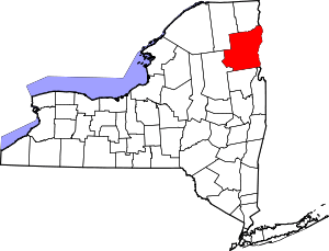 | |
| Villages | ||
| CDPs | ||
| Other hamlets | ||
| Footnotes | ‡This populated place also has portions in an adjacent county or counties | |