Lewellen, Nebraska
| Lewellen, Nebraska | |
|---|---|
| Village | |
|
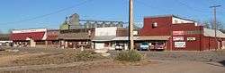
Main Street | |
 Location of Lewellen, Nebraska | |
| Coordinates: 41°19′50″N 102°8′44″W / 41.33056°N 102.14556°WCoordinates: 41°19′50″N 102°8′44″W / 41.33056°N 102.14556°W | |
| Country | United States |
| State | Nebraska |
| County | Garden |
| Area[1] | |
| • Total | 0.37 sq mi (0.96 km2) |
| • Land | 0.37 sq mi (0.96 km2) |
| • Water | 0 sq mi (0 km2) |
| Elevation | 3,317 ft (1,011 m) |
| Population (2010)[2] | |
| • Total | 224 |
| • Estimate (2012[3]) | 215 |
| • Density | 605.4/sq mi (233.7/km2) |
| Time zone | Mountain (MST) (UTC-7) |
| • Summer (DST) | MDT (UTC-6) |
| ZIP code | 69147 |
| Area code(s) | 308 |
| FIPS code | 31-26805[4] |
| GNIS feature ID | 0830687[5] |
Lewellen is a village in Garden County, Nebraska, United States. The population was 224 at the 2010 census.
Geography
Lewellen is located at 41°19′50″N 102°8′44″W / 41.33056°N 102.14556°W (41.330692, -102.145487).[6]
According to the United States Census Bureau, the village has a total area of 0.37 square miles (0.96 km2), all of it land.[1]
History
In 1855, General Harney and his troops made a surprise attack against the Brulé Sioux at their camp on Blue Creek, the site of what developed as present-day Lewellen, Nebraska. In what is known as the Battle of Blue Creek or the Battle of Ash Hollow, Chief Iron Shell and his warriors resisted the 600 troops brought by Harney. It was a punitive expedition by the US in retaliation for Sioux raids against settlers.
Many Sioux women and children hid in caves along Blue Creek but the soldiers fired into the caves, killing many. Two of Iron Shell's wives were captured that day, though Iron Shell escaped. That confrontation constituted the largest loss of life through death or capture and loss of property that the Brulé Sioux had ever suffered; 86 of their people were killed outright.[7]
Lewellen was laid out in 1906 when the railroad was extended to that point.[8] It was named for storekeeper Frank Lewellen.[9]
Demographics
| Historical population | |||
|---|---|---|---|
| Census | Pop. | %± | |
| 1930 | 419 | — | |
| 1940 | 532 | 27.0% | |
| 1950 | 510 | −4.1% | |
| 1960 | 411 | −19.4% | |
| 1970 | 376 | −8.5% | |
| 1980 | 368 | −2.1% | |
| 1990 | 307 | −16.6% | |
| 2000 | 282 | −8.1% | |
| 2010 | 224 | −20.6% | |
| Est. 2015 | 210 | [10] | −6.2% |
2010 census
As of the census[2] of 2010, there were 224 people, 130 households, and 53 families residing in the village. The population density was 605.4 inhabitants per square mile (233.7/km2). There were 200 housing units at an average density of 540.5 per square mile (208.7/km2). The racial makeup of the village was 94.6% White, 0.4% African American, 1.8% Native American, 0.9% from other races, and 2.2% from two or more races. Hispanic or Latino of any race were 4.5% of the population.
There were 130 households of which 13.1% had children under the age of 18 living with them, 30.0% were married couples living together, 6.9% had a female householder with no husband present, 3.8% had a male householder with no wife present, and 59.2% were non-families. 54.6% of all households were made up of individuals and 40.7% had someone living alone who was 65 years of age or older. The average household size was 1.72 and the average family size was 2.55.
The median age in the village was 58.4 years. 12.9% of residents were under the age of 18; 5.4% were between the ages of 18 and 24; 14.7% were from 25 to 44; 26.8% were from 45 to 64; and 40.2% were 65 years of age or older. The gender makeup of the village was 49.1% male and 50.9% female.
2000 census
As of the census[4] of 2000, there were 282 people, 137 households, and 69 families residing in the village. The population density was 789.5 people per square mile (302.4/km²). There were 172 housing units at an average density of 481.5 per square mile (184.5/km²). The racial makeup of the village was 93.97% White, 1.06% African American, 0.71% Native American, 1.06% Asian, 1.06% from other races, and 2.13% from two or more races. Hispanic or Latino of any race were 1.77% of the population.
There were 137 households out of which 14.6% had children under the age of 18 living with them, 39.4% were married couples living together, 8.8% had a female householder with no husband present, and 49.6% were non-families. 44.5% of all households were made up of individuals and 27.7% had someone living alone who was 65 years of age or older. The average household size was 1.86 and the average family size was 2.55.
In the village the population was spread out with 14.5% under the age of 18, 3.9% from 18 to 24, 16.7% from 25 to 44, 27.0% from 45 to 64, and 37.9% who were 65 years of age or older. The median age was 57 years. For every 100 females there were 79.6 males. For every 100 females age 18 and over, there were 75.9 males.
As of 2000 the median income for a household in the village was $19,191, and the median income for a family was $30,417. Males had a median income of $18,000 versus $15,625 for females. The per capita income for the village was $13,124. About 15.9% of families and 20.1% of the population were below the poverty line, including 34.2% of those under the age of eighteen and 15.4% of those sixty five or over.
See also
References
- 1 2 "US Gazetteer files 2010". United States Census Bureau. Retrieved 2012-06-24.
- 1 2 "American FactFinder". United States Census Bureau. Retrieved 2012-06-24.
- ↑ "Population Estimates". United States Census Bureau. Retrieved 2013-05-29.
- 1 2 "American FactFinder". United States Census Bureau. Retrieved 2008-01-31.
- ↑ "US Board on Geographic Names". United States Geological Survey. 2007-10-25. Retrieved 2008-01-31.
- ↑ "US Gazetteer files: 2010, 2000, and 1990". United States Census Bureau. 2011-02-12. Retrieved 2011-04-23.
- ↑ Sprague, Donovin Arleigh (2005). Rosebud Sioux, p. 49. Arcadia Publishing.
- ↑ Shumway, Grant Lee (1921). History of Western Nebraska and Its People. Western publishing & engraving Company. p. 261.
- ↑ "Lewellen". CALMIT - University of Nebraska-Lincoln. Retrieved 9 August 2014.
- ↑ "Annual Estimates of the Resident Population for Incorporated Places: April 1, 2010 to July 1, 2015". Retrieved July 2, 2016.
- ↑ "Census of Population and Housing". Census.gov. Retrieved June 4, 2015.
Municipalities and communities of Garden County, Nebraska, United States | ||
|---|---|---|
| City | ||
| Village | ||
| CDP | ||
| Unincorporated communities | ||