Lesnewth
| Lesnewth | |
| Cornish: Lysnowyth | |
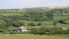 Typical South-West England complex hedgerows patterns in part of the rolling Valency valley in the civil parish. |
|
 Lesnewth |
|
| Population | 60 (Civil Parish, 2001)[1] |
|---|---|
| OS grid reference | SX131903 |
| Civil parish | Lesnewth |
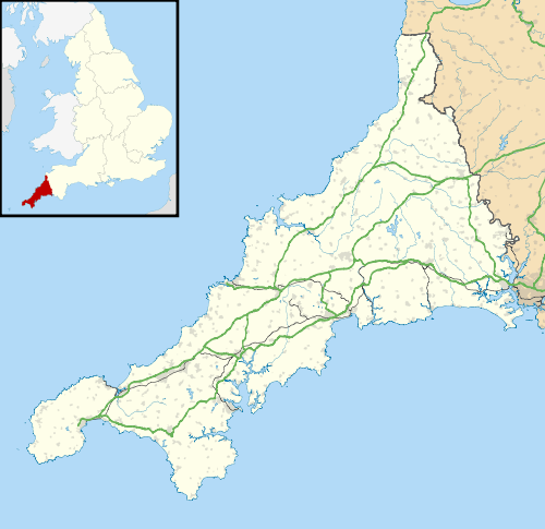
| Unitary authority | Cornwall |
| Ceremonial county | Cornwall |
| Region | South West |
| Country | England |
| Sovereign state | United Kingdom |
| Post town | BOSCASTLE |
| Postcode district | PL35 |
| Dialling code | 01840 |
| Police | Devon and Cornwall |
| Fire | Cornwall |
| Ambulance | South Western |
| EU Parliament | South West England |
| UK Parliament | North Cornwall |
Coordinates: 50°40′59″N 4°38′49″W / 50.683°N 4.647°W
Lesnewth (Cornish: Lysnowyth)[2] is a civil parish and village in Cornwall, England, United Kingdom. It is about six miles east of Tintagel Head and two miles east of Boscastle.[3]
The parish is bounded on the north by St Juliot, on the east by St Juliot and Davidstow, on the south by Davidstow, and on the west by Minster, Cornwall. It is a small sparsely populated parish set in farmland with only a few houses, farms and a church.[4] Lesnewth manor is mentioned in the Domesday Survey of 1086, as Lisniwen.[5] Lesnewth was also the name of one of ten ancient administrative shires of Cornwall: see Lesnewth (hundred).
Lesnewth lies within the Cornwall Area of Outstanding Natural Beauty (AONB). Almost a third of Cornwall has AONB designation, with the same status and protection as a National Park.
Notable buildings
The oldest buildings of Lesnewth include the Church, the Rectory, the Mill and Penpol, the latter of which is believed to be the original farmhouse to the surrounding north facing valley side. These buildings date back over 400 years, although there is believed to have been settlement in this area and on the opposing side of the Valency Valley for over 1000 years. The Church of St Michael was in part rebuilt by J. P. St Aubyn about 1865 though the tower is mediaeval.
Etymology
The name is of Cornish origin and means 'New Court' (that is a chieftain's estate): the 'Old Court' was at Helstone near Camelford (Hen-lis, -ton being a Saxon addition) once known as Helston-in-Trigg in distinction to Helston-in-Kerrier.
References
- ↑ Office for National Statistics : Census 2001 : Parish Headcounts : North Cornwall. Retrieved 14 September 2011. Note ONS raw data (as opposed to this older figure) is for an area 'too small to publish all data for reasons of confidentiality of living people' its parish data being combined with Tresparrett into output area E00095808 so more demographic statistics will become available in a few decades from 2011
- ↑ Place-names in the Standard Written Form (SWF) Archived May 15, 2013, at the Wayback Machine. : List of place-names agreed by the MAGA Signage Panel Archived May 15, 2013, at the Wayback Machine.. Cornish Language Partnership.
- ↑ Ordnance Survey: Landranger map sheet 190 Bude & Clovelly ISBN 978-0-319-23145-6
- ↑ GENUKI website Lesnewth; retrieved April 2010
- ↑ "Place name: Lesnewth, Cornwall Folio: 124v Great Domesday Book ...". Discovery.nationalarchives.gov.uk. Retrieved 28 December 2014.
External links
![]() Media related to Lesnewth at Wikimedia Commons
Media related to Lesnewth at Wikimedia Commons
Cornwall Portal | |
| Unitary authorities | |
| Major settlements |
|
| Rivers | |
| Topics | |