Lemont Township, Cook County, Illinois
| Lemont Township | |
|---|---|
| Township | |
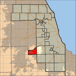 Location in Cook County | |
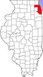 Cook County's location in Illinois | |
| Coordinates: 41°39′52″N 87°57′49″W / 41.66444°N 87.96361°WCoordinates: 41°39′52″N 87°57′49″W / 41.66444°N 87.96361°W | |
| Country | United States |
| State | Illinois |
| County | Cook |
| Area | |
| • Total | 21.07 sq mi (54.57 km2) |
| • Land | 20.40 sq mi (52.83 km2) |
| • Water | 0.67 sq mi (1.74 km2) 3.19% |
| Elevation | 732 ft (223 m) |
| Population (2010) | |
| • Total | 21,113 |
| • Density | 1,002/sq mi (386.8/km2) |
| Time zone | CST (UTC-6) |
| • Summer (DST) | CDT (UTC-5) |
| ZIP codes | 60439, 60464, 60480 |
| GNIS feature ID | 0429244 |
| Website |
www |
Lemont Township is one of 29 townships in Cook County, Illinois, USA. As of the 2010 census, its population was 21,113.[1]
Geography
According to the United States Census Bureau, Lemont Township covers an area of 21.07 square miles (54.6 km2); of this, 20.4 square miles (53 km2) (96.81 percent) is land and 0.67 square miles (1.7 km2) (3.19 percent) is water.
Cities, towns, villages
- Lemont
- Palos Park (west edge)
- Willow Springs
- Woodridge
Adjacent townships
- Downers Grove Township, DuPage County (north)
- Lyons Township (northeast)
- Palos Township (east)
- Orland Township (southeast)
- Homer Township, Will County (south)
- Lockport Township, Will County (southwest)
- DuPage Township, Will County (west)
Cemeteries
The township contains these four cemeteries: Bethany Lutheran, Danish, Mount Vernon Memorial Park and Saint Matthew Evangelical Lutheran.
Major highways
Airports and landing strips
- Lemont Fire Department Heliport
- Lemont Industrial Park Airport
(Closed and demolished for residential subdivision)
Rivers
Lakes
- Goose Lake
Landmarks
- Black Partridge Forest
- Red Gate Woods (Cook County Forest Preserves)
- Sag Quarries Forest Preserve
- Tampier Slough Woods (Cook County Forest Preserves)
Political districts
- Illinois's 13th congressional district
- State House District 82
- State Senate District 41
References
- "Lemont Township, Cook County, Illinois". Geographic Names Information System. United States Geological Survey. Retrieved 2010-01-10.
- United States Census Bureau 2007 TIGER/Line Shapefiles
- United States National Atlas
- ↑ "Geographic Identifiers: 2010 Demographic Profile Data (DP-1): Lemont township, Cook County, Illinois". U.S. Census Bureau, American Factfinder. Retrieved March 21, 2013.
External links
- Lemont Township official website
- City-Data.com
- Illinois State Archives
- Township Officials of Illinois
- Cook County Official Site
This article is issued from Wikipedia - version of the 11/17/2016. The text is available under the Creative Commons Attribution/Share Alike but additional terms may apply for the media files.