Lelant
| Lelant | |
 The railway station and old station building. The building is now a private house. |
|
 Lelant |
|
| OS grid reference | SW544372 |
|---|---|
| – London | 300 mi (480 km) ENE |
| Civil parish | St Ives |
| Unitary authority | Cornwall |
| Ceremonial county | Cornwall |
| Region | South West |
| Country | England |
| Sovereign state | United Kingdom |
| Post town | ST. IVES |
| Postcode district | TR26 |
| Dialling code | 01736 |
| Police | Devon and Cornwall |
| Fire | Cornwall |
| Ambulance | South Western |
| EU Parliament | South West England |
| UK Parliament | St Ives |
Coordinates: 50°11′02″N 5°26′24″W / 50.184°N 5.440°W
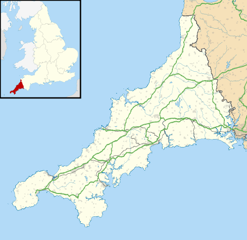
Lelant (Cornish: Lannanta[1]) is a village in west Cornwall, England, UK. It is on the west side of the Hayle Estuary, about 2 1⁄2 miles (4.0 km) southeast of St Ives and one mile (1.6 km) west of Hayle.[2] The village is part of St Ives civil parish (meaning that it falls within the parish area of St Ives Town Council) and also in St Ives Parliamentary constituency. The birth, marriage, and death registration district is Penzance.[3] There is a ward (called Lelant and Carbis Bay). Its population at the 2011 census was 3,892[4] The South West Coast Path, which follows the coast of south west England from Somerset to Dorset passes through Lelant, along the estuary and above Porth Kidney Sands.[2]
History
The name is derived from the Cornish lann and Anta, meaning church-site of Anta.[5] The earliest attested spelling is Lananta in about 1170.[6][7] Nothing is known about Anta, and Lelant parish church is dedicated to St Uny.[8] However, Carbis Bay church is dedicated to St Anta. Langdon (1896) records nine stone crosses in the parish, of which four are in the churchyard.
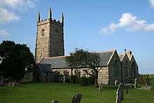
At one time Lelant was an important town and seaport having a market and a custom-house.[9] A parish terrier of 1727 describing the bounds of the glebe land states that about 50 acres of land, and the vicarage, were overwhelmed by sand. The terrier does not give a date but does say that it was not in the living memory of man. In the spring of 1875, during the building of the railway line between St Erth railway station and St Ives, several human skeletons, graves and a building were found by a gang of navvys. Observers of the building thought it was of an ecclesiastical nature, and it is possible that it is the site of a pre-Norman church, burial ground and the former Lelant town.[9] Lelant was formerly an ecclesiastical parish being the mother church of both Towednack and St Ives.[10] The parish church of St Uny's Church, Lelant is situated at the east end of the village on the edge of the towans and overlooking the West Cornwall Golf Club.[2] Lelant was a seaport in the Middle Ages, but the trade was lost to St Ives when the estuary silted up.
At Lower Lelant is a house called The Abbey which was built in the 16th century and renovated in the 18th.[11] In 1831 it was reported that much granite was quarried here, and that there were several tin mines nearby.[8] The family of Praed were landowners here for many centuries. The early 19th century politician and poet Winthrop Mackworth Praed was a member of the family, though he did not live in Cornwall.
Transport

Lelant lies on the short A3074 road that leads to Carbis Bay and St Ives, just to the north of the main A30 after it bypasses Hayle and where it swings south-westwards across country towards its end at Penzance on the south coast, about six miles away.
The village is served by two railway stations on the St Ives branch. The original station, Lelant, was built by the Great Western Railway in 1877 to serve Lelant village. Lelant Saltings was built in 1978 as park and ride station to relieve traffic congestion in St Ives and Carbis Bay.
Sport
The West Cornwall Golf Club is situated to the east of the village overlooking St Ives Bay and Godrevy Island. It is the oldest golf club in Cornwall.[12] St Ives Town play in the Cornwall Combination, a level 12 league in the English football league system. They play their home matches at the Saltings, which is between the village and Lelant Saltings railway station.
Notable people
- Jim Barnes, golfer; winner of the PGA Championship, the U.S. Open, and the British Open
- Philip Christophers, member of the Legislative Assembly of Alberta, Canada
- Rosamunde Pilcher, author of romance novels
References
- ↑ http://www.magakernow.org.uk/idoc.ashx?docid=f3fabe0c-206f-4e0c-8889-4ce4a5060e5b&version=-1
- 1 2 3 Ordnance Survey: Landranger map sheet 203 Land's End ISBN 978-0-319-23148-7
- ↑ Adams, Maxwell. "Lelant Administration". Lelant website. Retrieved 2011-09-26.
- ↑ "Ward population for 2015 census.Retrieved 7 Feb 2015".
- ↑ Mills, A. D. (1991). The Popular Dictionary of English Place-Names. Parragon Book Service Ltd & Magpie Books. p. 208. ISBN 0-7525-1851-8.
- ↑ Archives of the Dean and Chapter of Exeter, Number 3672.
- ↑ For further information about the forms of this place name see: Gover, J. E. B. (1948) The place names of Cornwall volume 6, pages 635-658 (typescript at the Royal Institution of Cornwall and reference copy at the Cornwall Record Office, Truro); research note books on Cornish place names of Oliver Padel (at the Institute of Cornish Studies, Tremough); and Adams, Maxwell. "The real and true name of Lelant". Lelant website. Retrieved 2011-09-26.
- 1 2 GENUKI website; Lelant. Retrieved April 2010.
- 1 2 Noall, Cyril (1964). "Nineteenth-Century Discoveries at Lelant". Cornish Archaeology Hendhyscans Kernow. 3: 34–6.
- ↑ Beacham, Peter; Pevsner, Nikolaus (2014). Cornwall. New Haven and London: Yale University Press. p. 301. ISBN 978 0 300 12668 6.
- ↑ Pevsner, N. (1970) Cornwall, 2nd ed. Penguin Books; p. 100
- ↑ "West Cornwall Golf Club". Club Systems International. Retrieved 4 April 2015.
External links
| Wikimedia Commons has media related to Lelant. |
Cornwall Portal | |
| Unitary authorities | |
| Major settlements |
|
| Rivers | |
| Topics | |