Lawashi River
| Lawashi River | |
| Country | Canada |
|---|---|
| Ontario | Ontario |
| Region | Northwestern Ontario |
| District | Kenora |
| Part | Kenora, Unorganized |
| Part of | James Bay drainage basin |
| Tributaries | |
| - left | Lawashi Channel |
| Source | Unnamed lake |
| - elevation | 147 m (482 ft) |
| - coordinates | 52°13′33″N 84°30′54″W / 52.22583°N 84.51500°W |
| Mouth | James Bay |
| - elevation | 0 m (0 ft) |
| - coordinates | 52°52′58″N 82°10′26″W / 52.88278°N 82.17389°WCoordinates: 52°52′58″N 82°10′26″W / 52.88278°N 82.17389°W |
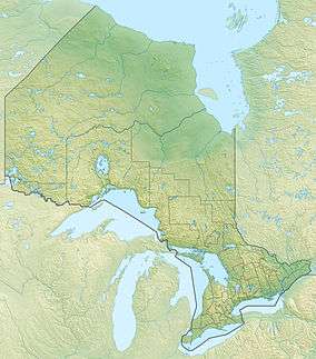 Location of the mouth of the Lawashi River in Ontario | |
The Lawashi River is a river in Unorganized Kenora District in Northwestern Ontario, Canada.[1][2] The river is a tributary of James Bay.[3]
Course
For a map showing the river course, see this reference.[2]
The river begins at an unnamed lake and heads east then northeast. It takes in the left tributary Lawashi Channel arriving from the Attawapiskat River 8.5 kilometres (5.3 mi) upstream from the river mouth, and reaches its mouth at James Bay, approximately 11 kilometres (7 mi) southeast of the mouth of the Attawapiskat River.
Tributaries
- Lawashi Channel
See also
References
- ↑ "Lawashi River". Geographical Names Data Base. Natural Resources Canada. Retrieved 2011-10-10.
- 1 2 "Lawashi River". Atlas of Canada. Natural Resources Canada. 2010-02-04. Retrieved 2011-10-10. Shows the course of the river highlighted on a map.
- ↑ Map 17 (PDF) (Map). 1 : 1,600,000. Official road map of Ontario. Ministry of Transportation of Ontario. 2010-01-01. Retrieved 2011-10-10.
This article is issued from Wikipedia - version of the 5/4/2016. The text is available under the Creative Commons Attribution/Share Alike but additional terms may apply for the media files.