Laurel Summit State Park
| Laurel Summit State Park | |
|---|---|
| Pennsylvania State Park | |
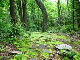 Wolf Rock Loop | |
| Country | United States |
| State | Pennsylvania |
| County | Westmoreland |
| Township | Cook |
| Location | [1] |
| - coordinates | 40°07′04″N 79°10′30″W / 40.11778°N 79.17500°WCoordinates: 40°07′04″N 79°10′30″W / 40.11778°N 79.17500°W |
| - elevation | 2,674 ft (815.0 m) [1] |
| Area | 6 acres (2 ha) |
| Founded | 1964 |
| Managed by | Pennsylvania Department of Conservation and Natural Resources |
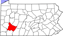
 Location of Laurel Summit State Park in Pennsylvania | |
| Website : Laurel Summit State Park | |
Laurel Summit State Park is a 6-acre (2.4 ha) Pennsylvania state park in Cook Township, Westmoreland County, Pennsylvania in the United States. It is also a picnic area with a scenic view of Linn Run on the summit of Laurel Mountain. The temperatures at Laurel Summit State Park are generally several degrees cooler than the surrounding towns in the valleys.[2] The elevation of the park is 2,739 feet (835 m) above sea level.[1]
The area in and surrounding Laurel Summit State Park is now a thriving second growth forest. One hundred years ago it was generally described as a "waste land". The ridges of the Laurel Mountain had once been covered with old-growth forest. These forests were clear cut during the lumber era that swept over most of the mountains and forests of Pennsylvania during the mid-to-late 19th century and very early 20th century. The lumberman stripped the mountains. They took the logs to the sawmill where they were cut into lumber. Smaller logs were used to reinforce the mine shafts of the many coal mines throughout southwestern Pennsylvania and West Virginia. The bark of the hemlock tree was used as a source of tannin at the tanneries of the area. The only thing the lumbermen left behind was the treetops. These tree tops were left to dry. The passing steam locomotives of the Pittsburgh, Westmoreland and Somerset Railroad would ignite this dry brush causing massive wildfires that swept through the mountains and valleys. In 1909, after the Commonwealth of Pennsylvania had purchased the land from the lumberman, Forester John R. Williams reported, "I should say that fully three-fifths (60%) of the reserve had been burned since the lumbering was done. The fires did great damage to the young growth. Some places were covered with nothing but ferns and blackberry bushes." Scars from these fires can still be seen today in the Laurel Summit vicinity.[2]
Most of the wildlife in the area was devastated due to the destruction of their habitat or over hunting. White-tailed deer were imported from Michigan and New York to reestablish what had once been a thriving population of deer. These deer were released throughout Pennsylvania. The current population of deer in Pennsylvania are descended from the original stock that was introduced in 1910 after the lumberman had moved out of the area.[2]
Nearby state parks
The following state parks are within 30 miles (48 km) of Laurel Summit State Park:[3][4][5]
- Keystone State Park (Westmoreland County)
- Kooser State Park (Somerset County)
- Laurel Mountain State Park (Westmoreland County)
- Laurel Hill State Park (Somerset County)
- Laurel Ridge State Park (Cambria, Fayette, Somerset, and Westmoreland counties)
- Linn Run State Park (Westmoreland County)
- Ohiopyle State Park (Fayette County)
- Shawnee State Park (Bedford County)
- Yellow Creek State Park (Indiana County)
References
- 1 2 3 "Laurel Summit State Park". Geographic Names Information System. United States Geological Survey. August 30, 1990. Retrieved 2008-05-06.
- 1 2 3 "Laurel Summit State Park". Pennsylvania Department of Conservation and Natural Resources. Retrieved 2006-11-29.
- ↑ Michels, Chris (1997). "Latitude/Longitude Distance Calculation". Northern Arizona University. Retrieved 2008-04-23.
- ↑ "Find a Park by Region (interactive map)". Pennsylvania Department of Conservation and Natural Resources. Retrieved November 18, 2011.
- ↑ 2007 General Highway Map Westmoreland County Pennsylvania (PDF) (Map). 1:65,000. Pennsylvania Department of Transportation, Bureau of Planning and Research, Geographic Information Division. Retrieved 2007-07-27. Note: shows Laurel Summit State Park
External links
| Wikimedia Commons has media related to Laurel Summit State Park. |
- "Laurel Summit State Park — Official map" (PDF). (301 KB)