Lathrop, California
| City of Lathrop | |
|---|---|
| City | |
 Location in San Joaquin County and the state of California | |
 City of Lathrop Location in the United States | |
| Coordinates: 37°49′1″N 121°17′19″W / 37.81694°N 121.28861°WCoordinates: 37°49′1″N 121°17′19″W / 37.81694°N 121.28861°W | |
| Country |
|
| State |
|
| County | San Joaquin |
| Incorporated | July 1, 1989[1] |
| Government | |
| • Mayor | Sonny Dhaliwal[2] |
| • Senate | Cathleen Galgiani (D)[3] |
| • Assembly | Heath Flora (R)[3] |
| • U. S. Congress | Jerry McNerney (D)[4] |
| • City manager | Stephen Salvatore[5] |
| Area[6] | |
| • Total | 23.033 sq mi (59.655 km2) |
| • Land | 21.931 sq mi (56.800 km2) |
| • Water | 1.102 sq mi (2.854 km2) 4.79% |
| Elevation[7] | 23 ft (7 m) |
| Population (April 1, 2010)[8] | |
| • Total | 22,112 |
| • Estimate (2013)[8] | 19,626 |
| • Density | 960/sq mi (370/km2) |
| Time zone | PST (UTC-8) |
| • Summer (DST) | PDT (UTC-7) |
| ZIP code | 95330 |
| Area code(s) | 209 |
| FIPS code | 06-40704 |
| GNIS feature ID | 1658948 |
| Website |
www |
Lathrop is a city located in San Joaquin County, California, United States. At the 2010 census Lathrop’s population was 18,023. The city is located in Northern California at the intersection of Interstate 5 and SR 120.
History
Lathrop was platted when the railroad was extended to that point.[9] A post office has been in operation at Lathrop since 1871.[10] The city was named for the maiden name of the wife of Leland Stanford.[9] In September 1869, four months after the railheads of the transcontinental railroad met at Promontory, Utah, the completion of the San Joaquin River Bridge at Mossdale crossing at Lathrop actually completed the west coast link.
On August 14, 1889 Chief Justice of California David S. Terry assaulted United States Supreme Court Justice Stephen J. Field, at the train station in Lathrop. Field's bodyguard United States Marshal David Neagle (formerly assigned to Tombstone, Arizona) shot and killed Terry. The events led the United States Supreme Court decision In re Neagle.
Geography
Lathrop is located at 37°49′1″N 121°17′19″W / 37.81694°N 121.28861°W (37.816904, -121.288633).[11] The San Joaquin River is on the west side of Lathrop and has elevation of 20 feet (7 m).
Neighboring towns include Manteca, Ripon, French Camp, and Tracy.
According to the United States Census Bureau, the city covers an area of 23.0 square miles (60 km2), 21.9 square miles (57 km2) of it land, and 1.1 square miles (2.8 km2) of it (4.79%) water.
Government
The mayor of Lathrop is Sonny Dhaliwal.[2] The current city council consists of Mayor Dhaliwal, Vice-Mayor Omar Ornelas, Councilmember Martha Salcedo, Councilmember Steve Dresser, and Councilmember Paul Akinjo.[2]
Lathrop is represented in the California State Assembly by Assemblymember Heath Flora.[12]
Public transportation
The City of Lathrop is served by The San Joaquin Regional Transit District.
Demographics
| Historical population | |||
|---|---|---|---|
| Census | Pop. | %± | |
| 1890 | 577 | — | |
| 1960 | 1,123 | — | |
| 1970 | 2,137 | 90.3% | |
| 1980 | 3,717 | 73.9% | |
| 1990 | 6,841 | 84.0% | |
| 2000 | 10,445 | 52.7% | |
| 2010 | 18,023 | 72.6% | |
| Est. 2015 | 20,866 | [13] | 15.8% |
2010
The 2010 United States Census[15] reported that Lathrop had a population of 18,023. The population density was 782.5 people per square mile (302.1/km²). The racial makeup of Lathrop was 7,410 (41.1%) White, 1,300 (7.2%) African American, 231 (1.3%) Native American, 3,968 (22.0%) Asian (mostly Filipino), 144 (0.8%) Pacific Islander, 3,735 (20.7%) from other races, and 1,235 (6.9%) from two or more races. Hispanic or Latino of any race were 7,674 persons (42.6%).
The Census reported that 18,011 people (99.9% of the population) lived in households, 6 (0%) lived in non-institutionalized group quarters, and 6 (0%) were institutionalized.
There were 4,782 households, out of which 2,738 (57.3%) had children under the age of 18 living in them, 2,973 (62.2%) were opposite-sex married couples living together, 719 (15.0%) had a female householder with no husband present, 379 (7.9%) had a male householder with no wife present. There were 376 (7.9%) unmarried opposite-sex partnerships, and 35 (0.7%) same-sex married couples or partnerships. 484 households (10.1%) were made up of individuals and 128 (2.7%) had someone living alone who was 65 years of age or older. The average household size was 3.77. There were 4,071 families (85.1% of all households); the average family size was 3.99.
The population was spread out with 5,819 people (32.3%) under the age of 18, 1,814 people (10.1%) aged 18 to 24, 5,324 people (29.5%) aged 25 to 44, 3,897 people (21.6%) aged 45 to 64, and 1,169 people (6.5%) who were 65 years of age or older. The median age was 30.5 years. For every 100 females there were 99.7 males. For every 100 females age 18 and over, there were 97.7 males.
There were 5,261 housing units at an average density of 228.4 per square mile (88.2/km²), of which 3,604 (75.4%) were owner-occupied, and 1,178 (24.6%) were occupied by renters. The homeowner vacancy rate was 3.7%; the rental vacancy rate was 5.5%. 13,191 people (73.2% of the population) lived in owner-occupied housing units and 4,820 people (26.7%) lived in rental housing units.
2008
As of 2008,[16] the city had a population of 17,429. The population density was 637.6 people per square mile (246.2/km²). There were 2,991 housing units at an average density of 182.6 per square mile (70.5/km²). The racial makeup of the city was 50.92% White, 4.49% African American, 1.21% Native American, 13.36% Asian (mostly Filipino), 0.54% Pacific Islander, 21.11% from other races, and 8.38% from two or more races. Hispanic or Latino of any race were 38.59% of the population.
Sister city
Lathrop participates in the Sister City program and is tied to Bacarra, Ilocos Norte, Philippines.
Shopping and restaurants
Lathrop has stores such as Target, Savemart, Circle K, and Tower Mart. Lathrop also has McDonald's, Jack in the Box, Taco Bell, Denny's, Carl's Jr., Siena Italian restaurant, multiple Subway restaurants, Little Caesars, Mountain Mike's, Yan Yan Deli, Texas Buffalo Wild Wings Sports Bar, Quiznos, La Hacienda Taqueria, Burger King, A&W, KFC, China Wok, Amici Sushi, CK Grill & Bar, Mikasa Japanese Bistro, Baskin Robins, and Milan's Pizza.
Economy
According to the City's 2011 Comprehensive Annual Financial Report,[17] the top employers in the city are:
| # | Employer | # of employees |
|---|---|---|
| 1 | Super Store Industries | 401 |
| 2 | 330 | |
| 3 | California Natural Products | 250 |
| 4 | Simplot | 200 |
| 5 | Mid Valley Plastering | 200 |
| 6 | Pilkington | 200 |
| 7 | Berry Plastics | 200 |
| 8 | Swiss American Sausage | 175 |
| 9 | Target | 160 |
| 10 | The Home Depot | 150 |
| 11 | Boral | 116 |
| 12 | Carpenter Co. | 100 |
| 13 | CBC Steel Buildings | 100 |
| 14 | Diamond Pet Foods | 100 |
| 15 | SMART Refrigerated Transport | 100 |
| 16 | Yosemite Express | 100 |
Economic potential
The City of Lathrop has a seven-mile (11 km) radius population of 105,893 with an average household income of $63,072.
Lathrop is centered between the Stockton and Tracy submarkets – both within a 20 miles (32 km) radius.
In April 2014, electric car maker Tesla Motors (based in Palo Alto, CA, about an hour southwest) announced that it would be opening a factory in Lathrop, in a 430,000 sq-ft facility that was once a DaimlerChrysler distribution center. The Tesla website showed 34 positions it was looking to fill to start.[18]
Lathrop large development
- Mossdale Village-Located west of I-5 and east of the San Joaquin River is Mossdale Village- consists of 2375 units. Of unique historical significance, the development abuts the site of the San Joaquin River Bridge, the final link to the west coast for the Transcontinental Railroad, actually completed 4 months after the official completion celebration and the driving of the "final" golden spike at Promontory Utah. (California State Historical Marker number 781-7 is at Mossdale Crossing Park.)
Education
Most of Lathrop is part of the Manteca Unified School District. But once River Islands Development is built, students from that community will be part of Tracy High School District and Banta Elementary district. The district has integrated student devices in the 2014-2015 school year, which students received in late January. Lathrop has also adopted Common Core into their curriculum.
Elementary schools
Lathrop has 3 schools that teach preschool to grade 8. These include Lathrop Elementary, Mossdale, and Joseph Widmer Jr., all of which belong to MUSD (Manteca Unified School District). A program known as the Lathrop Area Music Program, or LAMP for short, allows 7-8th graders from the schools previously stated the opportunity to take a daily elective for choir or band at Lathrop High during the high school's 1st period.
High schools
Lathrop High School the first secondary school in Lathrop that opened in 2008. Lathrop High, the home of the Spartans, has teams for wrestling, basketball, volleyball, golf, cheerleading, football, soccer, cross country, track, swim, baseball, softball, and competitive academics, as well as many clubs and extracurricular activities/electives. Also worth noting, the Spartan band, consisting of concert band, Symphonic band, marching band, and drum line, performs at Cal Band Day at Cal Berkeley.
River Islands High School is next planned high school to open.
References
- ↑ "California Cities by Incorporation Date" (Word). California Association of Local Agency Formation Commissions. Retrieved August 25, 2014.
- 1 2 3 "City Council". City of Lathrop. Retrieved January 8, 2015.
- 1 2 "Statewide Database". UC Regents. Retrieved November 23, 2014.
- ↑ "California's 9th Congressional District - Representatives & District Map". Civic Impulse, LLC. Retrieved March 12, 2013.
- ↑ "City Manager's Office". City of Lathrop. Retrieved January 11, 2015.
- ↑ "2010 Census U.S. Gazetteer Files – Places – California". United States Census Bureau.
- ↑ "Lathrop". Geographic Names Information System. United States Geological Survey. Retrieved March 20, 2015.
- 1 2 "Lathrop (city) QuickFacts". United States Census Bureau. Retrieved March 20, 2015.
- 1 2 Lee, Ralph (Dec 16, 2005). "Lathrop founded by Stanford to bypass Stockton". Lodi News-Sentinel. p. 14. Retrieved 28 October 2015.
- ↑ "San Joaquin County". Jim Forte Postal History. Retrieved 28 October 2015.
- ↑ "US Gazetteer files: 2010, 2000, and 1990". United States Census Bureau. 2011-02-12. Retrieved 2011-04-23.
- ↑ "Members: Assembly Internet". State of California.
- ↑ "Annual Estimates of the Resident Population for Incorporated Places: April 1, 2010 to July 1, 2015". Retrieved July 2, 2016.
- ↑ "Census of Population and Housing". Census.gov. Retrieved June 4, 2015.
- ↑ "2010 Census Interactive Population Search: CA - Lathrop city". U.S. Census Bureau. Retrieved July 12, 2014.
- ↑ "American FactFinder". United States Census Bureau. Retrieved 2008-01-31.
- ↑ City of Lathrop, California Comprehensive Annual Financial Report for Fiscal Year Ended June 30, 2011 (PDF) (Report). p. 129. Retrieved February 25, 2012.
- ↑ "Tesla seeks workers for ex-Chrysler property in Calif.". Automotive News. Bloomberg. April 23, 2014. Retrieved 24 April 2014.
External links
| Wikimedia Commons has media related to Lathrop, California. |
Municipalities and communities of San Joaquin County, California, United States | ||
|---|---|---|
| Cities | 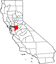 | |
| CDPs | ||
| Unincorporated communities | ||
| Ghost towns |
| |