Langley, South Carolina
| Langley, South Carolina | |
|---|---|
| Census-designated place | |
 Langley | |
| Coordinates: 33°31′4″N 81°50′38″W / 33.51778°N 81.84389°WCoordinates: 33°31′4″N 81°50′38″W / 33.51778°N 81.84389°W | |
| Country | United States |
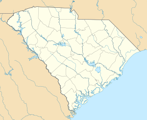
| State | South Carolina |
| County | Aiken |
| Area | |
| • Total | 1.2 sq mi (3.0 km2) |
| • Land | 1.2 sq mi (3.0 km2) |
| • Water | 0.0 sq mi (0.0 km2) |
| Elevation | 190 ft (60 m) |
| Population (2010) | |
| • Total | 1,447 |
| • Density | 1,260/sq mi (486.5/km2) |
| Time zone | Eastern (EST) (UTC-5) |
| • Summer (DST) | EDT (UTC-4) |
| ZIP code | 29834 |
| Area code(s) | 803 |
| FIPS code | 45-40390[1] |
| GNIS feature ID | 1246294[2] |
Langley is a census-designated place (CDP) in Aiken County, South Carolina, United States. The population was 1,447 at the 2010 census.[3] It is bordered by Gloverville to the northeast and Burnettown to the west.
Langley is part of the Augusta, Georgia metropolitan area. Langley is located in historic Horse Creek Valley.
The community was named after Langley, in England.[4]
2010 Census
As of the 2010 census, the population of Langley was 1,447. 0.35% of the population were of American Indian or Alaska Native, 0.28% were Asian, 4.77% were African American, 0.07% were Native Hawaiian or oher Pacific Islander, 91.91% were white, 0.83% were some other race, and 1.80% were of two or more races. Persons of Hispanic or Latino origin (of any race) comprised 2.56% of the population.
Males made up 48.79% of the population, and females 51.21%. Children under age 5 were 7.46% of the population, persons aged 5 to 17 were 15.89%, persons aged 18 to 64 were 62.61%, and persons aged 65 or over were 14.03% of the population.[5]
References
- ↑ "American FactFinder". United States Census Bureau. Retrieved 2008-01-31.
- ↑ "US Board on Geographic Names". United States Geological Survey. 2007-10-25. Retrieved 2008-01-31.
- ↑ "Geographic Identifiers: 2010 Demographic Profile Data (G001): Langley CDP, South Carolina". U.S. Census Bureau, American Factfinder. Retrieved August 6, 2013.
- ↑ Chicago and North Western Railway Company (1908). A History of the Origin of the Place Names Connected with the Chicago & North Western and Chicago, St. Paul, Minneapolis & Omaha Railways. p. 92.
- ↑ http://censusviewer.com/city/SC/Langley/2010
Municipalities and communities of Aiken County, South Carolina, United States | ||
|---|---|---|
| Cities | 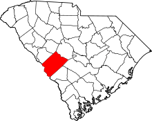 | |
| Towns | ||
| CDPs | ||
| Unincorporated communities | ||
| Footnotes | ‡This populated place also has portions in an adjacent county or counties | |