Lane Cove
| Lane Cove Sydney, New South Wales | |||||||||||||
|---|---|---|---|---|---|---|---|---|---|---|---|---|---|
 Lane Cove Plaza | |||||||||||||
| Population | 9,474 (2011 census)[1] | ||||||||||||
| • Density | 3,790/km2 (9,820/sq mi) | ||||||||||||
| Postcode(s) | 2066 | ||||||||||||
| Area | 2.5 km2 (1.0 sq mi) | ||||||||||||
| Location | 9 km (6 mi) north-west of Sydney CBD | ||||||||||||
| LGA(s) | Municipality of Lane Cove | ||||||||||||
| State electorate(s) | Lane Cove, Willoughby | ||||||||||||
| Federal Division(s) | North Sydney | ||||||||||||
| |||||||||||||
Lane Cove is an affluent middle-class suburb on the Lower North Shore of Sydney, in the state of New South Wales, Australia. Lane Cove is nine kilometres north-west of the Sydney central business district and is the administrative centre for the local government area of the Municipality of Lane Cove. It is a highly desirable, family-oriented suburb well serviced by schools, shops, cafes, restaurants, medical and dental services, recreational facilities and public transport. Lane Cove West and Lane Cove North are separate suburbs.
Lane Cove occupies a peninsula on the northern side of Port Jackson (Sydney Harbour), at the opening of the Lane Cove River. It is adjacent to the Lower North Shore suburbs of Riverview, Longueville, Willoughby and Artarmon. The regional administrative and shopping hub of Chatswood is located 2.5 kilometres away.
History
There are a number of possibilities of the origin of the name 'Lane Cove'. The first written use of the name was by Lieutenant William Bradley after he had just sailed along the river in 1788. Some have argued that it was named after Lieutenant Michael Lane, a respected cartographer, who had once worked with Captain Cook. Others say that it was in honour of John Lane, who was the son of the London Lord Mayor at the time as well as a good friend of the first Governor, Arthur Phillip. In any case, the name stuck, and by the 1800s was being used to refer to all the land north of the river.
Aboriginal culture
Prior to the arrival of the First Fleet, the area in which Lane Cove is situated was inhabited by the Cam-mer-ray-gal Group of the Ku-ring-gai Aboriginal Tribe. The group, which inhabited the north shore of Port Jackson, was one of the largest in the Sydney area.[2]
European settlement
Lieutenant Ralph Clark was the first European to land, a short distance from the entrance to the Lane Cove River on 14 February 1790. There were land grants in 1794 to some privates and non-commissioned officers in the New South Wales Corps, although few of these grants were actually settled as the steep, timbered land was not particularly habitable. However, Lane Cove was an excellent source for timber and other commodities that the settlers required. During the 19th century, farms and dairies were also established. There were also many industrial and manufacturing factories constructed around Greenwich. A detailed history of the early years of Lane Cove is found in Ball. John and Pam, Revisiting the early history of Lane Cove, 2010, Oughtershaw Press, ISBN 978-0-9593420-7-9. 253 pages.
Most of the residential growth in the area however occurred after World War II when returning soldiers were granted blocks of land around Lane Cove. The land value, which was relatively cheap during this time, surged during the 1980s and 1990s when the water views, large suburban blocks, ease of transport and quiet streets became popular.[3]
In 2005, Lane Cove briefly caught the attention of the world's press when part of an apartment block (which is now classified as being in the new suburb of North Lane Cove) collapsed into an excavation for the Lane Cove Tunnel and a pet bird in the evacuated block was rescued by a robot.[4]
Lane Cove North was split off to become a separate suburb on 20 January 2006.[5]
Former tram line
The tram service to Lane Cove opened as an electric line from Crows Nest in February, 1900, with trams connecting with other electric services at Ridge St. It was initially opened as far as Gore Hill and extended to Lane Cove in March, 1909. Some through services operated to and from Milsons Point.[6]
In September 1909, a new line was opened from McMahons Point to Victoria Cross, North Sydney and a new direct route was opened via what is now the Pacific Highway from Victoria Cross to Crows Nest. Services to Lane Cove and Chatswood were altered to operate to and from McMahons Point via the new direct route to Crows Nest, in conjunction with the construction of the Sydney Harbour Bridge.
In March, 1932 the Sydney Harbour Bridge with its associated railway and tramway tracks was opened and services from Lane Cove to the CBD were diverted to operate to and from Wynyard Station via the Sydney Harbour Bridge route. Trams entered Wynyard station via a tunnel entrance at the south-eastern pylon of the bridge.
From Lane Cove a cross regional service to Balmoral was also available. Upon departure from the Lane Cove terminus opposite the council chambers, trams travelled north on Longueville Road turning right onto the Pacific Highway. At Crows Nest, separate lines branched left onto Falcon Street, travelling through Cammeray, Neutral Bay, Cremorne Junction and Mosman before Joining Military Road. The line then split into two separate lines at the intersection of Middle Head Road and Bradleys Head Road. Turning left into Gordon Street off Middle Head Road, the line then entered on to its own off road reservation, crossing several small residential streets as it wound its way down to Henry Plunkett Reserve, entering The Esplanade near the corner of Botanic Road and terminating near Hunters Parade.[7]
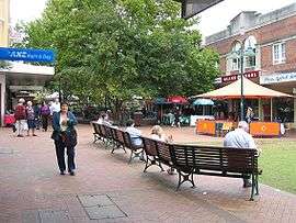
Commercial area

Although Lane Cove is primarily a residential area, it contains some commercial areas.
Lane Cove has a shopping centre that includes a pedestrian plaza at the eastern end of Burns Bay Road, where it meets Longueville Road. There is a Coles supermarket, a new Woolworths supermarket, a pub and a number of small specialty stores in this area, as well as a large number of restaurants and cafes. At the end of Longueville Road is the Lane Cove Businessman's Club which is the only local Club in the Area.
Several large businesses are located in Lane Cove including the Australian headquarters of statistical software company SAS, the recording house for Warner Bros., Festival Mushroom Records, as well as Bluescope Steels Marketing branch in Lane Cove West.
Lane Cove Library
Lane Cove Library is located at Library Walk, Lane Cove. Lane Cove Council recently extended and refurbished the Library. The new Library was officially opened in July 2010. The extension/refurbishment increased Library space from 1,203 sq m to 3,301 sq m - exceeding state benchmarks.
Greenwich Library
A small Branch Library is located at Greenwich.
Lane Cove Aquatic Centre
Lane Cove Aquatic Centre contains a 50-metre swimming pool, a 25-metre swimming pool, a shallow pool for toddlers and young children and a well equipped gym. There are also water springs, a sauna, spa and a kiosk.
Transport
The Gore Hill Freeway, which brings traffic from the city, the airport and southern suburbs connects to two major roads at Lane Cove - the Pacific Highway which travels north and Epping Road which goes north-west. The traffic problems at these intersections led to the construction of the Lane Cove Tunnel, which takes vehicles straight from the Gore Hill Expressway to the M2. Cars can now travel from the Baulkham Hills Shire to the airport without having to pass a single set of traffic lights (although there are tolls to pay in each direction). Since the opening of the Lane Cove Tunnel, two lanes of Epping Road between Mowbray Road and Lane Cove have been removed, with the left lane in each direction becoming a Bus Lane, reducing Epping Road in some sections to one lane in each direction for general traffic.
Lane Cove was the terminus of one of Sydney's northern tram lines, which closed in the late 1950s. Trams operated to Wynyard in the city and Balmoral via Crows Nest. The current 254 bus route largely follows the city route from Longueville Road to Wynyard via Crows Nest and North Sydney. The 140 bus route From Manly to Epping follows a large section of the old Balmoral route. A new major bus interchange constructed at the intersection of Epping Road and Longueville Road, as part of the Lane Cove tunnel works, opened in March 2008 with approximately 25 separate bus routes (including school routes) operating from here. This provides connections to north-west Sydney with services to Pennant Hills and Rouse Hill operated by HillsBus, and publicly operated services to Chatswood, Epping, North Sydney, Manly, Gladesville and Drummoyne. City (QVB) Express services are extremely busy during morning peak.[8]
A cyclepath has been constructed along the southern edge of Epping Road from the Pacific Highway to the Lane Cove River. This cyclepath links to the Gore Hill Freeway Cyclepath. Connecting cyclepaths allow cyclists to journey to Chatswood, North Sydney, Willoughby and the Macquarie Park area.
A ferry service that travels someway down the Lane Cove River, stops at Longueville Wharf and Greenwich Wharf.
The closest train stations are quite a distance away at Chatswood, Artarmon, and St Leonards. It is not surprising that according to the 2001 census, only 4.1% of the population travelled to work by train alone. Other ways to travel include the train and bus (1.7%), walking or cycling (5.9%), the bus only (14.3%), and car (71.0%).
Education, culture and religion
Schools in Lane Cove are:
- Currambena School - an independent primary and preschool.
- Lane Cove Public School - a primary school, established in 1876, that educates around 800 students.
- St Michael's School - a Catholic primary school, originally run by the Sisters of Mercy, who began teaching there in 1922.[9]
- Saint Ignatius' College, Riverview - a Jesuit high school for boys, founded in 1880.
Cultural groups and services include the Lane Cove Youth Orchestra, Lane Cove Concert Band, Lane Cove Art Society, Lane Cove Dance Academy, Lane Cove Music and Cultural Centre, Lane Cove Historical Society, Lane Cove Theatre Company and Lane Cove Bushland and Conservation Society.
Annual festivals are the Lane Cove Autumn Harmony Festival and the Cameraygal Festival.
Churches in Lane Cove are:
- St Michael's Catholic Church
- St Andrew's Anglican Church
- Lane Cove Uniting Church
- The Christian City Church meets each Sunday at Lane Cove Public School.
Sports
The Lane Cove Aquatic Leisure Centre provides excellent facilities and is situated adjacent to Pottery Green Oval, which is used for cricket in summer and soccer and baseball in winter.[10] The Lane Cove Cricket Club and Lane Cove Rugby Club have their homeground at Tantallon Oval.[11][12] The cricket club was established in 1893 and the Rugby Club in 1949. The Longueville Bowling Club, now known as the Longueville Sporting Club, has a lawn bowls green and is located close to the Lane Cove Country Club 9 hole golf course.[13] Saint Ignatius' College, Riverview is an active participant in the Athletic Association of the Great Public Schools of New South Wales, and has fielded cricket and rugby sides in this sporting competition for over a century. It also hosts the historic Riverview Gold Cup Regatta on the Lane Cove River. The rowing race day began in 1882.[14]
Lane Cove also has Junior sporting clubs.
- Lane Cove Junior Rugby Union Club - U5 to U16
- Lane Cove Junior Rugby Club - Minis, U10 to U16
- Lane Cove Tigers Junior Rugby League Club
- Lane Cove Cats AFL Club - Auskick, U9 to U11
- Lane Cove Football Club - U6 to U18
- Lane Cove Cricket Club - U9 to Seniors
Parks

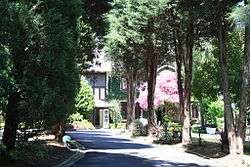
Around 16% of the area is devoted to public recreational areas including Burns Bay Park, Tambourine Bay Park, Pottery Green, Blackman Park and Tantallon Oval. As well as this there is a large amount of bushland surrounding the river's edge especially near Riverview and Lane Cove West. Lane Cove also has many small creeks and rivers that flow through it and therefore has many expanses of bushland. The Lane Cove River is the largest river in the area. Lane Cove National Park is located close to the suburb. The Lane Cove Bushland Park is home to an endangered species of fungus, Hygrocybe lanecovensis, which is found nowhere else.[15] The species was discovered in the 1990s.
Demographics
According to the 2011 census, the suburb of Lane Cove had a population of 9,474 people. Of these:[1]
- Sex distribution: There were notably fewer males (4,428 or 46.7%) than females (5,046 or 53.3%). So for each seven males, there were approximately eight females.
- Age distribution: Residents had a similar range of ages to the country overall. The median age was 38 years, compared to the national median of 37 years. Children aged under 15 years made up 18.5% of the population (national average is 19.3%) and people aged 65 years and over made up 15.8% of the population (national average is 14.0%).
- Ethnic diversity : 62% were born in Australia, compared to the national average of 70%; the next most common countries of birth were England 5.9%, China 2.6%, New Zealand 2.4%, India 2.0%, and South Africa 1.3%. At home, 74% of residents only spoke English; other languages spoken at home included Cantonese 3.0%, Mandarin 2.7%, Italian 1.3%, and Spanish 1.3%.
- Finances: The median household weekly income was $1,942, compared to the national median of $1,234. This difference is also reflected in real estate prices, with the median mortgage payment in Lane Cove being $2,600 per month, compared to the national median of $1,800.
- Transport: On the day of the Census, 29% of employed people traveled to work on public transport, and 49% by car (either as driver or as passenger).
- Housing: Half (50%) of occupied private dwellings were flats, units or apartments; 40% were separate houses, and 9% were semi-detached (row or terrace houses, townhouses etc.). The average household size was 2.4 people. Individual house prices start at $1.5 million for small, older style residences, largely based on land value. Larger, newer houses sell for more than $2.0 million. There is currently a trend in Lane Cove to buy an older house in order to demolish and build a new house.
Notable residents

Writers:
- Robert Dessaix's autobiography, A Mother's Disgrace, contains a memoir of growing up in Lane Cove in the 1950s.
- Robert Hughes, art critic. His memoir Things I Didn't Know discusses his high schooling as a boarder at St Ignatius' College, Riverview.
- Christopher Brennan, poet who boarded at Riverview [16]
Artists:
- Brett Whiteley, artist and twice winner of the Archibald Prize
Politicians:
- Barnaby Joyce, Senator. boarded at Riverview
Sportspeople:
- Brett Lee, Australian cricketer and Bollywood star. Lived in Lane Cove for a time,[17] leaving in 2013.[18]
- Sam Newman, Australian rules football player
Entertainers:
- Nicole Kidman, actress[19]
- Smoky Dawson, actor, singer, television, film and radio star[20]
- Michael Hutchence, vocalist of INXS.
- Natarsha Belling, Australian news presenter
In popular culture
In 2009, the shopping centre on Longueville Road was used in the filming of Underbelly: The Golden Mile depicting Darlinghurst Road, Kings Cross.[21]
References
- 1 2 Australian Bureau of Statistics (31 October 2012). "Lane Cove (State Suburb)". 2011 Census QuickStats. Retrieved 5 November 2012.
- ↑ "A Brief History of Lane Cove". About the area. Lane Cove Council. Retrieved 2007-10-29.
- ↑ The Book of Sydney Suburbs, Frances Pollon, Angus & Robertson Publishers, 1990, p.146 ISBN 0-207-14495-8, page 146
- ↑ "Commuter chaos to go on after tunnel collapse". Sydney Morning Herald. 2 Nov 2005.; "Tweety's free as a bird". Sydney Morning Herald. 4 Nov 2005.
- ↑ "Geographical names register extract - Lane Cove North". Geographical Names Board of New South Wales. Retrieved 16 June 2014.
- ↑ D Keenan: The North Sydney lines of the Sydney tramway system. Transit Press November 1987 ISBN 0-909338-05-1
- ↑ Gregory's Street Directory 1955, Map 58, 59, 75
- ↑ "Your Guide to Bus Services at lane Cove Interchange" (PDF). About the area. NSW Department of Transport. Archived from the original (PDF) on 2008-07-19. Retrieved 2008-04-20.
- ↑ http://www.stmichaelslanecove.com/school/history1.asp
- ↑ http://www.lanecove.nsw.gov.au/Living%20in%20the%20Area/Parks/Facilities/PotteryGreenOval.htm
- ↑ http://lanecove.nsw.cricket.com.au/
- ↑ http://www.covies.com/
- ↑ http://www.lanecovecountryclub.com.au/
- ↑ http://www.riverview.nsw.edu.au/index.php?option=com_content&task=view&id=38&Itemid=188
- ↑ NSW threatened species: Hygrocybe lanecovensis
- ↑ http://adb.anu.edu.au/biography/brennan-christopher-john-5345
- ↑ http://www.smh.com.au/sport/cricket/allrounder-set-to-deliver-a-20m-brilliant-new-career-20100821-139w0.html
- ↑ http://www.dailytelegraph.com.au/entertainment/sydney-confidential/brett-lee-shacks-up-with-lana-anderson/story-fni0cvc9-1226756402730
- ↑ http://womansday.ninemsn.com.au/celebrity/celebrityprofiles/1015207/nicole-kidman
- ↑ Shedden, Iain (2008-02-21). "Loved ones gather to farewell Smoky". The Australian.
- ↑ http://www.tv.com/news/underbelly-shooting-on-the-streets-of-sydney-17526/
External links
| Wikimedia Commons has media related to Lane Cove, New South Wales. |
- Lane Cove at DMOZ
- Lane Cove Council
- Margaret Farlow (2011). "Lane Cove". Dictionary of Sydney. Retrieved 27 September 2015. [CC-By-SA]
Coordinates: 33°49′01″S 151°10′10″E / 33.81688°S 151.16945°E