Dawson County, Texas
| Dawson County, Texas | |
|---|---|
|
The Dawson County Courthouse in Lamesa | |
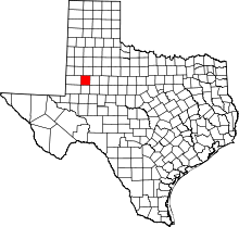 Location in the U.S. state of Texas | |
 Texas's location in the U.S. | |
| Founded | 1905 |
| Named for | Nicholas Mosby Dawson |
| Seat | Lamesa |
| Largest city | Lamesa |
| Area | |
| • Total | 902 sq mi (2,336 km2) |
| • Land | 900 sq mi (2,331 km2) |
| Population | |
| • (2010) | 13,833 |
| • Density | 15/sq mi (6/km²) |
| Congressional district | 11th |
| Time zone | Central: UTC-6/-5 |
| Website |
www |

Dawson County is a county located in the U.S. state of Texas. As of the 2010 census, its population was 13,833.[1] The county seat is Lamesa.[2] The county was created in 1876 and later organized in 1905.[3] It is named for Nicholas Mosby Dawson,[4] a soldier of the Texas Revolution.
Dawson County comprises the Lamesa, TX Micropolitan Statistical Area.
History
A Dawson County was founded in 1856 from Kinney County, Maverick County and Uvalde County, but was divided in 1866 between Kinney County and Uvalde County. The current Dawson County was founded in 1876.
In 1943, the discovery well for the Spraberry Trend, the third-largest oil field in the United States by remaining reserves,[5] was drilled in Dawson County on land owned by farmer Abner Spraberry, for whom the geological formation and associated field was named. While most of the oil fields are in the counties to the south, a small portion of the Spraberry Trend is in Dawson County. Production on the field did not begin until 1949, and by 1951 an oil boom was underway in the area, with Midland at its center.[6]
Like all Texas counties as stipulated in the Texas Constitution of 1876, Dawson County has four commissioners chosen by single-member district and a countywide elected county judge, the chief administrator of the county.
James Edward "J. E." Airhart, Sr. (1915-2007), served for thirty years from 1935 to 1985 on the Dawson County Commissioners Court, in which capacity he worked to obtain the county livestock and fair barn, the general aviation airport, and numerous highway improvements. He was instrumental in the successful negotiation of rights-of-way for U.S. Highway 87 north to O'Donnell and south to Ackerly. A farmer and rancher, Airhart also served on the Klondike Board of Education and as a Baptist deacon.[7] J. E. "Jimmy" Airhart, Jr. (1935-2016), the oldest of Airhart's six children, was a farmer/rancher and educator, who was superintendent of the Dawson County Independent School District.[8]
Geography
According to the U.S. Census Bureau, the county has a total area of 902 square miles (2,340 km2), of which 900 square miles (2,300 km2) is land and 1.8 square miles (4.7 km2) (0.2%) is water.[9]
Major highways
Adjacent counties
- Lynn County (north)
- Borden County (east)
- Martin County (south)
- Gaines County (west)
- Terry County (northwest)
- Andrews County (southwest)
- Borden County (southeast)
Demographics
| Historical population | |||
|---|---|---|---|
| Census | Pop. | %± | |
| 1880 | 24 | — | |
| 1890 | 29 | 20.8% | |
| 1900 | 37 | 27.6% | |
| 1910 | 2,320 | 6,170.3% | |
| 1920 | 4,309 | 85.7% | |
| 1930 | 13,573 | 215.0% | |
| 1940 | 15,367 | 13.2% | |
| 1950 | 19,113 | 24.4% | |
| 1960 | 19,185 | 0.4% | |
| 1970 | 16,604 | −13.5% | |
| 1980 | 16,184 | −2.5% | |
| 1990 | 14,349 | −11.3% | |
| 2000 | 14,985 | 4.4% | |
| 2010 | 13,833 | −7.7% | |
| Est. 2015 | 13,520 | [10] | −2.3% |
| U.S. Decennial Census[11] 1850–2010[12] 2010–2014[1] | |||
As of the census[13] of 2000, 14,985 people, 4,726 households, and 3,501 families resided in the county. The population density was 17 people per square mile (6/km²). There were 5,500 housing units at an average density of 6 per square mile (2/km²). The racial makeup of the county was 72.47% White, 8.66% Black or African American, 0.30% Native American, 0.25% Asian, 16.56% from other races, and 1.77% from two or more races. About 48.19% of the population were Hispanic or Latino of any race.
Of the 4,726 households, 35.10% had children under the age of 18 living with them, 59.40% were married couples living together, 11.00% had a female householder with no husband present, and 25.90% were not families. About 23.90% of all households were made up of individuals and 13.30% had someone living alone who was 65 years of age or older. The average household size was 2.69 and the average family size was 3.20.
In the county, the population was distributed as 25.60% under the age of 18, 8.90% from 18 to 24, 30.70% from 25 to 44, 20.50% from 45 to 64, and 14.30% who were 65 years of age or older. The median age was 36 years. For every 100 females, there were 124.30 males. For every 100 females age 18 and over, there were 129.90 males.
The median income for a household in the county was $28,211, and for a family was $32,745. Males had a median income of $27,259 versus $16,739 for females. The per capita income for the county was $15,011. About 16.40% of families and 19.70% of the population were below the poverty line, including 29.20% of those under age 18 and 12.80% of those age 65 or over.
Communities

Cities
- Ackerly (partly in Martin County)
- Lamesa (county seat)
- Los Ybanez
- O'Donnell (mostly in Lynn County)
Census-designated place
Unincorporated communities
See also
References
- 1 2 "State & County QuickFacts". United States Census Bureau. Retrieved December 10, 2013.
- ↑ "Find a County". National Association of Counties. Retrieved 2011-06-07.
- ↑ "Texas: Individual County Chronologies". Texas Atlas of Historical County Boundaries. The Newberry Library. 2008. Retrieved May 21, 2015.
- ↑ Gannett, Henry (1905). The Origin of Certain Place Names in the United States. Govt. Print. Off. p. 101.
- ↑ Top 100 Oil and Gas Fields
- ↑ Handbook of Texas Online: Spraberry Oil Field
- ↑ "J. E. Airhart". Lubbock Avalanche-Journal. March 26, 2007. Retrieved August 6, 2016.
- ↑ "James Edward Airhart, Jr.". Lubbock Avalanche-Journal. Retrieved August 6, 2016.
- ↑ "2010 Census Gazetteer Files". United States Census Bureau. August 22, 2012. Retrieved April 22, 2015.
- ↑ "County Totals Dataset: Population, Population Change and Estimated Components of Population Change: April 1, 2010 to July 1, 2015". Retrieved July 2, 2016.
- ↑ "U.S. Decennial Census". United States Census Bureau. Retrieved April 22, 2015.
- ↑ "Texas Almanac: Population History of Counties from 1850–2010" (PDF). Texas Almanac. Retrieved April 22, 2015.
- ↑ "American FactFinder". United States Census Bureau. Retrieved 2011-05-14.
External links
- Dawson County government’s website
- Dawson County in Handbook of Texas Online at the University of Texas
- TXGenWeb Project for Dawson County
- Dawson County History at HistoricTexas.net
 |
Terry County | Lynn County | | |
| Gaines County | |
Borden County | ||
| ||||
| | ||||
| Martin County |
Municipalities and communities of Dawson County, Texas, United States | ||
|---|---|---|
| Cities | | |
| CDP | ||
| Other unincorporated communities | ||
| Footnotes | ‡This populated place also has portions in an adjacent county or counties | |
Coordinates: 32°44′N 101°57′W / 32.74°N 101.95°W