Lafayette, Colorado
| City of Lafayette, Colorado | |
|---|---|
| Home Rule Municipality | |
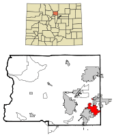 Location in Boulder County and the state of Colorado | |
| Coordinates: 39°59′42″N 105°6′2″W / 39.99500°N 105.10056°WCoordinates: 39°59′42″N 105°6′2″W / 39.99500°N 105.10056°W | |
| Country |
|
| State |
|
| County[1] | Boulder County |
| Founded | 1888 |
| Incorporated | January 6, 1890[2] |
| Named for | Lafayette Miller |
| Government | |
| • Type | Home Rule Municipality[1] |
| • Mayor | Christine Berg[3] |
| • Mayor Pro Tem | Gustavo Reyna[4] |
| • City Administrator | Gary Klaphake[5] |
| Area | |
| • Total | 9.6 sq mi (24.9 km2) |
| • Land | 9.5 sq mi (24.5 km2) |
| • Water | 0.2 sq mi (0.4 km2) |
| Elevation[6] | 5,210 ft (1,588 m) |
| Population (2010) | |
| • Total | 24,453 |
| • Density | 2,584/sq mi (997.8/km2) |
| Time zone | MST (UTC-7) |
| • Summer (DST) | MDT (UTC-6) |
| ZIP code[7] | 80026 |
| Area code(s) | Both 303 and 720 |
| FIPS code | 08-41835 |
| GNIS feature ID | 0202813 |
| Highways | US 287, SH 7, SH 42 NW Parkway |
| Website |
www |
The City of Lafayette /ˌlɑːfɪˈjɛt/ is a Home Rule Municipality located in Boulder County, Colorado, United States. The city population was 24,453 at the 2010 United States Census.[8]
Geography
Lafayette is located in southeastern Boulder County at 39°59′42″N 105°6′2″W / 39.99500°N 105.10056°W (39.995, -105.100556).[9] It is bordered by the town of Erie to the north and east, by the city of Broomfield to the east and south, and by Louisville to the southwest. U.S. Highway 287 is the main road through the city, leading north to Longmont and south to Broomfield and Denver. State Highway 7 leads east from Lafayette to Brighton and west to Boulder.
According to the United States Census Bureau, Lafayette has a total area of 9.6 square miles (24.9 km2), of which 9.5 square miles (24.5 km2) is land and 0.15 square miles (0.4 km2), or 1.50%, is water.[8]
History
Lafayette was founded in 1888 by Mary Miller. She and her husband, Lafayette Miller, had moved to the area to farm land acquired via the Homestead Act in 1871. In 1874 the Millers moved to Boulder. Lafayette Miller ran a butcher shop and was a town trustee. Lafayette Miller died in 1878, after which Mary Miller moved back to the farm with their six small children. In 1884 coal was discovered on the Miller farm, and in 1887 John Simpson sank the first shaft, thereby starting the coal mining era. In 1888 Mary Miller designated 150 acres (0.61 km2) of the farm for the town of Lafayette, which she named after her late husband. In July 1888 a second mine, the Cannon, went into operation and the first houses were built. On January 6, 1890,[2] the town of Lafayette was incorporated. As stipulated in the original town deeds, no alcohol was sold east of what is now known as Public Road.[10][11]
Lafayette quickly became a part of the coal-mining boom that all of eastern Boulder and southwestern Weld counties were experiencing, with the Cannon and Simpson mines being the largest and most productive. By 1914 Lafayette was a booming town with two banks, four hotels, and a brickworks. Lafayette was also the location of a power station that served Louisville, Boulder, Longmont, and Fort Collins.
Mary Miller continued to be a leader in the community, especially in January 1900, when the town burned. She founded the Miller Bank in 1892, and it became the Lafayette Bank in 1902.[11] She was elected president of the bank, and at that time was the only woman bank president in the world. The bank closed in 1914 because of roughly $90,000 in bad loans to the United Mine Workers. She remained devoted to the temperance movement and eventually ran for state treasurer on the Prohibition ticket. Miller died in 1921 at her daughter-in-law's home at 501 E. Cleveland Street.
Lafayette continued to thrive as a coal-mining town. Many miners struck in the aforementioned strike in the 1910s, which was nationally recognized as a great Wobbly (Industrial Workers of the World, a radical labor group) strike, noted for the Ludlow Massacre of miners' families by the National Guard in the Southern Coal Field near Trinidad, Colorado.
In 1927, Lafayette's coal miners struck again. This time, the mining massacre was closer to home, resulting in the deaths of five Lafayette resident miners just northeast of town in the Columbine Mine Massacre on November 27, 1927, in what is now the ghost town of Serene near Erie.
Another female financier came to the miners' aid. Josephine Roche, the daughter of the anti-labor deceased owner of the Rocky Mountain Fuel Company (RMFC) that owned many of the mines in the Lafayette area, used some shares of the company she had inherited from her father, bought a controlling interest in the company, and immediately began the most labor-friendly mine operation in the United States. She became a top assistant to Franklin D. Roosevelt's Secretary of Labor, Frances Perkins. Back in Lafayette, life became much better for the coal miners with the more labor-friendly management of the RMFC.
Coal mining declined as an industry by the 1950s as natural gas replaced coal. The Black Diamond mine closed in 1956, and Lafayette became once more an agriculture-based community. As Denver and Boulder grew, residential growth in Lafayette increased. With the increase in residential growth, the farm-based economy changed and commercial, small industrial and manufacturing factors became more important.
Today
The Lafayette City Council serves as the community's legislative body, enacting ordinances, appropriating funds to conduct city business, and providing policy direction for city governance through the city administrator. The council consists of seven members who are elected on a non-partisan basis in odd-numbered years. Terms are staggered as four seats must be filled each election year. The three councilors with the most votes serve four-year terms and the fourth receives a two-year term. The mayor and mayor pro-tem are selected by the City Council for two-year terms. The current mayor of Lafayette is Christine Berg and the mayor pro-tem is Gustavo Reyna.[12]
In 2010 leaders were signed for several empty big-box stores on South Boulder Road. Jax Sporting Goods moved into the old Ace Hardware building on the corner of S. Boulder and Highway 287, and next door Sunflower Market opened a new store where Albertsons had been housed. In 2014, new commercial buildings were built in the same marketplace, that house a few restaurants like Chipotle, and telecommunications companies like AT&T.
Lafayette has a variety of events each year, including an oatmeal festival in cooperation with the Quaker Oats Company, a peach festival, a wine festival, and Lafayette Days. Festival Plaza is a gathering place in Old Town Lafayette on Public Road and Chester Streets. The Plaza is composed of a series of four smaller interconnected plazas each designed with features to promote various events.
Education
Lafayette public schools are part of the Boulder Valley School District. The main public high school in Lafayette is Centaurus High School, which has approximately 1,000 students. Peak to Peak Charter School offers kindergarten through high school. The public middle school is Angevine Middle School. This school feeds into Centaurus and is also very diverse. The elementary schools are Lafayette, Alicia Sanchez, Bernard D. 'Pat' Ryan STEAM school, and Pioneer Elementary, a bilingual school where English and Spanish are both spoken. Alexander Dawson School is a private K-12 college prep school in the north part of town.
Demographics
| Historical population | |||
|---|---|---|---|
| Census | Pop. | %± | |
| 1890 | 410 | — | |
| 1900 | 970 | 136.6% | |
| 1910 | 1,892 | 95.1% | |
| 1920 | 1,815 | −4.1% | |
| 1930 | 1,842 | 1.5% | |
| 1940 | 2,052 | 11.4% | |
| 1950 | 2,090 | 1.9% | |
| 1960 | 2,612 | 25.0% | |
| 1970 | 3,498 | 33.9% | |
| 1980 | 8,985 | 156.9% | |
| 1990 | 14,548 | 61.9% | |
| 2000 | 23,197 | 59.5% | |
| 2010 | 24,453 | 5.4% | |
| Est. 2015 | 27,729 | [13] | 13.4% |
As of the census[15] of 2010, there were 24,453 people, 9,632 households, and 6,354 families residing in the city. The population density was 2,584 people per square mile (997.8/km²). There were 9,997 housing units at an average density of 1,052.3 per square mile (408.0/km²). The racial makeup of the city was 85.6% White, 1.1% African American, 0.9% Native American, 3.8% Asian, 0.05% Pacific Islander, 5.4% some other race, and 3.2% from two or more races. Hispanic or Latino of any race were 18.2% of the population.[16]
There were 9,632 households, of which 36.5% had children under the age of 18 living in them; 49.9% were headed by married couples living together; 11.6% had a female householder with no husband present; and 34.0% were non-families. Of all households, 25.5% were made up of individuals, and 5.9% were someone living alone who was 65 years of age or older. Average household size was 2.54, and average family size was 3.08.[16]
In the city, the population was spread out with 25.4% under the age of 18, 6.9% from 18 to 24, 29.7% from 25 to 44, 29.9% from 45 to 64, and 8.1% who were 65 years of age or older. The median age was 37.6 years. For every 100 females there were 95.8 males. For every 100 females age 18 and over, there were 91.9 males.[16]
For the period 2009-2011, the estimated median income for a household in the city in 2010 was $66,202, and the median income for a family was $79,212. Male full-time workers had a median income of $54,313 versus $50,166 for females. The per capita income for the city was $34,711. About 9.3% of families and 12.5% of the population were below the poverty line.[17]
Notable people
- Lars Grimsrud, aerospace engineer and performance automobile enthusiast
See also
References
- 1 2 "Active Colorado Municipalities". State of Colorado, Department of Local Affairs. Retrieved 2007-09-01.
- 1 2 "Colorado Municipal Incorporations". State of Colorado, Department of Personnel & Administration, Colorado State Archives. 2004-12-01. Retrieved 2007-09-02.
- ↑ "Staff Directory: Christine Berg". City of Lafayette. Retrieved 2014-02-14.
- ↑ "Staff Directory: Gustavo Reyna". City of Lafayette. Retrieved 2014-02-14.
- ↑ "Staff Directory: Gary Klaphake". City of Lafayette. Retrieved 2014-02-14.
- ↑ "US Board on Geographic Names". United States Geological Survey. 2007-10-25. Retrieved 2008-01-31.
- ↑ "ZIP Code Lookup" (JavaScript/HTML). United States Postal Service. Retrieved October 25, 2007.
- 1 2 "Geographic Identifiers: 2010 Demographic Profile Data (G001): Lafayette city, Colorado". U.S. Census Bureau, American Factfinder. Retrieved September 26, 2013.
- ↑ "US Gazetteer files: 2010, 2000, and 1990". United States Census Bureau. 2011-02-12. Retrieved 2011-04-23.
- ↑ "History of Lafayette". City of Lafayette. Retrieved 2007-02-01.
- 1 2 "Mary Miller". City of Lafayette. Retrieved 2007-02-01.
- ↑ http://cityoflafayette.com/index.aspx?nid=247
- ↑ "Annual Estimates of the Resident Population for Incorporated Places: April 1, 2010 to July 1, 2015". Retrieved July 2, 2016.
- ↑ "Census of Population and Housing". Census.gov. Retrieved June 4, 2015.
- ↑ "American FactFinder". United States Census Bureau. Retrieved 2008-01-31.
- 1 2 3 "Profile of General Population and Housing Characteristics: 2010 Demographic Profile Data (DP-1): Lafayette city, Colorado". U.S. Census Bureau, American Factfinder. Retrieved September 26, 2013.
- ↑ "Selected Economic Characteristics: 2009-2011 American Community Survey 3-Year Estimates (DP03): Lafayette city, Colorado". U.S. Census Bureau, American Factfinder. Retrieved September 26, 2013.
External links
- City of Lafayette official website
- Lafayette News (Lafayette's Weekly Newspaper)
- Arts Lafayette (Non Profit in support of Arts in Lafayette, Colorado)
Municipalities and communities of Boulder County, Colorado, United States | ||
|---|---|---|
| Cities | 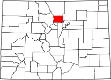 | |
| Towns | ||
| CDPs | ||
| Unincorporated communities | ||
| Ghost town | ||
| Footnotes | ‡This populated place also has portions in an adjacent county or counties | |