Lac de Payolle
| Lac de Payolle | |
|---|---|
 The Lac de Payolle in 2009 | |
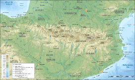 Lac de Payolle Map of the Pyrenees showing the location of Lac de Payolle | |
| Location | Hautes-Pyrénées, France |
| Coordinates | 42°56′04″N 00°17′50″E / 42.93444°N 0.29722°ECoordinates: 42°56′04″N 00°17′50″E / 42.93444°N 0.29722°E |
| Surface area | 10.1 ha (25 acres) |
| Surface elevation | 1,139 m (3,737 ft) |
The Lac de Payolle is an artificial lake in the French Pyrenees. It is located in the communes of Campan and Arreau of the Hautes-Pyrénées department in the Midi-Pyrénées region. Its western shore is the boundary between the communes of Ancizan and Arreau. It is usually completely frozen in winter.
Geography
It is located at the foot of the Col d'Aspin at 1,139 m (3,737 ft) altitude. With an area of 10 ha (25 acres), it is filled by three mountain streams.
Tourism
The lake is an important tourist resort centre: Payolle ski resort, where various activities are practiced such as mountain biking, orienteering, cross-country skiing, snowshoeing, dog sleds, horse or pony rides, paragliding, hiking, etc.
On the lake, fishing is practiced. A tourist fishing route was also laid out around the lake with gateways for fisherman, but also various watersports such as canoeing and sailing.[1]
Sport
Stage 7 of the 2016 Tour de France will finish at the lake on 8 July 2016.[2]
See also
- List of lakes of Hautes-Pyrénées
- List of lakes of the Pyrénées
- Col d'Aspin
References
- ↑ "Lac de Payolle". lacsdespyrenees.com (in French). Retrieved 24 October 2015.
- ↑ "Tour de France 2016: Chris Froome delight at 'great course'". BBC News. BBC News. 20 October 2015. Retrieved 24 October 2015.