L'Isle-Bouzon
| L'Isle-Bouzon | |
|---|---|
 | |
 L'Isle-Bouzon | |
|
Location within Occitanie region  L'Isle-Bouzon | |
| Coordinates: 43°55′42″N 0°43′45″E / 43.9283°N 0.7292°ECoordinates: 43°55′42″N 0°43′45″E / 43.9283°N 0.7292°E | |
| Country | France |
| Region | Occitanie |
| Department | Gers |
| Arrondissement | Condom |
| Canton | Saint-Clar |
| Intercommunality | Coeur de Lomagne |
| Government | |
| • Mayor (2008–2014) | Yves Bosc |
| Area1 | 15.95 km2 (6.16 sq mi) |
| Population (2008)2 | 238 |
| • Density | 15/km2 (39/sq mi) |
| Time zone | CET (UTC+1) |
| • Summer (DST) | CEST (UTC+2) |
| INSEE/Postal code | 32158 / 32380 |
| Elevation |
85–206 m (279–676 ft) (avg. 168 m or 551 ft) |
|
1 French Land Register data, which excludes lakes, ponds, glaciers > 1 km² (0.386 sq mi or 247 acres) and river estuaries. 2 Population without double counting: residents of multiple communes (e.g., students and military personnel) only counted once. | |
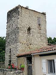
L'Isle-Bouzon is a commune in the Gers department in southwestern France.
Geography
The village lies above the right bank of the Auroue, which flows north through the western part of the commune. The river Arrats forms all of the commune's eastern border.

L'Isle-Bouzon and its surrounding communes
Population
| Historical population | ||
|---|---|---|
| Year | Pop. | ±% |
| 1962 | 338 | — |
| 1968 | 297 | −12.1% |
| 1975 | 282 | −5.1% |
| 1982 | 240 | −14.9% |
| 1990 | 230 | −4.2% |
| 1999 | 249 | +8.3% |
| 2008 | 238 | −4.4% |
See also
References
| Wikimedia Commons has media related to L'Isle-Bouzon. |
This article is issued from Wikipedia - version of the 10/8/2016. The text is available under the Creative Commons Attribution/Share Alike but additional terms may apply for the media files.