Lévis, Quebec
| Lévis | |||
|---|---|---|---|
| City | |||
| Ville de Lévis | |||
|
Lévis as seen from Terrasse Dufferin | |||
| |||
| Motto: Toujours à l'Avant-Garde | |||
 Location with surrounding municipalities. | |||
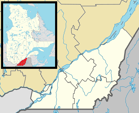 Lévis Location in southern Quebec. | |||
| Coordinates: 46°48′N 71°11′W / 46.800°N 71.183°WCoordinates: 46°48′N 71°11′W / 46.800°N 71.183°W[1] | |||
| Country |
| ||
| Province |
| ||
| Region | Chaudière-Appalaches | ||
| RCM | None | ||
| Constituted | January 1, 2002 | ||
| Boroughs | |||
| Government[2] | |||
| • Type | Lévis City Council | ||
| • Mayor | Gilles Lehouillier | ||
| • MPs |
Steven Blaney (C) Jacques Gourde (C) | ||
| • MNAs |
François Paradis (C) Marc Picard (C) Dominique Vien (L) | ||
| Area[2][3] | |||
| • Total | 497.00 km2 (191.89 sq mi) | ||
| • Land | 449.31 km2 (173.48 sq mi) | ||
| Population (2011)[3] | |||
| • Total | 138,769 | ||
| • Density | 308.8/km2 (800/sq mi) | ||
| • Pop 2006-2011 |
| ||
| • Dwellings | 59,024 | ||
| Time zone | EST (UTC−5) | ||
| • Summer (DST) | EDT (UTC−4) | ||
| Postal code(s) | G6V to G6Z, G7A | ||
| Area code(s) | 418 and 581 | ||
| Website |
www | ||


Lévis is a city in eastern Quebec, Canada. It is located on the south shore of the St. Lawrence River, opposite Quebec City. A ferry links Old Quebec with Old Lévis, and two bridges, the Quebec Bridge and the Pierre Laporte Bridge, connect western Lévis with Quebec City. The Société de transport de Lévis is responsible for public transportation by bus.
The population in July 2015 was 144,147.[4] Its current incarnation was founded on January 1, 2002, as the result of a merger among ten cities, including the older city of Lévis founded in 1861.
Lévis is also the name of a territory equivalent to a regional county municipality (TE) and census division (CD) of Quebec, coextensive with the city of Lévis. Its geographical code is 25 as a census division, and 251 as an RCM-equivalent territory.
History
First Nations people are said to have favoured the Pointe-Lévy (currently named Lévis) area long before French settlement due to its ideal location, at the junction of the St-Lawrence and the Chaudière rivers. Many archeological sites reveal evidence of human occupation for about 10,000 years. Some historians theorize that Pointe-Lévy could have been one of the main centres of Native American population development in the Quebec province.
In 1636, approximately 28 years after the foundation of Quebec City, The seignory of Lauzon was founded on the eastern part of the actual territory. In the following years, other seignories were founded near the St-Lawrence river. Pointe-Lévy was mainly an agricultural domain in which several lords ("Seigneurs") controlled their part of land in a medieval feodal way.
The land of the Lauzon seignory remained unoccupied until 1647, when Guillaume Couture became the first European settler installed in front of Quebec City. Couture was at the time first Administrator, Chief Magistrate, Captain of the Militia, member of the Sovereign Council and was widely considered a hero in New France. Couture was however not the first seignor of the Lauzon Seignory, as the land was owned by Jean de Lauzon (French Governor between 1651 and 1657).
During the Seven Years' War in the summer of 1759, General James Wolfe established a camp in the territory of Pointe-Lévy and laid siege to Quebec City. The siege succeeded and after firing cannons from the hills of Pointe-Lévy for three months and the battle on the plains in front of the walls, Quebec fell to the British. During this time, Pointe-Lévy served as the main camp to sustain the British army in the Quebec area. The constant cannon firing between Quebec City and Pointe-Lévy also served as a way to stop the French and British ships from going farther on the St. Lawrence river thus preventing reinforcement to other major cities like Montreal. In 1763, Marie-Josephte Corriveau was hanged in Quebec City for killing her husband, and, in accordance with English practice, her body was displayed in a cage for several weeks in St-Joseph-de-la-Pointe-Lévy (old part of the former City of Lauzon). This was an unusual punishment used for the first time by the British government in North America and reserved for persons found guilty of particularly heinous crimes. This punishment was practised in England since the Middle Ages.

From 1854, the railroad appeared in Pointe-Lévy making the city a major transportation centre for commerce and immigration. Being on the south shore of the St. Lawrence river, Pointe-Levy could be connected through rail to Ontario, Maine (and from there the whole United States) and the Maritime Provinces.
Many years later, between 1865 and 1872 while the city was still under control of Britain, a series of three forts were built to protect Quebec and the surroundings from the threat of American invasion. The forts were never really used for their intended purpose. One of these forts (Fort no.1) still remains today and can be visited.
The City of Lévis, named after the successor to Montcalm, the Chevalier de Levis, was erected in 1861. The founder of this new city was Mgr. Joseph-David Déziel (1806–1882). Many municipalities in the territory of present-day Lévis were merged between 1861 and 2002. Many towns were created and the Village of Pointe-Levy (or St-Joseph-de-la-Pointe-Lévy) became the Village of Lauzon in 1867 and then the City of Lauzon in 1910.
In the late 19th and beginning of the 20th century, Alphonse Desjardins, pioneered the foundation of the credit union movement and founded the first caisse populaire in Lévis. He also began a long process to create what later became the Desjardins Group by travelling everywhere in Quebec helping people in other cities to start their own credit union.
Legacy
On 28 June 1985 Canada Post issued 'Fort No.1, Point Levis, Que.' one of the 20 stamps in the “Forts Across Canada Series” (1983 & 1985). The stamps are perforated 12½ x 13 and were printed by Ashton-Potter Limited based on the designs by Rolf P. Harder.[5]
Geography
Lévis covers an area of 444 km2 (171 sq mi): 10% urban, 48% farmlands, 36% forests and 6% wetlands. In addition to the Saint Lawrence River, the Etchemin and Chaudière Rivers also run through the city before ending their journey in the Saint Lawrence. The Chaudière River also boasts a fall with a suspended bridge, which can be accessed from Autoroute 73.
Lévis County existed until the 1980s when it was divided into Desjardins Regional County Municipality and Les Chutes-de-la-Chaudière Regional County Municipality.
On January 1, 2002, ten cities were merged by the Quebec provincial government to form the new city of Lévis. Previously, the former cities of Lauzon and Saint-David-de-l'Auberivière had been merged to Lévis in 1989.[6] The regional county municipalities which these cities were a part of ceased to exist.
Boroughs
The new city was divided into three arrondissements or boroughs.[7] Desjardins, Les Chutes-de-la-Chaudière-Ouest and Les Chutes-de-la-Chaudière-Est, which correspond to most of the territory of the former RCMs (however, Saint-Henri and Saint-Lambert-de-Lauzon remained independent and did not amalgamate into Lévis).
The ten former municipalities are today districts (secteurs) within the city; each of the three boroughs is composed of either three or four districts.
Former Municipalities (10)
- Lévis (pre-2002 borders of the city)
- Charny
- Pintendre
- Sainte-Hélène-de-Breakeyville
- Saint-Étienne-de-Lauzon
- Saint-Jean-Chrysostome
- Saint-Joseph-de-la-Pointe-de-Lévy
- Saint-Nicolas
- Saint-Romuald
- Saint-Rédempteur
The pre-2002 Lévis had already merged with Lauzon and Saint-David-de-l'Auberivière in 1989.
Demographics
Population

| Canada census – Lévis, Quebec community profile | |||
|---|---|---|---|
| 2011 | 2006 | ||
| Population: | 138,769 (+6.7% from 2006) | 130,006 (+6.6% from 2001) | |
| Land area: | 449.31 km2 (173.48 sq mi) | 449.32 km2 (173.48 sq mi) | |
| Population density: | 308.8/km2 (800/sq mi) | 289.3/km2 (749/sq mi) | |
| Median age: | 40.7 (M: 39.6, F: 41.8) | 39.4 (M: 38.2, F: 40.5) | |
| Total private dwellings: | 59,024 | 54,425 | |
| Median household income: | $65,055 | $57,550 | |
| References: 2011[3] 2006[8] | |||
| Historical Census Data - Lévis, Quebec[9] | |||||||||||||||||||||||||||||||||||||||||||||||||||||||||||||||||||||||||||||
|---|---|---|---|---|---|---|---|---|---|---|---|---|---|---|---|---|---|---|---|---|---|---|---|---|---|---|---|---|---|---|---|---|---|---|---|---|---|---|---|---|---|---|---|---|---|---|---|---|---|---|---|---|---|---|---|---|---|---|---|---|---|---|---|---|---|---|---|---|---|---|---|---|---|---|---|---|---|
|
|
| |||||||||||||||||||||||||||||||||||||||||||||||||||||||||||||||||||||||||||
| [11][12] | |||||||||||||||||||||||||||||||||||||||||||||||||||||||||||||||||||||||||||||
The city of Lévis' population grew by an estimated 1.3 per cent in 5 years. Lévis is an old community in terms of population as the proportion of youths is lower than the national average and the proportion of those over 65 years of age is higher than the national average. Some 14.5 per cent is under 14 years of age, while those over 65 number 15.7 per cent. The city is one of the most homogeneous in Canada: around 99 per cent of the population are of European ancestry, while over 97% of residents speak French as their mother tongue.
Economy

Although a relatively small city, Lévis is not a typical suburb. The presence of several large employers has allowed many citizens to both live and work in Lévis. It is home to the Ultramar refinery, one of the largest in eastern Canada, Frito-Lay and Davie Shipbuilding are located in Lauzon Area (former city). A subsidiary of the Desjardins Group, Desjardins Financial Securities is headquartered in the city. The founder Desjardins, Alphonse Desjardins, lived in Lévis and ran with his wife, Dorimène Roy Desjardins, the first Caisse Populaire (similar to a credit union) from their home. The city is also a major agricultural business research and development centre. More and more high technology companies, such as Creaform (3D), are established in Lévis.
Lévis is home to the enclosed regional shopping mall, Les Galeries Chagnon which has 106 stores.
A lot of small business and entertainment developed in the city during the last decade and finalized the transformation from a Quebec City suburb into a small city.
Education
Commission scolaire des Navigateurs operates Francophone public schools.
There are many schools of different levels, including the Cégep de Lévis-Lauzon and a UQAR campus (Université du Québec à Rimouski).
Notable people
- Alphonse Desjardins - co-operator, founder of the Desjardins Group
- Jean Carignan - fiddler
- Céline Bonnier - actress
- Ariane Moffatt - singer
- Pierre-Luc Létourneau-Leblond - hockey player for the New Jersey Devils
- Kalyna Roberge - speed skater
- Charles Hamelin - short-track speed skater
See also
- Levis De-Icer
- List of regional county municipalities and equivalent territories in Quebec
- Municipal reorganization in Quebec
References
- ↑ Reference number 35834 of the Commission de toponymie du Québec (French)
- 1 2 Geographic code 25213 in the official Répertoire des municipalités (French)
- 1 2 3 http://www12.statcan.gc.ca/census-recensement/2011/dp-pd/prof/details/page.cfm?Lang=E&Geo1=CSD&Code1=2425213&Geo2=PR&Code2=24&Data=Count&SearchText=Levis&SearchType=Begins&SearchPR=01&B1=All&Custom=
- ↑ "Quebec statistics" (in French). 2.statcan.ca. 2009-12-10. Retrieved 2012-01-02.
- ↑ Canada Post stamp
- ↑ Lévis at The Canadian Encyclopedia.
- ↑ City of Lévis. History(French)
- ↑ "2006 Community Profiles". Canada 2006 Census. Statistics Canada. March 30, 2011. Retrieved 2014-04-17.
- ↑ Statistics Canada: 1996, 2001, 2006, 2011 census
- ↑ http://www.mamrot.gouv.qc.ca/repertoire-des-municipalites/fiche/municipalite/25213/
- ↑ "Évolution démographique des 10 principales villes du Québec (sur la base de 2006) selon leur limites territoriales actuelles1, Recensements du Canada de 1871 à 2006" (in French). Institut de la statistique du Québec. 2008-02-01. Retrieved 2012-02-08.
- ↑ These figures correspond to the territory of the city of Lévis following the municipal reorganizations of 2002 and 2006.
External links
- (French) Ville de Lévis
 |
Saint Lawrence River Portneuf RCM |
Saint Lawrence River Quebec TE |
Saint Lawrence River L'Île-d'Orléans RCM |
|
| Lotbinière RCM | |
Bellechasse RCM | ||
| ||||
| | ||||
| La Nouvelle-Beauce RCM |
| Regional county municipalities and equivalent territories | |
|---|---|
| Municipalities | |