Kyerwa District
| Kyerwa District | |
|---|---|
| District | |
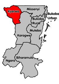 Kyerwa District's location within Kagera Region. | |
| Country | Tanzania |
| Region | Kagera Region |
| Population (2012) | |
| • Total | 321,026 |
Kyerwa District is one of the eight districts of the Kagera Region of Tanzania. It is one of the 20 new districts that were formed in Tanzania since 2010; it was split off from Karagwe District.[1] It is bordered to the north by Uganda, to the east by Missenyi District, to the south by Karagwe District and to the west by Rwanda.
According to the 2012 Tanzania National Census, the population of Kyerwa District was 321,026.[2]
Transport
Unpaved trunk road T39 from Kayanga in Karagwe District to the Ugandan border passes through Kyerwa District.[3]
Administrative subdivisions
As of 2012, Kyerwa District was administratively divided into 18 wards.[2]
Wards
|
|
|
References
- ↑ "New constituencies up for grabs as CUF cries foul". The Citizen. Retrieved 17 February 2016.
- 1 2 "Census 2012". National Bureau of Statistics. Retrieved 16 February 2016.
- ↑ "Kagera Roads Network" (PDF). Tanroads. Retrieved 16 February 2016.
This article is issued from Wikipedia - version of the 5/22/2016. The text is available under the Creative Commons Attribution/Share Alike but additional terms may apply for the media files.