Krishnanagar, Nepal
| Krishnanagar कृष्णनगर नगरपालिका Jhandanagar | |
|---|---|
| municipality | |
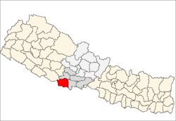
 Krishnanagar Location in Nepal | |
| Coordinates: 27°30′07″N 82°47′35″E / 27.502°N 82.793°ECoordinates: 27°30′07″N 82°47′35″E / 27.502°N 82.793°E | |
| Country |
|
| Zone | Lumbini Zone |
| District | Kapilvastu District |
| Population (1991) | |
| • Total | 20,670 |
| Time zone | NST (UTC+5:45) |
| Postal Code | 32815 A.P.O |
| Area code(s) | 076 |
| Website | www.krishnanagarmun.gov.np |
Krishnanagar (also known as Jhandanagar) is a municipality in Kapilvastu district of Lumbini Zone in the western terai part of Nepal. The municipality was established on 18 May 2014 by merging the existing Krishnanagar, Sirsihawa, Shivanagar village development committees (VDCs).[1][2] on Nepal's southern border with India across from Barhani Bazar. Movement of Indian and Nepalese nationals across the border is unrestricted, however there is a customs checkpoint for goods. Goods bound for Dang and Arcghakhanchi cross here. Krishnanagar connects by road to the east-west Mahendra Highway.
Commerce
Krishnanagar is a wealthy, industrialized village with rice, oil and steel mills,sugar mill and many cement industries. Highway connecting it with other places is an industrial road.
Culture
Krishnanagar is highly rich in culture, as different religions' people live here and because of the border area, both Indian and Nepalese people, Hindus and Muslims celebrates the festival of Hindu culture and Muslim culture together.
References
- ↑ "72 new municipalities announced". My Republica.com. Archived from the original on June 18, 2014. Retrieved 2014-06-10.
- ↑ "Government announces 72 new municipalities". The Kathmandu Post. Retrieved 2014-06-10.