Kovilambakkam
| Kovilambakkam Sunnambu Kolathur, Chinna Kovilambakkam & Periya Kovilambakkam | |
|---|---|
| Neighbourhood | |
 Kovilambakkam | |
| Coordinates: 12°56′45″N 80°12′05″E / 12.9457357°N 80.2014543°ECoordinates: 12°56′45″N 80°12′05″E / 12.9457357°N 80.2014543°E | |
| Country | India |
| State | Tamil Nadu |
| District | Kanchipuram |
| Taluk | Sholinganallur |
| Panchayat Union | St. Thomas Mount |
| Rural | Rural |
| Ward | 1 to 12 |
| Government | |
| • Type | Panchayat Board |
| • Body | Kovilambakkam Village Panchayat |
| Population (2001) | |
| • Total | 9,277 |
| Languages | |
| • Official | Tamil |
| Time zone | IST (UTC+5:30) |
| PIN | 600129, Old-600117 |
| Telephone code | 91-44 |
| Vehicle registration | TN-14 & TN-22 |
| Lok Sabha constituency | Chennai South |
| Legislative Assembly constituency | Sholinganallur |
| Website | http://www.kanchi.tn.nic.in/ (Governmental) |
Kovilambakkam is a suburb which is located within Chennai, Tamil Nadu, India. It is administered by the Kovilambakkam Panchayat Board, which is under control of the Sholinganallur district.
Demographics
As of 2001 India census,[1] Kovilambakkam had a population of 9,277. Males constitute 4,746 of the population and females 4,531. There were 2,145 households. Its location code is 03000200082000 as per TN Gov. Kovilambakkam has an average literacy rate of 72.55%, higher than the national average of 59.5%: male literacy is 55.7%, and female literacy is 44.3%. In Kovilambakkam, 14% of the population is under 6 years of age and at one point Kovilambakkam had a very big lake called 'MGR Nagar Yeri', which is now occupied illegally and has been converted as a residential area with all amenities in it. Many lakes are occupied this way and due to this there is no way for rain water to stagnate in the lake. Due to that residential areas were badly affected by the 2015 floods. However, the government is not taking any steps to retain the occupied lake as well as the rain water drain canal.
Facilities
TNEB Sub Stations - Kovilambakkam
Samuthaya Nala Koodam
Police Booth Near Gandhi Nagar entrance
Viduthalai Nagar playground
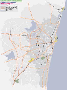
Location
 |
Pallavaram | Keelkattalai | Velachery | |
| Nanmangalam | |
Pallikaranai | ||
| ||||
| | ||||
| Santhoshpuram | Medavakkam | Vadakkupattu |
Schools and colleges
- Govt. Higher Secondary School
- A. V. G. Vidyalaya Matriculation School on Periyar Salai
- Sri Ram Matriculation School
- Tagore Matriculation School
- Golden Matriculation School
- Pole Star Matriculation School
- San Academy
- Himayam Matriculation School
- Panchayat Union Primary School, Kovilambakkam
Bus Routes
They are many buses well connected to various routes with frequent availability of MTC buses. The area which consist partially of 200Ft Road starts from Kamatchi Memorial Hospital.
V 51 - Tambaram to Velacher & T.Nagar
91 - Tambaram to Thiruvanmiyur
91G - Guduvanchery to Thiruvanmiyur
91V - Vandalaur to Thiruvanmiyur
91cut - Pallavaram to Thiruvanmiyur
B21 - Guduvanchery to Broadway
S12 - Keelkatalai to Velachery
S91 - Keelkatalai to Medavakkam Koot road
S88 - Pallikaranai to Medavakkam Koot road
B 51 - Tambaram to T.Nagar
14M - Medavakkam Koot Road to St Thomas mount/NGO Colony
M11 - Tambaram To Saidapet
M51s - S.Kolathur to T. Nagar
V151 - Tambaram West to T. Nagar via S.Kolathur
552K - Keelkatalai to Thiruporur
References
- ↑ "Census of India 2001: Data from the 2001 Census, including cities, villages and towns (Provisional)". Census Commission of India. Archived from the original on 2004-06-16. Retrieved 2008-11-01.
External links
- WIKIMAPIA
- Undermining Farm Wells
- At cremation ground, it’s trash that burns
- Village panchayats to get new roads
- Village panchayats to get new roads
[ [ and have many browsing center my browsing center name is rkn browsing