Dobra Kolata
| Dobra Kolata | |
|---|---|
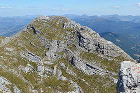 Dobra Kolata from summit Zla Kolata | |
| Highest point | |
| Elevation | 2,528 m (8,294 ft) |
| Coordinates | 42°29′56″N 19°54′00″E / 42.4989°N 19.9°ECoordinates: 42°29′56″N 19°54′00″E / 42.4989°N 19.9°E |
| Geography | |
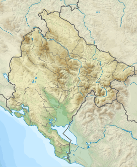 Dobra Kolata Albania and Montenegro | |
Dobra Kolata (in Montenegrin and Serbian) or Kolata e Mirë (in Albanian) is a mountain in the Kolata massif located in Albania and Montenegro, part of the Prokletije, standing at 2,528 m (8,294 ft) high. It and Zla Kolata, which is 2,534 m (8,314 ft) high, are the two peaks of the Kolata massif located on the border. The highest peak is completely on Albanian territory and called Rodi e Kollatës, it rises 2,552 m (8,373 ft). Kolata is the second highest peak in Montenegro after its neighbour Zla Kolata.
References
This article is issued from Wikipedia - version of the 9/21/2015. The text is available under the Creative Commons Attribution/Share Alike but additional terms may apply for the media files.