Kokrajhar district
| Kokrajhar district | |
|---|---|
| District | |
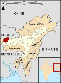 Map of Kokrajhar district in Assam | |
| Country | India |
| State | Assam |
| Headquarters | Kokrajhar |
| Area | |
| • Total | 3,129 km2 (1,208 sq mi) |
| Population (2011) | |
| • Total | 886,999 |
| • Density | 280/km2 (730/sq mi) |
| Time zone | IST (UTC+05:30) |
| ISO 3166 code | IN-AS |
| Website | kokrajhar.gov.in |
Kokrajhar district (ˌkɒkrəˈʤɑ: ;Bodo: )कक्राझार is an administrative district in the state of Assam in north-eastern India. The district headquarters are located at Kokrajhar town. The district occupies an area of 3,169.22 km². As of 2001, the district had a population of 905,764. Hindus 594,168, Muslims 184,441 (20.36%).
Kokrajhar district serves as the gateway to the northeastern region of India. Roads and rails to Seven Sister States pass through this district on their way to other northeast states.[1]
History
Kokrajhar was originally a part the undivided Goalpara district. In 1957, under the administration of Bimala Prasad Chaliha as the Chief Minister of Assam, three sub-divisions were created one of which was Kokrajhar. This sub-division was made into a district on 1 July 1983.[2]
On 29 September 1989 Bongaigaon district was created from parts of Kokrajhar and Goalpara.[2]
Geography
Kokrajhar district occupies an area of 3,129 square kilometres (1,208 sq mi),[3] comparatively equivalent to Russia's Waigeo Island.[4] Kokrajhar district is located on the northern bank of the Brahmaputra river. It forms the gateway to the Seven Sister States. Kokrajhar shares its boundary with Bongaigaon (now known as Chirang), Dhubri, West Bengal, Barpeta and Bhutan.
National protected area
- Manas National Park (Part)
Economy

In 2006 the Indian government named Kokrajhar one of the country's 250 most backward districts (out of a total of 640).[5] It is one of the eleven districts in Assam currently receiving funds from the Backward Regions Grant Fund Programme (BRGF).[5]
Divisions
There are four Assam Legislative Assembly constituencies in this district: Gossaigaon, Kokrajhar West, Kokrajhar East, and Sidli.[6] All but Gossaigaon are designated for scheduled tribes.[6] All four are in the Kokrajhar Lok Sabha constituency.[7]
Demographics
According to the 2011 census Kokrajhar district has a population of 886,999,[8] roughly equal to the nation of Fiji.[9] This gives it a ranking of 467th in India (out of a total of 640).[8] The district has a population density of 280 inhabitants per square kilometre (730/sq mi).[8] Its population growth rate over the decade 2001-2011 was 5.19%.[8] Kokrajhar has a sex ratio of 958 females for every 1000 males,[8] and a literacy rate of 66.63%.[8]
The district is multi-ethnic, with no majority ethnic group. Most of the Bodo and Assamese are Hindu, with a small Christian minority. Almost all of the Bengalis are Muslim, while more than 90% of the Santhals are Christian.[10]
Culture
Places of interest
- Onthai Gwlao: Located in Chandrapara near the bank of river Gwrang.
- Mahamaya temple: Located on the border between Kokrajhar and Dhubri.
- Thandwi Bineswar Brahma Memorial Park: Located in Bhatermary on the bank of River Gwrang.
- Daimalu Park: Located in Karigaon.
Flora and fauna
In 1990 Kokrajhar district became home to Manas National Park, which has an area of 500 km2 (193.1 sq mi).[11] It shares the park with four other districts.
Popularity
Since Chakrashila Wildlife Sanctuary of the district is the protected habitat of endangered Golden Langur and Ultapani Reserve forest is the home of more than 300 different species of butterflies so the district has been declared as the land of Butterflies and Golden Langur. Even different species of butterflies are found in different areas also as well as the Golden Langur is also can be found in Ultapani Reserve Forest. Haltugaon Forest Division in partnership with 135 Infantry Battalion (TA) Eco Task Force and 15th Battalion the Dogra Regiment (all India) organized a plantation drive in Ultapani on 29 April 2012 where they planted 40,885 saplings of trees by a team of 100 people within 1 hour and achieved Guinness World Record of Most Trees planted. The motto of the record attempt was 'Plant Trees, Save Lives' and the aim was to save the forests of the region and to increase environmental awareness. After this achievement Kokrajhar town has been declared as the city of Guinness World Record.[12]
Notable personalities
- Bineshwar Brahma, poet and author
- Upendranath Brahma, Bodo leader
- Ranjit Shekhar Mooshahary, IPS officer, director general of National Security Guards and Border Security Force, former governor of Meghalaya.
- Sansuma Khunggur Bwiswmuthiary, Bodoland politician, nationalist and social activist
- Kameshwar Brahma, writer, president of Bodo Sahitya Sabha and Padma Shri recipient
See also
References
- 1 2 District Report - KOKRAJHAR Ministry of Minority Affairs, Govt of India
- 1 2 Law, Gwillim (2011-09-25). "Districts of India". Statoids. Retrieved 2011-10-11.
- ↑ Srivastava, Dayawanti et al. (ed.) (2010). "States and Union Territories: Assam: Government". India 2010: A Reference Annual (54th ed.). New Delhi, India: Additional Director General, Publications Division, Ministry of Information and Broadcasting (India), Government of India. p. 1116. ISBN 978-81-230-1617-7.
- ↑ "Island Directory Tables: Islands by Land Area". United Nations Environment Program. 1998-02-18. Retrieved 2011-10-11.
Waigeo 3,154km2
- 1 2 Ministry of Panchayati Raj (8 September 2009). "A Note on the Backward Regions Grant Fund Programme" (PDF). National Institute of Rural Development. Retrieved 27 September 2011.
- 1 2 "List of Assembly Constituencies showing their Revenue & Election District wise break - up" (PDF). Chief Electoral Officer, Assam website. Retrieved 26 September 2011.
- ↑ "List of Assembly Constituencies showing their Parliamentary Constituencies wise break - up" (PDF). Chief Electoral Officer, Assam website. Retrieved 26 September 2011.
- 1 2 3 4 5 6 "District Census 2011". Census2011.co.in. 2011. Retrieved 2011-09-30.
- ↑ US Directorate of Intelligence. "Country Comparison:Population". Retrieved 2011-10-01.
Fiji 883,125 July 2011 est.
- ↑ Census 2001
- ↑ Indian Ministry of Forests and Environment. "Protected areas: Assam". Retrieved 25 September 2011.
- ↑ Most trees planted in one hour (team)/url=http://www.guinnessworldrecords.com/records-1000/most-trees-planted-in-one-hour-%28team%29/
External links
 |
|
| ||
| Jalpaiguri district, West Bengal | |
Chirang district | ||
| ||||
| | ||||
| Cooch Behar district, West Bengal | Dhubri district | Bongaigaon district |
| Topics | |
|---|---|
| History | |
| Districts & Divisions |
|
| Geography | |
| Culture | |
| Arts, Literature, Music Cinema |
|
| People | |
| Notable surnames |
|
| Urban centres | |
| |
Coordinates: 26°24′00″N 90°16′12″E / 26.40000°N 90.27000°E