Kirchschlag bei Linz
| Kirchschlag bei Linz | ||
|---|---|---|
|
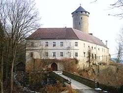
Wildberg castle | ||
| ||
 Kirchschlag bei Linz Location within Austria | ||
| Coordinates: 48°24′49″N 14°16′41″E / 48.41361°N 14.27806°ECoordinates: 48°24′49″N 14°16′41″E / 48.41361°N 14.27806°E | ||
| Country | Austria | |
| State | Upper Austria | |
| District | Urfahr-Umgebung | |
| Government | ||
| • Mayor | Dr. Gertraud Deim (ÖVP) | |
| Area | ||
| • Total | 17 km2 (7 sq mi) | |
| Elevation | 896 m (2,940 ft) | |
| Population (14 June 2016)[1] | ||
| • Total | 2,103 | |
| • Density | 120/km2 (320/sq mi) | |
| Time zone | CET (UTC+1) | |
| • Summer (DST) | CEST (UTC+2) | |
| Postal code | 4202 | |
| Area codes | 0 72 15 | |
| Vehicle registration | UU | |
| Website | www.kirchschlag.net | |

Kirchschlag bei Linz is a municipality in the district of Urfahr-Umgebung in the Austrian state of Upper Austria.
Population
| Historical population | ||
|---|---|---|
| Year | Pop. | ±% |
| 1991 | 1,683 | — |
| 2001 | 1,906 | +13.3% |
References
| Wikimedia Commons has media related to Kirchschlag bei Linz. |
This article is issued from Wikipedia - version of the 11/2/2016. The text is available under the Creative Commons Attribution/Share Alike but additional terms may apply for the media files.