Kirchlengern
| Kirchlengern | ||
|---|---|---|
|
Town hall | ||
| ||
 Kirchlengern | ||
Location of Kirchlengern within Herford district 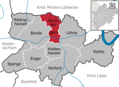
 | ||
| Coordinates: 52°12′00″N 08°37′59″E / 52.20000°N 8.63306°ECoordinates: 52°12′00″N 08°37′59″E / 52.20000°N 8.63306°E | ||
| Country | Germany | |
| State | North Rhine-Westphalia | |
| Admin. region | Detmold | |
| District | Herford | |
| Government | ||
| • Mayor | Rüdiger Meier (CDU) | |
| Area | ||
| • Total | 33.78 km2 (13.04 sq mi) | |
| Population (2015-12-31)[1] | ||
| • Total | 16,085 | |
| • Density | 480/km2 (1,200/sq mi) | |
| Time zone | CET/CEST (UTC+1/+2) | |
| Postal codes | 32278 | |
| Dialling codes | 05223 (Bünde) | |
| Vehicle registration | HF | |
| Website | www.kirchlengern.de | |


Kirchlengern is a municipality in the district of Herford, in North Rhine-Westphalia, Germany.
Geography

Lutheran Monastery Church of St. Mary's in Kirchlengern-Stift Quernheim
Kirchlengern is situated on the river Else, approx. 10 km north of Herford.
Neighbouring places
Division of the municipality
The municipality is divided in 7 districts:
- Häver (1,900 inhabitants)
- Kirchlengern (6,051 inhabitants)
- Klosterbauerschaft (2,568 inhabitants)
- Quernheim (1,549 inhabitants)
- Rehmerloh (203 inhabitants)
- Stift Quernheim (1,668 inhabitants)
- Südlengern (3,154 inhabitants)
Notable Persons
- 1821, Tönies Wellensiek, †1903
- 1833, Ernst Heinrich Lindemann, †1900
- 1901, Rudolf Bäumer †25. September 1973
- 1911, August Wilhelm Torweihe †1994
- 1923, Werner Diestelhorst
- 1924, Hellmuth Buddenberg, †2003
- 1942, Gunter Gabriel
- 1953, Jürgen Klute
- 1953, Reinhard Göhner
- 1958, Elke Kruse
- 1963, Hermann Menninghaus
- 1983, Gerrit Hahn
- 1984, David Odonkor
- 1988, Chrissy Kütemann
- 1989, Oliver Schaffer
- 1989, Shane Saxton
References
- ↑ "Amtliche Bevölkerungszahlen". Landesbetrieb Information und Technik NRW (in German). 18 July 2016.
External links
- Official site (German)
Towns and municipalities in Herford (district) | ||
|---|---|---|
This article is issued from Wikipedia - version of the 6/21/2015. The text is available under the Creative Commons Attribution/Share Alike but additional terms may apply for the media files.