Kilburn Dam
| Kilburn Dam | |
|---|---|
 The Kilburn Dam seen from the viewpoint on the R74 next to Sterkfontein Dam | |
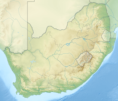 Location of Kilburn Dam in South Africa | |
| Official name | Kilburn Dam |
| Location | KwaZulu-Natal, South Africa |
| Coordinates | 28°35′05″S 29°05′40″E / 28.5846°S 29.0945°ECoordinates: 28°35′05″S 29°05′40″E / 28.5846°S 29.0945°E |
| Opening date | 1981 |
| Owner(s) | Department of Water Affairs |
| Dam and spillways | |
| Type of dam | earth-fill |
| Impounds | Majaneni River[1] |
| Height | 48 m (157 ft)[2] |
| Length | 1,100 m (3,600 ft)[2] |
| Reservoir | |
| Creates | Kilburn Dam Reservoir |
| Total capacity | 36,700 ML (29,800 acre·ft)[2] |
| Catchment area | 30 km2 (12 sq mi) |
| Surface area | 207 ha (510 acres) |
| Power station | |
| Operator(s) | Eskom |
| Commission date | 1981 |
| Type | Pumped Storage |
| Turbines | 4 |
| Installed capacity | 1,000 MW (1,300,000 hp) |
The Kilburn Dam, an earth-fill type dam and part of the Tugela-Vaal Water Project and Drakensberg Pumped Storage Scheme, is located 500 metres (1,600 ft) lower than the Sterkfontein Dam, on the Mnjaneni River, near Bergville, KwaZulu-Natal, province of South Africa. The dam was commissioned in 1981, has a capacity of 36,700 cubic metres (1,300,000 cu ft), and a surface area of 207 hectares (510 acres), the dam wall is 48 metres (157 ft) high. The main purpose of the dam assembly is to serve for the generation of hydro-electricity and its hazard potential has been ranked high (3).
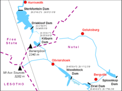
Kilburn Dam's position in the Drakensberg Pumped Storage Scheme
See also
References
- ↑ "Kilburn Dam". Department of Water Affairs and Forestry. Retrieved 2008-10-22.
- 1 2 3 "Pumped Storage Scheme" (PDF). 5. Eskom. October 2005. Retrieved 2008-10-22.
This article is issued from Wikipedia - version of the 11/19/2015. The text is available under the Creative Commons Attribution/Share Alike but additional terms may apply for the media files.