Khour, India
| Khour Deonian | |
|---|---|
| Village | |
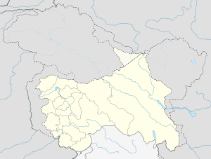 Khour Deonian  Khour Deonian Location in Jammu and Kashmir, India | |
| Coordinates: 32°36′N 74°48′E / 32.6°N 74.8°ECoordinates: 32°36′N 74°48′E / 32.6°N 74.8°E | |
| Country |
|
| State | Jammu and Kashmir |
| District | Jammu |
| Elevation | 279 m (915 ft) |
| Population (2001) | |
| • Total | 6,142 |
| Languages | |
| • Official | English,punjabi |
| Time zone | IST (UTC+5:30) |
| Vehicle registration | JK02 |
Khour Deonian is a Village in Teh. R.S.Pura of Jammu district in the Indian state of Jammu and Kashmir.
Wealth
- S.Darshan Singh Azad,provincial Vice President and chairman of judicial committee of rs pura,famous person of jammu and richest person of rs pura with a wealth of 60 crores
Geography
Khour Deonian is located at 32°22′N 74°29′E / 32.36°N 74.48°E. It has an average elevation of 279 metres (915 feet). It is located on right bank of famous Chhanab at a distance of about 3 km.
Economy
Main economic activity of khour deonian is agriculture and dairy farming.People are very hardworking. Basmati rice is grown on large scale.Poultry farms are also contributing to the wealth of the people.Some of the prominent poultry farms include Hind poultry etc.
Demographics
As of 2011 India census,[1] Khour Deonian had a population of 2480 with 547 no of households. Males constitute 53.5% of the population and females 46.5%. Khour Deonian has an average literacy rate of 71%, higher than the national average of 59.5%: male literacy is 56.3%, and female literacy is 43.7%. In Khour Deonian, 11% of the population is under 6 years of age.
References
- ↑ "Census of India 2001: Data from the 2001 Census, including cities, villages and towns (Provisional)". Census Commission of India. Archived from the original on 2004-06-16. Retrieved 2008-11-01.