Khot
| Khot Խոտ | |
|---|---|
| community | |
 Khot | |
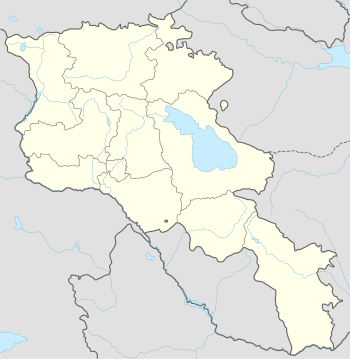
| Coordinates: 39°26′24″N 46°20′10″E / 39.44000°N 46.33611°ECoordinates: 39°26′24″N 46°20′10″E / 39.44000°N 46.33611°E | |
| Country |
|
| Marz (Province) | Syunik |
| Area[1] | |
| • Total | 17.97 km2 (6.94 sq mi) |
| Population (2011) | |
| • Total | 942 |
| • Density | 52/km2 (140/sq mi) |
| Time zone | (UTC+4) |
| • Summer (DST) | (UTC+5) |
| Khot at GEOnet Names Server | |
Khot (Armenian: Խոտ; formerly, Khotavan and Khovt) is a village and rural community (municipality) in the Syunik Province of Armenia. On the 1823 Survey of Karabagh the population is reported to consist of 37 households, all aremenian. The National Statistical Service of the Republic of Armenia (ARMSTAT) reported its population as 1,079 in 2010,[2] up from 890 at the 2001 census.[3]
References
- ↑ Region.mtaes.am/ "Syunik regional e-Governance System" Check
|url=value (help) (in Armenian). Syunik Region Province provincial government. Click on link entitled "Համայնքներ" (community) and search for the place by Armenian name. - ↑ "Marzes of the Republic of Armenia and Yerevan City in Figures, 2010" (PDF). National Statistical Service of the Republic of Armenia (ARMSTAT).
- ↑ Report of the results of the 2001 Armenian Census, National Statistical Service of the Republic of Armenia

This article is issued from Wikipedia - version of the 10/30/2015. The text is available under the Creative Commons Attribution/Share Alike but additional terms may apply for the media files.