Kenvil, New Jersey
| Kenvil, New Jersey | |
|---|---|
| Census-designated place | |
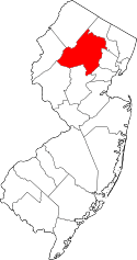
 Map of former Succasunna-Kenvil CDP in Morris County. Inset: Location of Morris County in New Jersey. | |
| Coordinates: 40°52′13″N 74°37′54″W / 40.870198°N 74.631639°WCoordinates: 40°52′13″N 74°37′54″W / 40.870198°N 74.631639°W | |
| Country |
|
| State |
|
| County | Morris |
| Township | Roxbury |
| Area[1] | |
| • Total | 1.581 sq mi (4.095 km2) |
| • Land | 1.330 sq mi (3.444 km2) |
| • Water | 0.251 sq mi (0.651 km2) 15.89% |
| Elevation[2] | 709 ft (216 m) |
| Population (2010 Census)[3] | |
| • Total | 3,009 |
| • Density | 2,262.8/sq mi (873.7/km2) |
| Time zone | Eastern (EST) (UTC-5) |
| • Summer (DST) | Eastern (EDT) (UTC-4) |
| FIPS code | 3436720[1][4] |
| GNIS feature ID | 02584005[1][5] |
Kenvil is an unincorporated community and census-designated place (CDP) located within Roxbury Township, in Morris County, New Jersey, United States,[6] that had been part of the Succasunna-Kenvil CDP as part of the 2000 United States Census, at which time the population of the combined was 12,569.[7] For the 2010 Census, the area was split into two CDPs, Succasunna (with a 2010 Census population of 9,152[8]) and Kenvil (3,009 as of 2010[3]).[9][10][11]
History
The Hercules Powder Company in Kenvil has had explosions in 1934, killing 6 people; in 1940, killing 51 people; and in 1989, shattering windows across town.[12]
Geography
According to the United States Census Bureau, the CDP had a total area of 1.581 square miles (4.095 km2), including 1.330 square miles (3.444 km2) of land and 0.251 square miles (0.651 km2) of water (15.89%).[1][13]
Demographics
| Historical population | |||
|---|---|---|---|
| Census | Pop. | %± | |
| 2010 | 3,009 | — | |
| Population sources: 2010[3] | |||
Census 2010
At the 2010 United States Census, there were 3,009 people, 1,095 households, and 773.1 families residing in the CDP. The population density was 2,262.8 per square mile (873.7/km2). There were 1,149 housing units at an average density of 864.1 per square mile (333.6/km2). The racial makeup of the CDP was 83.52% (2,513) White, 2.19% (66) Black or African American, 0.13% (4) Native American, 7.18% (216) Asian, 0.00% (0) Pacific Islander, 4.55% (137) from other races, and 2.43% (73) from two or more races. Hispanics or Latinos of any race were 15.99% (481) of the population.[3]
There were 1,095 households, of which 30.3% had children under the age of 18 living with them, 54.6% were married couples living together, 10.4% had a female householder with no husband present, and 29.4% were non-families. 25.0% of all households were made up of individuals, and 13.1% had someone living alone who was 65 years of age or older. The average household size was 2.66 and the average family size was 3.13.[3]
In the CDP, 20.9% of the population were under the age of 18, 7.6% from 18 to 24, 26.1% from 25 to 44, 28.9% from 45 to 64, and 16.5% who were 65 years of age or older. The median age was 42.2 years. For every 100 females there were 95.4 males. For every 100 females age 18 and over, there were 94.8 males.[3]
Transportation
U.S. Route 46 and Route 10 pass through the area. The Morristown and Erie Railway runs rail freight service through the area 2-5 times per week on its High Bridge Branch.
References
- 1 2 3 4 Gazetteer of New Jersey Places, United States Census Bureau. Accessed July 21, 2016.
- ↑ U.S. Geological Survey Geographic Names Information System: Kenvil Census Designated Place, Geographic Names Information System. Accessed December 23, 2012.
- 1 2 3 4 5 6 DP-1 - Profile of General Population and Housing Characteristics: 2010 Demographic Profile Data for Kenvil CDP, New Jersey, United States Census Bureau. Accessed December 23, 2012.
- ↑ American FactFinder, United States Census Bureau. Accessed September 4, 2014.
- ↑ US Board on Geographic Names, United States Geological Survey. Accessed September 4, 2014.
- ↑ Locality Search, State of New Jersey. Accessed April 18, 2015.
- ↑ DP-1: Profile of General Demographic Characteristics: 2000; Census 2000 Summary File 1 (SF 1) 100-Percent Data for Succasunna-Kenvil CDP, New Jersey, United States Census Bureau. Accessed December 23, 2012.
- ↑ DP-1 - Profile of General Population and Housing Characteristics: 2010 Demographic Profile Data for Succasunna CDP, New Jersey, United States Census Bureau. Accessed December 23, 2012.
- ↑ New Jersey: 2010 - Population and Housing Unit Counts - 2010 Census of Population and Housing (CPH-2-32), p. III-4. United States Census Bureau, August 2012. Accessed December 23, 2012. "New CDPs: Kenvil (formed from part of deleted Succasunna-Kenvil CDP) and Succasunna (formed from part of deleted Succasunna-Kenvil CDP); Deleted CDPs: Succasunna-Kenvil (split to form Kenvil and Succasunna CDPs)."
- ↑ GCT-PH1 - Population, Housing Units, Area, and Density: 2010 - County -- County Subdivision and Place from the 2010 Census Summary File 1 for Morris County, New Jersey, United States Census Bureau. Accessed December 23, 2012.
- ↑ 2006-2010 American Community Survey Geography for New Jersey, United States Census Bureau. Accessed December 23, 2012.
- ↑ Hochman, Louis C. "Long-vacant Hercules plant site could get transit village, warehouses", NJ Advance Media for NJ.com, September 15, 2014. Accessed July 21, 2016. "Hundreds of residents manufacturer high explosives at the Hercules Powder Factory, according to the Roxbury Township Historical Society. Two explosions killed six workers in 1934. Then, in 1940, more than 297,000 pounds of gunpowder blew up at the factory in a series of explosions and fires, leveling 20 buildings in the nearby area. That explosion killed 51 people and injured and burned 200 others, according to the historical society."
- ↑ US Gazetteer files: 2010, 2000, and 1990, United States Census Bureau. Accessed September 4, 2014.