Kawal
| Kawal कवाल | |
|---|---|
| Word | |
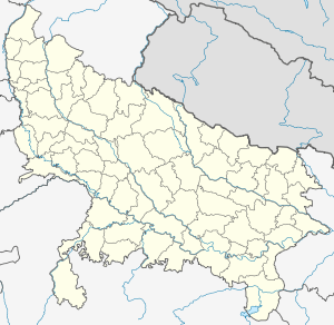 Kawal  Kawal Location in Uttar Pradesh, India | |
| Coordinates: 29°20′0″N 77°51′0″E / 29.33333°N 77.85000°ECoordinates: 29°20′0″N 77°51′0″E / 29.33333°N 77.85000°E | |
| Country |
|
| State | Uttar Pradesh |
| District | Muzaffarnagar |
| Block | Jansath |
| Elevation | 232 m (761 ft) |
| Languages | |
| • Official | Hindi |
| Time zone | IST (UTC+5:30) |
| Vehicle registration | UP-12 |
| Nearest city | Jansath |
| Lok Sabha constituency | Bijnor |
| Website |
up |
Kawal (Hindi: कवाल, Urdu: كوال) is a village in the Muzaffarnagar district of western Uttar Pradesh in northern India.[1] It lies between two rivers - the Ganges (Ganga) in the East and Yamuna in the West. It also lies between two branches of the Ganges Canal, an old canal of the River Ganges.
History
In 2013, a dispute between Hindus and Muslims in Kawal triggered the 2013 Muzaffarnagar riots.[2]
Geography
It is located at 29.33° N 77.85° E. It has an average elevation of 232 meters (761 feet) above Mean Sea Level (MSL).
Demographics
Its population is approximately 12,000.It is a very sensitive village in terms of both the communities.
References
This article is issued from Wikipedia - version of the 10/2/2016. The text is available under the Creative Commons Attribution/Share Alike but additional terms may apply for the media files.