Kastamonu
| Kastamonu | |
|---|---|
| Municipality | |
 Kastamonu | |
| Coordinates: 41°22′35″N 33°46′35″E / 41.37639°N 33.77639°ECoordinates: 41°22′35″N 33°46′35″E / 41.37639°N 33.77639°E | |
| Country | Turkey |
| Province | Kastamonu Province |
| Government | |
| • Mayor | Tahsin BABAŞ (AKP) |
| Area[1] | |
| • District | 1,834.04 km2 (708.13 sq mi) |
| Population (2012)[2] | |
| • Urban | 96,217 |
| • District | 128,537 |
| • District density | 70/km2 (180/sq mi) |
| Climate | Cfb |
| Website |
www |
Kastamonu is the capital district of the Kastamonu Province, Turkey. According to the 2000 census, population of the district is 102,059 of which 64,606 live in the urban center of Kastamonu.[3][4] (Population of the urban center in 2010 is 91,012.[5]) The district covers an area of 1,834 km2 (708 sq mi),[6] and the town lies at an elevation of 904 m (2,966 ft). It is located to the south of the province.
History
The city is believed to have been founded in the 18th century BC. The town was known as Timonion (Τιμόνιον in Greek) during the Roman period.
The change of name of the town dates to the 10th century AD. Manuel Erotikos Komnenos, a Thracian soldier who became a prominent general and the father of the Byzantine emperor Isaac I Komnenos, was given lands around Kastamonu by Emperor Basil II and built a fortress there named Kastra Komnenon (Κάστρα Κομνηνών). Manuel came to the notice of Basil II because of his defence, in 978, of Nicaea against the rebel Bardas Skleros.[7] The name Kastra Komnenon was shortened to Kastamone, and later turcified to Kastamoni and Kastamonu.
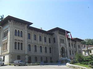
The Dress Code Revolution started at Kastamonu by Atatürk on August 23, 1925. Atatürk made his historical speech concerning about the "Hat and Dress Revolution" in 1925 at his visit to Kastamonu at Cumhuriyet Halk Partisi building.[8] The building is now used as Archeological Museum. The materials used by Atatürk in his Kastamonu visit are also exhibited in the museum.
Economic history
In the early 20th century, nickel was being mined in the area around Kastamonu.[9]
Education
Kastamonu is home to Kastamonu University, which was established in 2006 by incorporating existing colleges, schools, and institutes that were previously under Ankara University and Gazi University.
Notable high schools in Kastamonu are:
- Abdurrahman Paşa Lisesi, also known as Kastamonu Lisesi, the first modern high school that was established in Anatolia in late Ottoman Empire.
- Kastamonu Mustafa Kaya Lisesi, an Anatolian high school, one of the most successful high schools in Turkey outside Istanbul, Ankara and İzmir.
Climate
Kastamonu has an oceanic climate (Köppen : Cfb) with cold winters and warm summers. The average annual precipitation is evenly distributed throughout the year, with spring being the wettest season.
| Climate data for Kastamonu, Turkey | |||||||||||||
|---|---|---|---|---|---|---|---|---|---|---|---|---|---|
| Month | Jan | Feb | Mar | Apr | May | Jun | Jul | Aug | Sep | Oct | Nov | Dec | Year |
| Average high °C (°F) | 3.2 (37.8) |
6.0 (42.8) |
10.8 (51.4) |
16.5 (61.7) |
21.1 (70) |
24.6 (76.3) |
27.8 (82) |
28.0 (82.4) |
23.9 (75) |
17.9 (64.2) |
10.9 (51.6) |
4.9 (40.8) |
16.3 (61.33) |
| Daily mean °C (°F) | −0.9 (30.4) |
0.7 (33.3) |
4.3 (39.7) |
9.6 (49.3) |
14.1 (57.4) |
17.5 (63.5) |
20.3 (68.5) |
20.0 (68) |
15.6 (60.1) |
10.6 (51.1) |
5.1 (41.2) |
0.9 (33.6) |
9.82 (49.68) |
| Average low °C (°F) | −4.3 (24.3) |
−3.5 (25.7) |
−0.8 (30.6) |
3.5 (38.3) |
7.6 (45.7) |
10.5 (50.9) |
12.4 (54.3) |
12.3 (54.1) |
8.9 (48) |
5.2 (41.4) |
0.9 (33.6) |
−2.3 (27.9) |
4.2 (39.57) |
| Average precipitation mm (inches) | 31.7 (1.248) |
27.7 (1.091) |
35.8 (1.409) |
53.5 (2.106) |
71.4 (2.811) |
72.8 (2.866) |
32.0 (1.26) |
29.6 (1.165) |
31.9 (1.256) |
39.3 (1.547) |
27.9 (1.098) |
34.6 (1.362) |
488.2 (19.219) |
| Average rainy days | 12.8 | 11.1 | 12.6 | 13.4 | 14.6 | 12.0 | 6.4 | 5.8 | 6.7 | 9.1 | 9.6 | 12.2 | 126.3 |
| Average relative humidity (%) | 78 | 76 | 68 | 62 | 64 | 64 | 55 | 57 | 61 | 67 | 78 | 81 | 67.6 |
| Mean monthly sunshine hours | 68.2 | 95.2 | 142.6 | 165 | 226.3 | 255 | 300.7 | 291.4 | 216 | 164.3 | 108 | 55.8 | 2,088.5 |
| Mean daily sunshine hours | 2.2 | 3.4 | 4.4 | 5.5 | 7.2 | 8.4 | 10.0 | 9.4 | 7.3 | 5.4 | 3.5 | 2.0 | 5.72 |
| Source: Turkish State Meteorological Service [10] | |||||||||||||
|source 2= Weatherbase [11]
Notable natives
- Latifî (1491-1582), Ottoman poet
- Iovan Tsaous (Yiannis Eitziridis) (1893–1942), Greek musician and composer
- Oğuz Atay (1934–1977), novelist
- Rıfat Ilgaz (1911–1993), novelist
- Halit Akmansü (1883–1923), military officer in the Ottoman and Turkish armies
Notes
- ↑ "Area of regions (including lakes), km²". Regional Statistics Database. Turkish Statistical Institute. 2002. Retrieved 2013-03-05.
- ↑ "Population of province/district centers and towns/villages by districts - 2012". Address Based Population Registration System (ABPRS) Database. Turkish Statistical Institute. Retrieved 2013-02-27.
- ↑ Turkish Statistical Institute. "Census 2000, Key statistics for urban areas of Turkey" (in Turkish). Archived from the original (XLS) on July 22, 2007. Retrieved 2008-11-17.
- ↑ GeoHive. "Statistical information on Turkey's administrative units". Retrieved 2008-11-22.
- ↑ Statistical Institute
- ↑ Statoids. "Statistical information on districts of Turkey". Retrieved 2008-11-22.
- ↑ Runciman, pp. 54-55
- ↑ İğdemir, Uluğ (1963). Atatürk. Mango, Andrew (trans.). Ankara: Turkish National Commission for UNESCO. pp. 165–170. OCLC 75604149.
- ↑ Prothero, G.W. (1920). Anatolia. London: H.M. Stationery Office. p. 106.
- ↑ "Kastamonu". Turkish State Meteorological Service. Retrieved 2 September 2016.
- ↑ Kastamonu, Turkey Travel Weather Averages (Weatherbase)
References
- Falling Rain Genomics, Inc. "Geographical information on Kastamonu, Turkey". Retrieved 2008-11-14.
- Runciman, Steven (1951) A History of the Crusades, Vol. I: The First Crusade, Cambridge University Press.
Further reading
- Boğaç A. Ergene: Local Court, Provincial Society and Justice in the Ottoman Empire, Legal Practice and Dispute Resolution in Çankırı and Kastamonu (1652-1744). Studies in Islamic Law and Society, volume 17, Brill, Leiden, 2003. ISBN 90-04-12609-0.
External links
| Wikivoyage has a travel guide for Kastamonu. |
| Wikimedia Commons has media related to Kastamonu. |
- Kastamonu governor's official website (Turkish)
- Kastamonu, Çatalzeytin local newspaper (Turkish)
- Kastamonu culture & travel guide
- Kastamonu, Araç Muhacirler köyü
