Karachi South District
Karachi South District (Sindhi: ضلعو ڏکڻ ڪراچی Urdu: ضلع کراچی جنوبی ) is an administrative district of Karachi Division in Sindh, Pakistan. It is located in the southern part of Karachi.
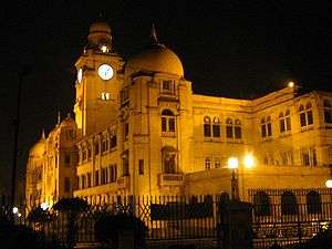
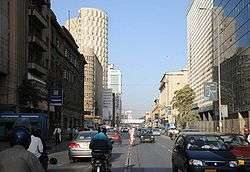
Karachi South District is the economic backbone of the country. It has Head Offices of many Corporations, Companies and Banks. Governor House, Chief Minister House, Sindh Assembly, High Court, Embassies and Consulates of different countries and other government offices are also located there.
The district was abolished in 2000, and was divided into three towns namely: Jamshed Town, Lyari Town and Saddar Town.
On 11 July 2011, the Sindh Government restored again Karachi South District.[1]
In November 2013, Jamshed Town was added into Karachi East District, after three eastern towns of that district split up to form a new district named Korangi. Now Karachi South comprises two towns: Lyari and Saddar.
Sindhi and Baloch form majority in the district followed by Muhajirs, Gujaratis and others.
_Clifton%2C_Karachi.jpg)
Administrative Towns of Karachi South
Following is the list of two administrative towns of Karachi South District.[2]
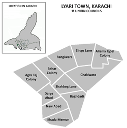
Lyari Town
| Union Council |
|
|---|---|
| U.C. 1 Agra Taj Colony | |
| U.C. 2 Daryaabad | |
| U.C. 3 Nawabad | |
| U.C. 4 Khada Memon Society | |
| U.C. 5 Baghdadi | |
| U.C. 6 Shah Baig Line | |
| U.C. 7 Bihar Colony | |
| U.C. 8 Ragiwara | |
| U.C. 9 Singo Line | |
| U.C. 10 Chakiwara | |
| U.C. 11 Allama Iqbal Colony | |
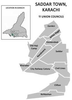
Saddar Town
| Union Council |
|
|---|---|
| U.C. 1 Old Haji Camp | |
| U.C. 2 Garden | |
| U.C. 3 Kharadar | |
| U.C. 4 City Railway Colony | |
| U.C. 5 Nanak Wara | |
| U.C. 6 Gazdarabad | |
| U.C. 7 Millat Nagar/Islam Pura | |
| U.C. 8 Saddar | |
| U.C. 9 Civil Line | |
| U.C. 10 Clifton | |
| U.C. 11 Kehkashan | |
References
- ↑ Karachi’s district status restored, notification issued, Published in The News Tribe on 11 July 2011, Retrieved on 22 August 2012
- ↑ Districts in Karachi
Coordinates: 24°51′38″N 67°01′34″E / 24.8605°N 67.0261°E
Provincial capital: Karachi | ||
| Banbhore |  | |
| Hyderabad | ||
| Karachi | ||
| Larkana | ||
| Mirpur Khas | ||
| Sukkur | ||
| Shaheed Benazir Abad | ||
| Disputed | ||