Kapan, Nepal
| Kapan, Nepal कपन | |
|---|---|
| Village development committee | |
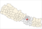
 Kapan, Nepal Location in Nepal | |
| Coordinates: 27°44′N 85°22′E / 27.74°N 85.37°ECoordinates: 27°44′N 85°22′E / 27.74°N 85.37°E | |
| Country |
|
| Zone | Bagmati Zone |
| District | Kathmandu District |
| Population (2011) | |
| • Total | 48,463 |
| Time zone | Nepal Time (UTC+5:45) |
Kapan, Nepal is a village in Kathmandu District in the Bagmati Zone of central Nepal. It is situated in the outskirts of Kathmandu. At the time of the 2011 Nepal census it had a population of 48,463 in 12,324 households.[1] Kapan Sangit Sarowar (a platform for musicians), Kapan Monastery (Buddhist temple) etc. are tourist places situated at Kapan. Kapan VDC consists of several settlements, e. g.: Mahankal, New Colony, Jyotinagar, Saraswatinagar, Golphutar or Baluwakhani.
References
Headquarter: Kathmandu | |||
 |  | ||
This article is issued from Wikipedia - version of the 12/30/2014. The text is available under the Creative Commons Attribution/Share Alike but additional terms may apply for the media files.