Kamet
| Kamet | |
|---|---|
| कामेत | |
 Kamet and neighboring peaks in 1908, by British mountaineer Charles Granville Bruce. | |
| Highest point | |
| Elevation |
7,756 m (25,446 ft) [1] Ranked 29th |
| Prominence |
2,825 m (9,268 ft) [1] Ranked 121st |
| Isolation | 70 kilometres (43 mi) |
| Listing | Ultra |
| Coordinates | 30°55′12″N 79°35′30″E / 30.92000°N 79.59167°ECoordinates: 30°55′12″N 79°35′30″E / 30.92000°N 79.59167°E [1] |
| Geography | |
 Kamet Location in northern India | |
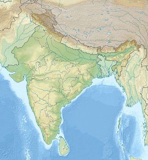
| Location | Uttarakhand, India |
| Parent range | Garhwal Himalayas |
| Climbing | |
| First ascent | 21 June 1931 by Frank Smythe, Eric Shipton, R.L. Holdsworth and Lewa Sherpa |
| Easiest route | glacier/snow/ice climb |
- For the thus named written Hebrew character vowel form markup, see Romanization of Hebrew
Kamet (Hindi: कामेत) is the second highest mountain in the Garhwal region of Uttarakhand, after Nanda Devi. It lies in the Chamoli District of Uttarakhand, close to the border with Tibet. It is the third highest mountain in India, although it ranks lower if counting mountains inside Indian-claimed territory in the disputed regions of Jammu & Kashmir controlled by Pakistan, and it is the 29th highest in the world. In appearance it resembles a giant pyramid topped by a flat summit area with two peaks.
Climbing
Due to its position near the Tibetan Plateau, Kamet is remote and not as accessible as some Himalayan peaks. It also receives a great deal of wind from the Plateau. However, by modern standards, it is a relatively straightforward ascent for such a high mountain. Early explorers of the region faced long approach marches of around 200 miles (321.9 km) from Ranikhet through dense mountain forest; access is easier today.
While attempts to climb Kamet began in 1855, the first ascent was not made until 1931 by Frank Smythe, Eric Shipton, R.L. Holdsworth and Lewa Sherpa, members of a British expedition. Kamet was the first summit over 25,000 ft (7,620 m) to be climbed, and was the highest summit reached until the first ascent of Nanda Devi five years later. (However, far higher non-summit altitudes had been reached on the north side of Mount Everest in the 1920s.)
The standard route begins from the East Kamet (or Purbi Kamet) Glacier, ascending via Meade's Col (c. 7,100m/23,300 ft), the saddle between Kamet and its northern outlier Abi Gamin. From Meade's Col the route ascends the northeast edge of the north face. The ascent to Meade's col involves steep gullies, a rock wall, and several glacier climbs. Five camps are usually placed en route. The final ascent to the summit involves steep snow, possibly icy.
Neighboring and subsidiary peaks
Kamet is surrounded by three principal neighboring or subsidiary peaks:
- Mukut Parbat, 7,242 m (23,760 ft) Ranked 97th, prominence = 840 m, 30°57′08″N 79°34′13″E / 30.95222°N 79.57028°E, northwest of Kamet. First ascent 1951 (see below). The lower of Mukut Parbat's twin summit has an elevation of 7,130 m (23,392 ft).
- Abi Gamin, 7,355m (24,130 ft), prominence = 217 m 30°55′57″N 79°36′09″E / 30.93250°N 79.60250°E, north-northeast of Kamet; connected to Kamet by Meade’s Col. First ascent 1950.
- Mana, 7,272m (23,858 ft)Ranked 92nd, prominence = 720 m, 30°52′52″N 79°36′57″E / 30.88111°N 79.61583°E, south-southeast of Kamet. First ascent 1937.
Several adjoining peaks, such as Mana NW, 7,092 m, Point 6,977 m, Deoban, 6,855 m, and Bidhan Parbat, 6,519 m, also lie close to Kamet.[2]
Nomenclature
There are varying explanations of the name "Kamet." C. F. Meade gives the pronunciation as /ˈkʌmeɪt/, and claims that it is known to Tibetans as Kangmen, signifying "huge grandmother of a sacred snow chain". However, Frank Smythe writes in his book Kamet Conquered that the genesis of the name is from the Tibetan word Kangmed ("the lower snows", from kang, "snow", and med, "little"), as distinct from the "higher snows" of the Kailash range, 110 miles east of Kamet. (This range is slightly lower than Kamet, its highest peak being Gurla Mandhata, 7,728 m/25,355 ft; however it stands more fully on the high Tibetan Plateau). At dawn and dusk, "the copper colored rock of Mount Kamet reflecting the oblique rays of the sun on its hanging glaciers appears to set these glaciers aglow with crackling flames and bathes the mountain in a red burning glow". Hence the term "glacier fire" is also used as an allusion to the name Kamet.
Partial timeline
- 1848: Richard Strachey determines the height and location of Kamet, as well as the neighboring peaks Abi Gamin, Mukut Parbat, and Mana.
- 1855: German explorers and scientists Adolphe and Robert Schlagintweit, invited by the East India Company to make surveys, travel into Tibet in disguise. After being discovered and arrested, they return, and attempt Abi Gamin from Tibet (via the Abi Gamin Glacier), believing it to be Kamet. (This mistake hampers expeditions until 1912.) They claim to reach a height of 6,785 m (22,260 ft), which is extraordinary for this date.
- 1877: I. S. Pocock of the Survey of India, under E. C. Ryall, accurately surveys Kamet's position. However, he supports the inaccurate belief that Abi Gamin is a minor subpeak of Kamet and that a northern route to the summit is practical.
- 1907: Dr. T. G. Longstaff, Brig. Gen. C. G. Bruce and A. L. Mumm, with alpine guides Alexis and Henri Brocherel, make a preliminary reconnaissance of the eastern and western sides of Kamet. The highest point reached is 6,100 m (20,000 ft) above the East Kamet Glacier. Longstaff deems the East Kamet route as too dangerous due to avalanche risk.
- 1910-1911: C. F. Meade, with Alpine guides Alexis Brocherel and Pierre Blanc, and a separate expedition under Dr. A. M. Kellas, make a preliminary reconnaissance of the western side of the peak; they explore Khaiam Pass and Glacier.
- 1911: Capt. A. M. Slingsby attempt Kamet on the western side from Ghastoli Glacier (or West Kamet Glacier) via the col on the ridge between Abi Gamin and Mukut Parbat (subsequently named as Slingsby’s Col, 6,400 m/21,000 ft).
- 1912: Meade, with Alpine guides Franz Lochmatter of St. Niklaus in the canton Valais, Pierre Blanc, Justin Blanc and Jean Perrin, attempts Kamet by Slingsby's route, and also later explores the Raikhana glacier system to the east of Kamet. Meade concludes that the East Kamet Glacier is the only practicable route to Mt Kamet's summit.
- 1913: Slingsby attempts the same route as in 1911 and reaches 7,000 m (23,000 ft). (He later dies in battle in Mesopotamia in 1916.)
- 1913: Meade, with Alpine guide Pierre Blanc, attempts Kamet from the eastern side and reaches Meade’s Col, 7,138 m. (23,420 ft).
- 1914: Kellas makes another reconnaissance of which no records are available, and which is probably abandoned midway due to the commencement of World War I.
- 1920: Kellas and Col. H. T. Morshead attempt Meade's 1913 route and reach a point slightly above Meade’s Col.
- 1931: The first ascent of Kamet, detailed above.
- 1937: Frank Smythe returns to the Bhyundar Valley and makes the solo first ascent of Mana on 12 August, through its south ridge from the plateau at the head of the Uttari Naktoni glacier. His companion P.R.Oliver stopped exhausted at 23000'.[2][3]
- 1950: An Anglo-Swiss expedition ascends Abi Gamin from its North East ridge.
- 1951: Mukut Parbat is climbed via the steep northwest ridge by a crack New Zealand team that includes Edmund Hillary, George Lowe (mountaineer), H. E. Riddiford (leader), F. M. Cotter and Pasang Dawa Lama. Summitters were Riddiford, Cotter and Pasang Dawa Lama.[4]
- 1955: An Indian expedition from the Himalayan Mountaineering Institute in Darjeeling makes the second ascent of Kamet on 6 July. Major Narendra D. Jayal led the party; Jayal, Ang Tharkay, Da Namgyal, Ang Temba, and Hlakpa Dorje comprised the summit team. Their route followed the ridge linking Abi Gamin and Kamet.[5][6]
- 1966: Mana is climbed on 19 September by a new route, the NW ridge from Purbi Kamet glacier which had rebuffed Smythe in 1937, by Pranesh Chakraborty, Pasang Phutar, Tshering Lhakpa, Pasang Tshering from Camp 5(c.22500').[2]
- 1995: Mana Northwest is scaled by members of a joint Indo-Tibetan Border Police–Japanese expedition after a tough technical wall climb.
- 2000: To mark the turn of century, Ruptaps Mountaineering Club from Asansol, West Bengal climbed Kamet on 3 October 2000. The summiters were Leader Gautam Mukherjee and Jasjeet Singh.
- 2006: A commemorative 75th anniversary expedition by the Kolkata Section of the Himalayan Club puts ten climbers on the summit of Kamet. (First ascensionist Frank Smythe was a Himalayan Club member.)
- 2008: The southeast face(6,000 ft) was climbed for the first time by two Japanese climbers, Kazuya Hiraide and Kei Taniguchi.[7]
- 2010: An avalanche kills Lt Col C. Poornachandra and Maj Manish Gusain. They were a part of a 41-member Indian army team led by Col Ajay Kothiyal.
- 2012: The southwest face(2,000 m) was climbed for the first time by four French climbers, Sébastien Bohin, Didier Jourdan, Sébastien Moatti and Sébastien Ratel, following a route that they called Spicy Game.[8]
Glaciers and rivers
The West (Pachmi or Paschimi) Kamet Glacier, the East (Purbi or Purva) Kamet Glacier and the Raikana Glacier systems surround Kamet. The branches of the West Kamet Glacier head on the western slopes of Kamet, Abi Gamin, and Mukut Parbat. The East Kamet Glacier flows from the eastern side of Kamet and Mana. The Raikhana glacier originates on the east side of Meade’s Col saddle, flows east of Abi Gamin, and unites with the East Kamet Glacier. The West Kamet Glacier drains into the Saraswati River while the East Kamet Glacier feeds the Dhauliganga River; both rivers are tributaries of the Alaknanda River, the major river of the Chamoli district.
High altitude research
A. M. Kellas and his companion H. T. Morshead conducted scientific studies during their 1920 Kamet expedition focusing on the physiology of high altitude travel and acclimatization, and on the possibility of using supplemental oxygen. These studies eventually proved useful on expeditions to Mount Everest.
See also
References
- Notes
- 1 2 3 "High Asia I: The Karakoram, Pakistan Himalaya and India Himalaya (north of Nepal)". Peaklist.org. Retrieved 2014-05-28.
- 1 2 3 Joydeep Sircar, Himalayan handbook,Calcutta 1979
- ↑ Frank Smythe,Valley of Flowers, Hodder & Stoughton 1938
- ↑ Himalayan Journal Vol.17, p.42
- ↑ MOUNTAIN WORLD 1956/57, p.143
- ↑ American Alpine Journal, 1956, p. 142.
- ↑ Much-Eyed Face on Kamet Finally Climbed - Climbing magazine
- ↑ Kamet, Spicy Game, 2012 - Himalaya Masala
- Sources
- Meher Mehta (Vice President, Himalayan Club), "The Lure of Kamet," in the Kamet Commemorative Souvenir, Kolkata Section, Himalayan Club, 2006; 160 pages. (Commemorating 75 years after the first ascent; an exhaustive anthology of articles by famous mountaineers, plus maps, routes and rare historical photographs, including those taken by Frank Smythe.)
- Neate, Jill (1989). High Asia: An illustrated guide to the 7,000 metre peaks. The Mountaineers. ISBN 0-89886-238-8.
- H. Adams Carter, "Classification of the Himalaya," in the American Alpine Journal, 1985.
- The Himalayan Index