Gulbarga
| Gulbarga ಕಲಬುರಗಿ | |
|---|---|
| City | |
| Kalaburagi | |
|
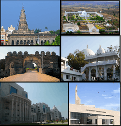
Clockwise Sharana Basaveshwara Temple, Budha Vihar, Khwaja Banda Nawaz Dargah, Central University of Karnataka, ESI Hospital Gulbarga and Gulbarga Fort | |
| Nickname(s): Sun City/ಬಿಸಿಲು ನಗರ | |
 Gulbarga  Gulbarga | |
| Coordinates: 17°20′00″N 76°50′00″E / 17.3333°N 76.8333°ECoordinates: 17°20′00″N 76°50′00″E / 17.3333°N 76.8333°E | |
| Country |
|
| State |
|
| Region | Bayaluseeme |
| District | Gulbarga district |
| Government | |
| • Type | Mayor–Council |
| • Body | District Administration |
| Area | |
| • Total | 107 km2 (41 sq mi) |
| Elevation | 454 m (1,490 ft) |
| Population (2011) | |
| • Total | 543,000 |
| • Density | 5,100/km2 (13,000/sq mi) |
| Demonym(s) | Kalaburgian |
| Languages | |
| • Official | Kannada |
| • Regional | English, Urdu |
| Time zone | IST (UTC+5:30) |
| PIN | 585101/102/103/104/105/106 |
| Telephone code | 91(847)-2XXXXXX |
| Vehicle registration | KA-32 |
| Website | www.gulbargacity.gov.in |
Gulbarga (officially Kalaburagi)[1] is a city in the Indian state of Karnataka, India. It is the administrative headquarters of the Gulbarga District and a major city of the North Karnataka region. Gulbarga is 623 km north of the state capital of Bangalore and 220 km from Hyderabad. Previously it was the part of Hyderabad State, it was incorporated into a newly formed Mysore State (now known as Karnataka) through the States Reorganisation Act [2] in 1956.
Gulbarga is famous for toordal or Pigeon pea and the limestone deposits . As per data released by Govt. of India for Census 2011, Gulbarga is an Urban Agglomeration coming under category of Class I UAs/Towns. Gulbarga city is governed by Municipal Corporation and is in Gulbarga Urban Region. It is a rapidly urbanising city which comes under Gulbarga Metropolitan area. The city is well known for its many places of architectural, historical and religious importance.
It is called one of the Sufi cities having famous religious places, like Khwaja Banda Nawaz Dargah and Ladle Mashak in Aland taluk of Gulbarga District. Every year during urs of hazrat banda nawaz people come from all India, far cities like Mumbai, Hyderabad, Lucknow, etc. and it has many other famous places like Sharana Basaveshwara Temple and Buddha Vihar. It also has a fort built during Bahmani rule. Has many domes like Hafth Gumbad (seven domes together) and Chor Gumbad.
History
The history of Gulbarga dates to the 6th century. The Rashtrakutas gained control over the area, but the Chalukyas regained their domain within a short period and reigned supreme for over 200 years. The Kalaharis who succeeded them ruled until the 12th century. Around the end of the 12th century, the Yadavas of Devagiri and the Hoysalas of Dwarasamadra destroyed the supremacy of the Chalukyas and Kalachuris of Kalyani. Around the same period, the Kakatiya kings of Warangal came into prominence and the present Gulbarga and Raichur districts formed part of their domain. The Kakatiya power was subdued in 1321 AD and the entire Deccan, including the district of Gulbarga, passed under the control of the Delhi Sultanate.
The revolt of the officers appointed from Delhi resulted in the founding of the Bahmani Sultanate in 1347 CE by Zafar Khan [Alaudin Hasan Gangu]], who chose Gulbarga (Ahasanabad) to be the capital.[3] When the Bahmani dynasty came to an end in 1428, the kingdom broke up into five independent Sultanates, Bijapur, Bidar, Berar, Ahmednager, and Golconda. The present Gulbarga/Gulbarga district came partly under Bidar and partly under Bijapur. The last of these sultanates, Golconda, finally fell to Aurangzeb in 1687.
With the conquest of the Deccan by Aurangezeb in the 17th century, Gulbarga passed under the Mughal Empire. In the early part of the 18th century, with the decline of the Mughal Empire, Asaf Jha, one of Aurangzeb's generals, formed the Hyderabad State, in which a major part of the Gulbarga area was also included. In 1948, Hyderabad State became a part of the Indian Union, and in 1956, excluding two talukas which were annexed to Andhra Pradesh, Gulbarga district became part of new Mysore State.
Gulbarga (Urdu) (city of flowers and gardens) was renamed Kalaburagi (Kannada) (Kala-Art/Bura-Bad, Strong Stone Fort)) effective 1 November 2014.[4]
Art and architecture
The largest collection of Islamic art is seen only at the domed ceiling and walls are adorned with painting containing calligraphy designs and floral, flower and plants and geometric patterns inside the 14th century tomb of Sufi saint Syed Shah Qhabulullah Husayni with natural colours. By religious restrictions the artist was prohibited from depicting living beings in the interior of tomb, and his imagination was therefore employed either in inventing new designs for religious texts or in adding further delicacy and subtleness to the geometric and floral devices by making the drawings more and more intricate. A small tomb beside the said Sufi’s has an excellent work painted flower plants on ceiling. Another vacant Shore Gumbad outside the city has delicate designs on its domed ceiling is superb.
The walls and ceiling of the tomb of Sultan Firuz Shah Bahmani can be appreciated which, although in monotone, represents faithfully the creepers and floral patterns, the numerous geometric devices and calligraphic styles. The most notable building, however, of this period is Jama Masjid of Gulbarga fort, built by Persian architect named Rafi in 1367 during the reign of Muhammad Shah Bahmani I.
The glory of the towns in north Karnataka really waned with the decline of Bahmani dynasty, although Barid Shahi and Adil Shahi kings kept up its beauty during their chequered rule. It suffers from pollution through nickel and lead. It has affected the mental health of people.
Royal patronage played an important role in the making of Islamic art, as it has in the arts of other culture. From 14th century onwards, especially in the eastern lands, the books of art provide the best documentation of the courtly patronage.
Today, the finest arts are found in India, Turkey, Iran, Syria, Pakistan, Egypt and Morocco, where the legacy of Islamic arts remain live and strong.
Geography
The entire district is on the Deccan Plateau, and the elevation ranges from 300 to 750 m above MSL. Two main rivers, the Krishna and Bhima, flow through the district. The predominant soil type is black soil. The district has many tanks, which irrigate the land along with the river. The Upper Krishna Project is a major irrigation venture in the district of Jowar. The main crops are groundnuts, rice, and pulses. Gulbarga is the largest producer of toor dal, or pigeon peas, in Karnataka. Gulbarga is an industrially backward district but is showing signs of growth in the cement, textile, leather and chemical industries. Gulbarga has a university with Medical and Engineering Colleges. The geographical area of the city is 64 square kilometres.[5]
Climate
The climate of the district is generally dry, with temperatures ranging from 8 °C to 45 °C and an annual rainfall of about 750 mm. The year in Gulbarga is divided into three main seasons. The summer lasts from late February to mid-June. It is followed by the southwest monsoon, which lasts from late June to late September. This is then followed by dry winter weather until mid-January.
Temperatures during the seasons are:
- Summer : 26 °C to 45 °C
- Monsoon : 23 °C to 33 °C
- Winter : 3 °C to 31 °C
| Climate data for Gulbarga | |||||||||||||
|---|---|---|---|---|---|---|---|---|---|---|---|---|---|
| Month | Jan | Feb | Mar | Apr | May | Jun | Jul | Aug | Sep | Oct | Nov | Dec | Year |
| Average high °F | 85.6 | 89.6 | 95 | 100.4 | 101.3 | 93.2 | 86 | 86.9 | 87.8 | 87.8 | 85.3 | 84.2 | 90.26 |
| Average low °F | 60.4 | 63.3 | 72.1 | 76.8 | 77.7 | 75.2 | 73.2 | 72.5 | 72.7 | 70.7 | 64.8 | 59.4 | 69.9 |
| Average precipitation inches | 0.106 | 0.173 | 0.177 | 0.713 | 1.551 | 4.689 | 4.587 | 5.843 | 7.346 | 4.142 | 1.098 | 0.181 | 30.606 |
| Average high °C | 29.8 | 32.0 | 35.0 | 38.0 | 38.5 | 34.0 | 30.0 | 30.5 | 31.0 | 31.0 | 29.6 | 29.0 | 32.37 |
| Average low °C | 15.8 | 17.4 | 22.3 | 24.9 | 25.4 | 24.0 | 22.9 | 22.5 | 22.6 | 21.5 | 18.2 | 15.2 | 21.06 |
| Average precipitation mm | 2.7 | 4.4 | 4.5 | 18.1 | 39.4 | 119.1 | 116.5 | 148.4 | 186.6 | 105.2 | 27.9 | 4.6 | 777.4 |
| Source: IMD | |||||||||||||
Demographics
As of the 2014 Indian census,[6] Gulbarga has a population of 1,101,989. Males constitute 55% of the population and females 45%. Gulbarga has an average literacy rate of 67%, higher than the national average of 59.5%. The male literacy is 70%, while that of females is 30%. In Gulbarga, 15% of the population is under 6 years of age. Kannada and Urdu are the main languages.
Tourism
There are many attractions in Gulbarga: Bahmani fort, Tomb of first Bahmani Sultan Hasan, Government Museum, Holkonda fort, Ferozabad fort, Sharanabasaveshwar Temple, Shri Kshetra Ganagapur (Ganagapur), a well-known pilgrimage site of the god Shri Sadguru Dattatreya Narasimha Saraswati, Sri Hulakantheshwar Temple (Herur B), and the Ghathargi Bhagayavanti Temple (Afzalpur Taluk), on the bank of the Bhima River.
Chor Gumbad: The beauty of Chor Gumbad, is not merely in its fine stucco, but its "environmental setting". The lone tomb is deliberately chosen to be built west of the Gulbarga fort, atop the hill. The tomb has some of the finest stucco on its ceilings and the jalis (now mostly broken). Chor Gumabd does not house a grave, but is perhaps a victory monument. It is a unique and beautifully set piece of architecture.
The tomb has an entrance to the east, facing the Gulbarga fort. The ceiling of the dome is decorated with a band of stucco scrolls, from which emerge large leaf shaped tree motifs filled with scrolls. There are steps that lead to an upper corridor screened by jalis (now mostly broken and vandalised), evidently meant for ladies of the Bahmani court. Further on the rooftop are chhatris, like miniature tombs on the four corners with domes and small corner minarets.
- Sufi Saints
Places of religious importance in Gulbarga include the Khwaja Banda Nawaz Dargah, Sharanabasaveshwar Temple, Buddha Vihar and Sheikh Roza Dargah. Devotees from all over the world visit these places of worship every year.


Places of interest
- Sharana Basaveshwara Temple
- Khwaja Banda Nawaz Dargah
- Buddha Vihara
- Gulbarga Fort
- Sharanabasaveshwara Lake
- Jumma Masjid (Gulbarga Fort)
- Sheikh Roza Dargah
- District Science centre
Cuisine
Jolada rotti /Jowari Bhakri (known as sorghum in the western world) is the staple diet in the region. It is prepared from jowar (sorghum) flour. Jolada Rotti or Jwarichi Bhakri is served with traditional curries, especially Brinjal curry, and spiced groundnut powder and yogurt. Generally, the food in Gulbarga is considered very spicy when compared with the rest of the state.
Hoorana Holige is a variant of Puran Poli of Maharashtra. This is a type of speciality sweet found only in Gulbarga and prepared during any festivals. It is a kind of stuffed pancake. Chickpeas and jaggery are grounded and stuffed into wheat flour and then cooked. This is served with mango pulp as a side dish.
Malpuri is a dessert which is a sweet which is stuffed with khoa. It is widely popular in Gulbarga and available across the city in shops and sweet stalls.
Tahaari is a local variant of rice delicacy mainly made with beef or mutton. It is made by mixing the meat and gravy with rice unlike biryani, where the rice is mixed with the gravy mixture. It is popular among the Muslim community in the city and available in Muslim restaurants across the city.
Transport

Gulbarga is 613 km north of Bengaluru and well connected by road to Bengaluru, Mumbai, Pune, Bijapur, Hyderabad and other major cities. Gulbarga has a 55.5-kilometre (34.5 mi) long, four-laned ring road.[7]
Local transport
Auto rickshaws are available for getting around the city at fairly reasonable rates. NEKRTC (Nrupatunga) city buses circulate within the city and travel to the nearby towns and villages. Nrupatunga Sarige Serves as the City public transport and has emerged as the popular commuting transport services within the city and surrounding suburbs of the city.Ola and Uber Cabs are also available.
Long-distance bus routes
Karnataka State Road Transport Corporation (KSRTC) runs a bus service to other cities and villages. There are also private bus services. The Bidar-Srirangapatna state highway makes travel easy to Bengaluru and the neighbouring states of Maharashtra and Goa. There are many private services running buses between Bangalore and Gulbarga, and between Mumbai and Gulbarga.
Railways
Gulbarga railway station is served by the Solapur-Guntakal line, which is part of the Mumbai-Chennai line. It is well connected by trains to all major parts of India, such as Mumbai, Delhi, Hyderabad, Chennai, Bengaluru, Ahmedabad, Coimbatore, Thiruvananthapuram, Kanyakumari, Pune, Bhubaneswar, Bhopal, Gwalior and Agra. A project connecting Gulbarga to Bidar via rail is still in progress. Once completed, it will help to reduce travel time between Bengaluru and New Delhi by 6–7 hours. Gulbarga railway station comes under the Central Railway.[8] -
Airport
Gulbarga Airport is being built to serve the city. The project site is 15 km East of the city on State Highway 10 (Sedam Road) near Srinivas Saradagi village. The ₹ 120 Crore project will be completed by the State Government through its own PWD with technical assistance from the Airports Authority of India (AAI).[9]
Education
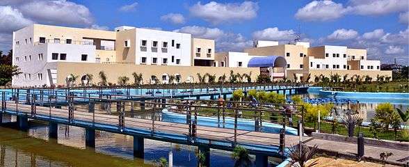
The city has four medical colleges: Mahadevappa Rampure Medical College (MRMC), KBN institute of medical sciences (KBNIMS), ESI medical college and Gulbarga institute of medical sciences (GIMS). There are three dental colleges, one run by HKE society and another by Albadar trust and another by ESI hospital.
There are six engineering colleges in the city run by education groups, including Khaja Banda Nawaz College of Engineering, KCT College of Engineering, Appa Institute of Engineering an Technology and Poojya Doddappa Appa College of Engineering (PDACE).[10]
Gulbarga has Gulbarga University, established in 1980. Its jurisdiction extends to the six districts of Gulbarga district, Yadgir, Bidar, Raichur, Bellary and Koppal. Earlier it was a post-graduate centre of Karnataka University, Dharwad since 1970. The main campus is on 860 acres (3.5 km2) of land, 6 kilometres (3.7 mi) east of Gulbarga city. It has 37 post-graduate departments and four post-graduate centres in Krishnadevarayanagar, Bellary, Raichur and Bidar. Another post-graduate centre at Basavakalyan is planned. The university enrolls about 3,500 students every year for post-graduate, MPhil and PhD programmes. Approximately 200 faculty members and about 700 technical and non-technical supporting staff are employed there. There are 230 colleges affiliated with this university offering graduate/diploma courses in arts, fine arts, music, social sciences, science and technology, commerce, education and law. The city has several nursing schools, including Vijaykumar College of Nursing, HKE Societies CON, Al-Kareem, and Al-Qamar.
The Central University of Karnataka is in the outskirts of the city on the way to Solapur and Aland. Central University of Karnataka was established in Gulbarga by Sri Mallikarjun Kharge. The institution is a young university with a lot of scope for improvement in overall functioning. Gulbarga is known as the 'City of Education' for its institutions managed by the private and the government sector.
Fine Arts: The Indian Royal Academy of Art and Culture an NGO established in the year 2004 founded by an artist Rehaman Patel is recognised all over India which organises National art exhibition, art camps and promotes the artists by honouring them with annual awards and exhibiting their talent at national and international level. The academy is located in the hilly area on ring road at Patel Street in Ganesh Nagar.
Politics
Gulbarga has been home to two ex-chief ministers of Karnataka, namely Veerendra Patil (1968–1971, 1988–1990) and Dharam Singh (2004–2006); both belonged to the Indian National Congress party. Mallikarjun Kharge is the present Member of Parliament and was also formerly the Union Minister for Railways. The Legislative Assembly members from Gulbarga are: Qamar-ul-Islam Gulbarga North, Dattatraya C Patil Revoor Gulbarga South and G Ramkrishna Gulbarga Rural. Gulbarga's present Mayor is : Syed Ahmed.
Gallery
-

Poojya Dodappa Appa College of Engineering
-

City Road Gulbarga
-

Budha Vihara Gulbarga
-

Gulbarga Fort
-

Jama Masjid Gulbarga
-

ESI Hospital Gulbarga
-

St. Mary's Church
-

Appa lake
-
VTU Regional Gulbarga
-

CMC Garden Gulbarga
-
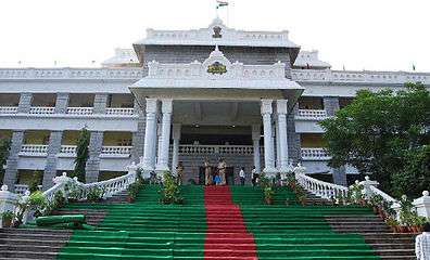
Mini Vidhan Soudha Gulbarga
Notes
- Gulnar K. Bosch, Islamic Art and Architecture, The New Book of Knowledge, Vol. 9P 354
- Elisabeth Siddiqui, Islamic Art, Colorado State University.
- Dept. of Islamic Art, The nature of Islamic art, "Intleilbrunn Timeline of Art History", The Metropolitan Museum of Art, New York, 2000.
- Linda Komaroff Ph.D., Curator of Islamic Art, Los Angeles County Museum of Art.
- Gulam Yazdani, Bidar its History and Monuments, published by His Exalted Highness Nizam’s Government, 1947 and reprint First Indian Edition by Motilal Banarsidass Publishers, Delhi in 1995.
- Dr. Rehaman Patel, Bidri Art of Karnataka-A Study, Ph.D. Thesis awarded by Gulbarga University in 2010.
- Mohammed Ayazuddin Patel, Monuments of Gulbarga-A Photo History book published by Ayaz Art Gallery, Gulbarga
- Earliest possible Buddhist settlement at Sannati
- Malkhed
- Dr. Rehaman Patel, Islamic Art of North Karnataka, Young Muslim Digest, May 2015
References
| Wikivoyage has a travel guide for Gulbarga. |
| Wikimedia Commons has media related to Gulbarga. |
- ↑ "Gulbarga city name changed". indiatoday.intoday.in. Retrieved 2 May 2016.
- ↑ "Central Government The States Reorganisation Act, 1956" (PDF). indiaenvironmentportal.org.in. Retrieved 18 Aug 2016.
- ↑ Sen, Sailendra (2013). A Textbook of Medieval Indian History. Primus Books. pp. 106–108. ISBN 978-9-38060-734-4.
- ↑ Variyar, Mugdha (November 1, 2014). "Bangalore Wakes up to 'Bengaluru'; 11 Other Karnataka Cities Renamed". IBTimes. Retrieved 16 May 2015.
- ↑ http://www.gulbargacity.mrc.gov.in/
- ↑ "Census of India 2001: Data from the 2001 Census, including cities, villages and towns (Provisional)". Census Commission of India. Archived from the original on 2004-06-16. Retrieved 2008-11-01.
- ↑ "PROJECT NAME : GULBARGA RING ROAD". Karnataka Road Development Corporation Limited. Retrieved 1 September 2012.
- ↑ "GULBARGA Railway Station".
- ↑ "Gulbarga airport project may go to PWD". Deccan Herald. 8 June 2015. Retrieved 9 June 2015.
- ↑ http://www.karnataka.com/education/engg/Gulbarga-engineering-colleges/. Missing or empty
|title=(help)