Kakrala
| Kakrala Kakrabad | |
|---|---|
| Town | |
| Nickname(s): Faisalkhanrealy.fb.com | |
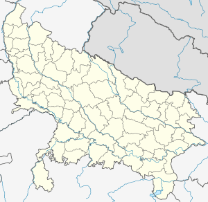 Kakrala Location in Uttar Pradesh, India | |
| Coordinates: 27°53′32″N 79°11′43″E / 27.89222°N 79.19528°ECoordinates: 27°53′32″N 79°11′43″E / 27.89222°N 79.19528°E | |
| Country |
|
| State | Uttar Pradesh |
| District | Badaun |
| Government | |
| • Chairman of Municipal Board | Mehboob Saqlaini |
| Area | |
| • Total | 39 km2 (15 sq mi) |
| Elevation | 160 m (520 ft) |
| Population (2011) | |
| • Total | 104,076 |
| • Density | 2,700/km2 (6,900/sq mi) |
| hindi. Urdu | |
| • Official | English, Urdu, Hindi |
| Time zone | IST (UTC+5:30) |
| PIN | 243637 |
| Vehicle registration | UP24 |

Kakrala is a city and municipal board in Badaun district in India state of Uttar Pradesh. It is located to the East of the district Headquarter. It is 12 km from Badaun. the term Kakrala originates from the apbhramsha Kakrabad. The most population of this town are consisting Muslims, as the Vibrant culture of India suggest, the town is also divers in terms of religion,festivals etc. India has a unique culture of Unity in diversity,the same phenomenon has occurred in this town also. In the vista of towns of this state one distinguishes Kakrala as quite significant. In fact Kakrala is the name of a city which has a well British era municipal board.It is situated approximately at 27.9° N 79.2° E. It has an average height of 160 meters or 524 feet. The discovery of Indian town or city becomes complete with the knowledge of its current demographic scenario. In order to meet the objectives, numerous demographers have organized surveys and research works and thus brought out significant information about Kakrala city. Regarding this, the Census report is praise worthy. Data like population, literacy rate etc. can be deduced from this report. According to this report Kakrala city has got a total population measurement of 104,380. Females are less in number than their male counterparts. This becomes obvious from the literacy rates of both males and females. In other words, male populace constitutes 73 %, while the total population of females comprises 57 %. Information about the children who are residing in Kakrala too can be deduced. Thus kids who are below six years of age constitute 20 % of the total population of Kakrala. Literacy rate adds to the information of this Kakrala city. The most of population of the city belongs to the Muslim Rajputs.
History
The history of Kakrala goes back to the Mughal era.At that time the town was covered with dense forests in the late 16th century, It was founded during the reign of Mughal Emperor Jahangir. The mass level immigration took place from the Hanumangarh (erstwhile Bhatner) Rajasthan. Most of them were Rajputs. Now, it has more than one lakh population. The city is an remarkable symbol of prosperity,and harmony.There is also a Dargah of Shah Shujaat Miyan Huzoor. Dargah is also popular as ziarat shareef. A madarsa is also running with the selflessly co-operation of saqlaini Academy, Bareilly.
Geography
Kakrala is located at 27°53′32″N 79°11′43″E / 27.89222°N 79.19528°E.[1] This place is situated in Budaun, Uttar Pradesh, India, its geographical coordinates are 27° 54' 0" North, 79° 12' 0" East and its original name (with diacritics) is Kakrāla. The average temperature in winter is 25 °C (77 °F), and can reach up to 38 °C (100 °F) in summer. .
Educational institute in Kakrala
- Rajput inter college
- H.M. Science inter college
- H.A.I. inter college
- New Hopes school
- Muslim Degree college
- Mother wisdom School
- Falah -e- Aam Islamic Inter College
- G.B. Girls Inter college
- Municipal Inter college
- AL Barkat inter college
- Jamiat -ul- Hasnaat girls inter college
- Hindustan Modern Public School
- Hira Islamic School
- Miftah Ul uloom Islamic school
- Darsgah Islamic school
- Jamia Bashiriya
- Madrasa Ashraf Ul Uloom
- zikara Islamic school
- Madrsa Sir Sayyad Islamic School
- Jamia Islamiya school Kakrala
- Madarsa Qamrul Uloom Islamia
- Shamima Khatoon Inter college
- Hazrat Shah Sharafat Modern Public School
Agriculture
The land in and around Kakrala is very fertile. The town produces guavas, sugar cane, wheat, and other agricultural products at a large scale. Agriculture is the most important business in kakrala. Some areas of lands having sandy soil which is suitable for the Potatoes,Sweet potatoes,and pea-nuts.
Demographics
As of 2011 India census,[2] Kakrala had a population of 104,000. Males constituted 53% of the population while females constituted 47%. Kakrala has an average literacy rate of 73%: male literacy is 78%, and female literacy is 67%.
References
| Wikimedia Commons has media related to Kakrala. |
- ↑ Falling Rain Genomics, Inc - Kakrala
- ↑ "Census of India 2001: Data from the 2001 Census, including cities, villages and towns (Provisional)". Census Commission of India. Archived from the original on 2004-06-16. Retrieved 2008-11-01.