Kakarajima
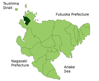
Kakarajima is the island furthest north on this map
Kakarajima or Kagarashima (加唐島), also known as Kakara, is an island to the north of Yobuko, which is in the Higashimatsuura District of Saga Prefecture, Japan. It is 1.75 miles long from north to south, and three quarters of a mile wide, with steep shores.[1] In 1884, it was reported that a cable had been laid between Korea and Japan, with an intermediate station on Kagara Island.[2] The island is a protected area for the vulnerable yellow bunting (Emberiza sulphurata).[3]
References
- ↑ Admiralty hydrogr. dept (1873). "Kagara Sima". The China sea directory. p. 301.
- ↑ The Electrical journal, Volume 13. 1884. p. 146.
- ↑ "Yellow Bunting Emberiza sulphurata". BirdLife International. Retrieved 2011-01-12.
Coordinates: 33°36′0″N 129°52′0″E / 33.60000°N 129.86667°E
This article is issued from Wikipedia - version of the 7/19/2016. The text is available under the Creative Commons Attribution/Share Alike but additional terms may apply for the media files.