Käerjeng
| Käerjeng | |
|---|---|
| Commune | |
|
Bascharage | |
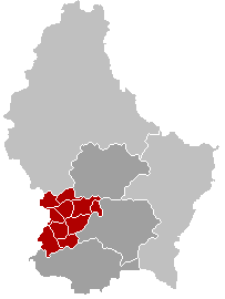
 Map of Luxembourg with Käerjeng highlighted in orange, and the canton in dark red | |
| Coordinates: 49°35′01″N 5°54′00″E / 49.5836°N 5.9°ECoordinates: 49°35′01″N 5°54′00″E / 49.5836°N 5.9°E | |
| Country |
|
| Canton | Capellen |
| Government | |
| • Mayor | Michel Wolter |
| Area | |
| • Total | 33.67 km2 (13.00 sq mi) |
| Area rank | 17 of 105 |
| Highest elevation | 395 m (1,296 ft) |
| • Rank | 55th of 105 |
| Lowest elevation | 271 m (889 ft) |
| • Rank | 76th of 105 |
| Population (2014) | |
| • Total | 9,875 |
| • Rank | 9th of 105 |
| • Density | 290/km2 (760/sq mi) |
| • Density rank | 24th of 105 |
| Time zone | CET (UTC+1) |
| • Summer (DST) | CEST (UTC+2) |
| LAU 2 | LU00009001 |
| Website |
www |

Käerjeng is a commune in southwestern Luxembourg, in the canton of Capellen. It lies on the border with Belgium. The commune of Käerjeng was formed on 1 January 2012 from the former communes of Bascharage and Clemency. The law creating Käerjeng was passed on 24 May 2011.[1] It has an area of 33.67 km2.
References
- ↑ "Mémorial A, 2011, No. 110" (PDF) (in French). Service central de législation. Retrieved 2012-01-02.
External links
-
 Media related to Käerjeng at Wikimedia Commons
 |
Arlon (BE-WLX) | Steinfort (Grass exclave) | | |
| Messancy (BE-WLX) Aubange (BE-WLX) |
|
Garnich Dippach | ||
| ||||
| | ||||
| Pétange | Differdange, Sanem |
 | ||
This article is issued from Wikipedia - version of the 12/1/2016. The text is available under the Creative Commons Attribution/Share Alike but additional terms may apply for the media files.