Johnsonburg, Pennsylvania
| Johnsonburg, Pennsylvania | |
|---|---|
| Borough | |
.jpg) | |
 Location in Elk County and the state of Pennsylvania. | |
| Coordinates: 41°29′38″N 78°40′47″W / 41.49389°N 78.67972°WCoordinates: 41°29′38″N 78°40′47″W / 41.49389°N 78.67972°W | |
| Country | United States |
| State | Pennsylvania |
| County | Elk |
| Settled | 1810 |
| Incorporated (borough) | 1891 |
| Area | |
| • Total | 2.94 sq mi (7.5 km2) |
| • Land | 2.9 sq mi (7.4 km2) |
| • Water | 0.04 sq mi (0.1 km2) |
| Elevation | 1,444 ft (440 m) |
| Population (2010) | |
| • Total | 2,483 |
| • Density | 856.2/sq mi (334.5/km2) |
| Time zone | Eastern (EST) (UTC-5) |
| • Summer (DST) | EDT (UTC-4) |
| Zip code | 15845 |
| Area code(s) | 814 |
Johnsonburg is a borough in Elk County, Pennsylvania, 124 miles (200 km) northeast of Pittsburgh and 115 miles (185 km) south of Buffalo, New York, in a productive farming and lumbering region. Paper mills were once common in the borough, with the Domtar mill still operating. In 1910, 4,334 people lived here. The population was 2,483 at the 2010 census.
History
It was founded in 1810 and incorporated in 1891.
The Johnsonburg Commercial Historic District was listed on the National Register of Historic Places in 1999.[1]
Geography
Johnsonburg is located at 41°29′38″N 78°40′47″W / 41.49389°N 78.67972°W (41.493950, -78.679600).[2]
According to the United States Census Bureau, the borough has a total area of 2.94 square miles (7.6 km2), 2.9 square miles (7.5 km2) of it land and 0.04 square miles (0.10 km2) (1.38%) of it water. It's also home to the Johnsonburg Area School.
Demographics
| Historical population | |||
|---|---|---|---|
| Census | Pop. | %± | |
| 1890 | 1,280 | — | |
| 1900 | 3,894 | 204.2% | |
| 1910 | 4,334 | 11.3% | |
| 1920 | 5,400 | 24.6% | |
| 1930 | 4,737 | −12.3% | |
| 1940 | 4,955 | 4.6% | |
| 1950 | 4,567 | −7.8% | |
| 1960 | 4,966 | 8.7% | |
| 1970 | 4,304 | −13.3% | |
| 1980 | 3,938 | −8.5% | |
| 1990 | 3,350 | −14.9% | |
| 2000 | 3,003 | −10.4% | |
| 2010 | 2,483 | −17.3% | |
| Est. 2015 | 2,371 | [3] | −4.5% |
| Sources:[4][5][6] | |||
2010
As of the census[7] of 2010, there were 2,483 people, 1,126 households, and 663 families residing in the borough. The population density was 856.2 people per square mile (334.5/km²). There were 1,293 housing units at an average density of 445.8 per square mile (174.2/km²). The racial makeup of the borough was 98.1% White, 0.1% African American, 0.2% Native American, 0.3% Asian, 0.05% Pacific Islander, 0.3% from other races, and 0.95% from two or more races. Hispanic or Latino of any race were 1.5% of the population.
There were 1,126 households, out of which 28% had children under the age of 18 living with them, 41.1% were married couples living together, 12.7% had a female householder with no husband present, and 41.1% were non-families. 37.5% of all households were made up of individuals, and 17.1% had someone living alone who was 65 years of age or older. The average household size was 2.21 and the average family size was 2.87.
In the borough the population was spread out, with 22.6% under the age of 18, 59.2% from 18 to 64, and 18.2% who were 65 years of age or older. The median age was 42 years.
The median income for a household in the borough was $30,856, and the median income for a family was $43,250. Males had a median income of $42,917 versus $24,207 for females. The per capita income for the borough was $16,438. About 9.8% of families and 16.9% of the population were below the poverty line, including 29.2% of those under age 18 and 7.0% of those age 65 or over.
2000
As of the census[5] of 2000, there were 3,003 people, 1,292 households, and 811 families residing in the borough. The population density was 989.6 people per square mile (382.7/km²). There were 1,435 housing units at an average density of 472.9 per square mile (182.9/km²). The racial makeup of the borough was 98.83% White, 0.03% African American, 0.30% Native American, 0.37% Asian, 0.03% Pacific Islander, 0.10% from other races, and 0.33% from two or more races. Hispanic or Latino of any race were 1.30% of the population.
There were 1,292 households, out of which 28.3% had children under the age of 18 living with them, 45.4% were married couples living together, 11.8% had a female householder with no husband present, and 37.2% were non-families. 33.3% of all households were made up of individuals, and 16.5% had someone living alone who was 65 years of age or older. The average household size was 2.32 and the average family size was 2.97.
In the borough the population was spread out, with 24.4% under the age of 18, 7.6% from 18 to 24, 27.3% from 25 to 44, 20.7% from 45 to 64, and 19.9% who were 65 years of age or older. The median age was 39 years. For every 100 females there were 96.8 males. For every 100 females age 18 and over, there were 94.4 males.
The median income for a household in the borough was $27,924, and the median income for a family was $39,491. Males had a median income of $33,354 versus $21,683 for females. The per capita income for the borough was $15,631. About 15.4% of families and 17.6% of the population were below the poverty line, including 29.4% of those under age 18 and 7.0% of those age 65 or over.
Paper mill
The major industry in Johnsonburg is paper, with the largest mill owned by the Domtar Corporation. It was built more than a century ago, originally owned by Curtis Publishing Company, publisher of the Saturday Evening Post. By 1950, it was believed to be the largest coated paper mill in the world.[8] By the 1960s, Curtis Publishing had financial concerns about the mill, and by 1969, had closed it. Six months later, investors, including industrialist George S. Petty, formed a group called Penntech Papers, to purchase the mill assets, and continued it in operation for the next 20 years. In 1990, Penntech sold the mill to Willamette Industries, which was acquired by Weyerhaeuser in February 2002 in a hostile takeover and then in 2007 was acquired by Domtar.
Historical notes
- Is the oldest settlement in Elk County, first settled in 1810.
- Was originally called Quay.
- Like many towns in the 1920s and 1930s with organized crime, the borough carried the name of "Little Chicago."
- It was once considered a booming town along the Clarion River where United States President Ulysses S. Grant visited during and after his presidency to fish with other retired Civil War generals that had lived there. Neighboring municipalities such as Kane and Wilcox were named after generals.
- During World War II, the borough had, per capita, the highest number of soldiers entering into military service. This fact was officially recognized years later.
- Paper from the mill originally was used for the Saturday Evening Post during the days that artist Norman Rockwell would do its covers. In later years, it would produce the paper used for the books in the Harry Potter series.[9]
- The Johnsonburg Commercial Historic District was listed on the National Register of Historic Places in 1999.[1]
- As of 2010, Johnsonburg had the third-least expensive median house price in the United States at $38,588.[10]
Schools
- Johnsonburg Elementary School
- Johnsonburg Area High School
Media
- Johnsonburg Press (weekly)
- Images of America: Johnsonburg by Arcadia Publishing
Famous natives
- Meco—Record producer and musician
References
| Wikimedia Commons has media related to Johnsonburg, Pennsylvania. |
- 1 2 National Park Service (2010-07-09). "National Register Information System". National Register of Historic Places. National Park Service.
- ↑ "US Gazetteer files: 2010, 2000, and 1990". United States Census Bureau. 2011-02-12. Retrieved 2011-04-23.
- ↑ "Annual Estimates of the Resident Population for Incorporated Places: April 1, 2010 to July 1, 2015". Retrieved July 2, 2016.
- ↑ "Census of Population and Housing". U.S. Census Bureau. Retrieved 11 December 2013.
- 1 2 "American FactFinder". United States Census Bureau. Retrieved 2008-01-31.
- ↑ "Incorporated Places and Minor Civil Divisions Datasets: Subcounty Resident Population Estimates: April 1, 2010 to July 1, 2012". Population Estimates. U.S. Census Bureau. Retrieved 11 December 2013.
- ↑ "American FactFinder". United States Census Bureau. Retrieved 2011-05-14.
- ↑ "Paper Mill". paperage.com.
- ↑ "Harry Potter". weyerhaeuser.com.
- ↑ "Least Expensive Homes". trulia.com.
Municipalities and communities of Elk County, Pennsylvania, United States | ||
|---|---|---|
| City | 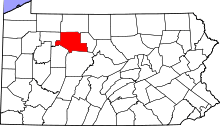 | |
| Boroughs | ||
| Townships | ||
| CDPs | ||
| Unincorporated communities | ||