Jezzine
| Jezzine جزين | |
|---|---|
 | |
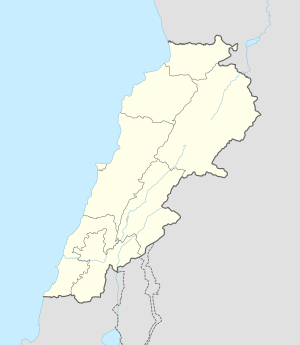 Jezzine Location in Lebanon | |
| Coordinates: 33°32′N 35°35′E / 33.533°N 35.583°E | |
| Country |
|
| Governorate | South Governorate |
| District | Jezzine District |
| Time zone | EET (UTC+2) |
| • Summer (DST) | EEST (UTC+3) |
Jezzine (Arabic: جزين Jizzīn) is a town in Lebanon, located 22 km (14 mi) from Sidon and 40 km (25 mi) south of Beirut.[1] It is the capital of Jezzine District. Surrounded by mountain peaks, pine forests (like the Bkassine Pine Forest), and at an average altitude of 950 m (3,117 ft), it is the main summer resort and tourist destination of South Lebanon. The town is also famous in Lebanon for its production of handmade, traditional cutlery and daggers with decorative inlays as well as the shrine of Our Lady of the Waterfall.
Demography
The inhabitants of Jezzine are mainly Maronites or Melkites. The town is located on the slopes of Tumat Niha and is surrounded with pine forests, vineyards and orchards. From the top of the huge rocky promontory known as al Shir, the visitor enjoys a panoramic view of the surrounding localities scattered in the midst of a fertile plain and protected by mountains.
Culture
Festivals
- The Feast of the Assumption of the Virgin Mary is celebrated on August 15 of each year with grand religious and cultural festivities.
- The Jezzine Summer Festival where Lebanon's top pop artists perform attracts hundreds of people each summer.
Libraries
- The Jezzine Public Library was built in 1960 and underwent extensive refurbishment and reorganization in 2004.
Theatres
- Empire Jezzine, the local movie theatre plays the latest Hollywood and Lebanese film hits.
Economy
Agriculture
- The production of pine nuts is the main agriculture product of Bkassine, the neighbor of Jezzine, as this village has the largest pine field in the Middle East.
Handcrafts
- Jezzine is internationally renowned for its handcrafted knives and other cutlery, made of inlaid mosaics and bone. The unique cutlery has been presented as gifts to dignitaries all over the world as a unique memento of Lebanon. The first family who produced this cutlery is the el Haddad family and started the company in 1770. The latest, master of this art, is Samir Haddad, who died 28 January 2015 at the age of 84. He was praised for his skills and art by many people.[2]
Tourism
- Jezzine is South Lebanon's primary summer resort. It is rich in natural beauty, featuring pine-forested valleys and mountain summits, ponds, and waterfalls. The town is known as the “City of Falls” because of its famous waterfalls, the Jezzine Falls.[2]
Major Attractions
At the entrance of Jezzine, there is "Saydet Jezzine" or "Saydet el-Maabour" (Our Lady of Jezzine) shrine; inside it lies the statue of the Virgin. In 1898, an important passageway connecting Jezzine with the coastal cities and Sidon was built. In 1955, the Virgin Statue was ascended during religions celebrations that occur on August 15, the day of the Virgin's Ascension. On this occasion, the celebrators go around the town till they reach the Virgin's Statue amidst prayers and lit candles.
The town overlooks a cliff of 40 meters high. At its sides, there are café houses and restaurants overlooking a wonderful landscape of Wadi Jezzine, which in turn overlooks green fields. In the center of the town there is the Municipal Palace, which was built according to the Ottoman style in 1898 during the reign of Sultan Abd el Hamid and the "Qaim Maqam" of the district, Saleem Bey Aammoun, at the expense of the municipality.
In Jezzine, there are churches that were built more than 200 years ago. They are famous for their huge stony vaults.
On the outskirts of the town you can see St. Maroun Church, which dates back to the 18th century. It was partially destroyed in 1759, and then repaired several times. It is distinguished for its vastness and elevated vaults. Believers reach the church via an old flight of stairs from the Old Section of the town.
The churches in Jezzine are:
- Saydet el-Yanbou' Church (built in 1796): It includes a valuable icon of the Virgin and her Baby, Jesus (painted by the Italian artist "Piarotti"). It is placed on a vaulted marble altar. There are huge columns that support the walls lined with argillaceous and leaden (dull gray) stones.
- St. Anthony Church (built in the 19th century): it has a central chapel beside which there are two other chapels. It includes 14 lit niches that represent the stages of the Cross Pathway, as well as engravings in the walls which surround the altar.
- St. Joseph Church (built in 1860): its architecture and vaults are beautiful. It has no central columns, and is divided into two parts: The first (for men) is higher than the other part (for women).
South of Jezzine lays Sirhal Palace, a huge building whose architecture is nontraditional. It was built by Dr. Farid Sirhal. The Palace includes spacious rooms topped with perforated glass colored vaults, as well as shapes of engraved water-springs. It looks imposing to the onlookers passing through the Ain Majdalein road. It is not open for visitors.[3]
History
The name, Jezzine, derives from the Aramaic (Syriac) word, meaning "depot" or "store". Many historians believe that Jezzine served as a storing location for traders because of its strategic location on the caravan route that connected the ancient port city of Sidon to the Chouf, the Beqaa Valley, and to Syria.[2]
The Australian 7th Division, with British and Free French forces, supported by the Royal Australian Air Force, Royal Australian Navy, Royal Navy and Royal Air Force, fought for Jezzine against Vichy French forces in 1941.
Julián Slim Haddad, born in 1887 in Jezzine, emigrated to Mexico when he was 14 years old. In Mexico City Julián would establish his enterprise Estrella de Oriente. One of his sons, Carlos Slim Helú, born on 28 January 1940 in Mexico City, inherited his fathers business talent and ultimately became the richest man in the world in 2007, according to Forbes magazine.
Landmarks
- Jezzine's Waterfalls, some as high as 90 m (295 ft)
- Our Lady of the Waterfall, a Marian shrine
- The 400-year-old Kanaan Family Palace
- The Chir cliff that offers panoramic views of the forested mountains and one of Jezzine's waterfalls that drops 90 m over the cliff.[3]
- The Grotto of Fakhreddin II
Famous People
- Carlos Slim Helú (1940), Businessman. He is the second richest man in the world
- Karen Maron (1979), War correspondent. Journalist. International Analyst. She is one of the TOP 100 most influential journalists in the world covering armed violence
- Michel Naim Aoun (1935), Thirteenth President of the Lebanese Republic. Former Prime Minister of Lebanon, Lebanese army commander and politician.
- Edmond Amin Rizk (1936), Former Minister, Deputy, Politician and Writer.
- Gabrielle Bou Rached (1985), Miss Lebanon.
References
- ↑ Profile of Jezzine - Jezzine - Lebanon - jizzine.com
- 1 2 3 Jezzine Lebanon
- 1 2 http://destinationlebanon.gov.lb/en/TourismRegion/details/16/84
External links
- Jezzine - Ain Majdalayne, Localiban
Capital: Jezzine | ||
| Towns and villages |  | |
Coordinates: 33°32′N 35°35′E / 33.533°N 35.583°E