Jakovo
| Jakovo | |
|---|---|
|
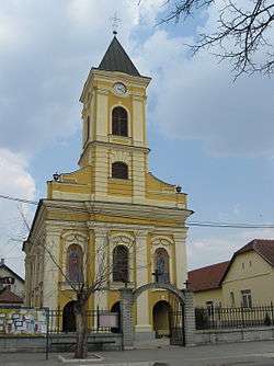
Orthodox Church of Ascension of Christ | |
 Jakovo | |
| Coordinates: 44°45′N 20°16′E / 44.750°N 20.267°E | |
| Country |
|
| Time zone | CET (UTC+1) |
| • Summer (DST) | CEST (UTC+2) |
Jakovo (Serbian Cyrillic: Јаково) is an suburban neighborhood of Belgrade, the capital of Serbia. It is located in Belgrade's municipality of Surčin.
Location
Jakovo is located in the south-eastern part of Syrmia [1] (sub-region of Podlužje), 24 kilometers south-west of downtown Belgrade and 6 kilometers south of the municipal seat of Surčin. The settlement is 4 kilometers away from the left bank of the Sava river.
Population
Jakovo is statistically classified as a rural settlement (village).[2] As it grows, and it experiences a steady population growth for decades, it makes almost one continuous built-up area with the neighboring settlements of Surčin, Bečmen and Boljevci. Historical population of Jakovo:[3]
- 1921 - 1,911
- 1931 - 2,015
- 1948 - 2,096
- 1953 - 2,249
- 1961 - 2,624
- 1971 - 3,123
- 1981 - 4,619
- 1991 - 5,483 (de jure)
- 1991 - 5,423 (de facto)
- 2002 - 6,066 (de jure)
- 2002 - 5,949 (de facto)
Ethnic structure (2002 census)
Main ethnic groups in Jakovo include:[2]
Characteristics
Jakovo is located in the western, finished section of the uncompleted Belgrade beltway and also on the Belgrade's internal freight railway Batajnica-Surčin-Ostružnica-Železnik-Resnik which in this section generally follows the route of the beltway.
One of the most famous Syrmian monasteries, Fenek, is located just outside the settlement, on the road to Boljevci. A riding school is also situated on the main road leading from Jakovo.
Stremen
Stremen (Cyrillic: Стремен) is the only salaš, secluded ranch-type farms quite common in Vojvodina and Hungary, on the territory of Belgrade. [4] It is location of the traditional horse racing fair Sremački preskok. Curiosity of the salaš is the German fiacre for transportation of 15 passengers, popularly called konjobus (horsebus). Stremen is 20 kilometers away from downtown Belgrade, but since 2008 it is also accessible via tourist boats which connect Novi Beograd's Block 45 and settlements in the municipality of Surčin through canals.
See also
References
- ↑ Jovan Đ. Marković (1990). Enciklopedijski geografski leksikon Jugoslavije (in Serbo-Croatian). Sarajevo: Svjetlost. ISBN 86-01-02651-6.
- 1 2 @Republika Srbija. Republički zavod za statistiku. (2003). Popis stanovništva, domaćinstava i stanova u 2002 - STANOVNIŠTVO nacionalna ili etnička pripadnost (in Serbian). Belgrade: Republički zavod za statistiku. ISBN 86-84433-00-9.
- ↑ Uporedni pregled broja stanovnika 1948, 1953, 1961, 1971, 1981, 1991 i 2002 - podaci po naseljima (in Serbian). Belgrade: Republički zavod za statistiku. 2004. ISBN 86-84433-14-9.
- ↑ ""Konjobusom" do salaša". Politika (in Serbian). 2008-06-19. p. 22.
External links
| Wikimedia Commons has media related to Jakovo. |
Coordinates: 44°45′N 20°16′E / 44.750°N 20.267°E