Jacksonville, North Carolina
| City of Jacksonville | ||
|---|---|---|
| City | ||
|
The 1904 Onslow County Courthouse with Highway Patrol car parked on the corner of Old Bridge and Court Streets. | ||
| ||
| Nickname(s): J-Ville, "Town" "J-Vegas" | ||
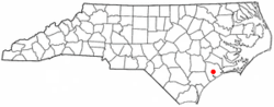 Location of Jacksonville within North Carolina | ||
| Coordinates: 34°45′35″N 77°24′35″W / 34.75972°N 77.40972°WCoordinates: 34°45′35″N 77°24′35″W / 34.75972°N 77.40972°W | ||
| Country | United States | |
| State | North Carolina | |
| County | Onslow | |
| Founded | 1757 | |
| Incorporated | 1842 | |
| Government | ||
| • Mayor | Sammy "The Mayor" Phillips | |
| Area | ||
| • City | 45.2 sq mi (117 km2) | |
| • Land | 44.5 sq mi (115.2 km2) | |
| • Water | 0.7 sq mi (1.8 km2) 1.51% | |
| • Urban | 64 sq mi (103 km2) | |
| • Metro | 909 sq mi (2,353 km2) | |
| Elevation | 15 ft (4.6 m) | |
| Population (2010) | ||
| • City | 70,145 | |
| • Density | 1,500.0/sq mi (579.2/km2) | |
| • Metro | 177,000 | |
| Time zone | EST (UTC-5) | |
| • Summer (DST) | EDT (UTC-4) | |
| ZIP Code | 28540, 28541, 28546 | |
| Area code(s) | 910 | |
| FIPS code | 37-34200[1] | |
| GNIS feature ID | 0987502[2] | |
| Website |
www | |

Jacksonville (/ˈdʒæksənˌvɪl/) is a city in Onslow County, North Carolina, United States. As of the 2010 United States census, the population stood at 70,145, which makes Jacksonville the 14th largest city in North Carolina.[3] Jacksonville is the principal city of and is included in the Jacksonville, North Carolina metropolitan area. In 2014, Forbes magazine ranked Jacksonville as the fifth fastest-growing small city in the United States.[4] Demographically, Jacksonville is the youngest city in the United States with an average age of 22.8 years old, which can be attributed to the large military presence. The low age may also be in part due to the population drastically going up over the past 80 years, from a mere 783 in the 1930 census to 70,145 in the 2010 census.[5]
It is the county seat of Onslow County,[6] and the home of the United States Marine Corps' Camp Lejeune and New River Air Station. Jacksonville is located adjacent to North Carolina's Southern Outer Banks (SOBX) area.
On 21 June 2016, the City of Jacksonville, NC, became the first jurisdiction to adopt a paid holiday honoring the 13th Amendment to the United States Constitution which made slavery in the United States and its territories illegal. The resolution of adoption targets the prevention of the modern slavery epidemic in the form of human trafficking, which includes forcing children to engage in labor, sex, and combat.
In recognition of the history of African Americans (and remembering the Montford Point Marines who faced second class citizenship), Jacksonville honored their heritage and the enfranchisement their ancestors received from the 13th Amendment. The holiday (Freedom Day) will be celebrated on the second Monday in December, which will always fall between the dates of the states' ratification (6 December 1865) and Secretary of State's proclamation of the 13th Amendment to the U.S. Constitution (18 December 1865).
History
The early history of Jacksonville starts with the end of the Tuscarora wars in 1713. The forced removal of Native American tribes was followed by permanent settlement of the regions between New Bern and Wilmington. The headwaters of the New River became a center of production for naval stores, particularly turpentine. The downtown waterfront park is built on the site of Wantland's Ferry, with bridges being constructed on either side of the original ferry site.
In 1752, a devastating hurricane destroyed the county seat of Johnston, and Wantlands Ferry, located further up the New River at the present site of Jacksonville was chosen as the site of the new county courthouse. The area was later known as Onslow Courthouse. In 1842 the town was incorporated and renamed Jacksonville in honor of former U.S. President Andrew Jackson. The town was briefly captured and occupied in November 1862 by a raiding party led by U.S. Navy Lt. William B. Cushing.
Jacksonville and Onslow County continued to rely on naval stores, lumber, and tobacco crops for industry. In 1939, Colonel George W. Gillette of the U.S. Army Corps of Engineers surveyed and mapped the area from Fort Monroe, Virginia to Fort Sumter, South Carolina which included the Onslow County coastline and the New River. The map is believed to have fostered the interest of the War and Navy Departments in establishing an amphibious training base in the area. Congressman Graham Arthur Barden of New Bern lobbied Congress to appropriate funds for the purchase of approximately 100,000 acres (400 km2) along the eastern bank of the New River. The establishment in 1941 of Marine Barracks, New River, later renamed Camp Lejeune Marine Corps Base led to the relocation of 700 families. While the landowners were compensated, many of the families displaced were sharecroppers who did not own the land their houses were built on, and did not receive compensation for their structures. Some African American families were able to purchase property from Raymond Kellum and established the community of Kellumtown. Other displaced families established communities in Georgetown, Pickettown, Bell Fork, and Sandy Run. The latter communities have since been absorbed by Jacksonville. Colonel Gillette had planned to retire near the small village of Marine, ironically named after a local family whose surname was Marine, but lost his land to the acquisition as well.
Construction of Camp Lejeune caused a population explosion in the small town of about 800 inhabitants as new workers migrated to the area. Growth continued to be fueled by both young Marine families and military retirees. Today, Jacksonville's primary industry is retail sales and services. The primary migration draw continues to be the U.S. Marine Corps.
The Bank of Onslow and Jacksonville Masonic Temple, Mill Avenue Historic District, and Pelletier House and Wantland Spring are listed on the National Register of Historic Places.[7]
Geography
Jacksonville is located at 34°45′35″N 77°24′35″W / 34.75972°N 77.40972°W (34.759630, -77.409765).[8]
According to the United States Census Bureau, the city has a total area of 45.2 square miles (117 km2), of which, 44.5 square miles (115 km2) of it is land and 0.7 square miles (1.8 km2) of it (1.51%) is water.
It is approximately 40 minutes from Wilmington and 15 minutes from the Intracoastal Waterway.
Demographics
| Historical population | |||
|---|---|---|---|
| Census | Pop. | %± | |
| 1870 | 60 | — | |
| 1880 | 94 | 56.7% | |
| 1890 | 170 | 80.9% | |
| 1900 | 309 | 81.8% | |
| 1910 | 505 | 63.4% | |
| 1920 | 656 | 29.9% | |
| 1930 | 783 | 19.4% | |
| 1940 | 873 | 11.5% | |
| 1950 | 3,960 | 353.6% | |
| 1960 | 13,491 | 240.7% | |
| 1970 | 16,289 | 20.7% | |
| 1980 | 18,237 | 12.0% | |
| 1990 | 30,013 | 64.6% | |
| 2000 | 66,715 | 122.3% | |
| 2010 | 70,145 | 5.1% | |
| Est. 2015 | 67,357 | [9] | −4.0% |
As of the census[1] of 2000, there were 66,715 people, 17,175 households, and 13,533 families residing in the city. The population density was 1,500.0 people per square mile (579.1/km²). There were 18,312 housing units at an average density of 411.7 per square mile (159.0/km²). The racial composition of the city was: 63.94% White, 23.96% Black or African American, 10.05% Hispanic or Latino American, 2.07% Asian American, 0.75% Native American, 0.19% Native Hawaiian or Other Pacific Islander, 5.42% some other race, and 3.67% two or more races. As of 2009, the estimated population for the city was 80,542.
There were 17,175 households out of which 49.5% had children under the age of 18 living with them, 63.8% were married couples living together, 12.3% had a female householder with no husband present, and 21.2% were non-families. 16.6% of all households were made up of individuals and 5.1% had someone living alone who was 65 years of age or older. The average household size was 2.83 and the average family size was 3.8
In the city the population was spread out with 24.3% under the age of 18, 36.3% from 18 to 24, 25.9% from 25 to 44, 8.8% from 45 to 64, and 4.8% who were 65 years of age or older. The median age was 22 years. Jacksonville has been named the youngest city in the nation (lowest median age) on various lists. For every 100 females there were 156.2 males. For every 100 females age 18 and over, there were 178.6 males.
The median income for a household in the city was $32,544, and the median income for a family was $33,763. Males had a median income of $17,121 versus $19,931 for females. The per capita income for the city was $14,237. About 12.5% of families and 14.1% of the population were below the poverty line, including 18.0% of those under age 18 and 17.7% of those age 65 or over.
The 2013 population estimate was 69,079, with 67.7% identifying as White and 20.0% identifying as Black or African-American. The median household income for 2009-2013 was $42,459.
Economy
Top employers
According to the City's 2012 Comprehensive Annual Financial Report,[11] the top employers in the city are:
| # | Employer | # of Employees |
|---|---|---|
| 1 | United States Department of Defense | 1000+ |
| 2 | Onslow County Schools | 1000+ |
| 3 | MCCS Camp Lejeune | 1000+ |
| 4 | Onslow Memorial Hospital | 1000+ |
| 5 | Onslow County | 1000+ |
| 6 | Walmart | 1000+ |
| 7 | Coastal Carolina Community College | 500-999 |
| 8 | Convergys | 500-999 |
| 9 | City of Jacksonville | 500-999 |
| 10 | Food Lion | 250-499 |
| 11 | Coastal Enterprises | 250-499 |
| 12 | McDonald's | 250-499 |
| 13 | Lowe's | 250-499 |
| 14 | Alorica | 250-499 |
| 15 | Stanadyne | 250-499 |
Law and government
The current mayor of Jacksonville is Sammy Phillips.
City council
- Jerome Willingham (Ward 1)
- Jerry Bitner(Ward 2)
- Michael Lazzara (Ward 3 and Mayor Pro Tem)
- Angelia Washington (Ward 4)
- Randy Thomas (Representative At-Large)
- Robert Warden (Representative At-Large)
The current Postmaster of Jacksonville is David James
Education
Public schools
Alternative School
- Onslow County Learning Center
Elementary Schools
- Southwest Elementary School
- Bell Fork Elementary School
- Blue Creek Elementary School
- Carolina Forest Elementary School
- Clyde Erwin Elementary School
- Hunters Creek Elementary School
- Jacksonville Commons Elementary School
- MeadowView Elementary School
- Morton Elementary School
- Parkwood Elementary School
- Silverdale Elementary School
- Stateside Elementary School
- Summersill Elementary School
- Thompson Elementary School
- Dixon Elementary School
Middle Schools
- Dixon Middle School
- Hunters Creek Middle School
- Jacksonville Commons Middle School
- Northwoods Park Middle School
- New Bridge Middle School
- Southwest Middle School
High Schools
- Dixon High School
- Jacksonville High School
- Northside High School
- Southwest High School
- White Oak High School
- Richlands High School
- Camp Lejeune High School
Private schools
- Fellowship Christian Academy
- Grace Baptist School
- Infant Of Prague Catholic School
- Jacksonville Christian Academy
- Living Water Christian School
- Montessori Children's School
- St. Anne's Day School
- Shiloh Institute of Learning
Public magnet schools
- Clyde Erwin Elementary School
- New Bridge Middle School
- Northwoods Elementary School (year round school)
Higher education
- Coastal Carolina Community College
- Miller-Motte Technical College - Jacksonville, NC branch
- University of Mount Olive - Jacksonville, NC branch
Charter School
Z.E.C.A. School of Arts and Technology
Notable people
- Ryan Adams, singer-songwriter, who frequently makes reference to Jacksonville in his songs, including a song titled "Jacksonville Skyline" with his former band Whiskeytown and the song, "The End" from his album Jacksonville City Nights. He has released a 7" single entitled "Jacksonville" on his own Pax-Am Label.
- AJ Styles, Professional Wrestler. Most notable for his time in TNA, ROH and NJPW, and currently WWE, where he is the current WWE World Champion.
- Jones Angell, play-by-play announcer for the North Carolina Tar Heels
- Art Bell, talk radio host
- Levi Brown, pro football player
- Edward B. Dudley, governor, congressman
- Mike Frier, pro football player
- David Green, pro football player
- Sara Hickman, singer
- Marcus Jones, pro football player with Tampa Bay Buccaneers
- Qasim Mitchell, pro football player
- Quincy Monk, pro football player
- Dian Parkinson, television personality and model
- Danielle Peck, singer
- Tyrone Willingham, former head football coach at University of Washington and the University of Notre Dame
References
- Murrell, Stratton C. and Billie Jean. Images of America: Jacksonville and Camp Lejeune, Arcadia Publishing, 2001. ISBN 0-7385-1356-3
- Watson, Alan D. Onslow County: A Brief History Division of Archives and History, North Carolina Department of Cultural Resources, Raleigh, 1995. ISBN 0-86526-263-2
- 1 2 "American FactFinder". United States Census Bureau. Archived from the original on September 11, 2013. Retrieved 2008-01-31.
- ↑ "US Board on Geographic Names". United States Geological Survey. 2007-10-25. Retrieved 2008-01-31.
- ↑ Jacksonville city, North Carolina
- ↑ Kotkin, Joel (2014-09-03). "America's Fastest-Growing Small Cities". Forbes. Retrieved 2014-09-03.
- ↑ Best places to live 2010: Top 25 Youngest. - Money.
- ↑ "Find a County". National Association of Counties. Archived from the original on May 31, 2011. Retrieved 2011-06-07.
- ↑ National Park Service (2010-07-09). "National Register Information System". National Register of Historic Places. National Park Service.
- ↑ "US Gazetteer files: 2010, 2000, and 1990". United States Census Bureau. 2011-02-12. Retrieved 2011-04-23.
- ↑ "Annual Estimates of the Resident Population for Incorporated Places: April 1, 2010 to July 1, 2015". Retrieved July 2, 2016.
- ↑ "Census of Population and Housing". Census.gov. Archived from the original on May 11, 2015. Retrieved June 4, 2015.
- ↑ City of Jacksonville CAFR
External links
| Wikimedia Commons has media related to Jacksonville, North Carolina. |
- Official website
- Jacksonville Daily News Website
-
 Jacksonville (North Carolina) travel guide from Wikivoyage
Municipalities and communities of Onslow County, North Carolina, United States | ||
|---|---|---|
| City |  | |
| Towns | ||
| CDPs | ||
| Unincorporated communities | ||
| Military bases | ||
| Footnotes | ‡This populated place also has portions in an adjacent county or counties | |