Immokalee, Florida
| Immokalee, Florida | |
|---|---|
| Census-designated place | |
 Location in Collier County and the state of Florida | |
| Coordinates: 26°25′16″N 81°25′22″W / 26.42111°N 81.42278°WCoordinates: 26°25′16″N 81°25′22″W / 26.42111°N 81.42278°W | |
| Country |
|
| State |
|
| County |
|
| Area | |
| • Total | 23.3 sq mi (60.3 km2) |
| • Land | 22.7 sq mi (58.8 km2) |
| • Water | 0.6 sq mi (1.5 km2) |
| Elevation | 33 ft (10 m) |
| Population (2010) | |
| • Total | 24,154 |
| • Density | 1,064/sq mi (410.8/km2) |
| Time zone | Eastern (EST) (UTC-5) |
| • Summer (DST) | EDT (UTC-4) |
| ZIP codes | 34142–34143 |
| Area code(s) | 239 |
| FIPS code | 12-33250[1] |
| GNIS feature ID | 0284474[2] |
Immokalee is an unincorporated area and a census-designated place (CDP) in Collier County, Florida, United States. The population was 24,154 at the 2010 census.[3] It is part of the Naples–Marco Island Metropolitan Statistical Area.
History
Originally the region was occupied by the Calusa Indians and centuries later occupied by the Seminole, after they moved down from the northern part of Florida. Initially the settlement was known as Gopher Ridge by the Seminole and Miccosukee Indians.[4] Immokalee means "My Home" in Mikasuki language.[4]
When the swamps were drained in the region, agriculture became the dominant industry. European-American hunters, trappers, Indian traders, cowmen, and missionaries moved in before the development of permanent villages.[4] The first permanent settlement was founded in 1872.[4]
In 1921 the Atlantic Coast Line Railroad was extended south to Immokalee.[4]
The Immokalee area is heavily agricultural. It is one of the major centers of tomato growing in the United States.[5] In 1960, CBS News anchor Edward R. Murrow reported on the working conditions in the surrounding farms for his Harvest of Shame report for CBS Reports, which described the harsh lives of migrant workers.[4]
Geography
Immokalee is located in northern Collier County along Florida State Road 29. LaBelle is 24 miles (39 km) to the north, and Interstate 75 (Alligator Alley) is 20 miles (32 km) to the south.
According to the United States Census Bureau, the CDP has a total area of 23.3 square miles (60.3 km2), of which 22.7 square miles (58.8 km2) is land and 0.58 square miles (1.5 km2), or 2.42%, is water.[3]
Demographics
| Historical population | |||
|---|---|---|---|
| Census | Pop. | %± | |
| 1960 | 3,224 | — | |
| 1970 | 3,764 | 16.7% | |
| 1980 | 11,038 | 193.3% | |
| 1990 | 14,120 | 27.9% | |
| 2000 | 19,763 | 40.0% | |
| 2010 | 24,154 | 22.2% | |
| source:[3][6] | |||
As of the census[1] of 2000, there were 19,763 people, 4,715 households, and 3,635 families residing in the CDP. The population density was 2,449.1 people per square mile (945.5/km²). There were 4,987 housing units at an average density of 618.0/sq mi (238.6/km²). The racial makeup of the CDP was 70.98% Hispanic (Of Any race), 18.03% African American, 3.19% White, 1.03% Native American, 0.20% Asian, 0.19% Pacific Islander, 35.66% from other races, and 6.38% from two or more races.
There were 4,715 households out of which 49.7% had children under the age of 18 living with them, 45.5% were married couples living together, 20.0% had a female householder with no husband present, and 22.9% were non-families. 13.1% of all households were made up of individuals and 3.9% had someone living alone who was 65 years of age or older. The average household size was 3.91 and the average family size was 4.10.
In the CDP the population was spread out with 34.9% under the age of 18, 15.7% from 18 to 24, 31.2% from 25 to 44, 14.1% from 45 to 64, and 4.1% who were 65 years of age or older. The median age was 25 years. For every 100 females there were 129.6 males. For every 100 females age 18 and over, there were 145.9 males.
The median income for a household in the CDP was $24,315, and the median income for a family was $22,628. Males had a median income of $17,875 versus $16,713 for females. The per capita income for the CDP was $8,576. About 34.6% of families and 39.8% of the population were below the poverty line, including 46.1% of those under age 18 and 26.9% of those age 65 or over.
Transportation
Immokalee Airport is a public-use airport located 1 mile (1.6 km) northeast of the central business district.
Collier Area Transit provides the local bus service and paratransit.[7] The #5 connects to Naples, the #7 connects to Marco Island (limited trips), and the 8A circulates within the area.
Immokalee used to be served by the Seaboard Coast Line Railroad (formerly Atlantic Coast Line) which ran a branchline from Palmdale through Immokalee to Everglades City. The line used to generate considerable agricultural-related traffic. The rail line was cut back to Sunniland south of Immokalee in the 1950s and then abandoned to the mainline at Palmdale in the 1980s. This left Immokalee without rail service.
The main road through Immokalee is State Road 29. Other important county roads through the region are CR 29A and CR 846.
Government
Being unincorporated, the area has no municipal government of its own and is governed by Collier County, Florida.
Community and education
Immokalee is the center of the region's agriculture industry and home to many immigrant and migrant families who work the vast fields which produce a large amount of the United States' fresh produce. Crops include cucumbers, bell peppers, citrus and about 90% of the nation's tomatoes that are harvested during the winter months.
Immokalee's public schools are operated by the District School Board of Collier County.
Elementary schools in Immokalee and serving Immokalee include Eden Park, Highlands, Lake Trafford, and Village Oaks. Pinecrest Elementary School, located outside of and adjacent to the CDP, serves a portion of the CDP. All residents are zoned to Immokalee Middle School and Immokalee High School, both located in the CDP.[8][9]
Landmarks and institutions
The federally recognized Seminole Tribe of Florida has one of its six reservations here, Immokalee, on which it operates one of its gaming casinos.
The Audubon Society's Corkscrew Swamp Sanctuary is nearby.
Media
Immokalee is home to WCIW-LP, a low power community radio station owned and operated by the Coalition of Immokalee Workers. The station was built by numerous volunteers from Immokalee and around the country in December 2003 at the fifth Prometheus Radio Project barnraising. WCIW broadcasts music, news, and public affairs to listeners in Spanish, Haitian Creole and several indigenous languages, including Mam and Kan.
Notable people
- Mackensie Alexander, Minnesota Vikings cornerback
- Albert Bentley, played football at Immokalee High School and went on to play for the Miami Hurricanes and the Indianapolis Colts
- Edgerrin James, former Pro Bowl running back, was born here
- Javarris James, his cousin and an Indianapolis Colts running back, was born here
- Brian Rolle, Philadelphia Eagles linebacker, was born here
- Ovince St. Preux, Ultimate Fighting Championship competitor
- Felipe Santos, missing person
See also
- Coalition of Immokalee Workers, a grassroots community and workers' organization in the area. The 2014 documentary Food Chains was shot in Immokalee.[10][11]
References
- 1 2 "American FactFinder". United States Census Bureau. Retrieved 2008-01-31.
- ↑ "US Board on Geographic Names". United States Geological Survey. 2007-10-25. Retrieved 2008-01-31.
- 1 2 3 "Geographic Identifiers: 2010 Demographic Profile Data (G001): Immokalee CDP, Florida". U.S. Census Bureau, American Factfinder. Retrieved July 16, 2014.
- 1 2 3 4 5 6 Mascia, Jennifer (June 15, 2011). "Everything You Ever Wanted to Know About Immokalee, Fla.". New York Times. Retrieved 29 September 2012.
- ↑ Bittman, Mark (June 14, 2011). "The True Cost of Tomatoes".
- ↑ "CENSUS OF POPULATION AND HOUSING (1790-2000)". U.S. Census Bureau. Retrieved 2010-07-17.
- ↑ "Archived copy". Archived from the original on October 13, 2013. Retrieved November 26, 2013.
- ↑ "Attendance Zones Effective 2009-2010." District School Board of Collier County. Retrieved on September 18, 2009.
- ↑ "Immokalee CDP, Florida." U.S. Census Bureau. Retrieved on September 18, 2009.
- ↑ Dave McNary, Eva Longoria’s ‘Food Chains’ Documentary Getting U.S. Distribution, Variety, March 31, 2014
- ↑ Frank Scheck, 'Food Chains': Film Review, The Hollywood Reporter, November 24, 2014
External links
- The Story of Immokalee 1938 WPA interview covering founding, slave era, post-Civil War Reconstruction and up through Great Depression. Electronic record maintained by Library of Congress. Accessed January 15, 2007.
Municipalities and communities of Collier County, Florida, United States | ||
|---|---|---|
| Cities | 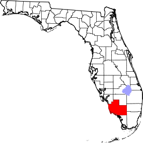 | |
| CDPs | ||
| Unincorporated communities | ||