Imlaystown, New Jersey
| Imlaystown, New Jersey | |
|---|---|
| Unincorporated community | |
|
Center of Imlaystown | |
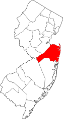
 Imlaystown, New Jersey 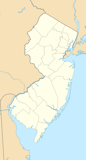 Imlaystown, New Jersey  Imlaystown, New Jersey Location of Imlaystown in Monmouth County Inset: Location of county within the state of New Jersey | |
| Coordinates: 40°10′03″N 74°30′55″W / 40.16750°N 74.51528°WCoordinates: 40°10′03″N 74°30′55″W / 40.16750°N 74.51528°W | |
| Country |
|
| State |
|
| County | Monmouth |
| Township | Upper Freehold |
| Named for | Imaly family |
| Elevation[1] | 105 ft (32 m) |
| ZIP code | 08501 |
| GNIS feature ID | 877307[1] |
.JPG)
Imlaystown is small historic unincorporated community located within Upper Freehold Township in Monmouth County, New Jersey, United States.[2] It is located in ZIP code 08526. The community is accessible from Exit 11 of Interstate 195.
History
Founded in 1690, the community was once the social, economic and political focus of Upper Freehold. It consists of approximately 30 buildings from the mid-19th century. Most were rebuilt in 1898 after a fire which destroyed much of the town. It takes its name from the Imlay family, the area's major landowners in the colonial period.
The Imlaystown post office was established on April 16, 1832, and discontinued on November 28, 2009.[3]
Sites of interest
Ye Olde Yellow Meeting House was built in 1737 by a congregation begun in 1720.[4]
The most recognizable building in Imlaystown is Salter's Mill situated on a 28-acre (110,000 m2) millpond that once supported an ice business as well as the mill.
The Happy Apple Inn is the community's only restaurant. Built as a stagecoach stopover between Trenton and the Jersey Shore in the mid-19th century, the current structure was rebuilt following a fire in 1904. The Happy Apple was opened in 1972 by the father of its present owners, Buddy Westendorf and wife Donna.
Preservation
Since the community's addition to the state and national registers of historic places in 1985, portions have suffered from neglect. While the community was somewhat revitalized in the 1990s, including the restoration of the millpond in 1995, many of its buildings are now dilapidated. Some are currently uninhabitable due to septic issues created by the proximity to Doctor's Creek. Upper Freehold's recent "Master Plan" was supposed to address the preservation of historic structures, rural character, and open space. Preservation New Jersey[5] believes that preventing the decay of Imlaystown is key to realizing the vision of this plan.
Notable people
People who were born in, residents of, or otherwise closely associated with Imlaystown include:
- Chris Tomson (born 1984), drummer with the band Vampire Weekend.[6]
References
- 1 2 "Imlaystown". Geographic Names Information System. United States Geological Survey.
- ↑ Locality Search, State of New Jersey. Accessed February 26, 2015.
- ↑ "Postmaster Finder - Post Offices by ZIP Code". United States Postal Service. Retrieved June 8, 2015.
- ↑ "Ye Olde Yellow Meeting House - New Jersey Historical Markers on". Waymarking.com. 2008-12-09. Retrieved 2012-02-18.
- ↑ Preservation New Jersey's Top Ten Endangered Historic Sites of Monmouth County
- ↑ Daniel, Jayanthi. "A Weekend on the Upper West Side", The New York Sun, June 1, 2007. Accessed August 16, 2012. "The band, which plans to release 1,000 copies of a new EP on June 16 before launching a month-long national tour in July, records its songs on a laptop in friends' basements and at Mr. Tomson's parents' house in Imlaystown, N.J., — not far, as Messrs. Koenig and Baio pointed out separately, from the Six Flags Great Adventure theme park."