Ihlara
| Ihlara | |
|---|---|
| Township | |
|
Ihlara Valley | |
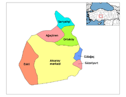 Location of Ihlara within Turkey. | |
| Country |
|
| Region | Central Anatolia |
| Province | Aksaray |
| Time zone | EET (UTC+2) |
| • Summer (DST) | EEST (UTC+3) |
| Postal code | 68x xx |
| Licence plate | 68 |
| Website | www.ihlara.bel.tr |

Ihlara is a township with own municipality in Aksaray Province, Central Anatolia, Turkey. It is situated at about 40 km (25 mi) from the province seat of Aksaray and near the town of Güzelyurt. The township is famed for the nearby valley of the same name, Ihlara Valley, which is a 16 km (10 mi) long gorge cut into volcanic rock in the southern part of Cappadocia, following several eruptions of Mount Erciyes. The Melendiz Stream flows through the valley.
What makes the valley unique is the ancient history of its inhabitants. The whole canyon is honeycombed with rock-cut underground dwellings and churches from the Byzantine period built by the Cappadocian Greeks. These local people were forced to leave the area and move to Greece in the 1923 Population exchange between Turkey and Greece.[1][2]
Due the valley's plentiful supply of water and hidden places, this was the first settlement of the first Christians escaping from Roman soldiers. In the Ihlara Valley there are hundreds of old churches in the volcanic rock caves. The best-known churches are Ağaçaltı Church with cross plan, Sümbüllü Church, Pürenliseki Church, Kokar Church, Yilanli Church, Karagedik Church, Kirkdamatli Church, Direkli Church, Ala Church, Kemerli Church and Egritas Church.

References
- ↑ Darke, Diana (2011). Eastern Turkey. Bradt Travel Guides. pp. 139–140. ISBN 978-1-84162-339-9.
The area became an important frontier province during the 7th century when Arab raids on the Byzantine Empire began. By now the soft tufa had been tunneled and chambered to provide underground cities where a settled if cautious life could continue during difficult times. When the Byzantines re-established secure control between the 7th and 11th centuries, the troglodyte population surfaced, now carving their churches into rock faces and cliffs in the Goreme and Sogamli areas, giving Cappadocia its fame today. […] At any rate here they flourished, their churches remarkable for being cut into the rock, but interesting especially for their paintings, relatively well preserved, rich in coloring, and with an emotional intensity lacking in the formalism of Constantinople; this is one of the few places where paintings from the pre-iconoclastic period have survived. Icons continued to be painted after the Seljuk conquest of the area in the 11th century, and the Ottoman conquest did not interfere with the Christian practices in Cappadocia, where the countryside remained largely Greek, with some Armenians. But decline set in and Goreme, Ihlara and Soganli lost their early importance. The Greeks finally ending their long history here with the mass exchange of populations between Turkey and Greece in 1923.
- ↑ Rodley, Lyn (2010). Cave Monasteries of Byzantine Cappadocia. Cambridge University Press. p. 1. ISBN 978-0-521-15477-2.
The tenth-century historian Leo the Deacon records a journey to Cappadocia made by Nikephoros Phokas shortly before he became emperor. Perhaps to recapture the attention of readers beginning to tire of troop movements he also offers a scrap of information about a curiosity of the region to which the emperor was heading: its inhabitants were once called troglodytes, because ‘they went underground in holes, clefts and labyrinths, as it were in dens and burrows’. This brief note was probably not based on first-hand knowledge but it might have been prompted by an awareness of the vast number of rock-cut cavities in an area to the west and southwest of Kaisareia (Kayseri of modern Turkey). Had Leo been more inclined to garrulous digression (or perhaps just better informed), he might have supplied more details of the troglodyte region and the task of bringing scholarly order to the hundreds of rock-cut monuments and other cavities in the area might have been much similar. … At this time the region was still inhabited by a mixed population of Turkish-speaking Moslems and Greek-speaking Christians. The latter group left for Greece in the early 1920s, during an exchange of population of minorities that was part of the radical social re-ordering initiated by Mustafa Kemal Atatürk; they were replaced by Turks from Greece, mostly from Thrace. In the two decades before this upheaval, however, members of the local Greek population acted as guides to Guillaume de Jerphanion, who made several visits to the volcanic valleys and wrote his meticulous descriptions of many painted Byzantine rock-cut churches.
External links
- Ihlara
- High-resolution pictures of Ihlara Valley
- Pictures and info
- Ihlara guide and photos
- Aksaray governorship (er)
- Information and map about Ihlara valley
| Province: | ||
|---|---|---|
| District: | ||
| Towns: | ||
Coordinates: 38°14′N 34°18′E / 38.233°N 34.300°E