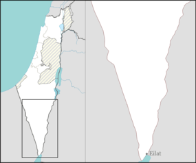
Idan, Israel
| Idan עִדָּן, עידן | |
|---|---|
 | |
 Idan | |
| Coordinates: 30°48′20″N 35°18′1″E / 30.80556°N 35.30028°ECoordinates: 30°48′20″N 35°18′1″E / 30.80556°N 35.30028°E | |
| District | Southern |
| Council | Central Arava |
| Affiliation | Moshavim Movement |
| Founded | 1980 |
| Founded by | Immigrants from USA, Canada and South Africa |
| Population (2015)[1] | 360 |
Idan (Hebrew: עִדָּן) is a moshav in southern Israel. Located in the Arabah valley, it falls under the jurisdiction of the Central Arava Regional Council. In 2015 it had a population of 360.
History
Moshav Idan was founded in 1980 by immigrants from Canada, the United States, and South Africa, who had organized in 1976. It takes its name from the nearby Idan Stream, which was in turn named after the Arab name for the stream, Wadi al-Aidan. In 2005, it had a population of 150.[2][3] After the Israel–Jordan peace treaty, some of the lands of Idan were handed over to Jordan.[3]
Peace road
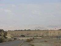
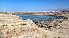
Between Idan and Hatzeva is a service road, called Peace Road. The Jewish National Fund paved the Peace Route, along the border between Israel and Jordan, for the benefit of central Arava inhabitants, following the Israel-Jordan Peace Treaty of 1994. The road runs along the foot of the Arava Cliffs, opposite the Edom Mountains, and is surrounded by agricultural fields and sandy expanses. A picnic area, lookouts and a trail have been built along the way. The road allows easy access to the eastern part of the Shezaf Nature Reserve.[4]
References
- ↑ "List of localities, in Alphabetical order" (PDF). Israel Central Bureau of Statistics. Retrieved 16 October 2016.
- ↑ Mapa's concise gazetteer of Israel (in Hebrew). Yuval El'azari (ed.). Tel-Aviv: Mapa Publishing. 2005. p. 408. ISBN 965-7184-34-7.
- 1 2 HaReuveni, Immanuel (1999). Lexicon of the Land of Israel (in Hebrew). Miskal - Yedioth Ahronoth Books and Chemed Books. p. 730. ISBN 965-448-413-7.
- ↑ "Starry skies and wide open spaces (2 of 2)". Haaretz. Retrieved 2014-01-13.