Hubbard, Oregon
| Hubbard, Oregon | |
|---|---|
| City | |
|
The watertower in Hubbard. | |
| Nickname(s): Home of the Hop Fest | |
 Location in Oregon | |
| Coordinates: 45°10′56″N 122°48′26″W / 45.18222°N 122.80722°WCoordinates: 45°10′56″N 122°48′26″W / 45.18222°N 122.80722°W | |
| Country | United States |
| State | Oregon |
| County | Marion |
| Incorporated | 1891 |
| Government | |
| • Mayor | James Yonally |
| Area[1] | |
| • Total | 0.71 sq mi (1.84 km2) |
| • Land | 0.71 sq mi (1.84 km2) |
| • Water | 0 sq mi (0 km2) |
| Elevation | 181 ft (55 m) |
| Population (2010)[2] | |
| • Total | 3,173 |
| • Estimate (2012[3]) | 3,198 |
| • Density | 4,469.0/sq mi (1,725.5/km2) |
| Time zone | Pacific (UTC-8) |
| • Summer (DST) | Pacific (UTC-7) |
| ZIP code | 97032 |
| Area code(s) | 503 |
| FIPS code | 41-35450[2] |
| GNIS feature ID | 1163057[4] |
| Website | www.cityofhubbard.org |

Hubbard is a city in Marion County, Oregon, United States. The population was 3,173 at the 2010 census. It is part of the Salem Metropolitan Statistical Area.
Geography
According to the United States Census Bureau, the city has a total area of 0.71 square miles (1.84 km2), all of it land.[1]
Demographics
| Historical population | |||
|---|---|---|---|
| Census | Pop. | %± | |
| 1880 | 141 | — | |
| 1890 | 117 | −17.0% | |
| 1900 | 213 | 82.1% | |
| 1910 | 283 | 32.9% | |
| 1920 | 320 | 13.1% | |
| 1930 | 330 | 3.1% | |
| 1940 | 387 | 17.3% | |
| 1950 | 493 | 27.4% | |
| 1960 | 526 | 6.7% | |
| 1970 | 975 | 85.4% | |
| 1980 | 1,640 | 68.2% | |
| 1990 | 1,881 | 14.7% | |
| 2000 | 2,483 | 32.0% | |
| 2010 | 3,173 | 27.8% | |
| Est. 2015 | 3,299 | [5] | 4.0% |
2010 census
As of the census of 2010, there were 3,173 people, 958 households, and 756 families residing in the city. The population density was 4,469.0 inhabitants per square mile (1,725.5/km2). There were 1,002 housing units at an average density of 1,411.3 per square mile (544.9/km2). The racial makeup of the city was 73.3% White, 0.5% African American, 2.3% Native American, 0.9% Asian, 0.1% Pacific Islander, 19.4% from other races, and 3.4% from two or more races. Hispanic or Latino of any race were 36.3% of the population.[2]
There were 958 households of which 49.9% had children under the age of 18 living with them, 60.9% were married couples living together, 13.0% had a female householder with no husband present, 5.0% had a male householder with no wife present, and 21.1% were non-families. 15.0% of all households were made up of individuals and 4.7% had someone living alone who was 65 years of age or older. The average household size was 3.31 and the average family size was 3.71.[2]
The median age in the city was 30.1 years. 33.7% of residents were under the age of 18; 9% were between the ages of 18 and 24; 30.6% were from 25 to 44; 20.1% were from 45 to 64; and 6.6% were 65 years of age or older. The gender makeup of the city was 50.3% male and 49.7% female.[2]
2000 census
As of the census of 2000, there were 2,483 people, 753 households, and 594 families residing in the city. The population density was 3,992.2 people per square mile (1,546.3/km²). There were 799 housing units at an average density of 1,284.6 per square mile (497.6/km²). The racial makeup of the city was 68.87% White, 0.32% African American, 1.93% Native American, 0.48% Asian, 0.12% Pacific Islander, 25.61% from other races, and 2.66% from two or more races. Hispanic or Latino of any race were 32.66% of the population.[2]
There were 753 households out of which 46.5% had children under the age of 18 living with them, 60.2% were married couples living together, 13.4% had a female householder with no husband present, and 21.0% were non-families. 15.4% of all households were made up of individuals and 5.7% had someone living alone who was 65 years of age or older. The average household size was 3.30 and the average family size was 3.67.[2]
In the city the population was spread out with 34.5% under the age of 18, 9.1% from 18 to 24, 32.8% from 25 to 44, 16.4% from 45 to 64, and 7.2% who were 65 years of age or older. The median age was 29 years. For every 100 females there were 102.2 males. For every 100 females age 18 and over, there were 100.6 males.[2]
The median income for a household in the city was $38,850, and the median income for a family was $42,552. Males had a median income of $32,731 versus $24,226 for females. The per capita income for the city was $14,383. About 11.0% of families and 14.8% of the population were below the poverty line, including 20.0% of those under age 18 and 9.0% of those age 65 or over.[2]
Transportation
Notable people
- Bill Bevens (1916–1991), U.S. baseball player
- Sally Hughes-Schrader (1895–1984), zoologist
- Marion Eugene Carl (1915-1998), World War II fighter ace
References
- 1 2 "US Gazetteer files 2010". United States Census Bureau. Retrieved 2012-12-21.
- 1 2 3 4 5 6 7 8 9 "American FactFinder". United States Census Bureau. Retrieved 2012-12-21.
- ↑ "Population Estimates". United States Census Bureau. Retrieved 2013-06-02.
- ↑ "US Board on Geographic Names". United States Geological Survey. 2007-10-25. Retrieved 2008-01-31.
- ↑ "Annual Estimates of the Resident Population for Incorporated Places: April 1, 2010 to July 1, 2015". Retrieved July 2, 2016.
- ↑ "Census of Population and Housing". Census.gov. Retrieved June 4, 2015.
External links
Municipalities and communities of Marion County, Oregon, United States | ||
|---|---|---|
| Cities | 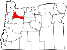 | |
| CDPs | ||
| Unincorporated communities | ||
| Ghost towns | ||
| Footnotes | ‡This populated place also has portions in an adjacent county or counties | |