Howard County, Indiana
| Howard County, Indiana | ||
|---|---|---|
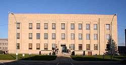 Howard County courthouse in Kokomo, Indiana | ||
| ||
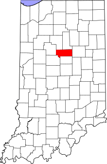 Location in the U.S. state of Indiana | ||
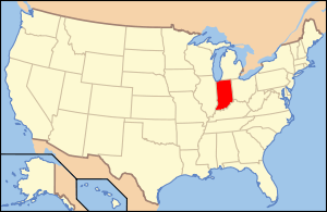 Indiana's location in the U.S. | ||
| Founded | 1844 | |
| Named for | Tilghman Howard | |
| Seat | Kokomo | |
| Largest city | Kokomo | |
| Area | ||
| • Total | 293.92 sq mi (761 km2) | |
| • Land | 293.06 sq mi (759 km2) | |
| • Water | 0.86 sq mi (2 km2), 0.29% | |
| Population | ||
| • (2010) | 82,752 | |
| • Density | 282/sq mi (109.03/km²) | |
| Congressional districts | 4th, 5th | |
| Time zone | Eastern: UTC-5/-4 | |
| Website |
www | |
| Footnotes: Indiana county number 34 | ||

Howard County is one of 92 counties in the U.S. state of Indiana. As of the 2010 census, the population was 82,752.[1] The county seat is Kokomo.[2] Originally named Richardville County, it was rechristened in 1844 to commemorate General Tilghman Ashurst Howard.
Howard County is part of the Kokomo, Indiana Metropolitan Statistical Area.
Geography
According to the 2010 census, the county has a total area of 293.92 square miles (761.2 km2), of which 293.06 square miles (759.0 km2) (or 99.71%) is land and 0.86 square miles (2.2 km2) (or 0.29%) is water.[3]
Adjacent counties
- Miami County, Indiana (North)
- Grant County, Indiana (East)
- Tipton County, Indiana (South)
- Clinton County, Indiana (Southwest)
- Carroll County, Indiana (West)
- Cass County, Indiana (Northwest)
History
This county was organized in 1844. It was first known as Richardville County. Its first name honored Jean Baptiste Richardville, a chief of the Miami.[4] Richardville's name was Pe-che-wa, which translates to “Wildcat”, hence Wildcat Creek.
In 1846, the name was changed to Howard County, in honor of Gen. Tilghman Howard, U.S. Representative from Indiana, who died in 1844.[5][6]
Places to See
- Kokomo Reservoir (Wildcat Creek Reservoir)
- Western Days Festival: First week of June, in Russiaville, Indiana
- Howard County 4-H Fair , in Greentown, Indiana
- Koh-Koh-Mah & Foster Living History Encampment, mid-September
- Kokomo-Howard County Public Library
Localities
City
Towns
Census-designated place
Townships
Other places
Climate and weather
| Kokomo, Indiana | ||||||||||||||||||||||||||||||||||||||||||||||||||||||||||||
|---|---|---|---|---|---|---|---|---|---|---|---|---|---|---|---|---|---|---|---|---|---|---|---|---|---|---|---|---|---|---|---|---|---|---|---|---|---|---|---|---|---|---|---|---|---|---|---|---|---|---|---|---|---|---|---|---|---|---|---|---|
| Climate chart (explanation) | ||||||||||||||||||||||||||||||||||||||||||||||||||||||||||||
| ||||||||||||||||||||||||||||||||||||||||||||||||||||||||||||
| ||||||||||||||||||||||||||||||||||||||||||||||||||||||||||||
In recent years, average temperatures in Kokomo have ranged from a low of 15 °F (−9 °C) in January to a high of 84 °F (29 °C) in July, although a record low of −26 °F (−32 °C) was recorded in January 1985 and a record high of 110 °F (43 °C) was recorded in July 1936. Average monthly precipitation ranged from 2.29 inches (58 mm) in February to 4.37 inches (111 mm) in July.[7]
Transportation
Airports
- Kokomo Municipal Airport
Highways
Bus Services
- City-Line Trolley Serves the city of Kokomo. It is a fixed transportation route that is free to ride and has free wifi.
- Trailways A service running from Indianapolis through Kokomo, and then to South Bend.
- Greyhound Lines A nationwide service, the Kokomo stop is at the Marathon gas station on North Reed Road, and Gano Street.
Walking Trails
- Walk Of Excellence - serves the city of Kokomo.
- Industrial Heritage Trail - serves the city of Kokomo.
- Nickle Plate Trail - ends in northern Howard County in unincorporated community, Cassville.
- Comet Trail - serves the town of Greentown, and is exactly one mile in length.
- Historic Downtown Trail - serves the city of Greentown, and you can also learn about Greentown's history while using the trail.
Education
Colleges and universities
- Indiana University Kokomo (IUK)
- Indiana Wesleyan University – Kokomo Campus
- Ivy Tech Community College
- Purdue College of Technology
Public school districts
- Kokomo-Center Township Consolidated School Corporation (K-12, Kokomo, Indiana) Kokomo High School (NCC)
- Eastern Howard School Corporation (K-12, Greentown, Indiana) (MIC)
- Northwestern School Corporation (K-12) (MIC)
- Taylor Community School Corporation (K-12, Indian Heights, Indiana) (MIC)
- Western School Corporation (K-12, Russiaville, Indiana) (MIC)
Private schools
- Redeemer Lutheran School (K-8)
- Sts. Joan of Arc and St. Patrick Catholic School (K-8)
- Temple Christian School (K-12)
- Victory Christian Academy (K-12)
- Acacia Academy (K-8)
Government
The county government is a constitutional body, and is granted specific powers by the Constitution of Indiana, and by the Indiana Code.
County Council: The county council is the legislative branch of the county government and controls all the spending and revenue collection in the county. Representatives are elected from county districts. The council members serve four-year terms. They are responsible for setting salaries, the annual budget, and special spending. The council also has limited authority to impose local taxes, in the form of an income and property tax that is subject to state level approval, excise taxes, and service taxes.[8][9]
Board of Commissioners: The executive body of the county is made of a board of commissioners. The commissioners are elected county-wide, in staggered terms, and each serves a four-year term. One of the commissioners, typically the most senior, serves as president. The commissioners are charged with executing the acts legislated by the council, collecting revenue, and managing the day-to-day functions of the county government.[8][9]
Court: The county maintains five courts. Circuit Court, Superior Court I, Superior Court II Superior Court III and Superior Court IV. The judge on the court is elected to a term of four years and must be admitted to practice law in the State of Indiana. In some cases, court decisions can be appealed to the Indiana Court of Appeals.
County Officials: The county has several other elected offices, including sheriff, coroner, auditor, treasurer, recorder, surveyor, and circuit court clerk Each of these elected officers serves a term of four years and oversees a different part of county government. Members elected to county government positions are required to declare party affiliations and to be residents of the county.[9]
IT Department The county is known for having the highest rated IT technical support in Indiana.
Howard County is part of Indiana's 2nd congressional district and Indiana's 5th congressional district; Indiana Senate districts 7 and 21;[10] and Indiana House of Representatives districts 30, 32 and 38.[11]
Demographics
| Historical population | |||
|---|---|---|---|
| Census | Pop. | %± | |
| 1850 | 6,657 | — | |
| 1860 | 12,524 | 88.1% | |
| 1870 | 15,847 | 26.5% | |
| 1880 | 19,584 | 23.6% | |
| 1890 | 26,186 | 33.7% | |
| 1900 | 28,575 | 9.1% | |
| 1910 | 33,177 | 16.1% | |
| 1920 | 43,965 | 32.5% | |
| 1930 | 46,696 | 6.2% | |
| 1940 | 47,752 | 2.3% | |
| 1950 | 54,498 | 14.1% | |
| 1960 | 69,509 | 27.5% | |
| 1970 | 83,198 | 19.7% | |
| 1980 | 86,896 | 4.4% | |
| 1990 | 80,827 | −7.0% | |
| 2000 | 84,964 | 5.1% | |
| 2010 | 82,752 | −2.6% | |
| Est. 2015 | 82,556 | [12] | −0.2% |
| U.S. Decennial Census[13] 1790-1960[14] 1900-1990[15] 1990-2000[16] 2010-2013[1] | |||
As of the 2010 United States Census, there were 82,752 people, 34,301 households, and 22,604 families residing in the county.[17] The population density was 282.4 inhabitants per square mile (109.0/km2). There were 38,679 housing units at an average density of 132.0 per square mile (51.0/km2).[3] The racial makeup of the county was 88.6% white, 6.9% black or African American, 0.9% Asian, 0.3% American Indian, 0.8% from other races, and 2.5% from two or more races. Those of Hispanic or Latino origin made up 2.7% of the population.[17] In terms of ancestry, 22.4% were German, 15.3% were American, 10.8% were English, and 10.2% were Irish.[18]
Of the 34,301 households, 30.7% had children under the age of 18 living with them, 48.3% were married couples living together, 13.1% had a female householder with no husband present, 34.1% were non-families, and 29.4% of all households were made up of individuals. The average household size was 2.38 and the average family size was 2.92. The median age was 40.7 years.[17]
The median income for a household in the county was $47,697 and the median income for a family was $55,479. Males had a median income of $50,838 versus $33,196 for females. The per capita income for the county was $23,759. About 13.1% of families and 16.4% of the population were below the poverty line, including 26.9% of those under age 18 and 4.3% of those age 65 or over.[19]
See also
References
- 1 2 "State & County QuickFacts". United States Census Bureau. Retrieved February 22, 2014.
- ↑ "Find a County". National Association of Counties. Retrieved 2011-06-07.
- 1 2 "Population, Housing Units, Area, and Density: 2010 - County". United States Census Bureau. Retrieved 2015-07-10.
- ↑ "A Look Back as We Move Forward". The Kokomo Tribune. March 28, 1999. p. 58. Retrieved August 16, 2014 – via Newspapers.com.

- ↑ De Witt Clinton Goodrich & Charles Richard Tuttle (1875). An Illustrated History of the State of Indiana. Indiana: R. S. Peale & co. p. 577.
- ↑ Gannett, Henry (1905). The Origin of Certain Place Names in the United States. Govt. Print. Off. p. 162.
- 1 2 "Monthly Averages for Kokomo, Indiana". The Weather Channel. Retrieved 2011-01-27.
- 1 2 Indiana Code. "Title 36, Article 2, Section 3". IN.gov. Retrieved 2008-09-16.
- 1 2 3 Indiana Code. "Title 2, Article 10, Section 2" (PDF). IN.gov. Retrieved 2008-09-16.
- ↑ "Indiana Senate Districts". State of Indiana. Retrieved 2011-07-14.
- ↑ "Indiana House Districts". State of Indiana. Retrieved 2011-07-14.
- ↑ "County Totals Dataset: Population, Population Change and Estimated Components of Population Change: April 1, 2010 to July 1, 2015". Retrieved July 2, 2016.
- ↑ "U.S. Decennial Census". United States Census Bureau. Retrieved July 10, 2014.
- ↑ "Historical Census Browser". University of Virginia Library. Retrieved July 10, 2014.
- ↑ "Population of Counties by Decennial Census: 1900 to 1990". United States Census Bureau. Retrieved July 10, 2014.
- ↑ "Census 2000 PHC-T-4. Ranking Tables for Counties: 1990 and 2000" (PDF). United States Census Bureau. Retrieved July 10, 2014.
- 1 2 3 "DP-1 Profile of General Population and Housing Characteristics: 2010 Demographic Profile Data". United States Census Bureau. Retrieved 2015-07-10.
- ↑ "DP02 SELECTED SOCIAL CHARACTERISTICS IN THE UNITED STATES – 2006-2010 American Community Survey 5-Year Estimates". United States Census Bureau. Retrieved 2015-07-10.
- ↑ "DP03 SELECTED ECONOMIC CHARACTERISTICS – 2006-2010 American Community Survey 5-Year Estimates". United States Census Bureau. Retrieved 2015-07-10.
External links
 |
Cass County | Miami County | | |
| Carroll County | |
Grant County | ||
| ||||
| | ||||
| Clinton County | Tipton County |
Municipalities and communities of Howard County, Indiana, United States | ||
|---|---|---|
| City | ||
| Towns | ||
| Townships | ||
| Other unincorporated communities |
| |

Coordinates: 40°29′N 86°07′W / 40.48°N 86.12°W