Horsham, Pennsylvania
| Horsham | |
| Census-designated place | |
 | |
| Country | United States |
|---|---|
| State | Pennsylvania |
| County | Montgomery |
| Township | Horsham |
| Elevation | 249 ft (75.9 m) |
| Coordinates | 40°10′57″N 75°08′04″W / 40.18250°N 75.13444°WCoordinates: 40°10′57″N 75°08′04″W / 40.18250°N 75.13444°W |
| Area | 5.5 sq mi (14.2 km2) |
| - land | 5.5 sq mi (14 km2) |
| - water | 0.0 sq mi (0 km2), 0% |
| Population | 14,842 (2010) |
| Density | 2,698.5/sq mi (1,041.9/km2) |
| Settled | 1682 |
| Timezone | EST (UTC-5) |
| - summer (DST) | EDT (UTC-4) |
| ZIP code | 19044 |
| Area code | 215 and 267 |
 Location of Horsham in Pennsylvania | |
 Location of Pennsylvania in the United States | |
Horsham is a census-designated place (CDP) in Montgomery County, Pennsylvania, United States. The population was 14,842 at the 2010 census. Horsham is located entirely within Horsham Township, and it is home to Naval Air Station Joint Reserve Base Willow Grove.
In 2007, Horsham was named the 15th best place to live in the United States by Money magazine.[1]
Geography
According to the United States Census Bureau, the CDP has a total area of 5.5 square miles (14 km2), all land.
Climate
The climate in this area is characterized by hot, humid summers and generally mild to cool winters. According to the Köppen Climate Classification system, Horsham has a humid subtropical climate, abbreviated "Cfa" on climate maps.[2]
Demographics
| Historical population | |||
|---|---|---|---|
| Census | Pop. | %± | |
| 1990 | 15,051 | — | |
| 2000 | 14,779 | −1.8% | |
| 2010 | 14,842 | 0.4% | |
As of the 2010 census, the CDP was 84.4% Non-Hispanic White, 4.7% Black or African American, 0.2% Native American and Alaskan Native, 5.8% Asian, 0.1% Native Hawaiian and Other Pacific Islander, 1.2% were Some Other Race, and 1.6% were two or more races. 3.5% of the population were of Hispanic or Latino ancestry.[3]
As of the census[4] of 2000, there were 14,779 people, 5,798 households, and 3,907 families residing in the CDP. The population density was 2,704.6 people per square mile (1,045.1/km2). There were 5,917 housing units at an average density of 1,082.8/sq mi (418.4/km2). The racial makeup of the CDP was 90.10% White, 3.79% African American, 0.19% Native American, 4.34% Asian, 0.60% from other races, and 0.98% from two or more races. Hispanic or Latino of any race were 1.45% of the population.
There were 5,798 households, out of which 33.5% had children under the age of 18 living with them, 54.5% were married couples living together, 9.6% had a female householder with no husband present, and 32.6% were non-families. 26.5% of all households were made up of individuals, and 6.3% had someone living alone who was 65 years of age or older. The average household size was 2.54 and the average family size was 3.12.
In the CDP, the population was spread out, with 25.3% under the age of 18, 6.7% from 18 to 24, 35.6% from 25 to 44, 21.5% from 45 to 64, and 10.9% who were 65 years of age or older. The median age was 36 years. For every 100 females there were 96.2 males. For every 100 females age 18 and over, there were 93.9 males.
The median income for a household in the CDP was $56,500, and the median income for a family was $68,619. Males had a median income of $43,177 versus $32,464 for females. The per capita income for the CDP was $25,116. About 1.7% of families and 3.1% of the population were below the poverty line, including 2.9% of those under age 18 and 2.9% of those age 65 or over.
Economy
Companies located in Horsham
- Arris Group, cable equipment manufacturer
- Astea International, service lifecycle management software provider[5]
- Benjamin Obdyke Incorporated, building materials manufacturer
- Bimbo Bakeries USA, corporate headquarters[6]
- Janssen, a Johnson & Johnson subsidiary
- Nutrisystem, corporate headquarters
- Penn Mutual, life insurance company
- Telerx, a Merck subsidiary
- Toll Brothers, corporate headquarters
- Trimech, SOLIDWORKS VAR[7]
- Music Choice, cable music company
Education
Schools in Horsham are part of the Hatboro-Horsham School District.
Transportation
Major roads in Horsham include Pennsylvania Route 611, which runs north-south through the community along Easton Road; Horsham Road, which heads northwest-southeast through the community and is designated as Pennsylvania Route 463 west of Pennsylvania Route 611; Pennsylvania Route 63, which runs northwest-southeast along the southwestern edge of Horsham on Welsh Road; County Line Road, which runs northwest-southeast along the border with Bucks County at the northeastern edge of the community; Blair Mill Road, which runs southwest-northeast along the southeastern edge of Horsham; Dresher Road, which runs southwest-northeast between Welsh Road and Pennsylvania Route 611; Meetinghouse Road, which runs southwest-northeast from Pennsylvania Route 611 at Dresher Road to County Line Road; and Norristown Road, which heads west from Horsham Road towards Maple Glen. The Willow Grove Interchange of the Pennsylvania Turnpike is located to the south in neighboring Upper Moreland Township, connecting to Pennsylvania Route 611.[8]
SEPTA provides bus service in Horsham.[9] The Route 55 bus follows Pennsylvania Route 611 through the community and heads north to Doylestown and south to Willow Grove and Olney Transportation Center in North Philadelphia.[9][10] Two additional bus routes serve the business parks in Horsham.[9] The Route 80 bus runs a limited stop express route between Horsham and the Olney Transportation Center while the Route 310 bus, known as the Horsham Breeze, connects to the Willow Grove Park Mall and the Willow Grove station along SEPTA Regional Rail's Warminster Line.[9][11][12]
Sport
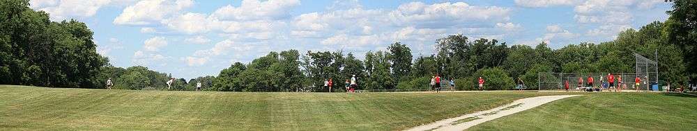
Ukrainian American Sports Centre – Tryzub.[13] Horsham Soccer Club Horsham Hawks Horsham Hounds: a Suburban baseball team, home games are played at Deep Meadow Park HHoops Basketball
References
- ↑ Three Local Towns Make Top 15 Places To Live - Local News Story - WCAU | Philadelphia
- ↑ Climate Summary for Horsham, Pennsylvania
- ↑ Census 2010: Pennsylvania. Usatoday.Com. Retrieved on 2013-07-21.
- ↑ "American FactFinder". United States Census Bureau. Retrieved 2008-01-31.
- ↑ About Us. Astea International. Retrieved on April 13, 2015. "240 Gibraltor Road, Suite 300 | Horsham, PA 19044"
- ↑ Home. Bimbo Bakeries USA. Retrieved on November 17, 2012. "255 Business Center Dr. | Horsham, PA 19044"
- ↑ "Contact Us | TriMech | 3D Printers and CAD Software". Retrieved 2016-09-12.
- ↑ Montgomery County, Pennsylvania Highway Map (PDF) (Map). PennDOT. 2015. Retrieved January 12, 2016.
- 1 2 3 4 SEPTA Official Transit & Street Map Suburban (PDF) (Map). SEPTA. Retrieved May 2, 2016.
- ↑ "Route 55 bus schedule" (PDF). SEPTA. Retrieved May 4, 2016.
- ↑ "Route 80 bus schedule" (PDF). SEPTA. Retrieved May 9, 2016.
- ↑ "Route 310 bus schedule" (PDF). SEPTA. Retrieved May 4, 2016.
- ↑ Ukrainian American Sports Centre – Tryzub
