Hoppers Crossing, Victoria
| Hoppers Crossing Melbourne, Victoria | |||||||||||||
|---|---|---|---|---|---|---|---|---|---|---|---|---|---|
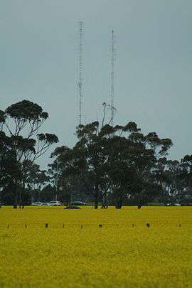 Canola Fields and Radio Towers in Hoppers Crossing | |||||||||||||
 Hoppers Crossing | |||||||||||||
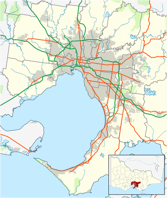
| Coordinates | 37°52′08″S 144°41′35″E / 37.869°S 144.693°ECoordinates: 37°52′08″S 144°41′35″E / 37.869°S 144.693°E | ||||||||||||
| Population | 37,598 (2011 census)[1] | ||||||||||||
| • Density | 2,112/km2 (5,471/sq mi) | ||||||||||||
| Postcode(s) | 3029 | ||||||||||||
| Area | 17.8 km2 (6.9 sq mi) | ||||||||||||
| Location | |||||||||||||
| LGA(s) | City of Wyndham | ||||||||||||
| State electorate(s) | |||||||||||||
| Federal Division(s) | Lalor | ||||||||||||
| |||||||||||||
Hoppers Crossing is a suburb of Melbourne, Victoria, Australia, 23.1 km south-west of Melbourne's central business district. Its local government area is the City of Wyndham. At the 2011 Census, Hoppers Crossing had a population of 37,598.
The suburb is named after Stephen Hopper (1832-1908) and his family, who were residents in the area.[2][3] Hoppers Lane runs through the site of the former State Research Farm at Werribee, and its crossing of the Geelong-Melbourne railway, adjacent to the present Hoppers Crossing railway station, led to the naming of the area.
History
Until 1963, Hoppers Crossing's only notable feature was a general store. In 1963 the town started to take shape, with the first subdivision of residential land. Hoppers Crossing grew rapidly and consistently into the 1970s, and the Post Office opened on 2 June 1975.[4] Hoppers Crossing's first shopping centre, Woodville Park, was built and in 1970, the area's first primary school, Mossfiel Primary School, had its first student intake.
Retail
In 1983, Hoppers Crossing Shopping Centre opened.[5] It includes a Target store, a Safeway Supermarket and 10 other stores.
Werribee Plaza opened in 1985. It was modernised between 2000 and 2006. Several significant redesigns and extensions have been built. It now includes retailers such as Myer, Woolworths, Big W, Kmart, Coles, JB Hi-Fi, Adairs, a Village Cinemas complex, Best & Less and many more. The Victorian State Government announced plans of a $300 million upgrade, which will more than double the plaza's retail space. Once completed, the plaza will be slightly smaller than Highpoint, the biggest shopping centre in Melbourne's West.
A smaller shopping centre, Hogans Corner, was established in 1997-1998.
Another shopping centre, Wyndham Village, was built on the corner of Sayers Road and Morris Road in 2005. It is on the Tarneit side of the border between Hoppers Crossing and Tarneit.[6]
There are also a large variety of warehouse and clearance sale shops on Old Geelong Road such as furniture, automotive and hardware stores.
Parks
There several parks including playgrounds and recreational areas generally 2-4 blocks of land in residential streets. Recreation reserves mostly exist along what once was a river or stream, although now serve as drainage reserves and the local Skeleton Creek.
Fauna and flora
Until recently Skeleton Creek had healthy populations of native reptiles, including;
- Tiger snake
- Eastern Blue-tongued Lizard
- Eastern brown snake
- Striped skink
- Stump-tailed skink
- Brush tail possum
Due to development some species are now depleting in the area. However the tiger snake and the eastern brown snake have been seen around the area recently.[7]
Education
State schools and colleges
Primary schools
- Bellbridge Primary School
- Baden Powell College
- - Derrimut Heath Campus
- - Tarneit P-9 Campus
- - Callistemon Campus
- Mossfiel Primary School
- Woodville Primary School
- Camebridge Primary School
Secondary colleges
- Hoppers Crossing Secondary College
- The Grange P-12 College's Deloraine Campus
- Suzanne Cory High School is a select entry school.
Catholic schools and colleges
Primary Schools
- St Peter Apostle
- St James the Apostle Primary School
Other religious and grammar colleges
- Heathdale Christian College (Prep to Year 12)
- Westbourne Grammar School
- - Westbourne Campus (Prep to Year 12), in nearby Truganina.
Universities
- Victoria University and TAFE.
- - Werribee Campus
In 2006 the principal of Derrimut Heath Primary School (Now Baden Powell College), Julie Mason, was chosen as the "Wyndham Citizen of the Year" for her key role in the development of the Wyndham Community Education Plan 2004-2007 and serving as chair of the Quality Community Plan Education Committee.[8]
Transport
Hoppers Crossing is served by the Hoppers Crossing railway station, located to the south of the suburb, on the Werribee line. The station opened in 1970 as a small station on the Geelong line, and was only served by a few diesel trains each day. In 1983 the station was relocated in conjunction with electrification of the Geelong line as far as Werribee. It was not until the mid-1990s that Hoppers Crossing started to receive train services comparable with the rest of suburban Melbourne.
In the mid-2000s a tramway was proposed for the Hoppers Crossing - Werribee area to replace bus services, but the idea was not seen as feasible by the Wyndham City Council and Victorian State Government.[9]
Bus services in Hoppers Crossing have typically connected areas close to the station with the station, Werribee Plaza, and Werribee. As Hoppers' satellite suburbs Tarneit and Truganina grow, bus services have also been extended. Hoppers is served by various buses.
Other major roads include the Princes Highway (C109), Heaths Road (C701), Derrimut Road (C702), Hogans Road, Morris Road, Tarneit Road and Sayers Road.[10]
Sports
Hoppers Crossing has many gyms and sports grounds. There are facilities for tennis, soccer, Australian rules football, basketball, netball and more. In 2004, the Federation Trail was opened, which links Werribee with Brooklyn, and soon Yarraville.
A new soccer complex was built at The Grange for the Hoppers Crossing Soccer Club. They previously played at Mossfiel Reserve, which is now a rugby football field. Founded in 1971, the 'Reds' have won 4 senior championships (1999, 2001, 2012 & 2014) and will compete in the Football Federation Victoria State League 3 Nth/West division in 2015. One of the most popular clubs in the region, Hoppers Crossing SC currently field 20 teams across junior, senior and masters age groups.
The Hoppers Crossing Football Club, nicknamed the 'Warriors', play at Hogans Road Reserve. The currently compete in the Western Region Football League first division, where they won senior premierships in 2002 and 2004. The Warriors are one of the biggest clubs in the league, boasting numerous junior sides as well seniors and reserves.
Hoppers Crossing Cricket Club, known as the 'Cats' was formed in 1977 and its first team was entered into the "B turf" section of the Sunshine Cricket Association in season 1977/78. The result in the club's first season was runners-up.
Hoppers Crossing is the home of Australian Olympic Gold Medalist Russell Mark and his wife Lauryn, a triple Commonwealth Games Gold Medalist.
References
- ↑ Australian Bureau of Statistics (31 October 2012). "Hoppers Crossing (State Suburb)". 2011 Census QuickStats. Retrieved 2012-06-28.
- ↑ "The Descendants of Stephen Hopper, 1587-1658". www.airgale.com.au. Retrieved 2012-08-05.
- ↑ "Obituary: Arthur Edward Hopper". The Banner (Werribee). 1941-08-28. Retrieved 2012-08-05.
- ↑ Premier Postal History. "Post Office List". Retrieved 2008-04-11.
- ↑ http://www.heraldsun.com.au/news/victoria/hoppers-crossing-top-spots-food-housing-and-history-of-melbournes-growing-western-suburb/news-story/c00206cf1d26d3cbdc0ed14533cffc24
- ↑ "Wyndham Village website". Retrieved 2012-01-28.
- ↑ "Skeleton Creek information". Retrieved 2012-01-30.
- ↑ "Wyndham 2006 Citizen of the Year Announced". City of Wyndham council. 10 February 2006. Archived from the original on 2007-09-01. Retrieved 2007-06-06.
- ↑ "Costly tram plan". Werribee, Hoppers Crossing, Point Cook Star. 2006-03-21. Retrieved 2012-08-05.
- ↑ "Map of the Wyndham LGA" (PDF). Retrieved 2012-01-28.