Hopkinton, Massachusetts
| Hopkinton, Massachusetts | ||
|---|---|---|
| Town | ||
|
Town Hall | ||
| ||
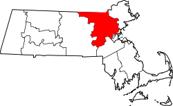
 Location in Middlesex County in Massachusetts | ||
| Coordinates: 42°13′43″N 71°31′23″W / 42.22861°N 71.52306°WCoordinates: 42°13′43″N 71°31′23″W / 42.22861°N 71.52306°W | ||
| Country | United States | |
| State | Massachusetts | |
| County | Middlesex | |
| Settled | 1715 | |
| Incorporated | 1715 | |
| Government | ||
| • Type | Open town meeting | |
| • Town Manager | Norman Khumalo | |
| • Board of Selectmen |
Benjamin L. Palleiko, Chair Todd Cestari Brian Herr John M. Mosher John Coutinho | |
| Area | ||
| • Total | 28.2 sq mi (72.9 km2) | |
| • Land | 26.6 sq mi (68.8 km2) | |
| • Water | 1.6 sq mi (4.2 km2) | |
| Elevation | 410 ft (125 m) | |
| Population (2010) | ||
| • Total | 14,925 | |
| • Density | 530/sq mi (200/km2) | |
| Time zone | Eastern (UTC-5) | |
| • Summer (DST) | Eastern (UTC-4) | |
| ZIP code |
01748 01784 (Woodville P.O. Boxes) | |
| Area code(s) | 508 / 774 | |
| FIPS code | 25-31085 | |
| GNIS feature ID | 0619400 | |
| Website | http://www.hopkintonma.gov/ | |
| Established by Edward Hopkins | ||


Hopkinton is a town in Middlesex County, Massachusetts, less than 30 miles (48 km) west of Boston. The town is best known as the starting point of the Boston Marathon, held annually on Patriots' Day in April, and as the headquarters for the enterprise-oriented Dell EMC. At the 2010 census, the town had a population of 14,925.[1] The US Census recognizes a village within the town known as Woodville, reporting a population of 2,550.[2]
History
The town of Hopkinton was incorporated on December 13, 1715. Hopkinton was named for an early colonist of Connecticut, Edward Hopkins,[3] who left a large sum of money to be invested in land in New England, the proceeds of which were to be used for the benefit of Harvard University. The trustees of Harvard purchased land from the Native American residents with money from the fund and incorporated the area, naming it in honor of its benefactor. During King George's War, natives raided the town, taking captives to Quebec.[4]
Grain was the first production crop grown in the area, while fruit and dairy industries were developed later. Agriculture predominated until 1840 when the boot and shoe industries were introduced into the town. By 1850 eleven boot and shoe factories were established in Hopkinton. Fires in 1882 and the migration of those industries to other parts of the country eliminated these industries from Hopkinton.
There are 215 Hopkinton properties listed in the State Register of Historic Places. The majority, 187, are located within the Cedar Swamp Archaeological District in Hopkinton and Westborough. The properties are also listed in the National Register of Historic Places.
Twenty-three properties are included within the Hopkinton Center Historic District, a local historic district which comprises properties around the Town Common, on East Main St. and the south side of Main St. The district was expanded in 2000 to include the Town Hall and in 2001 to include Center School. The Hopkinton Supply Company Building on Main St., located slightly west of the district, is listed in the National Register of Historic Places. Former factory worker housing in the center of town, contrasted against the more rural areas surrounding it, are visual reminders of Hopkinton’s past.
In 2005 the town established a second historic district in the village of Woodville. Ninety-seven properties are included within this district. The village of Woodville has retained its distinctive village atmosphere and strong architectural connection to Hopkinton’s industrial development and growth from the mid-to-late 19th century. The area was an early cotton clothmaking center and the site of a major shoe factory. When Boston seized Lake Whitehall for its water supply in 1894, the factories along its shores were closed or moved to other sites, as they were considered sources of pollution. Remaining factories and other buildings were destroyed in a fire in 1909. In the 18th century, it was an agricultural area with a few farms scattered north of the much smaller Lake Whitehall and its accompanying cedar swamp, and was the site of a grist mill on Whitehall Brook as early as 1714.
Within or near the Miscoe-Warren-Whitehall Watersheds ACEC (Area of Critical Environmental Concern), remains of large pits have been found. The pits were lined with bark by the Native Americans and used to store corn over the winter months.
At one time, it was believed that the waters flowing from the large swamp south of Pond St., under Pond St. and into Lake Whitehall contained magical healing powers. As a result, the area quickly was built up as a resort area. Visitors came by stagecoach to the Hopkinton Hotel, which was located between Pond St. and the lake. The mineral baths and their powers lured the visitors to the area. The baths can still be viewed by the edge of the stream that drains from the swamp. Within the ACEC area are also two beehive shaped stone structures, about 6 feet (1.8 m) tall. Their origin and use are unknown.
Hopkinton gains national attention once a year in April as it hosts the start of the Boston Marathon, a role the town has enjoyed since 1924. The town takes pride in its hospitality as runners from all over the world gather in Hopkinton to begin the 26.2-mile (42.2 km) run to Boston.
Geography
According to the United States Census Bureau, the town has a total area of 28.2 square miles (73.0 km2), of which 26.6 square miles (68.9 km2) is land and 1.6 square miles (4.1 km2), or 5.82%, is water.
Hopkinton is 17 miles (27 km) east of Worcester, 26 miles (42 km) west of Boston, and 195 miles (314 km) from New York City.
According to the United States Census Bureau, the census-designated place for the village has a total area of 1.5 square miles (4.0 km2), of which 1.5 square miles (4.0 km2) is land and 0.22% is water.[5]
Adjacent towns
Hopkinton is located in eastern Massachusetts, bordered by six towns:
 |
Westborough | Southborough | Ashland | |
| |
||||
| ||||
| | ||||
| Upton | Milford | Holliston |
Climate
The climate in Hopkinton tends to be quite warm during the summer, with daily high temperatures averaging in the 80s. Temperatures in the 90s are also known to occur between June and August as high-pressure air masses push in from the south. Winters are typical of areas inland and west of Boston. Snowfall averages near 60" but can vary tremendously from season to season.
The warmest month of the year is July with an average minimum and maximum temperature of 65 °F (18 °C) and 84 °F (29 °C) respectively. The coldest month of the year is January with an average minimum and maximum temperature of 16 and 35 °F (−9 and 2 °C) respectively.[6]
Temperature variations between night and day tend to be fairly limited during summer with a difference that can reach 18 °F (10 °C), and fairly limited during winter with an average difference of 16 °F (8.9 °C).
The annual average precipitation at Hopkinton is 51.25 inches (1,302 mm). Rainfall is fairly evenly distributed throughout the year. The wettest month of the year is November with an average rainfall of 4.69 inches (119 mm).[7]
| Normal temperature in January (max/min average) | 25.5 °F (−3.6 °C) |
| Normal temperature in July (max/min average) | 74.5 °F (23.6 °C) |
| Normal annual precipitation | 44.9 inches (1,140 mm)[8] |
Demographics
| Historical population | ||
|---|---|---|
| Year | Pop. | ±% |
| 1850 | 2,801 | — |
| 1860 | 4,340 | +54.9% |
| 1870 | 4,419 | +1.8% |
| 1880 | 4,601 | +4.1% |
| 1890 | 4,088 | −11.1% |
| 1900 | 2,623 | −35.8% |
| 1910 | 2,452 | −6.5% |
| 1920 | 2,289 | −6.6% |
| 1930 | 2,563 | +12.0% |
| 1940 | 2,697 | +5.2% |
| 1950 | 3,486 | +29.3% |
| 1960 | 4,932 | +41.5% |
| 1970 | 5,981 | +21.3% |
| 1980 | 7,114 | +18.9% |
| 1990 | 9,191 | +29.2% |
| 2000 | 13,346 | +45.2% |
| 2010 | 14,925 | +11.8% |
| * = population estimate. Source: United States Census records and Population Estimates Program data.[9][10][11][12][13][14][15][16][17][18] | ||
As of the census[19] of 2010, there were 14,925 people, 4,957 households, and 3,978 families residing in the town. The population density was 568.4 inhabitants per square mile (219.5/km2). There were 5,128 housing units at an average density of 195.3 per square mile (75.4/km2). The racial makeup of the town was 93.1% White, 0.8% Black or African American, 0.1% Native American, 4.4% Asian, 0.4% from other races, and 1.2% from two or more races. Hispanic or Latino of any race were 1.8% of the population.
There were 4,957 households out of which 48.1% had children under the age of 18 living with them, 70.5% were married couples living together, 6.9% had a female householder with no husband present, and 19.7% were non-families. 16.0% of all households were made up of individuals and 5.6% had someone living alone who was 65 years of age or older. The average household size was 2.99 and the average family size was 3.38.
Population was well-distributed by age, with 33.6% under the age of 20, 3.4% from 20 to 24, 22.0% from 25 to 44, 33.0% from 45 to 64, and 7.9% who were 65 years of age or older. The median age was 40.3 years. For every 100 females there were 96.8 males. For every 100 females age 18 and over, there were 93.4 males.
As of 2000, the median income for a household in the town was $89,281, and the median income for a family was $102,550. Males had a median income of $71,207 versus $42,360 for females. The per capita income for the town was $41,469. About 1.3% of families and 1.7% of the population were below the poverty line, including 1.4% of those under age 18 and 3.4% of those age 65 or over.
Hopkinton village
As of the census[19] of 2000, there were 2,628 people, 1,003 households, and 672 families residing in the CDP. The population density was 611.3/km² (1,584.3/mi²). There were 1,024 housing units at an average density of 238.2/km² (617.3/mi²). The racial makeup of the CDP was 97.18% White, 0.34% Black or African American, 0.15% Native American, 0.91% Asian, 0.08% Pacific Islander, 0.68% from other races, and 0.65% from two or more races. Hispanic or Latino of any race were 2.05% of the population.
There were 1,003 households out of which 34.5% had children under the age of 18 living with them, 55.4% were married couples living together, 9.2% had a female householder with no husband present, and 33.0% were non-families. 28.9% of all households were made up of individuals and 14.5% had someone living alone who was 65 years of age or older. The average household size was 2.52 and the average family size was 3.17.
In the CDP the population was spread out with 26.5% under the age of 18, 4.3% from 18 to 24, 32.0% from 25 to 44, 20.5% from 45 to 64, and 16.7% who were 65 years of age or older. The median age was 38 years. For every 100 females there were 85.7 males. For every 100 females age 18 and over, there were 82.3 males.
The median income for a household in the CDP was $52,250, and the median income for a family was $68,050. Males had a median income of $48,050 versus $37,862 for females. The per capita income for the CDP was $23,878. About 2.9% of families and 3.3% of the population were below the poverty line, including 5.1% of those under age 18 and 4.0% of those age 65 or over.
Government
Since its incorporation in 1715, Hopkinton has retained its original Open Town Meeting form of government. The town's day-to-day affairs had been directly overseen by an elected Board of Selectmen until 2007, when the Town's Charter Commission created a Town Manager position with more discretion, although the Town Manager still reports to the Selectmen.
Town Meeting
Begins on the first Monday in May and continues on consecutive evenings until the entire warrant is voted on.
Warrant
The Town Meeting Warrant is a document composed of the articles to be voted on. Any elected or appointed board, committee, or town officer or ten petitioning voters may request that an article be included on the warrant. Each article to be voted on is directed by the Board of Selectmen to an appropriate board or committee to hear and provide the original motion at Town Meeting. All articles which require expending of funds are directed to the Finance Committee; articles dealing with planning and zoning to the Planning Board; articles relating to by-laws to the By-Law Committee, and so forth.
Annual town election
Held on the third Monday in May. Polls are open 7:00am–8:00pm. All Hopkinton precincts vote at the Hopkinton Middle School (88 Hayden Rowe St).
County government
Massachusetts has 14 counties which were regional administrative districts before the Revolutionary War.[20] In 1997, the county governments of Middlesex, Berkshire, Essex, Hampden and Worcester were abolished. Many of their functions were turned over to state agencies.
Its county seats are Cambridge and Lowell.
| Clerk of Courts: | Michael A. Sullivan |
|---|---|
| District Attorney: | Marian T. Ryan |
| Register of Deeds: | Maria C. Curtatone |
| Register of Probate: | Tara E. DeCristofaro |
| County Sheriff: | Peter Koutoujian (D) |
| State government | |
| State Representative(s): | Carolyn Dykema (D) |
| State Senator(s): | Karen E. Spilka (D) |
| Governor's Councilor(s): | Robert L. Jubinville (D) |
| Federal government | |
| U.S. Representative(s): | Joseph Kennedy III (D-4th District) |
| U.S. Senators: | Elizabeth Warren (D), Ed Markey (D) |
Library
The Hopkinton Public Library was founded in 1867. It has been located in the heart of downtown, just steps away from the Town Common, since 1895. Until 1955, bequests were the only source of funding for the library. Since that time, the town government has been appropriating public funds for employee salaries, cost of cleaning the Library, utilities and assistance with the purchase of books. The library is now funded through various sources that include the Town Government, The McGovern Trust Fund, Annual State Aid and Friends of the Library.
The town library was established by the Young Men's Christian Association in 1867. Seven members served as the Trustees, incorporated the Library and adopted by-laws for the government of the Library in 1890. The current building was built in 1895 with contributions from local and former residents of Hopkinton. The second floor was used as a lecture hall and was remodeled later as a children’s room. A gallery was built to connect the Library building with the adjacent Episcopal Church after extensive renovation in 1967. This new section was named after the head librarian at the time, Mrs. Betty Strong. A special feature of the reading room is a stain glass window with a motif of water fountain bubbling water flowing over an open book and the inscription on the page reads "The fountain of wisdom flows through books.” The large hall clock that still stands near the circulation desk was presented to the Library by Mrs. F.V. Thompson and Mr. Abram Crooks.
The library was transferred to the town government in May 2010. Five members were appointed as the Library Trustees. Starting from May 2011, election will be held for the members of the Library Board of Trustees during the Annual Town Meeting.
In January 2016, the library moved to a temporary location at 65 South Street while the historic building on Main Street undergoes a major renovation and expansion.[21]
Education
Public schools
The Town of Hopkinton has a public school system which serves students from pre-kindergarten through twelfth grade. The Hopkinton Public Schools maintains a district website with a subpage for each Hopkinton school. Kindergarten students and first-graders attend the Center School, located on Ash Street. Grades 2 and 3 attend Elmwood School. Grades 4 and 5 attend Hopkins School. Grades 6 through 8 attend Hopkinton Middle School. Grades 9 through 12 attend Hopkinton High School. The town also has an integrated preschool currently located in the Elmwood School building.
Hopkinton offered a fee-based full-day kindergarten option for the first time during the 2010-11 school year via a lottery system. Free full-day Kindergarten was made available to all Kindergarten students starting in the 2014-15 school year. Hopkinton Public Schools does not offer any foreign language education before Grade 7.
Since residents approved the Center School Feasibility Study in May 2008, Hopkinton had been involved in an Elementary School Building Project with the Massachusetts School Building Authority. The solution approved unanimously by the Hopkinton Elementary School Building Committee and the MSBA was to build a new K-5 Elementary School on the town-owned Fruit Street property and then decommission the aging Center School. Residents voted down the new school at the March 21, 2011 Special Town Meeting and again at a Special Town Election on March 28, 2011.
In May 2013 voters approved funding a new Center School Feasibility Study. The solution proposed by the new Elementary School Building Committee was to build a new Preschool, Kindergarten and Grade 1 School at 135 Hayden Rowe Street (Route 85), on property newly purchased by the town for this purpose. This proposal was approved by voters at a November 2015 Special Town Meeting. The new school is expected to open in fall 2018. It will be located near the Hopkins School, Middle School and High School, on the same two-lane road, Route 85, which is the main north-south road in Hopkinton.[22]
Hopkinton High's school mascot is the Hiller "H", as the sports teams are known as the Hopkinton Hillers. Previously the teams were known as the Hopkinton Stonethrowers. The school primary colors are green and white, with orange as a secondary color.
Economy and business
Hopkinton is the corporate headquarters of EMC Corporation, a global manufacturer of software and systems for information management and storage. It is the state's largest technology company, which employs 6,800 people in Massachusetts. EMC, in addition to providing $1 million in annual real estate tax revenues, is a major contributor to the town's schools and recreational services.[23]
Transportation
Hopkinton is situated 26 miles (42 km) west of Boston in the MetroWest region of Massachusetts. Interstate Route 495 divides the town into east and west zones, which are connected by numerous spokes providing direct access to the airport and other communities in the Greater Boston Metropolitan Area.[24]
Major highways
Hopkinton is served by two interstate highways and two state highways. Interstates 90 (the Massachusetts Turnpike) and 495, form an interchange on the northern border of Hopkinton and neighboring Westborough. Proximity to Route 9 (The Boston/Worcester Turnpike) and Route 30 in Westborough, gives additional access to east/west destinations.
Principal highways are:
- Interstate 90 (Massachusetts Turnpike) (east/west) (the longest interstate highway in the United States)
- Interstate 495 (north/south)
- State Route 135 (east/west)
- State Route 85 (north/south)
Nearby major intersections
Mass transit
Rail
There is no passenger or freight rail service in Hopkinton.
Hopkinton is served by the Southborough MBTA Station, located on the border of Hopkinton and Southborough on Route 85 at Southville Road. MBTA commuter rail service is available to South Station and Back Bay Station, Boston, via the MBTA Framingham-Worcester Commuter Rail Line which connects South Station in Boston and Union Station in Worcester. Travel time to Back Bay is about 50 minutes.
Originally called the Framingham Commuter Rail Line, Framingham was the end of the line until rail traffic was expanded to Worcester in 1996.[25] The line also serves the communities of Newton, Wellesley, Natick, Ashland, Southborough, Westborough and Grafton.[26]
Direct rail service to Boston, to New York, and to many other points on the Amtrak network (National Railroad Passenger Corporation) is available through nearby Framingham.
CSX Transportation provides freight rail service and operates an auto transloading facility in nearby Framingham.
Bus
- Hopkinton is a Member Community of the MetroWest Regional Transit Authority, which provides local bus service to several towns in the MetroWest area, with service to the MBTA commuter rail station at Framingham.
- Big W Transportation provides service to Framingham.
- Peter Pan Bus Lines provides service to Worcester and Boston from Framingham.
Air
Boston's Logan International Airport is easily accessible from nearby Framingham. MassPort provides public transportation to all airport terminals from Framingham via the Logan Express bus service seven days per week. The bus terminal and paid parking facility are located on the Shoppers' World Mall property, off the Massachusetts Turnpike Exit 13, between Route 9 and Route 30, at the intersections of East Road and the Burr Street connector.[27]
The Worcester Municipal Airport, a Primary Commercial (PR) facility with scheduled passenger service, is easily accessible. It has two asphalt runways 5,500 and 6,900 ft (1,700 and 2,100 m) long. Instrument approaches available include precision and non-precision.
Commuter services
Park and ride services:[28]
- MassDOT operates a free park and ride facility at the parking lot at the intersection of Flutie Pass and East Road on the south side of Shoppers' World Mall.[29]
- MassDOT also operates a free park and ride facility at a parking lot adjacent to exit 12 of the Massachusetts Turnpike, across from California Avenue on the west side of Framingham.[30]
Media
Newspapers
Hopkinton has two local newspapers: The Hopkinton Independent and The Hopkinton Crier, and three online news outlets, HCAM, Hopkinton Patch and HopNews. The town is also served by The Boston Globe, The MetroWest Daily News, and the Telegram & Gazette.
Television
Hopkinton has a PEG television network known as HCAM, which controls two channels. Many HCAM shows can be viewed directly on their website.
HCAM-TV
HCAM-TV is the most-received of HCAM's channels, available in every household with cable television in the area. It can be found on Comcast channel 8 and Verizon channel 30.[31] The channel's daily schedule consists mostly of programming aimed at a family audience. Along with series and informative programming, HCAM-TV broadcasts the filming of one-time events (such as performances on the Hopkinton Common and films by the Hopkinton Center for the Arts).
HCAM-ED
HCAM-ED, sister channel to HCAM-TV, is received by less households and has lower programming standards than HCAM-TV. It is found on Comcast channel 96 and Verizon channel 31. The HCAM website also includes news articles and photos, updated daily.
Points of interest
- Hopkinton State Park, part of the Massachusetts State Park system is located on Route 85 (Cordaville Road).[32]
- Whitehall State Park is located on Route 135/Wood Street in Hopkinton.[33]
Accolades
- June 2014 - Hopkinton made the 'SafeWise 50 Safest Cities in Massachusetts' [34]
- 2013 National Citizen Survey results conducted by the National Research Center [35]
- 2012 - Hopkinton ranked 4th in the Central MA's Best Communities 2012 round-up [36]
- 2009 - Money magazine ranks Hopkinton 19th best place to live [37]
Culture
- Start of the Boston Marathon - Starting in 1924, when the Boston Athletic Association moved the starting line from Ashland, Hopkinton has garnered worldwide attention.[38]
Twin cities
Places of worship
- Community Covenant Church
- Faith Community Church of Hopkinton
- Islamic Masumeen Center
- Korean Presbyterian Church
- St John the Evangelist
- St Paul's Episcopal Church
- Vineyard Church of Hopkinton
- Woodville Baptist Church
Notable people
- John Eliot (1604–1690) Puritan missionary to the American Indians whom some called “the apostle to the Indians.
- Agnes Surriage Frankland, (1726-1783), wife of Sir Charles Henry ("Harry") Frankland, a British baronet
- Charles Morris (1731-1802), surveyor
- Daniel Shays (1747–1825), leader of Shays' Rebellion Street in Hopkinton named after him off Saddle hill road
- William Chamberlain (1755–1828), United States Representative from Vermont
- William Claflin (1818–1905), industrialist, philanthropist, 27th Governor of Massachusetts, United States Representative from 1877–1881
- Joseph H. Walker (1829-1907), United States Representative and Shoemaker
- William H. Ryan (1860-1939), US Congressman
- George V. Brown (1880–1937), sports organizer in United States, 30-year starter of Boston marathon, and Hockey Hall of Fame inductee
- Frank Merrill (1903–1955), World War II General
- Walter A. Brown (1905–1964), founding owner of the Boston Celtics and inductee into the basketball and hockey halls of fame
- Richard Egan (1936–2009), founder of EMC Corporation and former US Ambassador to Ireland
- Dennis Eckersley (1954- ), MLB pitcher (1975-1998), Baseball Hall of Fame (2004)
- David Franklin (scientist) (1961–), American microbiologist, entrepreneur and qui tam relator in landmark Franklin v. Parke-Davis case
- Steve Nicol (1961- ), Scottish-born coach of soccer team New England Revolution
- Keegan Bradley (1986- ), PGA Tour Golfer
- Jon Curran (1987- ), PGA Tour Golfer
Public buildings
Public buildings in Hopkinton:
| Built | Address | Building |
|---|---|---|
| 1775 | 13 Main St | Library |
| 1850 | 98 Hayden Rowe St | Cultural Arts Alliance |
| 1890 | 11 Ash St | Center School |
| 1894 | 85 Main St | Old High School |
| 1900 | 234 Wood St | Woodville Post Office |
| 1902 | 18 Main St | Town Hall |
| 1950 | 88 Hayden Rowe St | Middle School |
| 1964 | 14 Elm St | Elmwood School |
| 1973 | 83 Wood St | Dept of Public Works |
| 1996 | 73 Main St | Fire Department |
| 1997 | 104 Hayden Rowe St | Hopkins School |
| 1999 | 5 Cedar St | Hopkinton Post Office |
| 2001 | 90 Hayden Rowe St | High School |
| 2003 | 74 Main St | Police Department |
| 2005 | 28 Mayhew St | Senior Center |
Historic homes
Historical commission
The Town of Hopkinton established a historical commission which manages “the preservation, protection and development of the historical or archeological assets of such city or town”. Projects include conducting research for places of historic or archeological value, assisting cooperatively with others engaged in such research, and carrying out other initiatives for the purpose of protecting and preserving such places.
National Register of Historic Places
Hopkinton has two properties in the register.[40]
- Cedar Swamp Archeological District, Address Restricted. Listed 1988-05-23
- Hopkinton Supply Company Building, 26-28 Main Street. Listed 1983-03-10
Homes built in the 1700's
The 26 homes below were built in Hopkinton in 18th century.
| Built | # | Street |
|---|---|---|
| 1702 | 54 | Frankland Road |
| 1715 | 21 | East Main Street |
| 1720 | 156 | Pond Street |
| 1729 | 184 | Pond Street |
| 1730 | 5 | East Main Street |
| 1730 | 227 | Wood Street |
| 1732 | 223 | Wood Street |
| 1740 | 20 | Fruit Street |
| 1743 | 50 | Hayden Rowe Street |
| 1743 | 110 | Pond Street |
| 1745 | 92 | Main Street |
| 1750 | 50 | Frankland Road |
| 1750 | 26 | Fruit Street |
| 1750 | 149 | Hayden Rowe Street |
| 1750 | 192 | Hayden Rowe Street |
| 1750 | 155 | Winter Street |
| 1750 | 41 | East Main Street |
| 1750 | 123 | East Main Street |
| 1750 | 248 | Wood Street |
| 1764 | 19 | Fruit Street |
| 1770 | 282 | Wood Street |
| 1775 | 13 | East Main Street |
| 1785 | 152 | Hayden Rowe Street |
| 1790 | 348 | Wood Street |
| 1790 | 47 | East Main Street |
| 1790 | 9 | Frankland Road |
| 1794 | 76 | Main Street |
Homes built in the 1800's
The 188 homes below were built in Hopkinton in 19th century.
| Built | # | Street |
|---|---|---|
| 1800 | 63 | Main St. |
| 1800 | 43 | East Main St. |
| 1800 | 216 | Wood St. |
| 1800 | 235 | Wood St. |
| 1800 | 259 | Wood St. |
| 1800 | 11 | West Main St. |
| 1800 | 17 | Hayden Rowe St. |
| 1800 | 128 | Hayden Rowe St. |
| 1800 | 180 | Hayden Rowe St. |
| 1803 | 279 | Wood St. |
| 1810 | 246 | Wood St. |
| 1810 | 87 | Main St. |
| 1810 | 121 | Main St. |
| 1818 | 181 | Hayden Rowe St. |
| 1820 | 86 | Wood St. |
| 1820 | 20 | Wood St. |
| 1820 | 211 | Wood St. |
| 1820 | 347 | Wood St. |
| 1820 | 20 | East Main St. |
| 1820 | 109 | Hayden Rowe St. |
| 1828 | 140 | Hayden Rowe St. |
| 1829 | 222 | Wood St. |
| 1830 | 2 | Hayden Rowe St. |
| 1830 | 157 | Hayden Rowe St. |
| 1830 | 199 | Pond St. |
| 1830 | 41 | Wood St. |
| 1830 | 218 | Wood St. |
| 1830 | 7 | Clinton St. |
| 1830 | 1 | West Main St. |
| 1830 | 2 | West Main St. |
| 1830 | 35 | Main St. |
| 1830 | 82 | Main St. |
| 1832 | 210 | Wood St. |
| 1835 | 272 | Wood St. |
| 1839 | 255 | Wood St. |
| 1840 | 42 | Grove Street |
| 1840 | 4 | Fruit St. |
| 1840 | 22 | Winter St. |
| 1840 | 14 | Wood St. |
| 1840 | 200 | Wood St. |
| 1840 | 273 | Wood St. |
| 1840 | 326 | Wood St. |
| 1840 | 84 | Main St. |
| 1840 | 82 | East Main St. |
| 1840 | 52 | Hayden Rowe St. |
| 1840 | 158 | Hayden Rowe St. |
| 1840 | 159 | Hayden Rowe St. |
| 1843 | 102 | Main St. |
| 1843 | 11 | Grove Street |
| 1843 | 10 | Claflin Avenue |
| 1843 | 12 | Claflin Avenue |
| 1846 | 301 | Wood St. |
| 1850 | 17 | Grove Street |
| 1850 | 19 | Grove Street |
| 1850 | 27 | Grove Street |
| 1850 | 31 | Grove Street |
| 1850 | 10 | Church Street |
| 1850 | 30 | Church Street |
| 1850 | 33 | Church Street |
| 1850 | 18 | Winter St. |
| 1850 | 56 | Wood St. |
| 1850 | 80 | Main St. |
| 1850 | 109 | Main St. |
| 1850 | 207 | Wood St. |
| 1850 | 242 | Wood St. |
| 1850 | 250 | Wood St. |
| 1850 | 253 | Wood St. |
| 1850 | 274 | Wood St. |
| 1850 | 15 | Hayden Rowe St. |
| 1850 | 16 | Hayden Rowe St. |
| 1850 | 108 | Hayden Rowe St. |
| 1850 | 188 | Hayden Rowe St. |
| 1850 | 79 | Frankland Road |
| 1852 | 39 | Grove Street |
| 1853 | 19 | Wood St. |
| 1855 | 88 | Main St. |
| 1856 | 24 | East Main St. |
| 1856 | 24 | Winter St. |
| 1860 | 6 | Claflin Avenue |
| 1860 | 204 | Wood St. |
| 1860 | 205 | Wood St. |
| 1860 | 82 | Frankland Road |
| 1860 | 103 | Hayden Rowe St. |
| 1860 | 106 | Hayden Rowe St. |
| 1860 | 146 | Hayden Rowe St. |
| 1860 | 177 | Hayden Rowe St. |
| 1860 | 195 | Hayden Rowe St. |
| 1863 | 112 | Hayden Rowe St. |
| 1865 | 57 | Grove Street |
| 1865 | 59 | Grove Street |
| 1865 | 8 | Claflin Place |
| 1865 | 32 | Proctor St. |
| 1865 | 4 | West Main St. |
| 1865 | 143 | Hayden Rowe St. |
| 1865 | 174 | Hayden Rowe St. |
| 1865 | 175 | Hayden Rowe St. |
| 1865 | 175 | Hayden Rowe St. |
| 1865 | 184 | Hayden Rowe St. |
| 1865 | 185 | Hayden Rowe St. |
| 1865 | 190 | Hayden Rowe St. |
| 1865 | 6 | West Main St. |
| 1869 | 34 | Church Street |
| 1870 | 49 | Grove Street |
| 1870 | 55 | Grove Street |
| 1870 | 15 | Claflin Avenue |
| 1870 | 40 | Church Street |
| 1870 | 46 | Church Street |
| 1870 | 221 | Wood St. |
| 1870 | 7 | West Main St. |
| 1870 | 147 | Hayden Rowe St. |
| 1870 | 156 | Hayden Rowe St. |
| 1870 | 167 | Hayden Rowe St. |
| 1871 | 12 | Winter St. |
| 1875 | 52 | Grove Street |
| 1875 | 61 | Grove Street |
| 1875 | 4 | Claflin Place |
| 1875 | 10 | Claflin Place |
| 1875 | 12 | Claflin Place |
| 1875 | 42 | Church Street |
| 1874 | 44 | Church Street |
| 1875 | 7 | East Main St. |
| 1875 | 83 | East Main St. |
| 1875 | 107 | East Main St. |
| 1875 | 110 | Main St. |
| 1875 | 28 | Hayden Rowe St. |
| 1880 | 34 | Grove Street |
| 1880 | 38 | Grove Street |
| 1880 | 48 | Grove Street |
| 1880 | 54 | Grove Street |
| 1880 | 14 | Claflin Avenue |
| 1880 | 11 | Church Street |
| 1880 | 29 | Church Street |
| 1880 | 3 | Nebraska Street |
| 1880 | 5 | Nebraska Street |
| 1880 | 9 | Nebraska Street |
| 1880 | 210 | Pond St. |
| 1880 | 28 | Proctor St. |
| 1880 | 15 | Holt St. |
| 1880 | 19 | Hayden Rowe St. |
| 1880 | 48 | Hayden Rowe St. |
| 1880 | 121 | Hayden Rowe St. |
| 1880 | 145 | Hayden Rowe St. |
| 1880 | 151 | Hayden Rowe St. |
| 1880 | 12 | Wood St. |
| 1880 | 22 | Wood St. |
| 1880 | 34 | Wood St. |
| 1880 | 206 | Wood St. |
| 1880 | 224 | Wood St. |
| 1880 | 226 | Wood St. |
| 1880 | 244 | Wood St. |
| 1880 | 262 | Wood St. |
| 1880 | 16 | West Main St. |
| 1880 | 31 | West Main St. |
| 1880 | 78 | Main St. |
| 1880 | 81 | Main St. |
| 1880 | 86 | Main St. |
| 1880 | 104 | Main St. |
| 1882 | 24 | Proctor St. |
| 1885 | 21 | Grove Street |
| 1883 | 17 | Clinton St. |
| 1888 | 280 | Wood St. |
| 1890 | 20 | Grove Street |
| 1890 | 22 | Grove Street |
| 1890 | 24 | Grove Street |
| 1890 | 25 | Grove Street |
| 1890 | 26 | Grove Street |
| 1890 | 29 | Grove Street |
| 1890 | 30 | Grove Street |
| 1890 | 32 | Grove Street |
| 1890 | 33 | Grove Street |
| 1890 | 36 | Grove Street |
| 1890 | 37 | Grove Street |
| 1890 | 203 | Wood St. |
| 1890 | 219 | Wood St. |
| 1890 | 276 | Wood St. |
| 1890 | 13 | Church Street |
| 1890 | 27 | Church Street |
| 1890 | 9 | West Main St. |
| 1890 | 64 | West Main St. |
| 1890 | 86 | West Main St. |
| 1890 | 70 | Main St. |
| 1890 | 14 | Hayden Rowe St. |
| 1890 | 193 | Hayden Rowe St. |
| 1890 | 32 | East Main St. |
| 1890 | 111 | East Main St. |
| 1890 | 36 | Ash St. |
| 1890 | 15 | East Main St. |
| 1895 | 56 | Grove Street |
See also
References
- ↑ "Profile of General Population and Housing Characteristics: 2010 Demographic Profile Data (DP-1): Hopkinton town, Middlesex County, Massachusetts". U.S. Census Bureau, American Factfinder. Retrieved April 6, 2012.
- ↑ "Profile of General Population and Housing Characteristics: 2010 Demographic Profile Data (DP-1): Hopkinton CDP, Massachusetts". U.S. Census Bureau, American Factfinder. Retrieved April 10, 2012.
- ↑ Gannett, Henry (1905). The Origin of Certain Place Names in the United States. Govt. Print. Off. p. 160.
- ↑ "Collections, Historical and Miscellaneous and Monthly Literary Journal.". Retrieved 7 October 2014.
- ↑ "Geographic Identifiers: 2010 Demographic Profile Data (G001): Hopkinton CDP, Massachusetts". U.S. Census Bureau, American Factfinder. Retrieved April 10, 2012.
- ↑ "Hopkinton at Weather.com". Retrieved 7 October 2014.
- ↑ "Weather for Springfield area at Idcide.com". Retrieved 7 October 2014.
- ↑ U.S.G.S., National Climatic Data Center (Framingham Station)
- ↑ "TOTAL POPULATION (P1), 2010 Census Summary File 1". American FactFinder, All County Subdivisions within Massachusetts. United States Census Bureau. 2010.
- ↑ "Massachusetts by Place and County Subdivision - GCT-T1. Population Estimates". United States Census Bureau. Retrieved July 12, 2011.
- ↑ "1990 Census of Population, General Population Characteristics: Massachusetts" (PDF). US Census Bureau. December 1990. Table 76: General Characteristics of Persons, Households, and Families: 1990. 1990 CP-1-23. Retrieved July 12, 2011.
- ↑ "1980 Census of the Population, Number of Inhabitants: Massachusetts" (PDF). US Census Bureau. December 1981. Table 4. Populations of County Subdivisions: 1960 to 1980. PC80-1-A23. Retrieved July 12, 2011.
- ↑ "1950 Census of Population" (PDF). Bureau of the Census. 1952. Section 6, Pages 21-10 and 21-11, Massachusetts Table 6. Population of Counties by Minor Civil Divisions: 1930 to 1950. Retrieved July 12, 2011.
- ↑ "1920 Census of Population" (PDF). Bureau of the Census. Number of Inhabitants, by Counties and Minor Civil Divisions. Pages 21-5 through 21-7. Massachusetts Table 2. Population of Counties by Minor Civil Divisions: 1920, 1910, and 1920. Retrieved July 12, 2011.
- ↑ "1890 Census of the Population" (PDF). Department of the Interior, Census Office. Pages 179 through 182. Massachusetts Table 5. Population of States and Territories by Minor Civil Divisions: 1880 and 1890. Retrieved July 12, 2011.
- ↑ "1870 Census of the Population" (PDF). Department of the Interior, Census Office. 1872. Pages 217 through 220. Table IX. Population of Minor Civil Divisions, &c. Massachusetts. Retrieved July 12, 2011.
- ↑ "1860 Census" (PDF). Department of the Interior, Census Office. 1864. Pages 220 through 226. State of Massachusetts Table No. 3. Populations of Cities, Towns, &c. Retrieved July 12, 2011.
- ↑ "1850 Census" (PDF). Department of the Interior, Census Office. 1854. Pages 338 through 393. Populations of Cities, Towns, &c. Retrieved July 12, 2011.
- 1 2 "American FactFinder". United States Census Bureau. Retrieved 2015-05-18.
- ↑ League of Women Voters
- ↑ "Expansion Project Pages". Hopkinton Public Library.
- ↑ "New School Vote - Results and Next Steps". eHop.
- ↑ "Boston Globe article". Retrieved 7 October 2014.
- ↑ Department of Housing and Community Development
- ↑ Changes to Transit Service in the MBTA district
- ↑ RDVO, Inc. "MBTA Map of Commuter Rail service in Massachusetts, New Hampshire and Rhode Island". Retrieved 7 October 2014.
- ↑ Map showing Logan Express in Framingham
- ↑ Park & Ride locations in Massachusetts
- ↑ "Map showing park and ride lot at Shoppers World".
- ↑ "Map showing Park & Ride in West Framingham".
- ↑ "HCAM-TV Schedule". Hopkinton Community Access & Media. Retrieved October 16, 2014.
- ↑ http://www.mass.gov/dcr/parks/northeast/hpsp.htm
- ↑ http://www.mass.gov/dcr/parks/northeast/whit.htm
- ↑ "50 Safest Cities in Massachusetts". SafeWise. Retrieved 7 October 2014.
- ↑ "2013 National Citizen Survey".
- ↑ "Hopkinton #4: Central MA's Best Communities". GoLocalWorcester. 29 June 2012. Retrieved 26 April 2016.
- ↑ "Money magazine ranks Hopkinton 19th best place to live". MetroWest Daily News, Framingham, MA. Retrieved 7 October 2014.
- ↑ "Boston Globe Hopkinton COMMUNITY PROFILE article". Retrieved 7 October 2014.
- ↑ "Town of Hopkinton, MA". Retrieved 7 October 2014.
- ↑ "National Register of Historic Places Official Website--Part of the National Park Service, U.S. Department of the Interior". www.cr.nps.gov. Retrieved 2016-04-26.
Further reading
| Wikimedia Commons has media related to Hopkinton, Massachusetts. |
- Hopkinton Community Profile in The Boston Globe, 2003
- Hopkinton Listing in MetroWest Chamber of Commerce
- The story of Violet and Iris Carey - killed in a natural gas explosion in downtown Hopkinton, 2002
- 1871 Atlas of Massachusetts. by Wall & Gray. Map of Massachusetts. Map of Middlesex County.
- History of Middlesex County, Massachusetts, Volume 1 (A-H), (L-W) compiled by Samuel Adams Drake, published 1879-1880. 572 and 505 pages. Hopkinton article by Rev. Elias Nason in volume 1, pages 483-495
- Neil Entwistle
External links
- Town of Hopkinton official website
- Hopkinton Public Schools
- Hopkinton State Park
- HCAM
- Hopkinton Patch
- HopNews